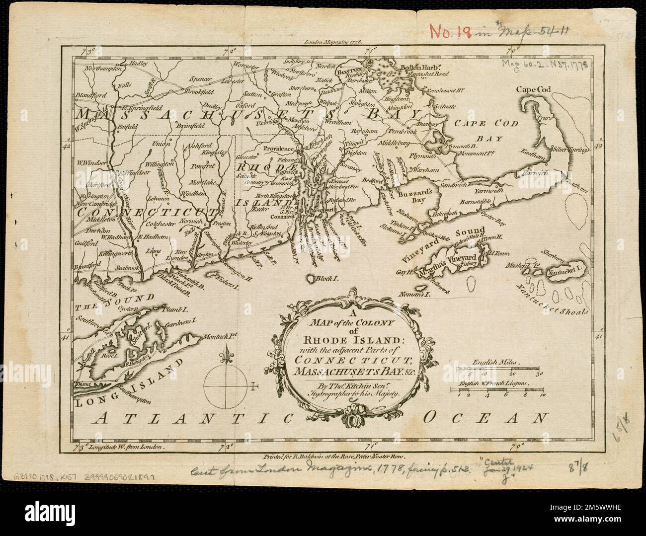
A map of the colony of Rhode Island : with the adjacent parts of Connecticut, Massachusetts Bay, &c. London Magazine 1778--Upper margin.. Includes Connecticut as far west as Branford and Farmington; Massachusetts extending west to the Connecticut River Valley and north to Boston, including Cape Cod, Martha's Vineyard, and Nantucket; and the eastern end of Long Island... , Massachusetts New England ,area Rhode Island Connecticut
RMID:Image ID:2M5WWHE
Image details
Contributor:
LM/BT / Alamy Stock PhotoImage ID:
2M5WWHEFile size:
43.9 MB (2.8 MB Compressed download)Releases:
Model - no | Property - noDo I need a release?Dimensions:
4488 x 3417 px | 38 x 28.9 cm | 15 x 11.4 inches | 300dpiMore information:
This image is a public domain image, which means either that copyright has expired in the image or the copyright holder has waived their copyright. Alamy charges you a fee for access to the high resolution copy of the image.
This image could have imperfections as it’s either historical or reportage.