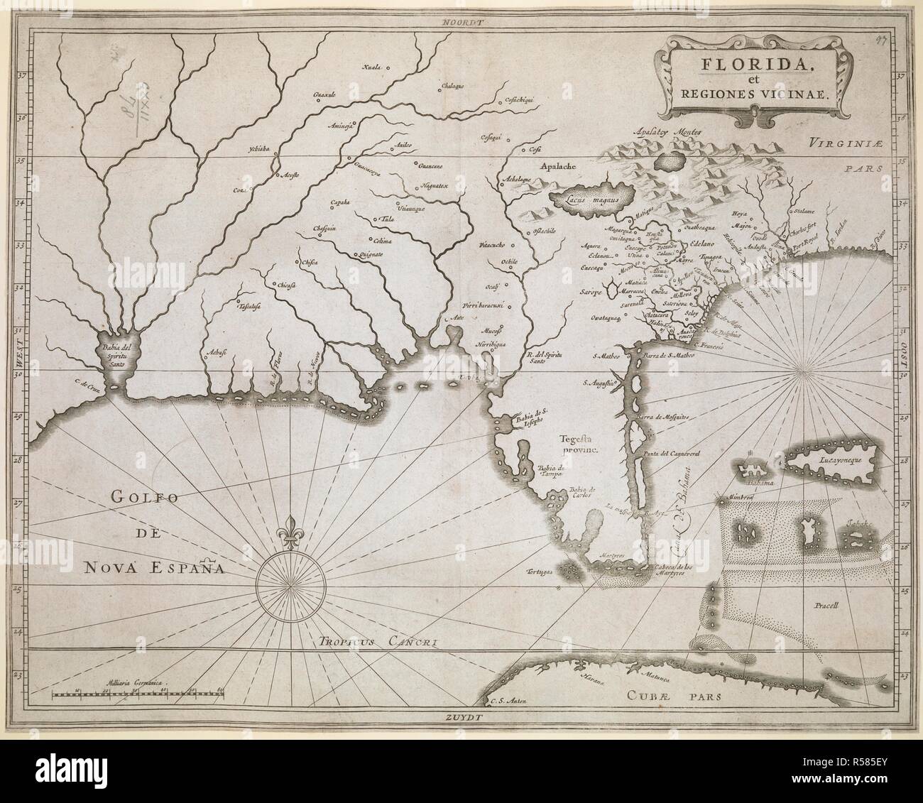
A map of Florida and the neighbouring regions. FLORIDA, et REGIONES VICINAE. [Leiden] : [Joannes de Laet], [between 1630 and 1640.]. Copperplate engraving. Source: Maps K.Top.122.78. Language: Latin.
![A map of Florida and the neighbouring regions. FLORIDA, et REGIONES VICINAE. [Leiden] : [Joannes de Laet], [between 1630 and 1640.]. Copperplate engraving. Source: Maps K.Top.122.78. Language: Latin. Stock Photo](https://c8.alamy.com/comp/R585EY/a-map-of-florida-and-the-neighbouring-regions-florida-et-regiones-vicinae-leiden-joannes-de-laet-between-1630-and-1640-copperplate-engraving-source-maps-ktop12278-language-latin-R585EY.jpg)
RMID:Image ID:R585EY
Image details
Contributor:
Album / British Library / Alamy Stock PhotoImage ID:
R585EYFile size:
129 MB (6 MB Compressed download)Releases:
Model - no | Property - noDo I need a release?Dimensions:
7500 x 6011 px | 63.5 x 50.9 cm | 25 x 20 inches | 300dpiMore information:
This image could have imperfections as it’s either historical or reportage.