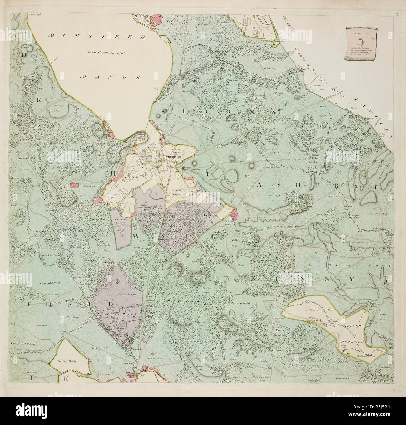
A detailed survey map of the New Forest, done on the orders of the Commissioners of the Land Revenue in 1789. Southampton county in England. . A Plan of His Majesty’s Forest called the New Forest. England 1789. A Plan of His Majesty’s Forest called the New Forest, in the County of Southampton, laid down from Surveys taken by Thos. Richardson, Wm. King, and Abm and Wm. Driver, by order of the Commissioners of the Land Revenue. Faden, 1789. Source: Maps 7.TAB.50 f.5. Language: English.
RMID:Image ID:R5J5RH
Image details
Contributor:
Album / British Library / Alamy Stock PhotoImage ID:
R5J5RHFile size:
69.6 MB (4.1 MB Compressed download)Releases:
Model - no | Property - noDo I need a release?Dimensions:
4986 x 4882 px | 42.2 x 41.3 cm | 16.6 x 16.3 inches | 300dpiMore information:
This image could have imperfections as it’s either historical or reportage.