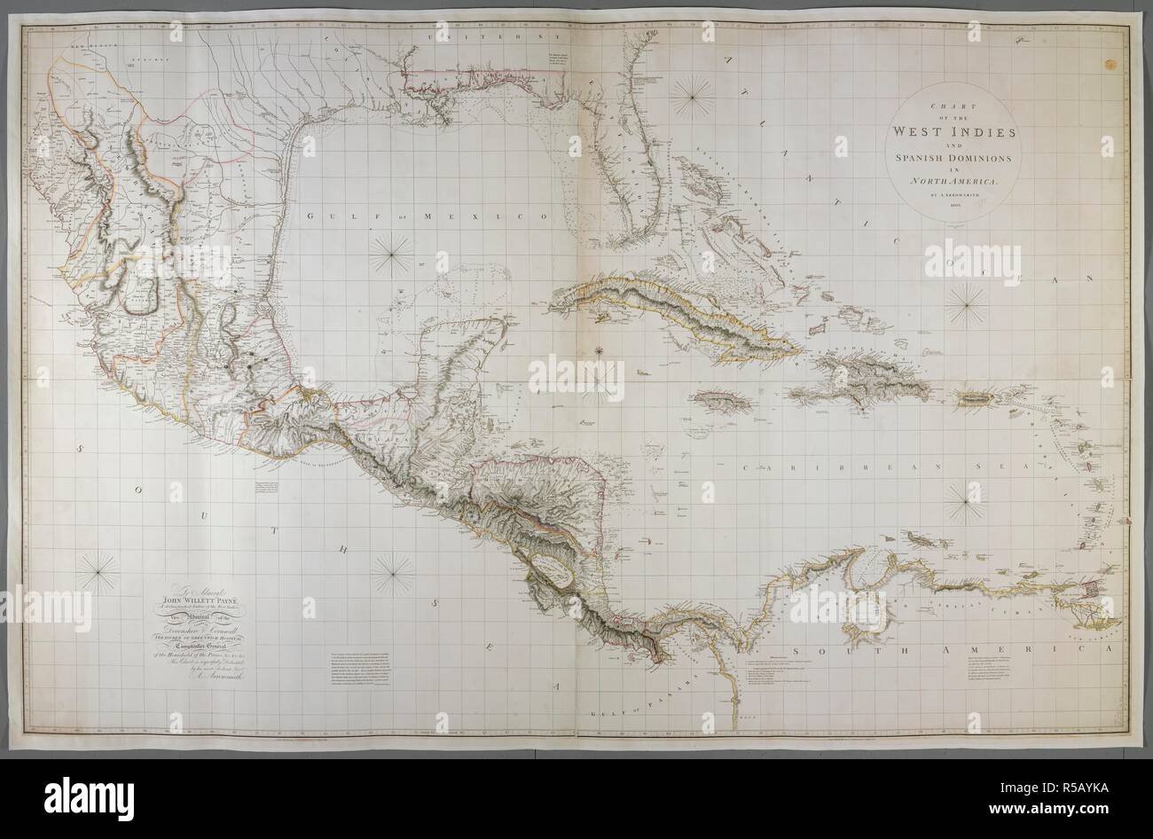
A chart of the West Indies and Spanish Dominions in North America. CHART OF THE WEST INDIES AND SPANISH DOMINIONS IN NORTH AMERICA. London : A. Arrowsmith No. 24 Rathbone Place., June 1st, 1803. Source: Maps K.Top.123.15.2 TAB. Language: English. Author: Arrowsmith, Aaron.
RMID:Image ID:R5AYKA
Image details
Contributor:
Album / British Library / Alamy Stock PhotoImage ID:
R5AYKAFile size:
120.6 MB (4.4 MB Compressed download)Releases:
Model - no | Property - noDo I need a release?Dimensions:
8000 x 5270 px | 67.7 x 44.6 cm | 26.7 x 17.6 inches | 300dpiMore information:
This image could have imperfections as it’s either historical or reportage.