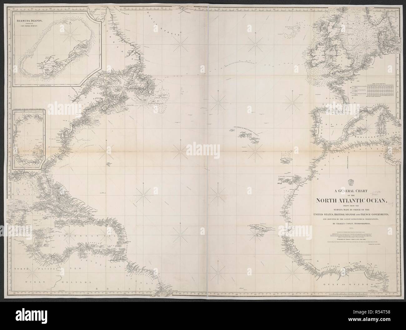
A chart of the North Atlantic Ocean. A General Chart of the North Atlantic Ocean. New York, 1864. Source: Maps 978.(36.). Language: English.
RMID:Image ID:R54T58
Image details
Contributor:
Album / British Library / Alamy Stock PhotoImage ID:
R54T58File size:
151 MB (5.4 MB Compressed download)Releases:
Model - no | Property - noDo I need a release?Dimensions:
8419 x 6271 px | 71.3 x 53.1 cm | 28.1 x 20.9 inches | 300dpiMore information:
This image could have imperfections as it’s either historical or reportage.