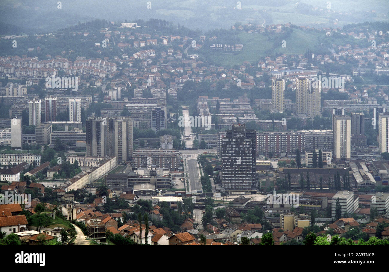
6th June 1993 During the Siege of Sarajevo: the view south from Hum Hill along Hamdije Čemerlića Street, known as Bratstva i Jedinstva (the street of 'Brotherhood and Unity') during the war. The street crosses Sniper Alley and the Miljacka River, into Bosnian-Serb-held Grbavica. At various points lorries and containers act as sniper barriers.
Image details
Contributor:
Johnny SaundersonImage ID:
2A5TNCPFile size:
169.5 MB (8.8 MB Compressed download)Releases:
Model - no | Property - noDo I need a release?Dimensions:
9683 x 6118 px | 82 x 51.8 cm | 32.3 x 20.4 inches | 300dpiDate taken:
6 June 1993Location:
Hum Hill, Sarajevo, Bosnia & Herzegovina.More information:
This image could have imperfections as it’s either historical or reportage.
Bottom-left is Tito Barracks where the Ukrainian UNPROFOR forces were based during the siege. Today, Tito Barracks is home to various faculties of the University of Sarajevo. Bosnian-Serb snipers operated from the pale yellow tower blocks on the right. The Siege of Sarajevo was the longest of a capital city in the history of modern warfare. After being initially besieged by the forces of the Yugoslav People's Army, Sarajevo was besieged by the Army of Republika Srpska from 5th April 1992 to 29th February 1996 (1, 425 days) during the Bosnian War. In total, 13, 952 people were killed during the siege.