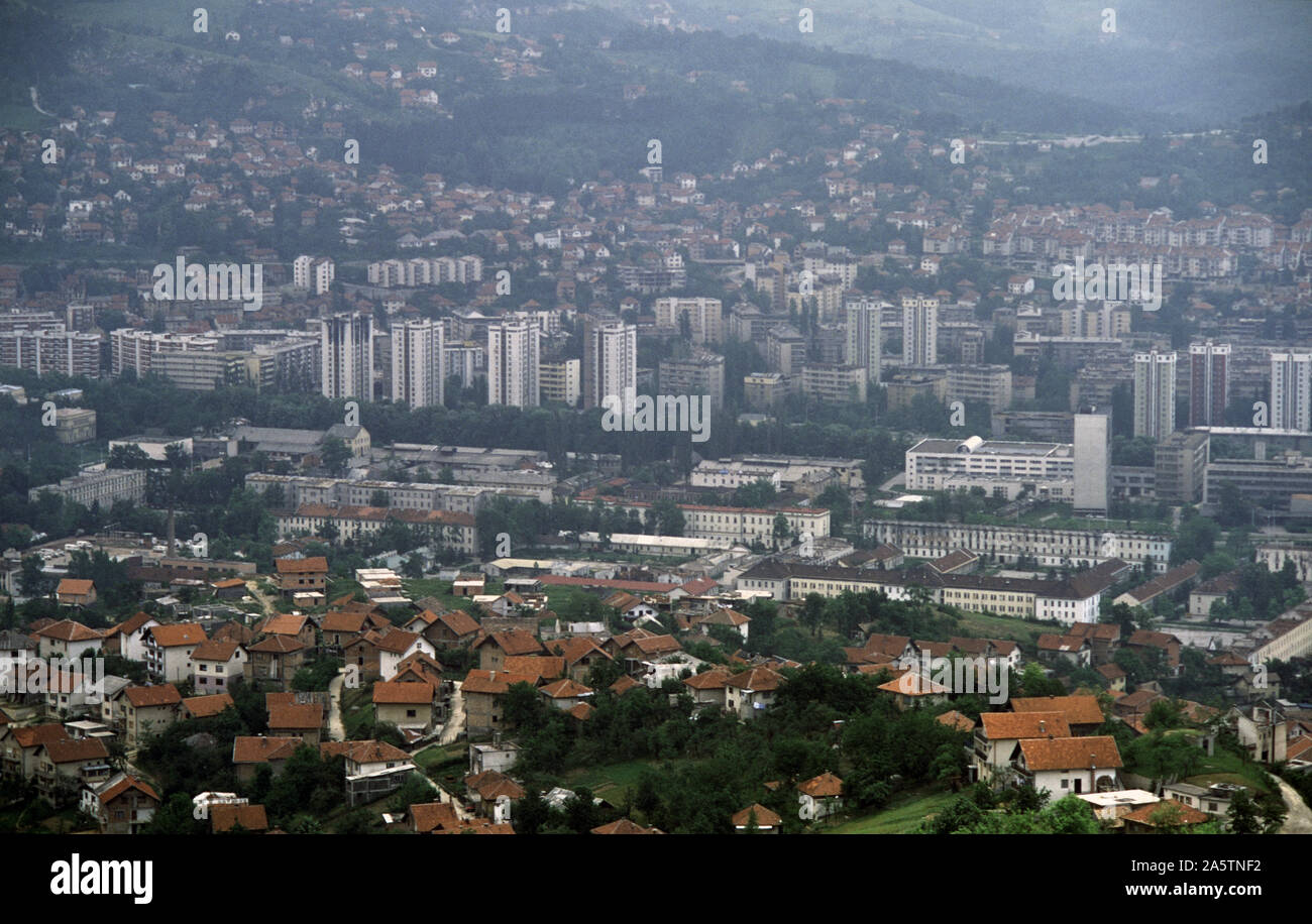
6th June 1993 During the Siege of Sarajevo: the view south-east from Hum Hill, across Sniper Alley, to Bosnian-Serb held Grbavica and the hills of Kovačići.
Image details
Contributor:
Johnny SaundersonImage ID:
2A5TNF2File size:
172.3 MB (7.8 MB Compressed download)Releases:
Model - no | Property - noDo I need a release?Dimensions:
9730 x 6189 px | 82.4 x 52.4 cm | 32.4 x 20.6 inches | 300dpiDate taken:
6 June 1993Location:
Hum Hill, Sarajevo, Bosnia & Herzegovina.More information:
This image could have imperfections as it’s either historical or reportage.
Beyond the red-roofed houses of Pofalići in the foreground, Bosnian-Serb snipers operated from the tower blocks on the south side of the Miljacka River. Tito Barracks sprawls acroos the lower part of the frame; this is where the Ukrainian UNPROFOR forces were based during the siege. Today, it is home to various faculties of the University of Sarajevo. The Siege of Sarajevo was the longest of a capital city in the history of modern warfare. After being initially besieged by the forces of the Yugoslav People's Army, Sarajevo was besieged by the Army of Republika Srpska from 5th April 1992 to 29th February 1996 (1, 425 days) during the Bosnian War. In total, 13, 952 people were killed during the siege.