Tasmasa Sahin Hill Aydincik Vr Mersin 77f
Image details
Contributor:
360Cities.net / Alamy Stock PhotoImage ID:
PN8GM9File size:
280.4 MB (74.2 MB Compressed download)Releases:
Model - no | Property - noDo I need a release?Dimensions:
14000 x 7000 px | 118.5 x 59.3 cm | 46.7 x 23.3 inches | 300dpiPhotographer:
Vr MersinMore information:
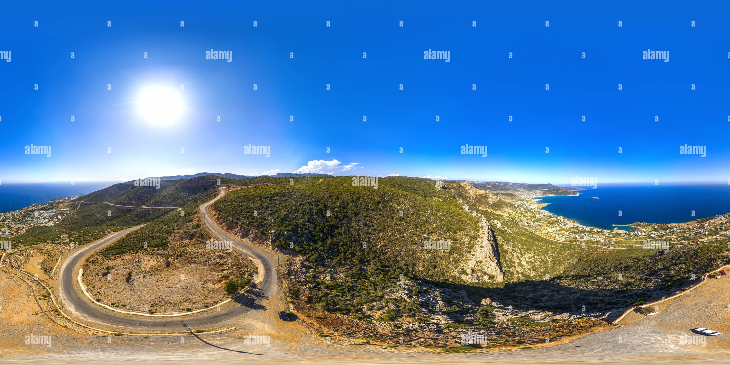
Cilicia and Mersin Cilicia Region roughly extends from the Manavgat River, through the southern foothills of the Taurus Mountains, to the Amanus Mountains. According to the geological structure, Cilicia is divided into two as the Rugged Cilicia (Cilicia Trachaea) and the Flat Cilicia (Cilicia Pedias ). The border between the Rugged Cilicia and the Flat Cilicia was the Lamos at times and the Soli at others. As it is known to those who toured around the area, there exist three gates that enable access to this land through a rugged course. The first of these is the Sertavul Pass, which is located to the north of Mut District. The second one is the Cilician Gate, which is known as the Gülek Pass and hosts a rock bearing the inscription “the Cilician Border”, and the last one is the Belen (Syria) Gate on the route to Hatay Province. Surrounded by Gazipaşa District of Antalya Province to the west, the provinces of Konya, Karaman and Niğde to the north and the Mediterranean Sea to the east, Mersin was annexed to the land of Ottomans in 1516 during the reign of (Yavuz) Selim I. It was then ruled by Kavalalı Mehmet Ali Pasha for some time, but later Ottomans gained control of the area once again. Mersin Province was founded in 1924. Districts of Silifke, Anamur, Gülnar and Mut were annexed to Mersin Province, and the Province was renamed as ‘İçel’. It is thought that the long used “İçel” name derived from the name given to the site by Turkish people who settled in the areas located on either side of Göksu River during the 12th century, or has actually transformed from “Uç il/ Uç el” denomination used by Anatolian Seljuk Sultanate for this “Uç ülke, uç diyar (literally: the frontier land)” located beyond the Taurus Mountains. Erdemli district was founded in 1954; then followed Aydıncık District (1987), Bozyazı and Çamlıyayla Districts (1989). In 2001, the name ‘İçel’ was, once again, replaced by “Mersin” due to intensive pressure from the citizens. Having a Metropolitan City