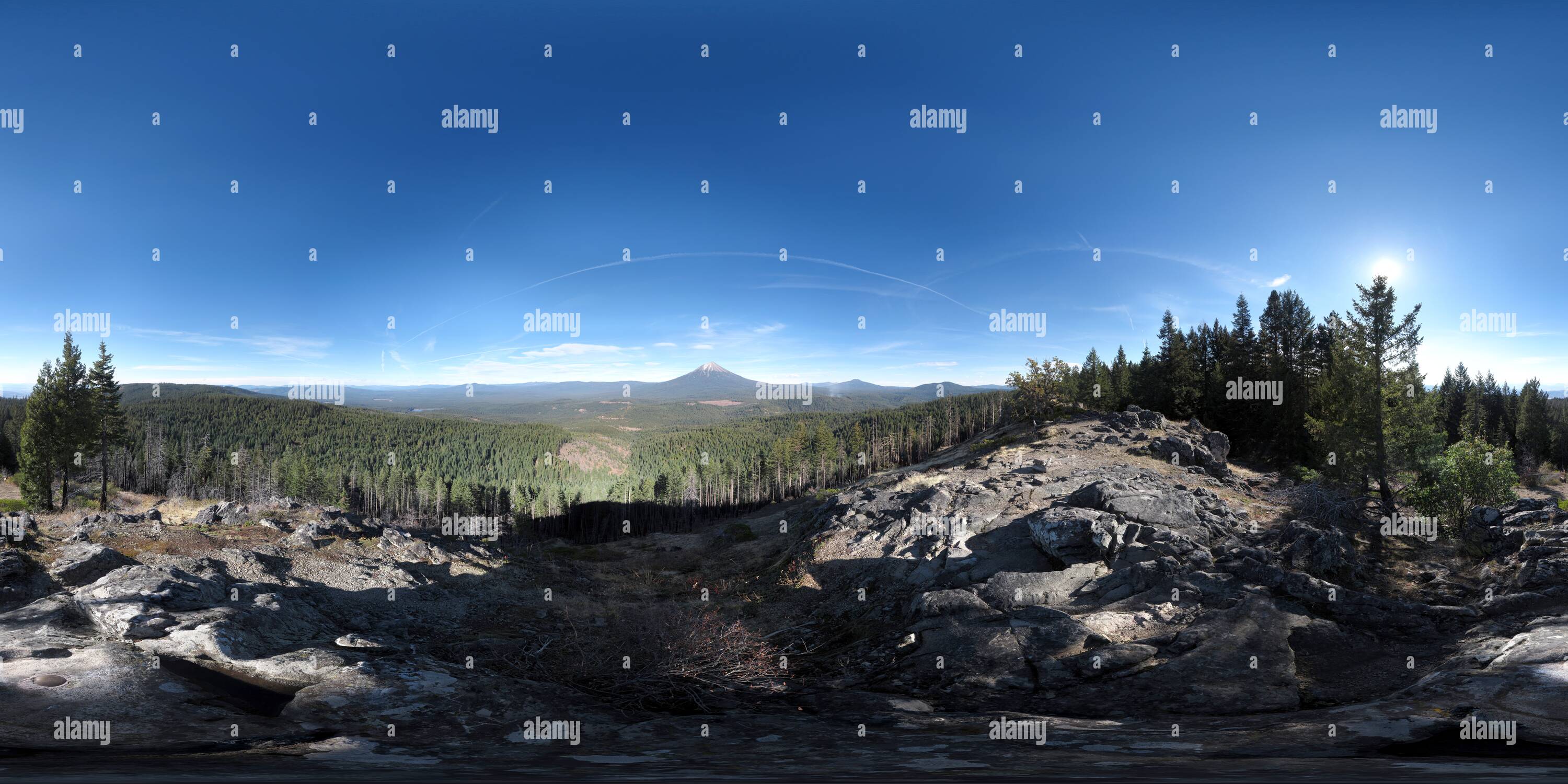
Buck Point (5006'/1526m) summit
Image details
Contributor:
360Cities.net / Alamy Stock PhotoImage ID:
PN5GDAFile size:
1,287.3 MB (60.7 MB Compressed download)Releases:
Model - no | Property - noDo I need a release?Dimensions:
29998 x 14999 px | 254 x 127 cm | 100 x 50 inches | 300dpiPhotographer:
William lMore information:
Buck Point (elev. 5, 006') is a small outcropping summit that is part of the higher Bieberststedt Butte east of Lakecreek, Oregon. The view captures a nice up close sight of Mt. McLoughlin as well as the Mountain Lakes & Sky Lakes Wilderness, spanning up to the Crater Lake Rim & Rabbit Ears to the north. From here one can also see the northern area of the Rogue Valley including the Lower & Upper Table Rocks. A fire lookout was constructed here in 1953 & was used until about 1970 now it is long gone.