1749 old antique vintage map plan chart
Image details
Contributor:
Antiqua Print Gallery / Alamy Stock PhotoImage ID:
T2J4FBFile size:
5.4 MB (310.3 KB Compressed download)Releases:
Model - no | Property - noDo I need a release?Dimensions:
2805 x 668 px | 23.7 x 5.7 cm | 9.4 x 2.2 inches | 300dpiDate taken:
1749Location:
NormandyMore information:
This image could have imperfections as it’s either historical or reportage.
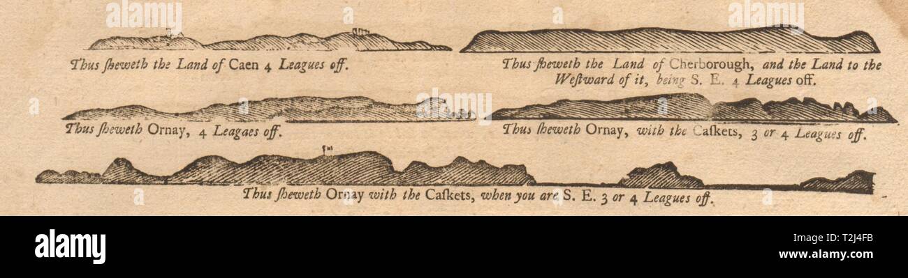
. Artist/engraver/cartographer: William & J. Mount, and Thomas Page. Provenance: "The English Pilot - Part I, describing the sea-coasts, capes, headlands, bays, roads, harbours, rivers and ports. Together with the soundings, sands, rocks and dangers in the Southern Navigation upon the coasts of England, Scotland, Ireland, Holland, Flanders, Spain, Portugal, to the Streights-Mouth; with the Coasts of Barbary, and off to the Canary, Madera, Cape de Verde and Western Islands shewing the courses and distances, from one place to another. The setting of the tides and currents. The ebbing and flowing of the sea &c.", London, printed for W. and J. Mount and T. Page, at the Postern on Tower-Hill, MDCCXLIX. Type: Antique 18th century copperplate coastal profile chart. The following places are shown or referred to on the coastal profile chart: Sheweth the Land of Caen – Chesborough – Westward – Sheweth Ornay – Caskets