Quick filters:
West java map Stock Photos and Images
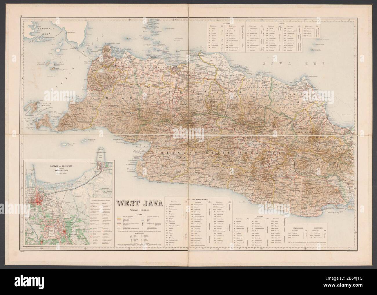 Kaart van West-Java Map of West Java with key and insert the card surrounding Batavia area. Numbered top left: 3. degree distribution along the randen. Manufacturer : publisher: Topographic device (listed property) Place manufacture: Java Date: 1905 Physical features: kleurenautotypie; mounted on linen material: paper towels Technique: kleurenautotypie Dimensions: sheet: h 655 mm × W 920 mmToelichtingHet relates to four blades which together form a card form, and on a piece of linen are gemonteerd. Subject: maps or separate countries or regions where: West Java Batavia Stock Photohttps://www.alamy.com/image-license-details/?v=1https://www.alamy.com/kaart-van-west-java-map-of-west-java-with-key-and-insert-the-card-surrounding-batavia-area-numbered-top-left-3-degree-distribution-along-the-randen-manufacturer-publisher-topographic-device-listed-property-place-manufacture-java-date-1905-physical-features-kleurenautotypie-mounted-on-linen-material-paper-towels-technique-kleurenautotypie-dimensions-sheet-h-655-mm-w-920-mmtoelichtinghet-relates-to-four-blades-which-together-form-a-card-form-and-on-a-piece-of-linen-are-gemonteerd-subject-maps-or-separate-countries-or-regions-where-west-java-batavia-image348480204.html
RM2B6XJ1G–Kaart van West-Java Map of West Java with key and insert the card surrounding Batavia area. Numbered top left: 3. degree distribution along the randen. Manufacturer : publisher: Topographic device (listed property) Place manufacture: Java Date: 1905 Physical features: kleurenautotypie; mounted on linen material: paper towels Technique: kleurenautotypie Dimensions: sheet: h 655 mm × W 920 mmToelichtingHet relates to four blades which together form a card form, and on a piece of linen are gemonteerd. Subject: maps or separate countries or regions where: West Java Batavia
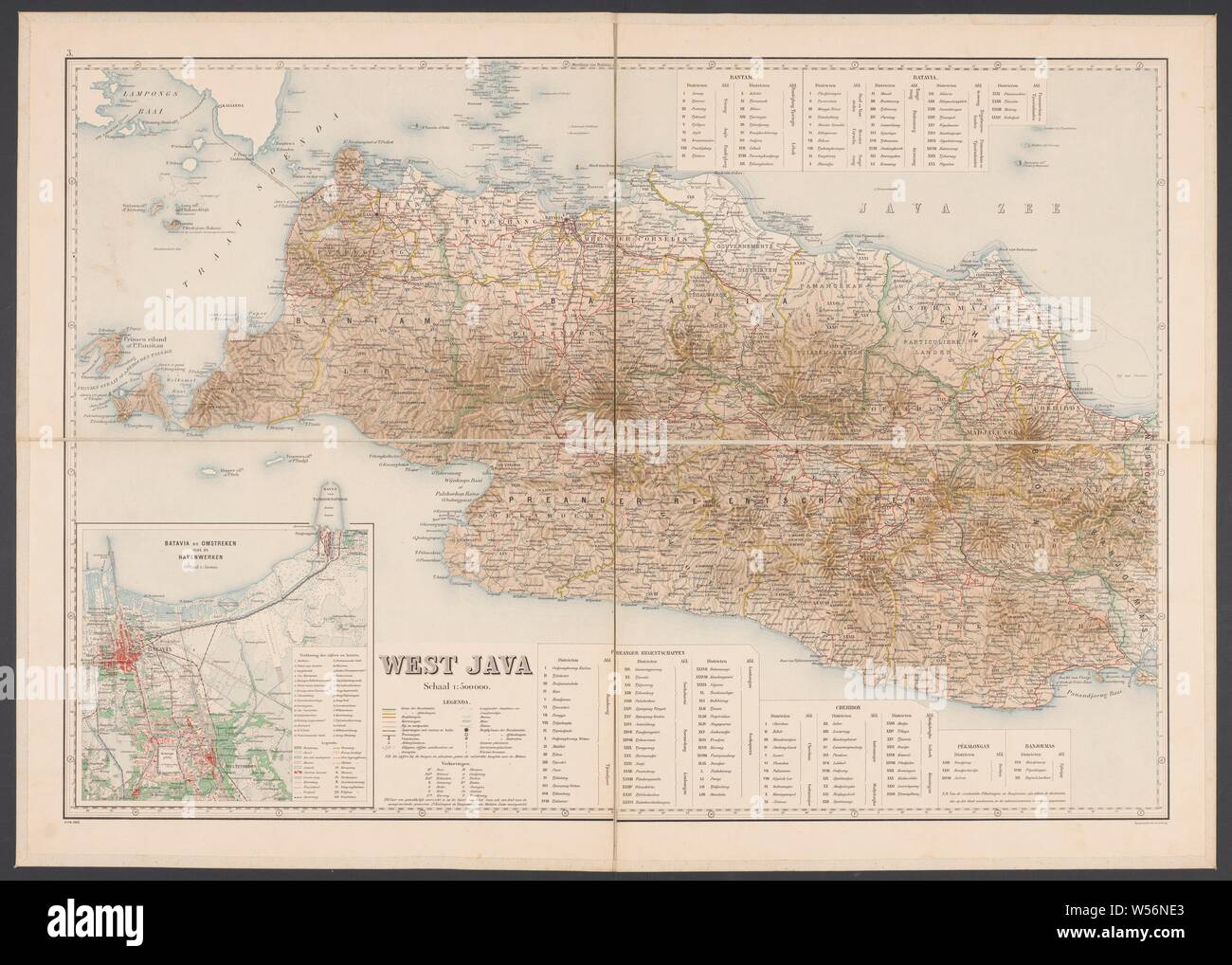 Map of West Java, Map of West Java with a legend and a map of the area around Batavia. Numbered top left: 3. With degree distribution along the edges, maps of separate countries or regions, West Java, Batavia, Topografische Inrichting (mentioned on object), Java, 1905, paper, linen (material), h 655 mm × w 920 mm Stock Photohttps://www.alamy.com/image-license-details/?v=1https://www.alamy.com/map-of-west-java-map-of-west-java-with-a-legend-and-a-map-of-the-area-around-batavia-numbered-top-left-3-with-degree-distribution-along-the-edges-maps-of-separate-countries-or-regions-west-java-batavia-topografische-inrichting-mentioned-on-object-java-1905-paper-linen-material-h-655-mm-w-920-mm-image261377371.html
RMW56NE3–Map of West Java, Map of West Java with a legend and a map of the area around Batavia. Numbered top left: 3. With degree distribution along the edges, maps of separate countries or regions, West Java, Batavia, Topografische Inrichting (mentioned on object), Java, 1905, paper, linen (material), h 655 mm × w 920 mm
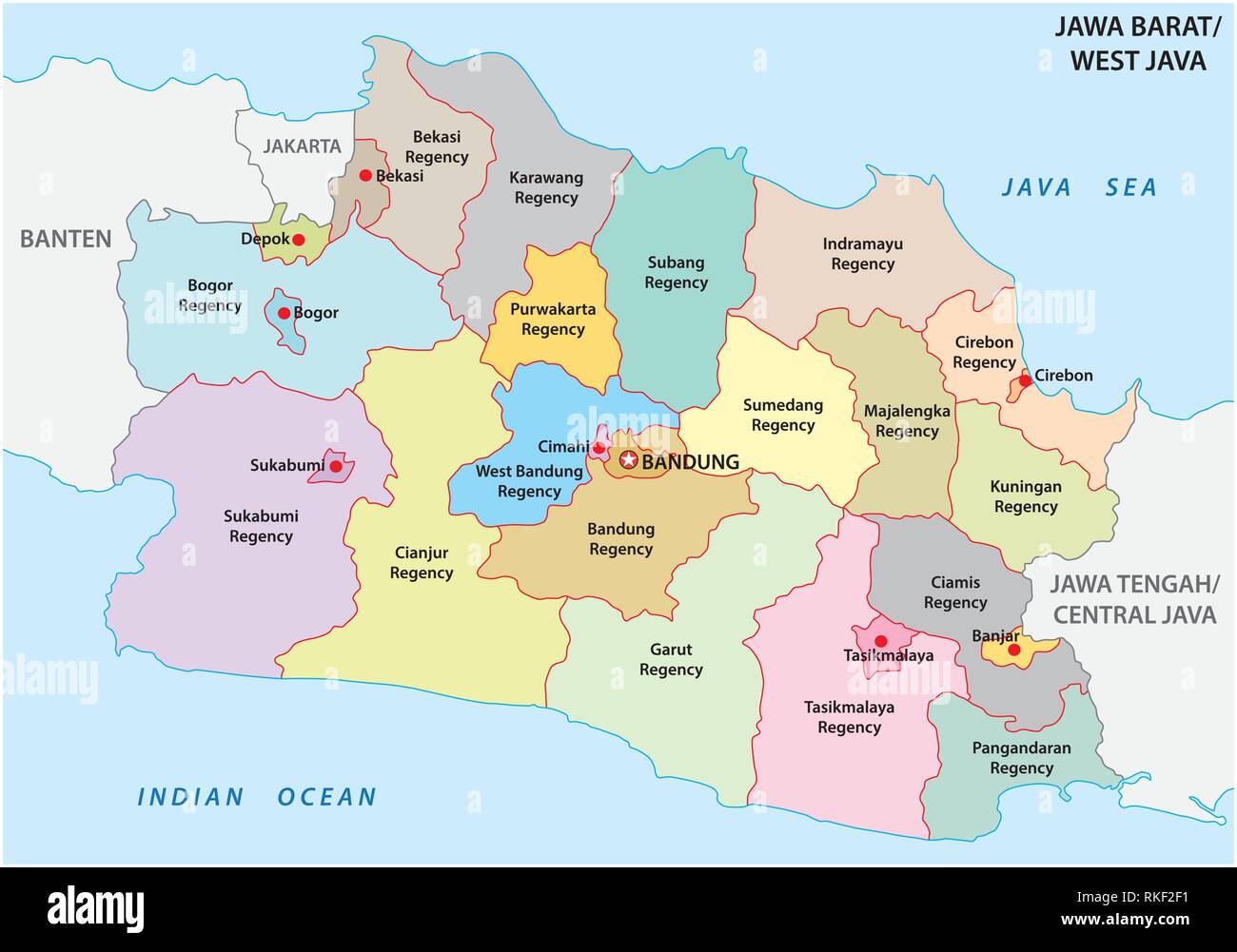 Jawa Barat, West Java administrative and political vector map, Indonesia Stock Vectorhttps://www.alamy.com/image-license-details/?v=1https://www.alamy.com/jawa-barat-west-java-administrative-and-political-vector-map-indonesia-image235744517.html
RFRKF2F1–Jawa Barat, West Java administrative and political vector map, Indonesia
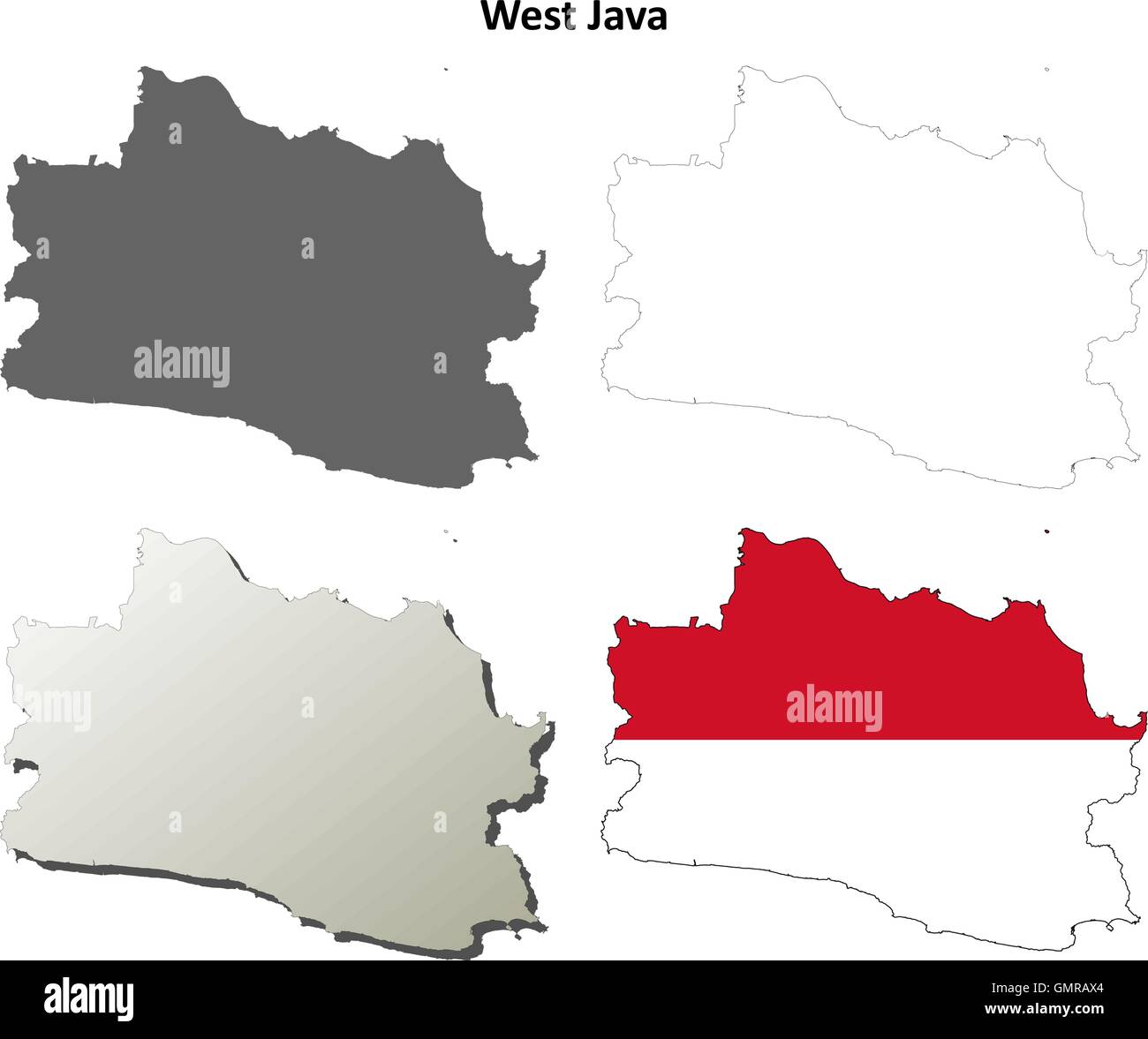 West Java blank outline map set Stock Vectorhttps://www.alamy.com/image-license-details/?v=1https://www.alamy.com/stock-photo-west-java-blank-outline-map-set-116068796.html
RFGMRAX4–West Java blank outline map set
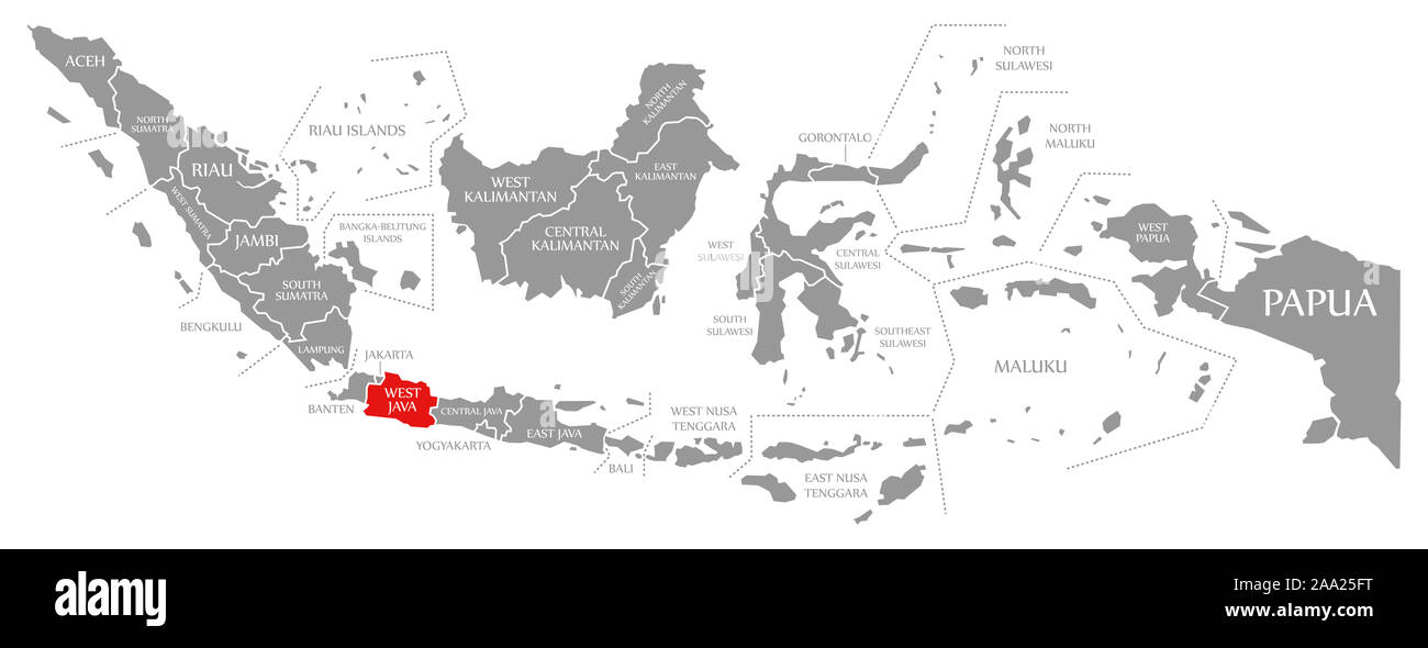 West Java red highlighted in map of Indonesia Stock Photohttps://www.alamy.com/image-license-details/?v=1https://www.alamy.com/west-java-red-highlighted-in-map-of-indonesia-image333191820.html
RF2AA25FT–West Java red highlighted in map of Indonesia
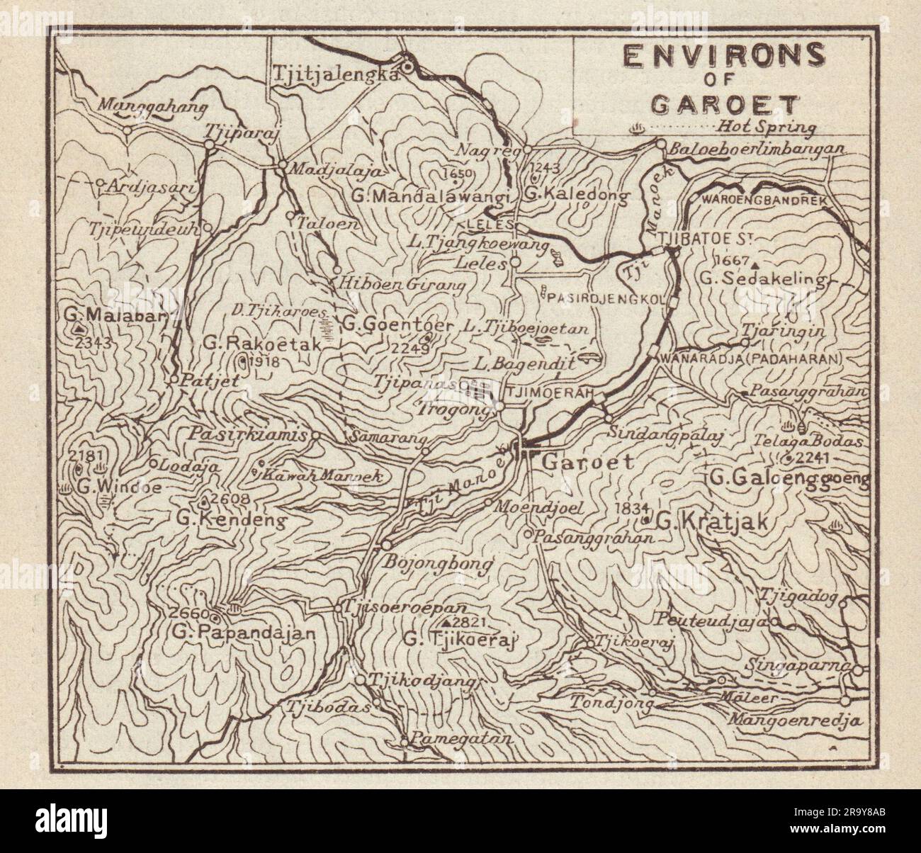 Garut, West Java. 'Environs of Garoet' sketch map. Indonesia 1917 old Stock Photohttps://www.alamy.com/image-license-details/?v=1https://www.alamy.com/garut-west-java-environs-of-garoet-sketch-map-indonesia-1917-old-image556862947.html
RF2R9Y8AB–Garut, West Java. 'Environs of Garoet' sketch map. Indonesia 1917 old
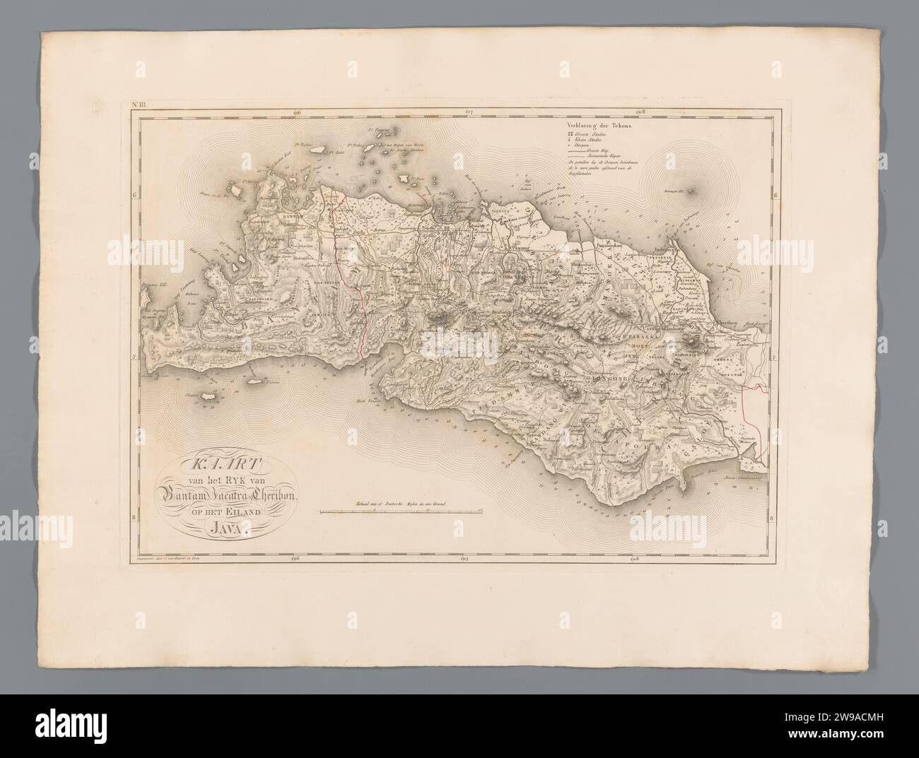 Map of Bantam and West-Java, C. van Baarsel and Son, 1818 print Numbered at the top right: III. The Hague paper engraving maps of separate countries or regions West-Java. Bantam Stock Photohttps://www.alamy.com/image-license-details/?v=1https://www.alamy.com/map-of-bantam-and-west-java-c-van-baarsel-and-son-1818-print-numbered-at-the-top-right-iii-the-hague-paper-engraving-maps-of-separate-countries-or-regions-west-java-bantam-image590913921.html
RM2W9ACMH–Map of Bantam and West-Java, C. van Baarsel and Son, 1818 print Numbered at the top right: III. The Hague paper engraving maps of separate countries or regions West-Java. Bantam
![. Nederlands: Titel catalogus Leupe (NA): Kaart als voren, van het West Eynde of de Eerste hoeck van Java tot een laag afloopende hoeck, hiermee wordt bedoeld de titel van VEL0436: Kaart van de zuidkust van Java.... Rechtsonder genummerd 261. De kustlijn loopt van 'T West Eijndt of de eerste hoeck van Java tot aan Van Laage afflopende hoeck. Op de kustlijn zijn bergen te zien Dit langs heen 3 a 4 dubbele Gebergte, langs heen laage Landt, Langs heen veel Sandt Strandt, maar niet Om Aan de [?] door de brandinge. Onder is de schaalverdeling Duijtsche Mijlen 15 voor een Graadt. English: Title in Stock Photo . Nederlands: Titel catalogus Leupe (NA): Kaart als voren, van het West Eynde of de Eerste hoeck van Java tot een laag afloopende hoeck, hiermee wordt bedoeld de titel van VEL0436: Kaart van de zuidkust van Java.... Rechtsonder genummerd 261. De kustlijn loopt van 'T West Eijndt of de eerste hoeck van Java tot aan Van Laage afflopende hoeck. Op de kustlijn zijn bergen te zien Dit langs heen 3 a 4 dubbele Gebergte, langs heen laage Landt, Langs heen veel Sandt Strandt, maar niet Om Aan de [?] door de brandinge. Onder is de schaalverdeling Duijtsche Mijlen 15 voor een Graadt. English: Title in Stock Photo](https://c8.alamy.com/comp/MMPC19/nederlands-titel-catalogus-leupe-na-kaart-als-voren-van-het-west-eynde-of-de-eerste-hoeck-van-java-tot-een-laag-afloopende-hoeck-hiermee-wordt-bedoeld-de-titel-van-vel0436-kaart-van-de-zuidkust-van-java-rechtsonder-genummerd-261-de-kustlijn-loopt-van-t-west-eijndt-of-de-eerste-hoeck-van-java-tot-aan-van-laage-afflopende-hoeck-op-de-kustlijn-zijn-bergen-te-zien-dit-langs-heen-3-a-4-dubbele-gebergte-langs-heen-laage-landt-langs-heen-veel-sandt-strandt-maar-niet-om-aan-de-door-de-brandinge-onder-is-de-schaalverdeling-duijtsche-mijlen-15-voor-een-graadt-english-title-in-MMPC19.jpg) . Nederlands: Titel catalogus Leupe (NA): Kaart als voren, van het West Eynde of de Eerste hoeck van Java tot een laag afloopende hoeck, hiermee wordt bedoeld de titel van VEL0436: Kaart van de zuidkust van Java.... Rechtsonder genummerd 261. De kustlijn loopt van 'T West Eijndt of de eerste hoeck van Java tot aan Van Laage afflopende hoeck. Op de kustlijn zijn bergen te zien Dit langs heen 3 a 4 dubbele Gebergte, langs heen laage Landt, Langs heen veel Sandt Strandt, maar niet Om Aan de [?] door de brandinge. Onder is de schaalverdeling Duijtsche Mijlen 15 voor een Graadt. English: Title in Stock Photohttps://www.alamy.com/image-license-details/?v=1https://www.alamy.com/nederlands-titel-catalogus-leupe-na-kaart-als-voren-van-het-west-eynde-of-de-eerste-hoeck-van-java-tot-een-laag-afloopende-hoeck-hiermee-wordt-bedoeld-de-titel-van-vel0436-kaart-van-de-zuidkust-van-java-rechtsonder-genummerd-261-de-kustlijn-loopt-van-t-west-eijndt-of-de-eerste-hoeck-van-java-tot-aan-van-laage-afflopende-hoeck-op-de-kustlijn-zijn-bergen-te-zien-dit-langs-heen-3-a-4-dubbele-gebergte-langs-heen-laage-landt-langs-heen-veel-sandt-strandt-maar-niet-om-aan-de-door-de-brandinge-onder-is-de-schaalverdeling-duijtsche-mijlen-15-voor-een-graadt-english-title-in-image184889189.html
. Nederlands: Titel catalogus Leupe (NA): Kaart als voren, van het West Eynde of de Eerste hoeck van Java tot een laag afloopende hoeck, hiermee wordt bedoeld de titel van VEL0436: Kaart van de zuidkust van Java.... Rechtsonder genummerd 261. De kustlijn loopt van 'T West Eijndt of de eerste hoeck van Java tot aan Van Laage afflopende hoeck. Op de kustlijn zijn bergen te zien Dit langs heen 3 a 4 dubbele Gebergte, langs heen laage Landt, Langs heen veel Sandt Strandt, maar niet Om Aan de [?] door de brandinge. Onder is de schaalverdeling Duijtsche Mijlen 15 voor een Graadt. English: Title in Stock Photohttps://www.alamy.com/image-license-details/?v=1https://www.alamy.com/nederlands-titel-catalogus-leupe-na-kaart-als-voren-van-het-west-eynde-of-de-eerste-hoeck-van-java-tot-een-laag-afloopende-hoeck-hiermee-wordt-bedoeld-de-titel-van-vel0436-kaart-van-de-zuidkust-van-java-rechtsonder-genummerd-261-de-kustlijn-loopt-van-t-west-eijndt-of-de-eerste-hoeck-van-java-tot-aan-van-laage-afflopende-hoeck-op-de-kustlijn-zijn-bergen-te-zien-dit-langs-heen-3-a-4-dubbele-gebergte-langs-heen-laage-landt-langs-heen-veel-sandt-strandt-maar-niet-om-aan-de-door-de-brandinge-onder-is-de-schaalverdeling-duijtsche-mijlen-15-voor-een-graadt-english-title-in-image184889189.htmlRMMMPC19–. Nederlands: Titel catalogus Leupe (NA): Kaart als voren, van het West Eynde of de Eerste hoeck van Java tot een laag afloopende hoeck, hiermee wordt bedoeld de titel van VEL0436: Kaart van de zuidkust van Java.... Rechtsonder genummerd 261. De kustlijn loopt van 'T West Eijndt of de eerste hoeck van Java tot aan Van Laage afflopende hoeck. Op de kustlijn zijn bergen te zien Dit langs heen 3 a 4 dubbele Gebergte, langs heen laage Landt, Langs heen veel Sandt Strandt, maar niet Om Aan de [?] door de brandinge. Onder is de schaalverdeling Duijtsche Mijlen 15 voor een Graadt. English: Title in
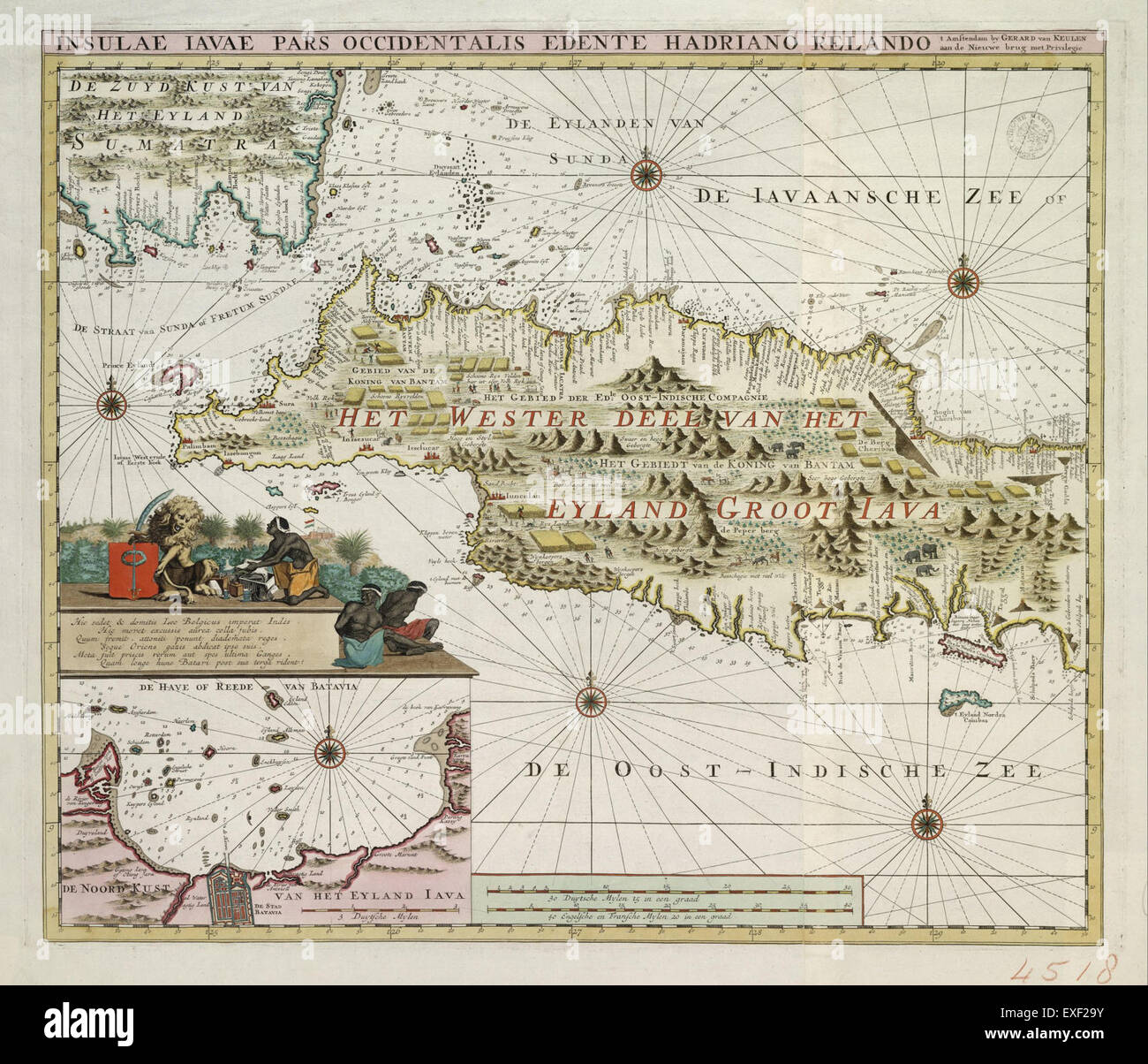 This 1740s hydrographic map of Western Java provides detailed topographical features, highlighting waterways, coastal areas, and the geography of the region during the colonial era. Stock Photohttps://www.alamy.com/image-license-details/?v=1https://www.alamy.com/stock-photo-this-1740s-hydrographic-map-of-western-java-provides-detailed-topographical-85153655.html
RMEXF29Y–This 1740s hydrographic map of Western Java provides detailed topographical features, highlighting waterways, coastal areas, and the geography of the region during the colonial era.
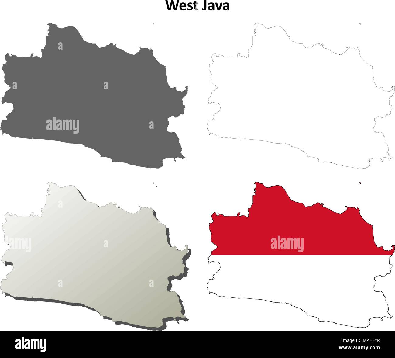 West Java blank outline map set Stock Vectorhttps://www.alamy.com/image-license-details/?v=1https://www.alamy.com/west-java-blank-outline-map-set-image178635963.html
RFMAHFYR–West Java blank outline map set
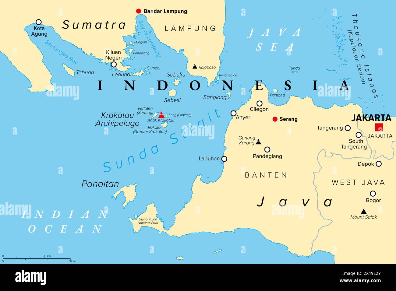 Sunda Strait, Indonesia, political map. Strait between the Indonesian islands Java and Sumatra, connecting Java Sea with the Indian Ocean. Stock Photohttps://www.alamy.com/image-license-details/?v=1https://www.alamy.com/sunda-strait-indonesia-political-map-strait-between-the-indonesian-islands-java-and-sumatra-connecting-java-sea-with-the-indian-ocean-image605030131.html
RF2X49E2Y–Sunda Strait, Indonesia, political map. Strait between the Indonesian islands Java and Sumatra, connecting Java Sea with the Indian Ocean.
RM2B0T74M–Ancient map of the west of the Island of Java from the 19th century manuscript 'Plantae Javanicae rariores, descriptae iconibusque illustratae, quas in insula Java, annis 1802-1818' (Java Plants, Description of plants on the island of Java) by Horsfield, Thomas, 1773-1859 Published in Latin in London in 1838
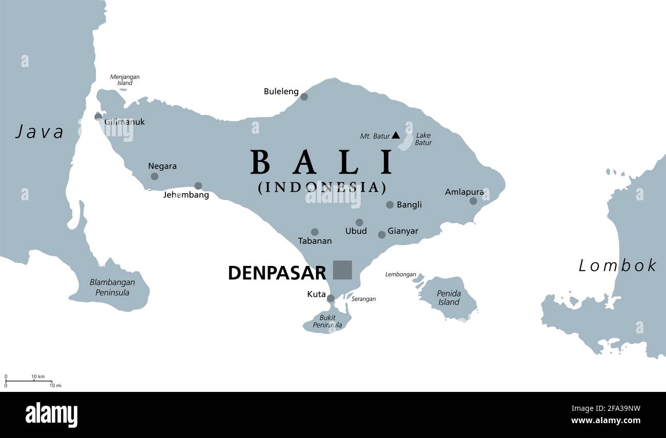 Bali, gray political map. A province and island of Indonesia, the westernmost of Lesser Sunda Islands, east of Java, west of Lombok. Stock Photohttps://www.alamy.com/image-license-details/?v=1https://www.alamy.com/bali-gray-political-map-a-province-and-island-of-indonesia-the-westernmost-of-lesser-sunda-islands-east-of-java-west-of-lombok-image419268917.html
RF2FA39NW–Bali, gray political map. A province and island of Indonesia, the westernmost of Lesser Sunda Islands, east of Java, west of Lombok.
![Indonesia: A map of Bantam on the west coast of Java in 1596, the year the first Dutch fleet arrived with a view to establishing a foothold on the spice trade. Etching, c. 1597-1598. Following successful expeditions to the East Indies [Indonesia], the Dutch set up a factory and a fortress in Bantam, which was later moved to the new capital in Jakarta. The Dutch East India Company, or VOC, was set up in 1602 to exploit the East Indies and, in particular, the Moluccas or Spice Islands, which were the world's major provider of nutmeg, mace, cloves and pepper. Stock Photo Indonesia: A map of Bantam on the west coast of Java in 1596, the year the first Dutch fleet arrived with a view to establishing a foothold on the spice trade. Etching, c. 1597-1598. Following successful expeditions to the East Indies [Indonesia], the Dutch set up a factory and a fortress in Bantam, which was later moved to the new capital in Jakarta. The Dutch East India Company, or VOC, was set up in 1602 to exploit the East Indies and, in particular, the Moluccas or Spice Islands, which were the world's major provider of nutmeg, mace, cloves and pepper. Stock Photo](https://c8.alamy.com/comp/2B014Y3/indonesia-a-map-of-bantam-on-the-west-coast-of-java-in-1596-the-year-the-first-dutch-fleet-arrived-with-a-view-to-establishing-a-foothold-on-the-spice-trade-etching-c-1597-1598-following-successful-expeditions-to-the-east-indies-indonesia-the-dutch-set-up-a-factory-and-a-fortress-in-bantam-which-was-later-moved-to-the-new-capital-in-jakarta-the-dutch-east-india-company-or-voc-was-set-up-in-1602-to-exploit-the-east-indies-and-in-particular-the-moluccas-or-spice-islands-which-were-the-worlds-major-provider-of-nutmeg-mace-cloves-and-pepper-2B014Y3.jpg) Indonesia: A map of Bantam on the west coast of Java in 1596, the year the first Dutch fleet arrived with a view to establishing a foothold on the spice trade. Etching, c. 1597-1598. Following successful expeditions to the East Indies [Indonesia], the Dutch set up a factory and a fortress in Bantam, which was later moved to the new capital in Jakarta. The Dutch East India Company, or VOC, was set up in 1602 to exploit the East Indies and, in particular, the Moluccas or Spice Islands, which were the world's major provider of nutmeg, mace, cloves and pepper. Stock Photohttps://www.alamy.com/image-license-details/?v=1https://www.alamy.com/indonesia-a-map-of-bantam-on-the-west-coast-of-java-in-1596-the-year-the-first-dutch-fleet-arrived-with-a-view-to-establishing-a-foothold-on-the-spice-trade-etching-c-1597-1598-following-successful-expeditions-to-the-east-indies-indonesia-the-dutch-set-up-a-factory-and-a-fortress-in-bantam-which-was-later-moved-to-the-new-capital-in-jakarta-the-dutch-east-india-company-or-voc-was-set-up-in-1602-to-exploit-the-east-indies-and-in-particular-the-moluccas-or-spice-islands-which-were-the-worlds-major-provider-of-nutmeg-mace-cloves-and-pepper-image344233207.html
Indonesia: A map of Bantam on the west coast of Java in 1596, the year the first Dutch fleet arrived with a view to establishing a foothold on the spice trade. Etching, c. 1597-1598. Following successful expeditions to the East Indies [Indonesia], the Dutch set up a factory and a fortress in Bantam, which was later moved to the new capital in Jakarta. The Dutch East India Company, or VOC, was set up in 1602 to exploit the East Indies and, in particular, the Moluccas or Spice Islands, which were the world's major provider of nutmeg, mace, cloves and pepper. Stock Photohttps://www.alamy.com/image-license-details/?v=1https://www.alamy.com/indonesia-a-map-of-bantam-on-the-west-coast-of-java-in-1596-the-year-the-first-dutch-fleet-arrived-with-a-view-to-establishing-a-foothold-on-the-spice-trade-etching-c-1597-1598-following-successful-expeditions-to-the-east-indies-indonesia-the-dutch-set-up-a-factory-and-a-fortress-in-bantam-which-was-later-moved-to-the-new-capital-in-jakarta-the-dutch-east-india-company-or-voc-was-set-up-in-1602-to-exploit-the-east-indies-and-in-particular-the-moluccas-or-spice-islands-which-were-the-worlds-major-provider-of-nutmeg-mace-cloves-and-pepper-image344233207.htmlRM2B014Y3–Indonesia: A map of Bantam on the west coast of Java in 1596, the year the first Dutch fleet arrived with a view to establishing a foothold on the spice trade. Etching, c. 1597-1598. Following successful expeditions to the East Indies [Indonesia], the Dutch set up a factory and a fortress in Bantam, which was later moved to the new capital in Jakarta. The Dutch East India Company, or VOC, was set up in 1602 to exploit the East Indies and, in particular, the Moluccas or Spice Islands, which were the world's major provider of nutmeg, mace, cloves and pepper.
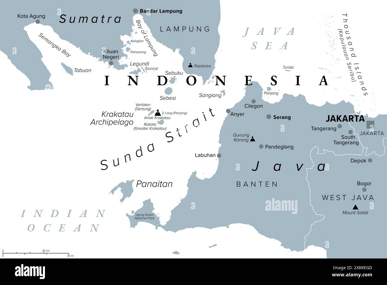 Sunda Strait, Indonesia, gray political map. Strait between Indonesian islands Java and Sumatra, connecting Java Sea with the Indian Ocean. Stock Photohttps://www.alamy.com/image-license-details/?v=1https://www.alamy.com/sunda-strait-indonesia-gray-political-map-strait-between-indonesian-islands-java-and-sumatra-connecting-java-sea-with-the-indian-ocean-image607796461.html
RF2X8REGD–Sunda Strait, Indonesia, gray political map. Strait between Indonesian islands Java and Sumatra, connecting Java Sea with the Indian Ocean.
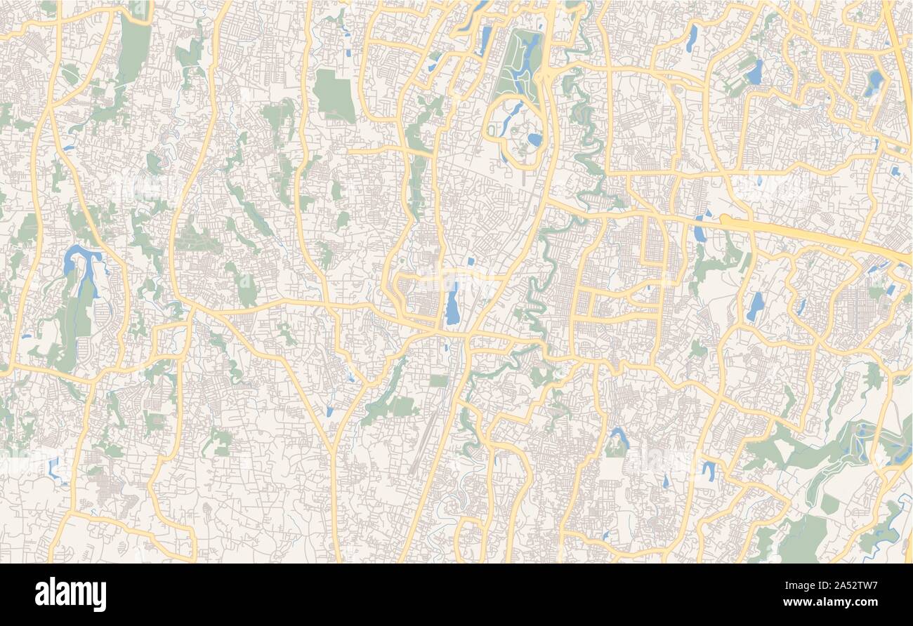 Printable street map of Depok, Province West Java, Indonesia. Map template for business use. Stock Vectorhttps://www.alamy.com/image-license-details/?v=1https://www.alamy.com/printable-street-map-of-depok-province-west-java-indonesia-map-template-for-business-use-image330133699.html
RF2A52TW7–Printable street map of Depok, Province West Java, Indonesia. Map template for business use.
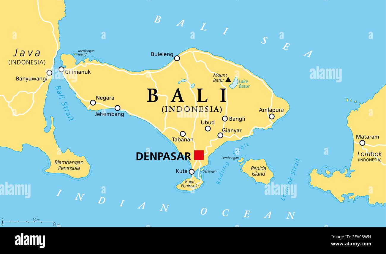 Bali political map, with capital Denpasar. A province and island of Indonesia, westernmost of Lesser Sunda Islands, east of Java, west of Lombok. Stock Photohttps://www.alamy.com/image-license-details/?v=1https://www.alamy.com/bali-political-map-with-capital-denpasar-a-province-and-island-of-indonesia-westernmost-of-lesser-sunda-islands-east-of-java-west-of-lombok-image419198465.html
RF2FA03WN–Bali political map, with capital Denpasar. A province and island of Indonesia, westernmost of Lesser Sunda Islands, east of Java, west of Lombok.
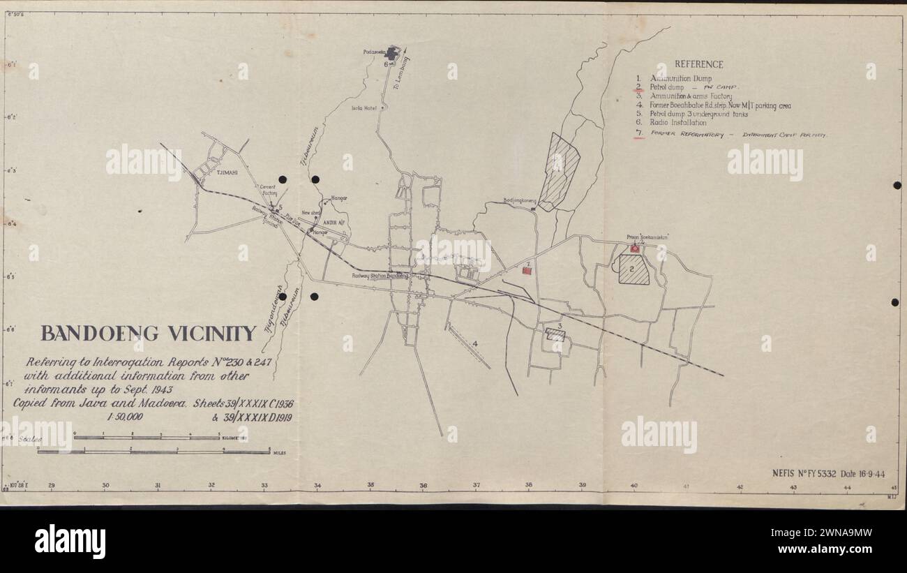 Map of Bandoeng during Indonesian War of Independence 1945-1948 Stock Photohttps://www.alamy.com/image-license-details/?v=1https://www.alamy.com/map-of-bandoeng-during-indonesian-war-of-independence-1945-1948-image598287449.html
RF2WNA9MW–Map of Bandoeng during Indonesian War of Independence 1945-1948
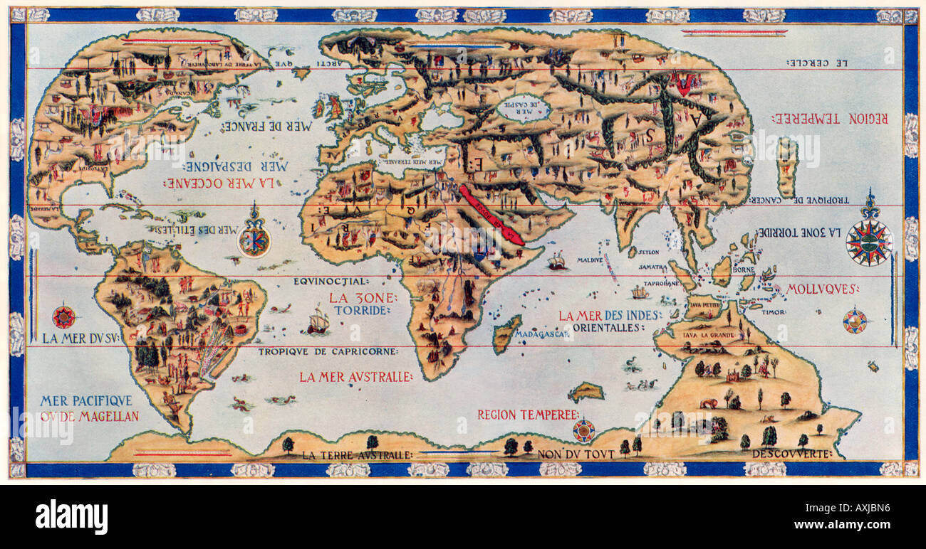 Dauphin Map by Pierre Desceliers made for Henri II by order of French King Francis I in 1546. Color halftone Stock Photohttps://www.alamy.com/image-license-details/?v=1https://www.alamy.com/dauphin-map-by-pierre-desceliers-made-for-henri-ii-by-order-of-french-image9632405.html
RMAXJBN6–Dauphin Map by Pierre Desceliers made for Henri II by order of French King Francis I in 1546. Color halftone
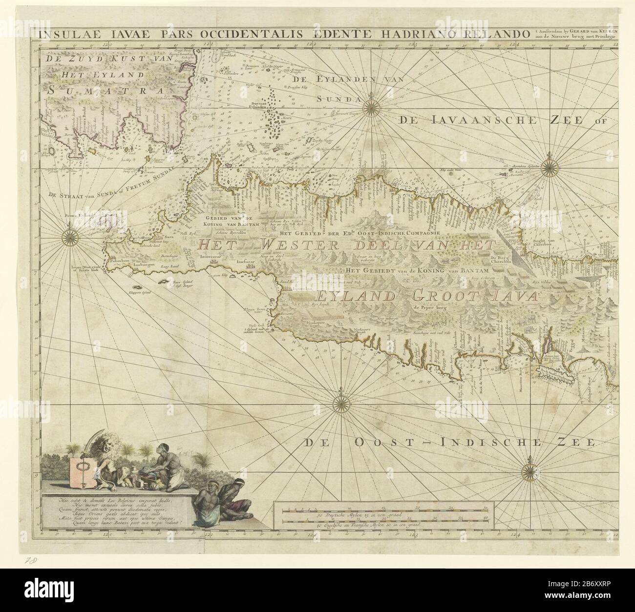 Kaart van het westelijk deel van Java Insulae Iavae Pars Occidentalis Edente Hadriano Relando (titel op object) Map of West Java and a tip of Sumatra (inksboven). There are five wind roses. There are topographical details on the map attached: rice fields, mountains, lighthouses, elephants etc. left a paean to the Netherlands as a colonizing nation with an allegorical representation of the Dutch Lion, to whom a Javanese man offering a gift, before two impassioned Javanese. Among the mid-scale in German, French and English miles (1: 1.1 mill). Left half of a map of the whole island Java. Manufac Stock Photohttps://www.alamy.com/image-license-details/?v=1https://www.alamy.com/kaart-van-het-westelijk-deel-van-java-insulae-iavae-pars-occidentalis-edente-hadriano-relando-titel-op-object-map-of-west-java-and-a-tip-of-sumatra-inksboven-there-are-five-wind-roses-there-are-topographical-details-on-the-map-attached-rice-fields-mountains-lighthouses-elephants-etc-left-a-paean-to-the-netherlands-as-a-colonizing-nation-with-an-allegorical-representation-of-the-dutch-lion-to-whom-a-javanese-man-offering-a-gift-before-two-impassioned-javanese-among-the-mid-scale-in-german-french-and-english-miles-1-11-mill-left-half-of-a-map-of-the-whole-island-java-manufac-image348487098.html
RM2B6XXRP–Kaart van het westelijk deel van Java Insulae Iavae Pars Occidentalis Edente Hadriano Relando (titel op object) Map of West Java and a tip of Sumatra (inksboven). There are five wind roses. There are topographical details on the map attached: rice fields, mountains, lighthouses, elephants etc. left a paean to the Netherlands as a colonizing nation with an allegorical representation of the Dutch Lion, to whom a Javanese man offering a gift, before two impassioned Javanese. Among the mid-scale in German, French and English miles (1: 1.1 mill). Left half of a map of the whole island Java. Manufac
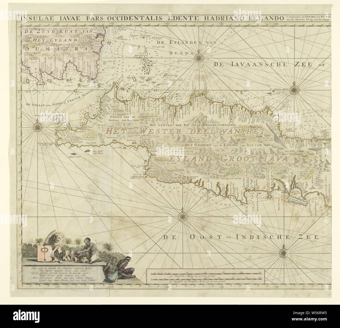 Map of the western part of Java, Insulae Iavae Pars Occidentalis Edente Hadriano Relando (title on object), Map of West Java and a tip of Sumatra (inks above). There are five compass roses. There are topographical details on the map: rice fields, mountains, lighthouses, elephants, etc. On the left a hymn on the Netherlands as a colonizing nation with an allegorical representation of the Dutch lion, to whom a Javanese man offers a gift, two handcuffed Javanese. Below the scale in German, French and English miles (1: 1.1 mill). Left half of a map of the entire island of Java, maps of separate Stock Photohttps://www.alamy.com/image-license-details/?v=1https://www.alamy.com/map-of-the-western-part-of-java-insulae-iavae-pars-occidentalis-edente-hadriano-relando-title-on-object-map-of-west-java-and-a-tip-of-sumatra-inks-above-there-are-five-compass-roses-there-are-topographical-details-on-the-map-rice-fields-mountains-lighthouses-elephants-etc-on-the-left-a-hymn-on-the-netherlands-as-a-colonizing-nation-with-an-allegorical-representation-of-the-dutch-lion-to-whom-a-javanese-man-offers-a-gift-two-handcuffed-javanese-below-the-scale-in-german-french-and-english-miles-1-11-mill-left-half-of-a-map-of-the-entire-island-of-java-maps-of-separate-image261379249.html
RMW56RW5–Map of the western part of Java, Insulae Iavae Pars Occidentalis Edente Hadriano Relando (title on object), Map of West Java and a tip of Sumatra (inks above). There are five compass roses. There are topographical details on the map: rice fields, mountains, lighthouses, elephants, etc. On the left a hymn on the Netherlands as a colonizing nation with an allegorical representation of the Dutch lion, to whom a Javanese man offers a gift, two handcuffed Javanese. Below the scale in German, French and English miles (1: 1.1 mill). Left half of a map of the entire island of Java, maps of separate
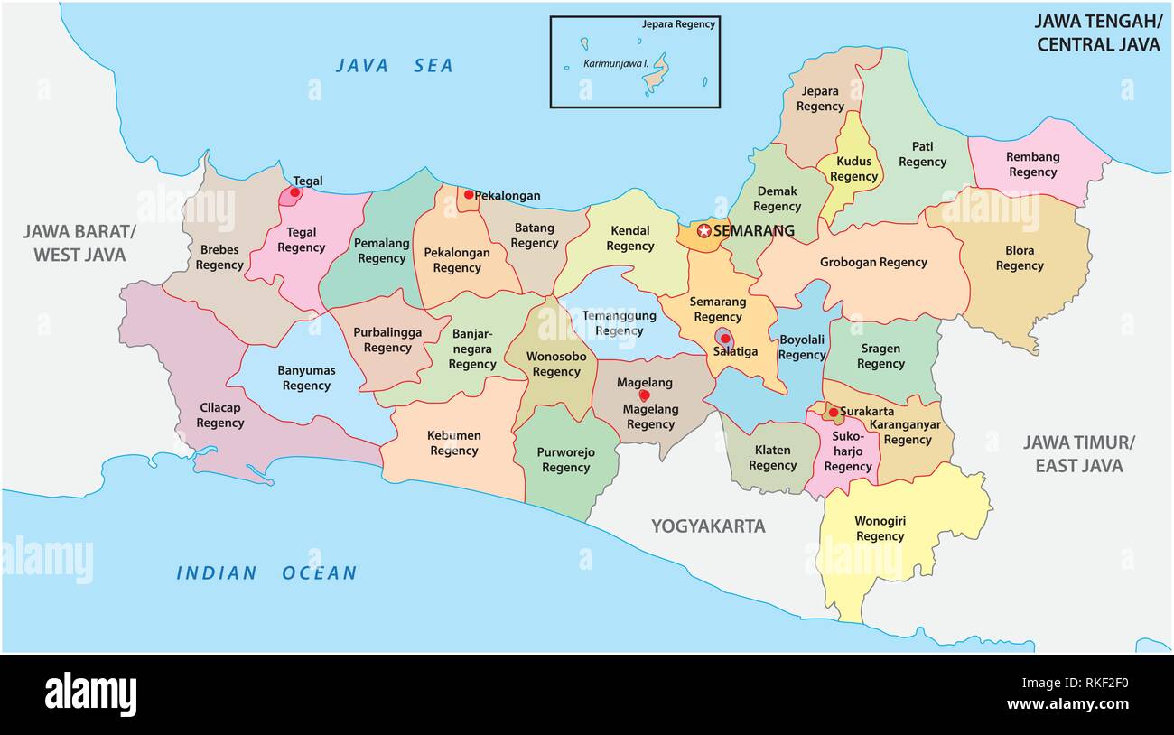 Jawa Tengah, Central Java administrative and political vector map, Indonesia Stock Vectorhttps://www.alamy.com/image-license-details/?v=1https://www.alamy.com/jawa-tengah-central-java-administrative-and-political-vector-map-indonesia-image235744516.html
RFRKF2F0–Jawa Tengah, Central Java administrative and political vector map, Indonesia
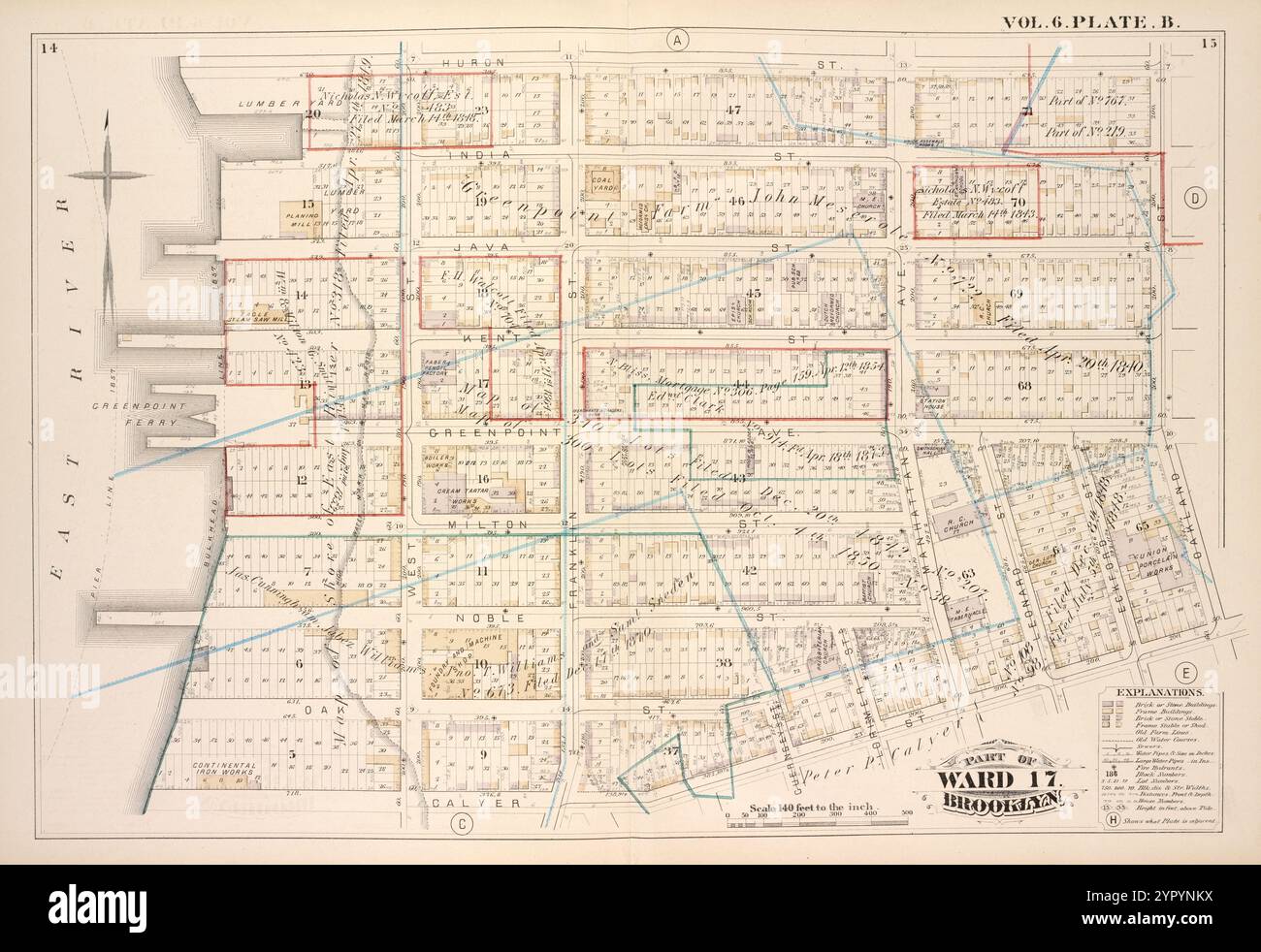 Map bound by Huron St., Oakland St., Calyer St., East River; Including India St., Java St., Kent St., Green Point St., Milton St., Noble St., Oak St., West St., Franklin St., Guernsey St., Lorimer St., Manhattan Ave., Leonard St., Eckford St., Vol. 6. Plate, B. 1880 Stock Photohttps://www.alamy.com/image-license-details/?v=1https://www.alamy.com/map-bound-by-huron-st-oakland-st-calyer-st-east-river-including-india-st-java-st-kent-st-green-point-st-milton-st-noble-st-oak-st-west-st-franklin-st-guernsey-st-lorimer-st-manhattan-ave-leonard-st-eckford-st-vol-6-plate-b-1880-image633705406.html
RM2YPYNKX–Map bound by Huron St., Oakland St., Calyer St., East River; Including India St., Java St., Kent St., Green Point St., Milton St., Noble St., Oak St., West St., Franklin St., Guernsey St., Lorimer St., Manhattan Ave., Leonard St., Eckford St., Vol. 6. Plate, B. 1880
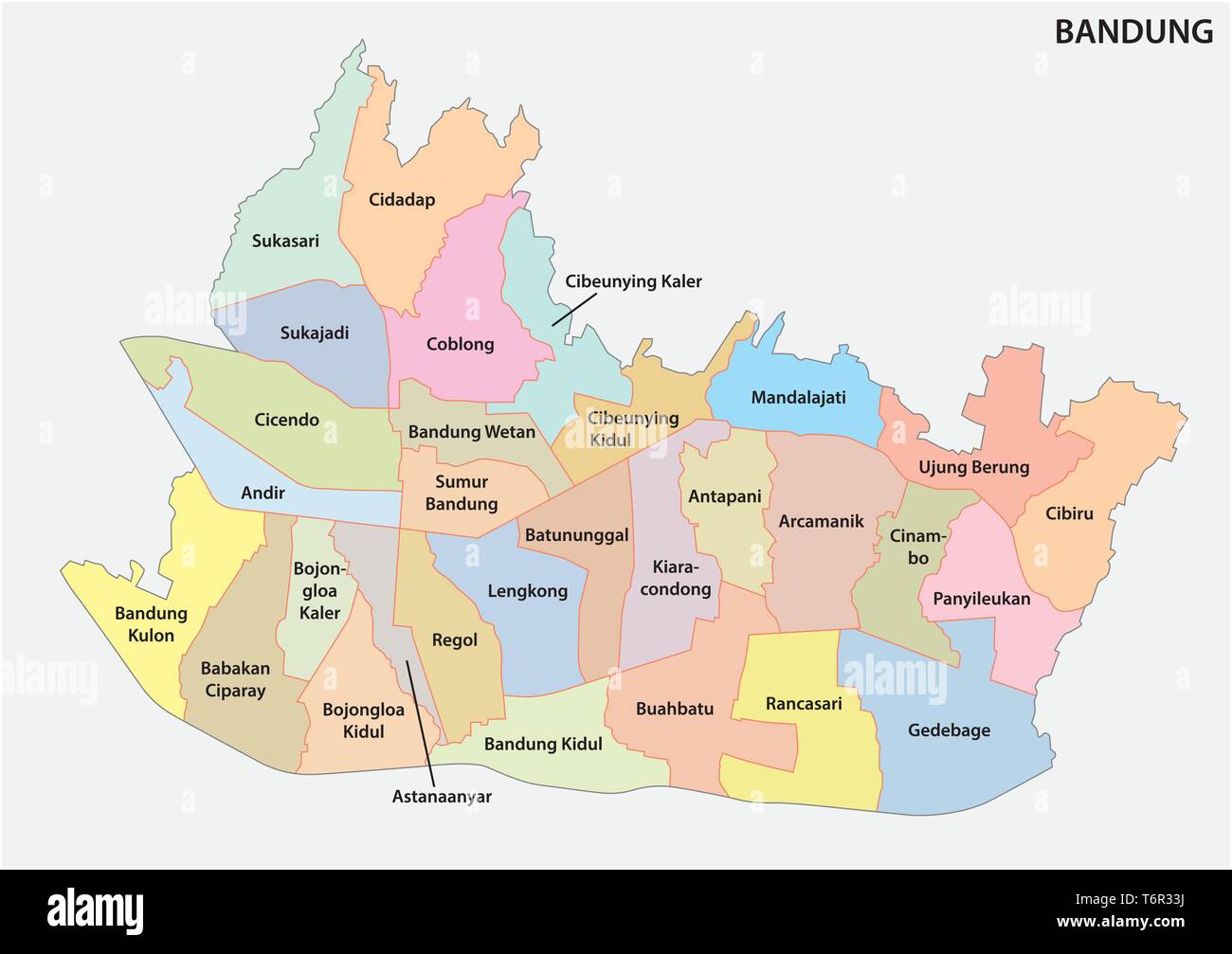 administrative and political map of the Indonesian city of Bandung Stock Vectorhttps://www.alamy.com/image-license-details/?v=1https://www.alamy.com/administrative-and-political-map-of-the-indonesian-city-of-bandung-image245140438.html
RFT6R33J–administrative and political map of the Indonesian city of Bandung
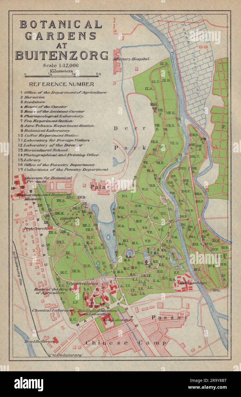 Bogor, West Java. 'Botanical Gardens at Buitenzorg'. Indonesia 1917 old map Stock Photohttps://www.alamy.com/image-license-details/?v=1https://www.alamy.com/bogor-west-java-botanical-gardens-at-buitenzorg-indonesia-1917-old-map-image556862988.html
RF2R9Y8BT–Bogor, West Java. 'Botanical Gardens at Buitenzorg'. Indonesia 1917 old map
 Map of West and Central Java, right part, Anonymous, 1890 - 1891 print Up to the top left: III. paper maps of separate countries or regions Java Stock Photohttps://www.alamy.com/image-license-details/?v=1https://www.alamy.com/map-of-west-and-central-java-right-part-anonymous-1890-1891-print-up-to-the-top-left-iii-paper-maps-of-separate-countries-or-regions-java-image594189393.html
RM2WEKJHN–Map of West and Central Java, right part, Anonymous, 1890 - 1891 print Up to the top left: III. paper maps of separate countries or regions Java
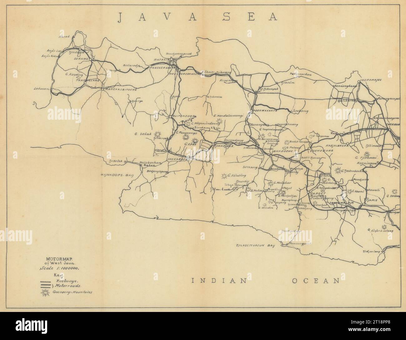 Motoring map of West Java, Indonesia. VAN STOCKUM 1930 old vintage chart Stock Photohttps://www.alamy.com/image-license-details/?v=1https://www.alamy.com/motoring-map-of-west-java-indonesia-van-stockum-1930-old-vintage-chart-image568750288.html
RF2T18PP8–Motoring map of West Java, Indonesia. VAN STOCKUM 1930 old vintage chart
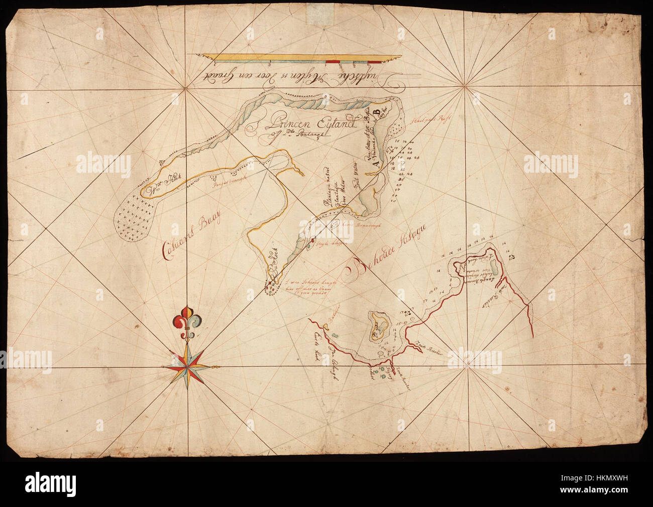 This map, designated AMH-5137-NA, depicts Java’s west coast and Princen Island, providing historical insight into the geographical landscape of Southeast Asia. Such maps were important for navigation and trade during the colonial period. Stock Photohttps://www.alamy.com/image-license-details/?v=1https://www.alamy.com/stock-photo-this-map-designated-amh-5137-na-depicts-javas-west-coast-and-princen-132611181.html
RMHKMXWH–This map, designated AMH-5137-NA, depicts Java’s west coast and Princen Island, providing historical insight into the geographical landscape of Southeast Asia. Such maps were important for navigation and trade during the colonial period.
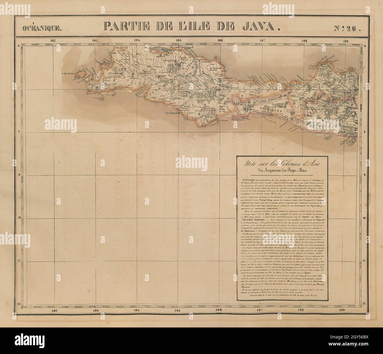 Océanique. Partie de l'ile de Java #26 West Java Indonesia VANDERMAELEN 1827 map Stock Photohttps://www.alamy.com/image-license-details/?v=1https://www.alamy.com/ocanique-partie-de-lile-de-java-26-west-java-indonesia-vandermaelen-1827-map-image446969710.html
RF2GY56BX–Océanique. Partie de l'ile de Java #26 West Java Indonesia VANDERMAELEN 1827 map
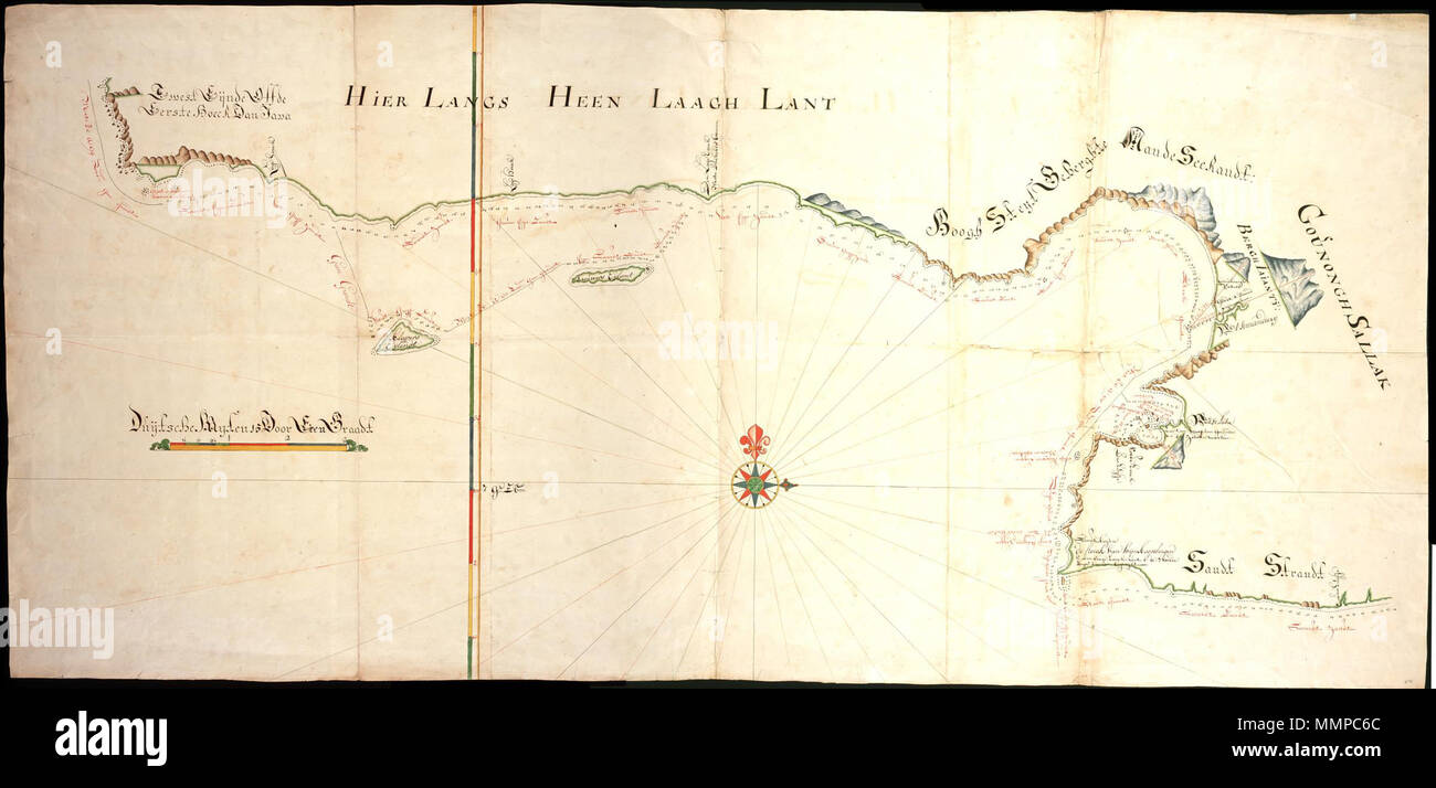 . Nederlands: Titel in catalogus Leupe (Nationaal Archief): Kaart van de Zuidkust van Java, van 't West Eynde off de Eerste hoeck van Java tot de hoeck van de Wijnkoopsbergen. English: Title in the Leupe Catalogue (National Archives): Kaart van de Zuidkust van Java, van 't West Eynde off de Eerste hoeck van Java tot de hoeck van de Wijnkoopsbergen. Nederlands: Kaart van de zuidkust van Java English: Map of the southern Java coast . between 1700 and 1800. Nederlands: Anoniem / Anonymous (landmeter / kaartenmaker) English: Anoniem / Anonymous (land surveyor / mapmaker) AMH-6387-NA Map of the s Stock Photohttps://www.alamy.com/image-license-details/?v=1https://www.alamy.com/nederlands-titel-in-catalogus-leupe-nationaal-archief-kaart-van-de-zuidkust-van-java-van-t-west-eynde-off-de-eerste-hoeck-van-java-tot-de-hoeck-van-de-wijnkoopsbergen-english-title-in-the-leupe-catalogue-national-archives-kaart-van-de-zuidkust-van-java-van-t-west-eynde-off-de-eerste-hoeck-van-java-tot-de-hoeck-van-de-wijnkoopsbergen-nederlands-kaart-van-de-zuidkust-van-java-english-map-of-the-southern-java-coast-between-1700-and-1800-nederlands-anoniem-anonymous-landmeter-kaartenmaker-english-anoniem-anonymous-land-surveyor-mapmaker-amh-6387-na-map-of-the-s-image184889332.html
RMMMPC6C–. Nederlands: Titel in catalogus Leupe (Nationaal Archief): Kaart van de Zuidkust van Java, van 't West Eynde off de Eerste hoeck van Java tot de hoeck van de Wijnkoopsbergen. English: Title in the Leupe Catalogue (National Archives): Kaart van de Zuidkust van Java, van 't West Eynde off de Eerste hoeck van Java tot de hoeck van de Wijnkoopsbergen. Nederlands: Kaart van de zuidkust van Java English: Map of the southern Java coast . between 1700 and 1800. Nederlands: Anoniem / Anonymous (landmeter / kaartenmaker) English: Anoniem / Anonymous (land surveyor / mapmaker) AMH-6387-NA Map of the s
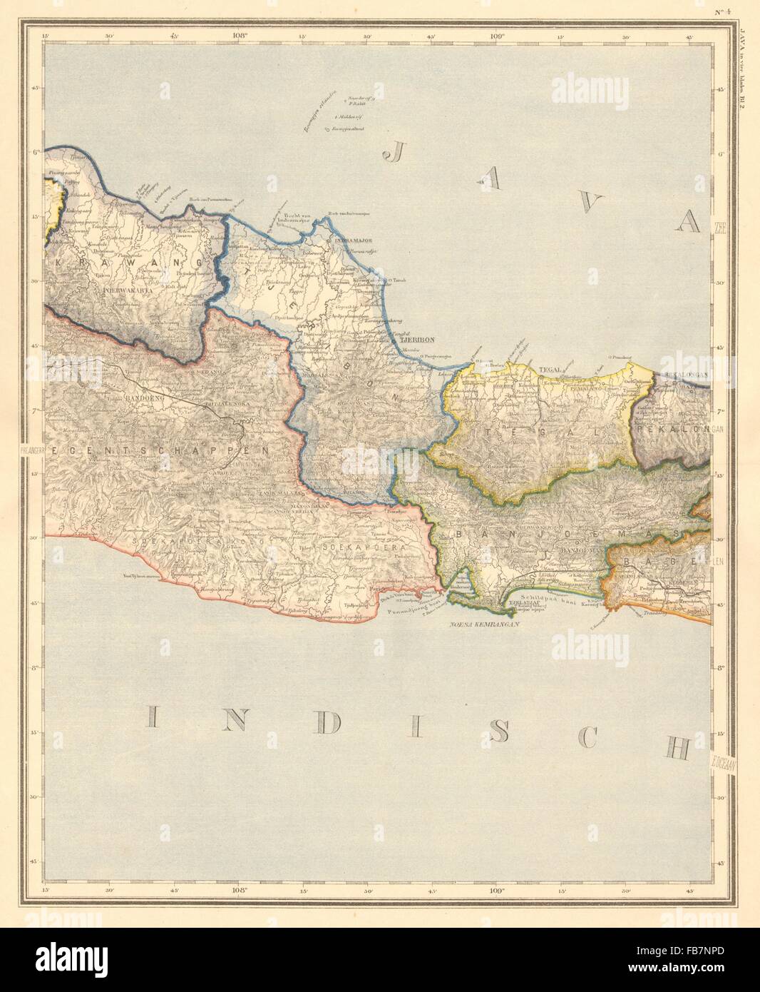 DUTCH EAST INDIES:Indonesia:West Central JAVA. Bandung. DORNSEIFFEN, 1892 map Stock Photohttps://www.alamy.com/image-license-details/?v=1https://www.alamy.com/stock-photo-dutch-east-indiesindonesiawest-central-java-bandung-dornseiffen-1892-92983813.html
RFFB7NPD–DUTCH EAST INDIES:Indonesia:West Central JAVA. Bandung. DORNSEIFFEN, 1892 map
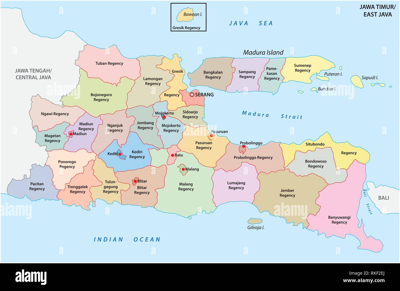 Jawa Timur, East Java administrative and political vector map, Indonesia Stock Vectorhttps://www.alamy.com/image-license-details/?v=1https://www.alamy.com/jawa-timur-east-java-administrative-and-political-vector-map-indonesia-image235744506.html
RFRKF2EJ–Jawa Timur, East Java administrative and political vector map, Indonesia
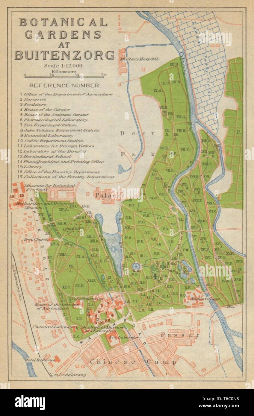 Bogor, West Java. 'Botanical Gardens at Buitenzorg'. Indonesia 1920 old map Stock Photohttps://www.alamy.com/image-license-details/?v=1https://www.alamy.com/bogor-west-java-botanical-gardens-at-buitenzorg-indonesia-1920-old-map-image244897108.html
RFT6C0N8–Bogor, West Java. 'Botanical Gardens at Buitenzorg'. Indonesia 1920 old map
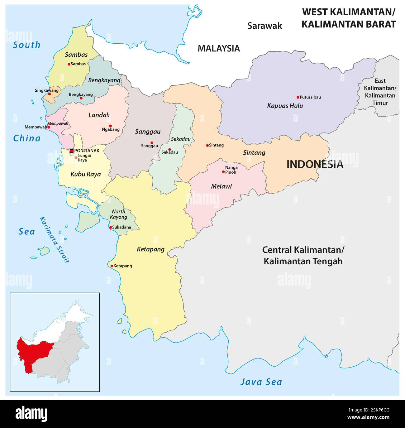 Administrative map of the Indonesian province of West Kalimantan, Borneo Stock Photohttps://www.alamy.com/image-license-details/?v=1https://www.alamy.com/administrative-map-of-the-indonesian-province-of-west-kalimantan-borneo-image648950080.html
RF2SKP6CG–Administrative map of the Indonesian province of West Kalimantan, Borneo
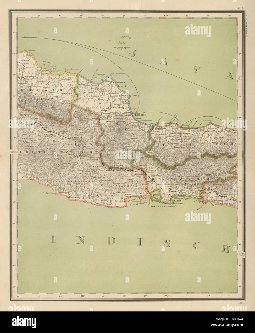 DUTCH EAST INDIES Indonesia West Central JAVA Bandung DORNSEIFFEN 1902 old map Stock Photohttps://www.alamy.com/image-license-details/?v=1https://www.alamy.com/dutch-east-indies-indonesia-west-central-java-bandung-dornseiffen-1902-old-map-image245136700.html
RFT6PXA4–DUTCH EAST INDIES Indonesia West Central JAVA Bandung DORNSEIFFEN 1902 old map
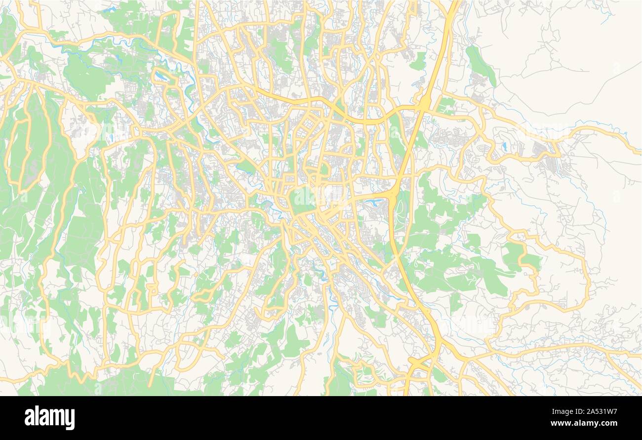 Printable street map of Bogor, Province West Java, Indonesia. Map template for business use. Stock Vectorhttps://www.alamy.com/image-license-details/?v=1https://www.alamy.com/printable-street-map-of-bogor-province-west-java-indonesia-map-template-for-business-use-image330137619.html
RF2A531W7–Printable street map of Bogor, Province West Java, Indonesia. Map template for business use.
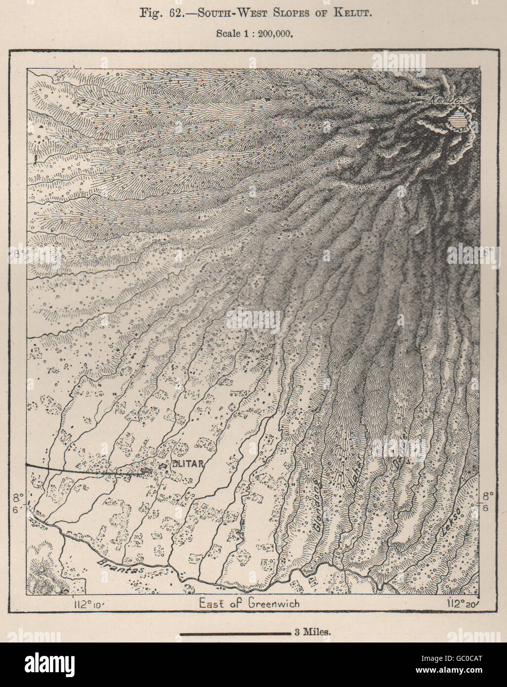 South-West Slopes of Kelut(Kelud)volcano,Java,Indonesia.East Indies, 1885 map Stock Photohttps://www.alamy.com/image-license-details/?v=1https://www.alamy.com/stock-photo-south-west-slopes-of-kelutkeludvolcanojavaindonesiaeast-indies-1885-110647792.html
RFGC0CAT–South-West Slopes of Kelut(Kelud)volcano,Java,Indonesia.East Indies, 1885 map
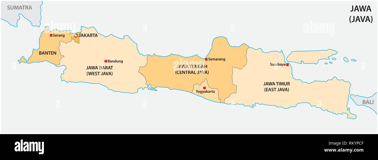 simple administrative and political vector map of indonesian island java Stock Vectorhttps://www.alamy.com/image-license-details/?v=1https://www.alamy.com/simple-administrative-and-political-vector-map-of-indonesian-island-java-image236023551.html
RFRKYPCF–simple administrative and political vector map of indonesian island java
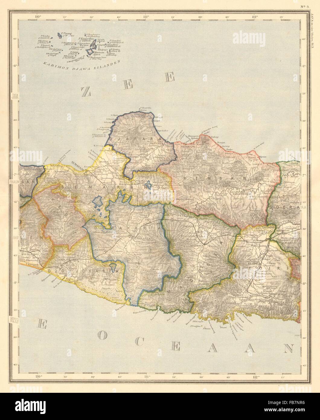 DUTCH EAST INDIES: Indonesia: JAVA. Yogyakarta Semarang. DORNSEIFFEN, 1892 map Stock Photohttps://www.alamy.com/image-license-details/?v=1https://www.alamy.com/stock-photo-dutch-east-indies-indonesia-java-yogyakarta-semarang-dornseiffen-1892-92983834.html
RFFB7NR6–DUTCH EAST INDIES: Indonesia: JAVA. Yogyakarta Semarang. DORNSEIFFEN, 1892 map
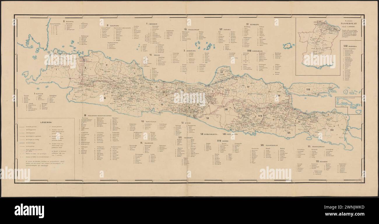 Map of Districts and Regencies in Java 19th Century Stock Photohttps://www.alamy.com/image-license-details/?v=1https://www.alamy.com/map-of-districts-and-regencies-in-java-19th-century-image598475569.html
RF2WNJWKD–Map of Districts and Regencies in Java 19th Century
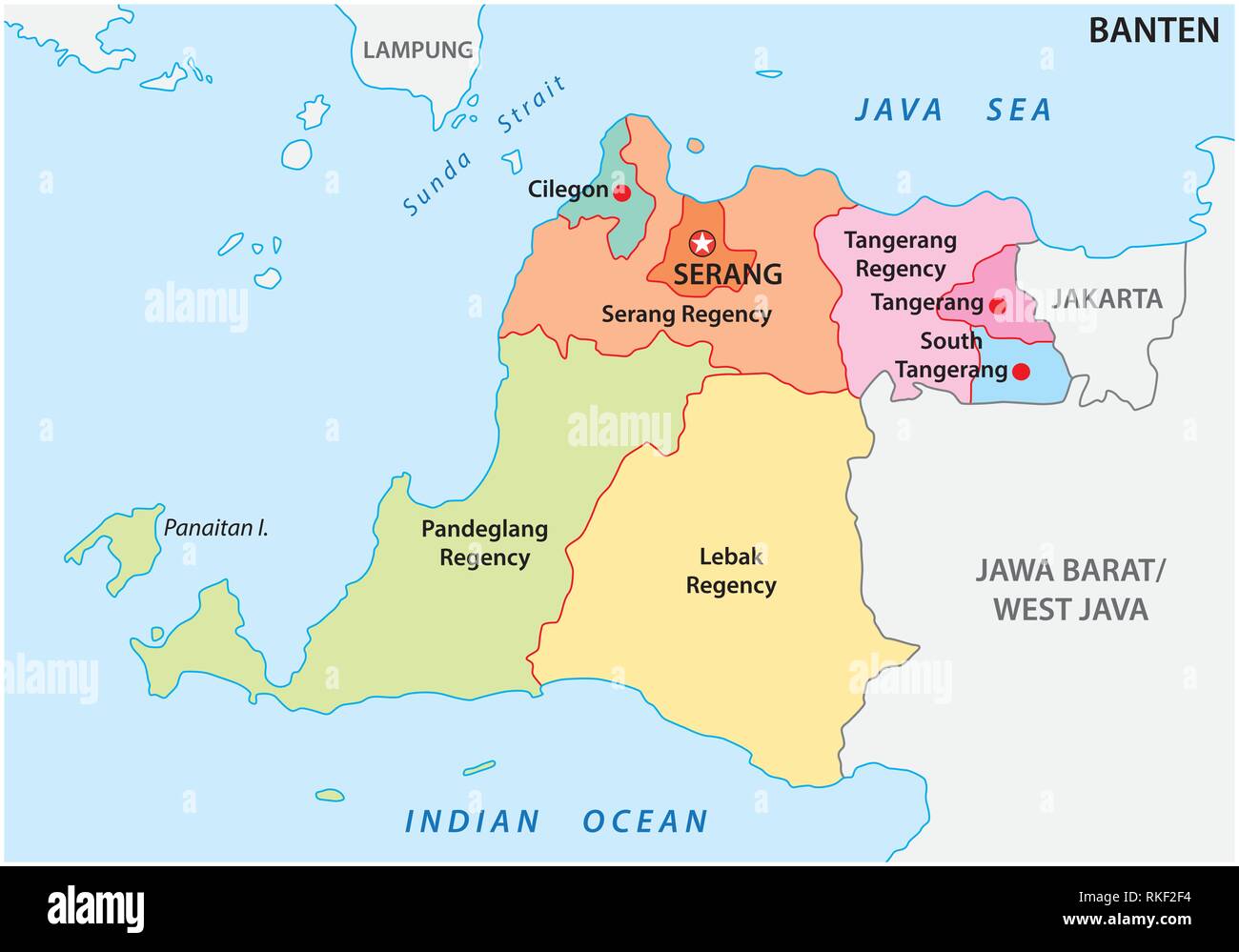 Banten administrative and political vector map, Indonesia Stock Vectorhttps://www.alamy.com/image-license-details/?v=1https://www.alamy.com/banten-administrative-and-political-vector-map-indonesia-image235744520.html
RFRKF2F4–Banten administrative and political vector map, Indonesia
![Brooklyn, Vol. 4, Double Page Plate No. 69; [Map bounded by Bell St., Pink St., Blue St., Bay St., Maspeth Ave., East Williamsburgh, Newtown Creek, Franklyn St., Kent St.; Including East River Dupont St., Eagle St., Freeman St., West St., Green St., Huron St., India St., Java St.] 1868 by Higginson, J. H. (Publisher) Stock Photo Brooklyn, Vol. 4, Double Page Plate No. 69; [Map bounded by Bell St., Pink St., Blue St., Bay St., Maspeth Ave., East Williamsburgh, Newtown Creek, Franklyn St., Kent St.; Including East River Dupont St., Eagle St., Freeman St., West St., Green St., Huron St., India St., Java St.] 1868 by Higginson, J. H. (Publisher) Stock Photo](https://c8.alamy.com/comp/2YPYR8W/brooklyn-vol-4-double-page-plate-no-69-map-bounded-by-bell-st-pink-st-blue-st-bay-st-maspeth-ave-east-williamsburgh-newtown-creek-franklyn-st-kent-st-including-east-river-dupont-st-eagle-st-freeman-st-west-st-green-st-huron-st-india-st-java-st-1868-by-higginson-j-h-publisher-2YPYR8W.jpg) Brooklyn, Vol. 4, Double Page Plate No. 69; [Map bounded by Bell St., Pink St., Blue St., Bay St., Maspeth Ave., East Williamsburgh, Newtown Creek, Franklyn St., Kent St.; Including East River Dupont St., Eagle St., Freeman St., West St., Green St., Huron St., India St., Java St.] 1868 by Higginson, J. H. (Publisher) Stock Photohttps://www.alamy.com/image-license-details/?v=1https://www.alamy.com/brooklyn-vol-4-double-page-plate-no-69-map-bounded-by-bell-st-pink-st-blue-st-bay-st-maspeth-ave-east-williamsburgh-newtown-creek-franklyn-st-kent-st-including-east-river-dupont-st-eagle-st-freeman-st-west-st-green-st-huron-st-india-st-java-st-1868-by-higginson-j-h-publisher-image633706665.html
Brooklyn, Vol. 4, Double Page Plate No. 69; [Map bounded by Bell St., Pink St., Blue St., Bay St., Maspeth Ave., East Williamsburgh, Newtown Creek, Franklyn St., Kent St.; Including East River Dupont St., Eagle St., Freeman St., West St., Green St., Huron St., India St., Java St.] 1868 by Higginson, J. H. (Publisher) Stock Photohttps://www.alamy.com/image-license-details/?v=1https://www.alamy.com/brooklyn-vol-4-double-page-plate-no-69-map-bounded-by-bell-st-pink-st-blue-st-bay-st-maspeth-ave-east-williamsburgh-newtown-creek-franklyn-st-kent-st-including-east-river-dupont-st-eagle-st-freeman-st-west-st-green-st-huron-st-india-st-java-st-1868-by-higginson-j-h-publisher-image633706665.htmlRM2YPYR8W–Brooklyn, Vol. 4, Double Page Plate No. 69; [Map bounded by Bell St., Pink St., Blue St., Bay St., Maspeth Ave., East Williamsburgh, Newtown Creek, Franklyn St., Kent St.; Including East River Dupont St., Eagle St., Freeman St., West St., Green St., Huron St., India St., Java St.] 1868 by Higginson, J. H. (Publisher)
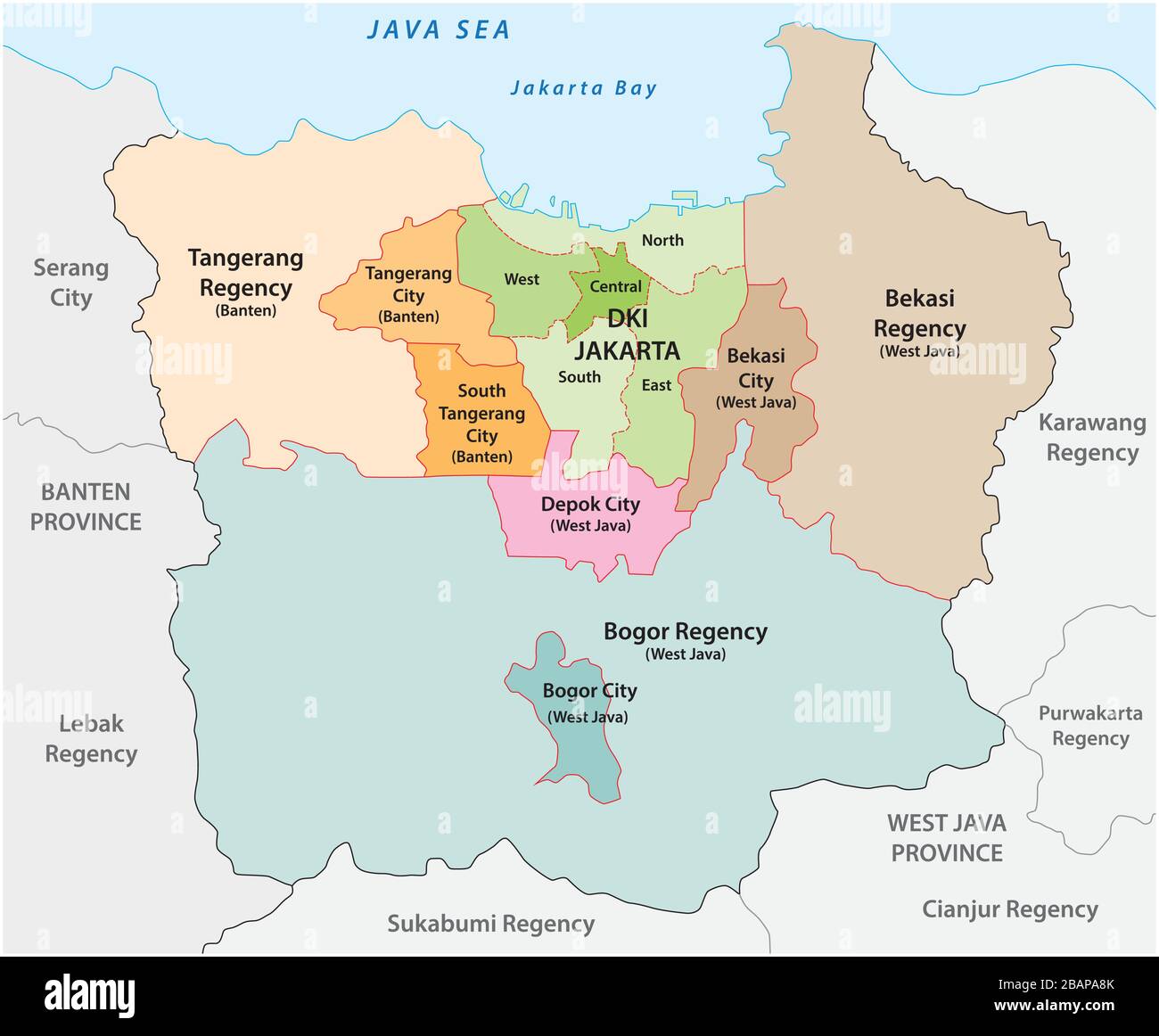 Administrative vector map of the Jakarta metropolitan area, the most populous metropolitan area in Indonesia Stock Vectorhttps://www.alamy.com/image-license-details/?v=1https://www.alamy.com/administrative-vector-map-of-the-jakarta-metropolitan-area-the-most-populous-metropolitan-area-in-indonesia-image350844947.html
RF2BAPA8K–Administrative vector map of the Jakarta metropolitan area, the most populous metropolitan area in Indonesia
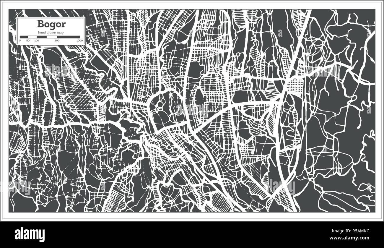 Bogor West Java Indonesia City Map in Retro Style. Outline Map. Vector Illustration. Stock Vectorhttps://www.alamy.com/image-license-details/?v=1https://www.alamy.com/bogor-west-java-indonesia-city-map-in-retro-style-outline-map-vector-illustration-image227043808.html
RFR5AMKC–Bogor West Java Indonesia City Map in Retro Style. Outline Map. Vector Illustration.
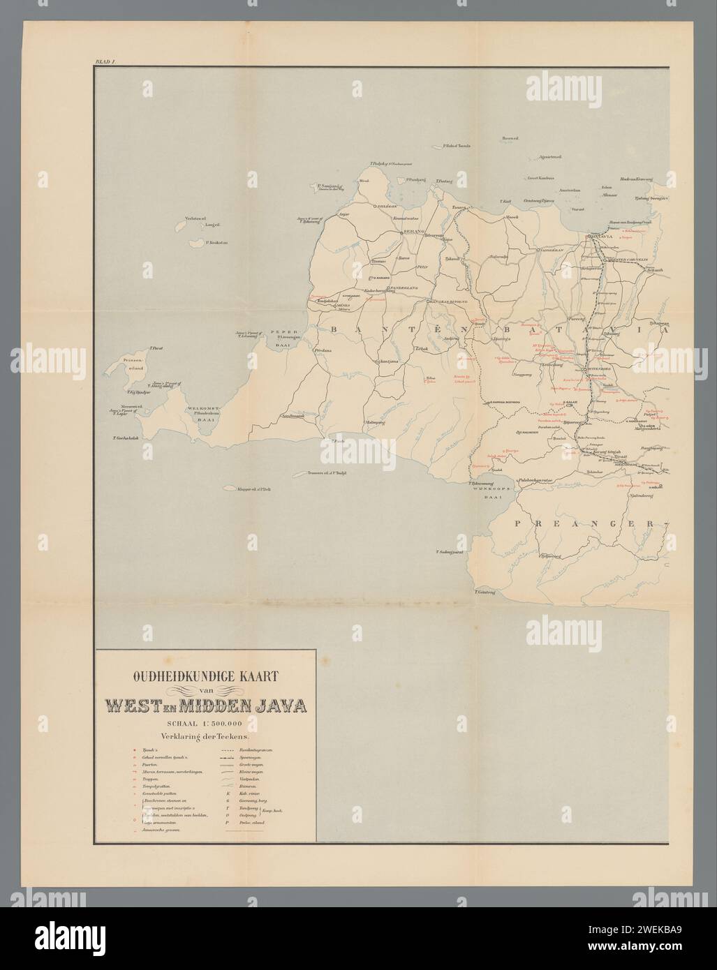 Map of West and Central Java, left part, Anonymous, 1890 - 1891 print At the top left numbered: I. paper maps of separate countries or regions Java Stock Photohttps://www.alamy.com/image-license-details/?v=1https://www.alamy.com/map-of-west-and-central-java-left-part-anonymous-1890-1891-print-at-the-top-left-numbered-i-paper-maps-of-separate-countries-or-regions-java-image594183697.html
RM2WEKBA9–Map of West and Central Java, left part, Anonymous, 1890 - 1891 print At the top left numbered: I. paper maps of separate countries or regions Java
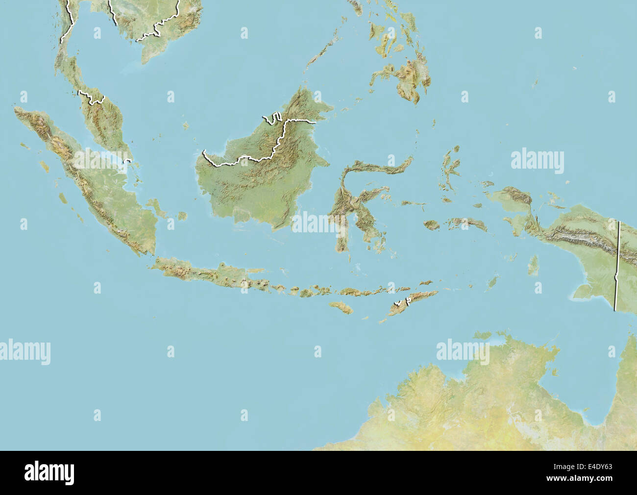 Indonesia, Relief Map With Border Stock Photohttps://www.alamy.com/image-license-details/?v=1https://www.alamy.com/stock-photo-indonesia-relief-map-with-border-71606811.html
RME4DY63–Indonesia, Relief Map With Border
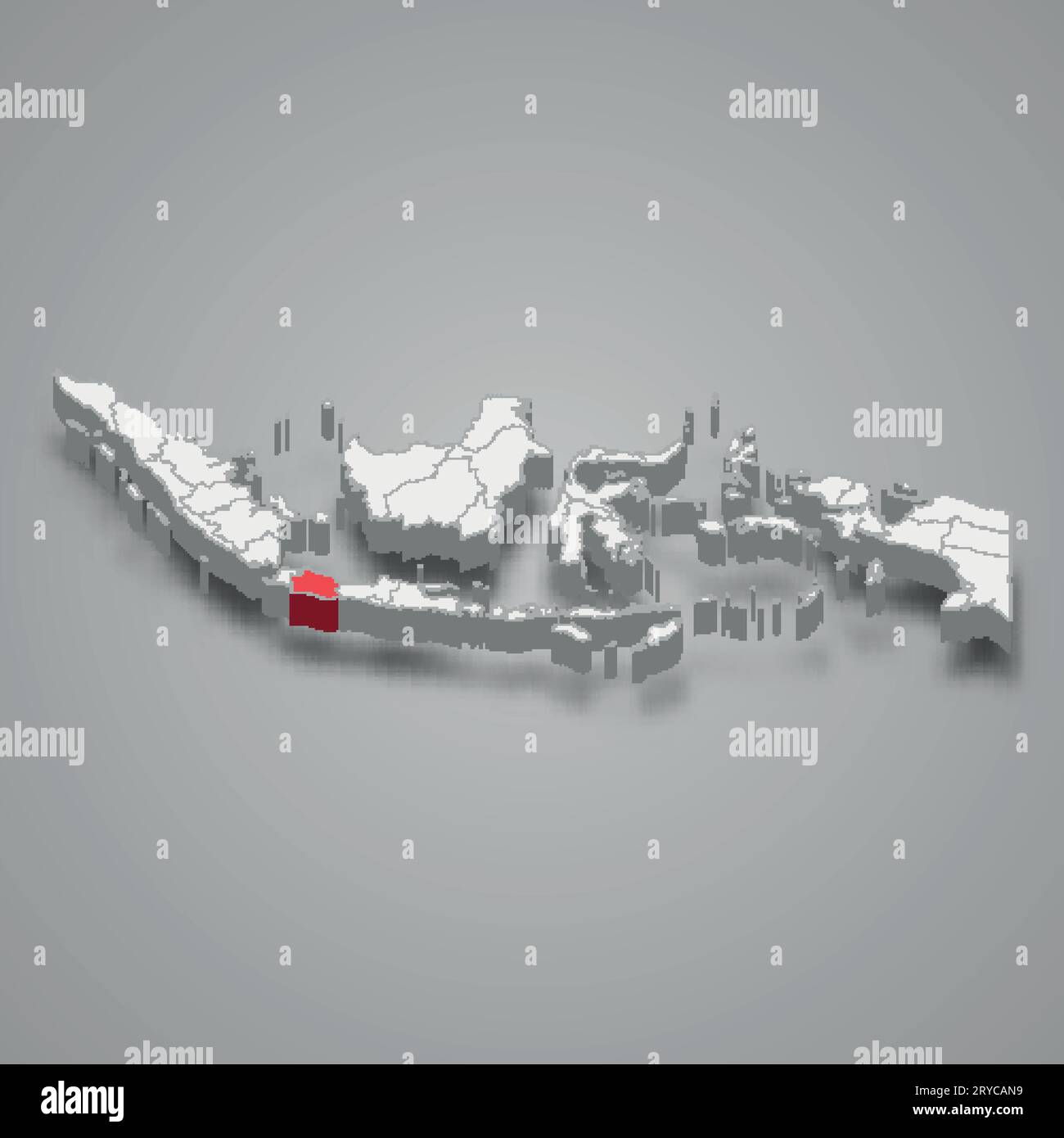 West Java province location Indonesia 3d isometric map Stock Vectorhttps://www.alamy.com/image-license-details/?v=1https://www.alamy.com/west-java-province-location-indonesia-3d-isometric-map-image567599349.html
RF2RYCAN9–West Java province location Indonesia 3d isometric map
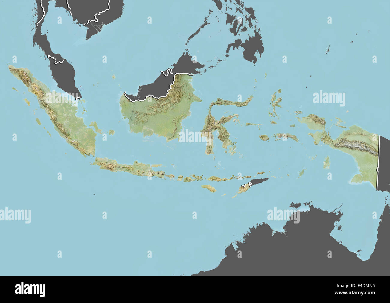 Indonesia, Relief Map With Border and Mask Stock Photohttps://www.alamy.com/image-license-details/?v=1https://www.alamy.com/stock-photo-indonesia-relief-map-with-border-and-mask-71601745.html
RME4DMN5–Indonesia, Relief Map With Border and Mask
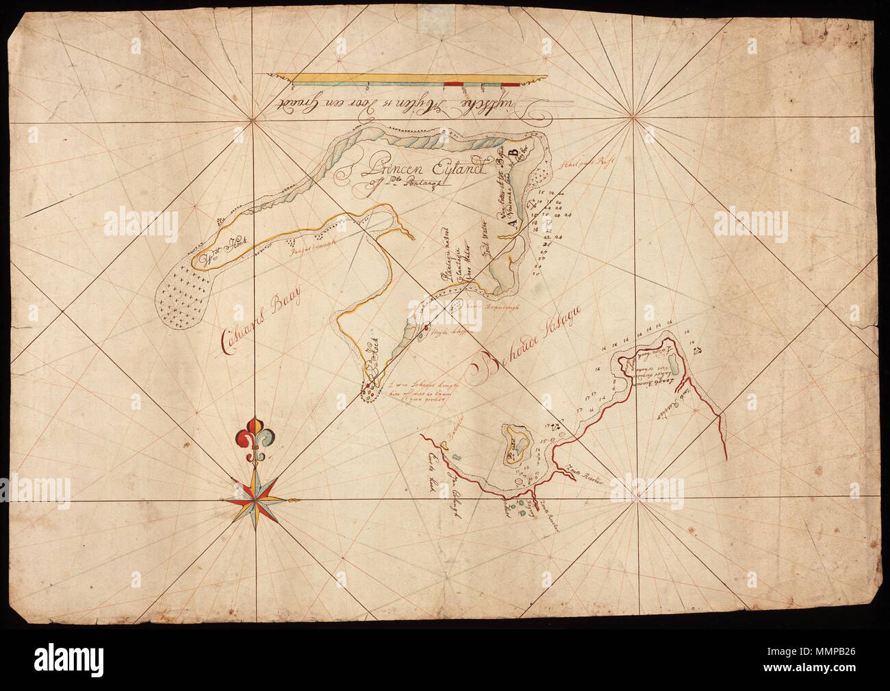 . Nederlands: Titel in catalogus Leupe (Nationaal Archief): Kaart van 't Princen Eylandt of P. Pontangh, met de Behoude passagie, van de Eerste tot de Tweede Hoek. Notities verso: Jaavast Westkust en De Behouwde passagie. English: Title in the Leupe catalogue (National Archives): Kaart van 't Princen Eylandt of P. Pontangh, met de Behoude passagie, van de Eerste tot de Tweede Hoek. Notes on reverse: Jaavast Westkust en De Behouwde passagie. Nederlands: Kaart van Java's westkust en Princen Eyland English: Map of Java's west coast and Princen Island . between 1650 and 1750. Nederlands: Anoniem Stock Photohttps://www.alamy.com/image-license-details/?v=1https://www.alamy.com/nederlands-titel-in-catalogus-leupe-nationaal-archief-kaart-van-t-princen-eylandt-of-p-pontangh-met-de-behoude-passagie-van-de-eerste-tot-de-tweede-hoek-notities-verso-jaavast-westkust-en-de-behouwde-passagie-english-title-in-the-leupe-catalogue-national-archives-kaart-van-t-princen-eylandt-of-p-pontangh-met-de-behoude-passagie-van-de-eerste-tot-de-tweede-hoek-notes-on-reverse-jaavast-westkust-en-de-behouwde-passagie-nederlands-kaart-van-javas-westkust-en-princen-eyland-english-map-of-javas-west-coast-and-princen-island-between-1650-and-1750-nederlands-anoniem-image184888430.html
RMMMPB26–. Nederlands: Titel in catalogus Leupe (Nationaal Archief): Kaart van 't Princen Eylandt of P. Pontangh, met de Behoude passagie, van de Eerste tot de Tweede Hoek. Notities verso: Jaavast Westkust en De Behouwde passagie. English: Title in the Leupe catalogue (National Archives): Kaart van 't Princen Eylandt of P. Pontangh, met de Behoude passagie, van de Eerste tot de Tweede Hoek. Notes on reverse: Jaavast Westkust en De Behouwde passagie. Nederlands: Kaart van Java's westkust en Princen Eyland English: Map of Java's west coast and Princen Island . between 1650 and 1750. Nederlands: Anoniem
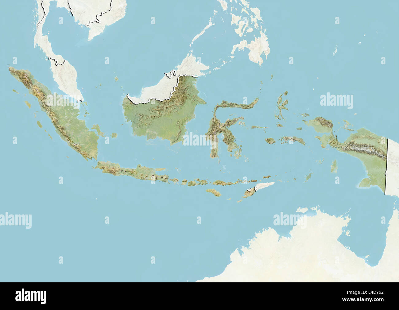 Indonesia, Relief Map With Border and Mask Stock Photohttps://www.alamy.com/image-license-details/?v=1https://www.alamy.com/stock-photo-indonesia-relief-map-with-border-and-mask-71606810.html
RME4DY62–Indonesia, Relief Map With Border and Mask
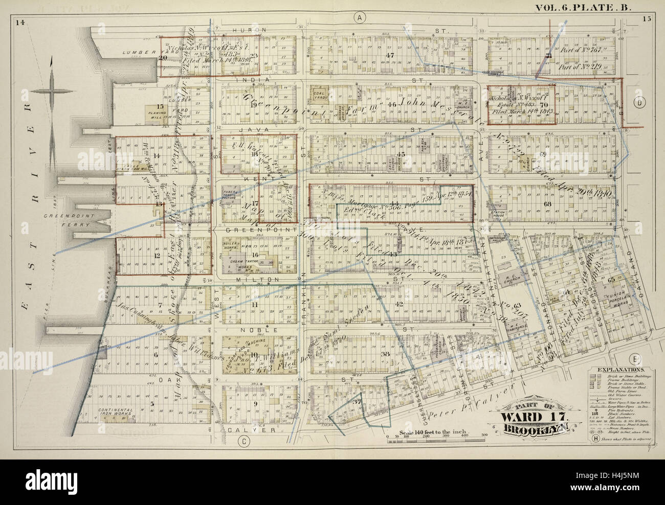 Vol. 6. Plate, B. Map bound by Huron St., Oakland St., Calyer St., East River; Including India St., Java St., Kent St. Stock Photohttps://www.alamy.com/image-license-details/?v=1https://www.alamy.com/stock-photo-vol-6-plate-b-map-bound-by-huron-st-oakland-st-calyer-st-east-river-123330864.html
RMH4J5NM–Vol. 6. Plate, B. Map bound by Huron St., Oakland St., Calyer St., East River; Including India St., Java St., Kent St.
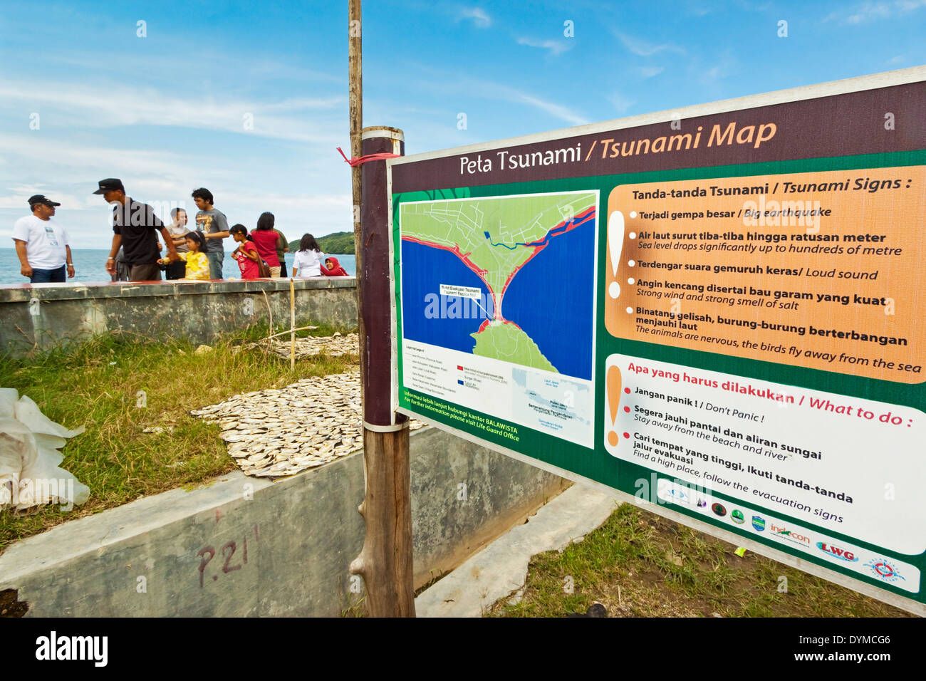 Tsunami map & list of danger signs to watch out for, at this popular south coast resort; Pangandaran, West Java, Java, Indonesia Stock Photohttps://www.alamy.com/image-license-details/?v=1https://www.alamy.com/tsunami-map-list-of-danger-signs-to-watch-out-for-at-this-popular-image68675718.html
RMDYMCG6–Tsunami map & list of danger signs to watch out for, at this popular south coast resort; Pangandaran, West Java, Java, Indonesia
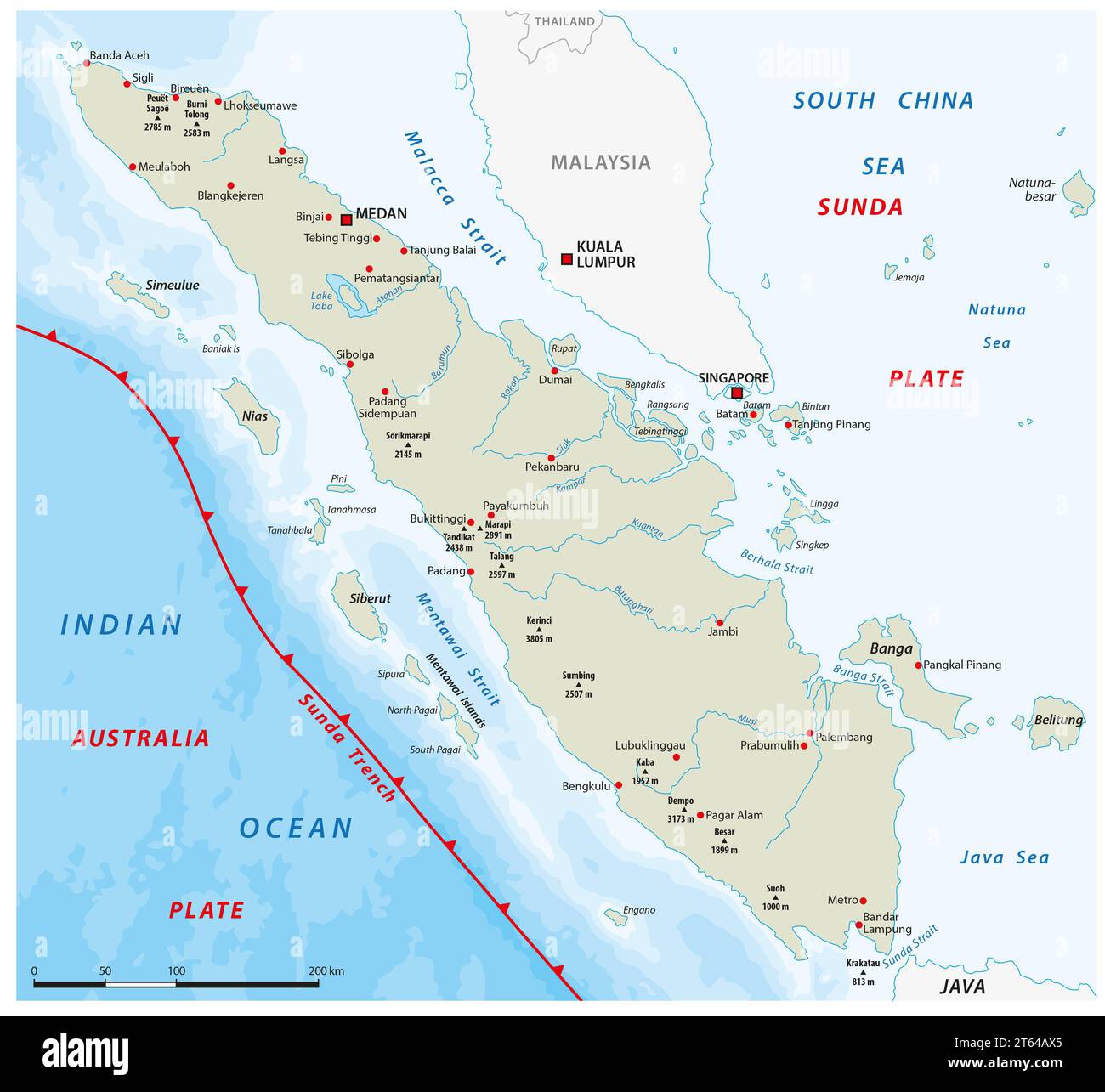 Map of the Sunda Trench off the west coast of Sumatra, Indonesia Stock Photohttps://www.alamy.com/image-license-details/?v=1https://www.alamy.com/map-of-the-sunda-trench-off-the-west-coast-of-sumatra-indonesia-image571726461.html
RF2T64AX5–Map of the Sunda Trench off the west coast of Sumatra, Indonesia
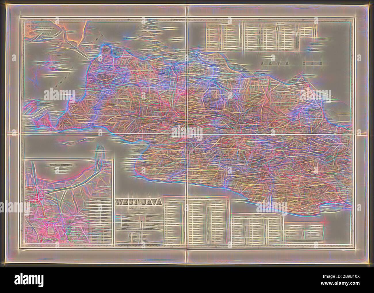 Map of West Java, Map of West Java with a legend and a map of the area around Batavia. Numbered top left: 3. With degree distribution along the edges, maps of separate countries or regions, West Java, Batavia, Topografische Inrichting (mentioned on object), Java, 1905, paper, linen (material), h 655 mm × w 920 mm, Reimagined by Gibon, design of warm cheerful glowing of brightness and light rays radiance. Classic art reinvented with a modern twist. Photography inspired by futurism, embracing dynamic energy of modern technology, movement, speed and revolutionize culture. Stock Photohttps://www.alamy.com/image-license-details/?v=1https://www.alamy.com/map-of-west-java-map-of-west-java-with-a-legend-and-a-map-of-the-area-around-batavia-numbered-top-left-3-with-degree-distribution-along-the-edges-maps-of-separate-countries-or-regions-west-java-batavia-topografische-inrichting-mentioned-on-object-java-1905-paper-linen-material-h-655-mm-w-920-mm-reimagined-by-gibon-design-of-warm-cheerful-glowing-of-brightness-and-light-rays-radiance-classic-art-reinvented-with-a-modern-twist-photography-inspired-by-futurism-embracing-dynamic-energy-of-modern-technology-movement-speed-and-revolutionize-culture-image349981546.html
RF2B9B10X–Map of West Java, Map of West Java with a legend and a map of the area around Batavia. Numbered top left: 3. With degree distribution along the edges, maps of separate countries or regions, West Java, Batavia, Topografische Inrichting (mentioned on object), Java, 1905, paper, linen (material), h 655 mm × w 920 mm, Reimagined by Gibon, design of warm cheerful glowing of brightness and light rays radiance. Classic art reinvented with a modern twist. Photography inspired by futurism, embracing dynamic energy of modern technology, movement, speed and revolutionize culture.
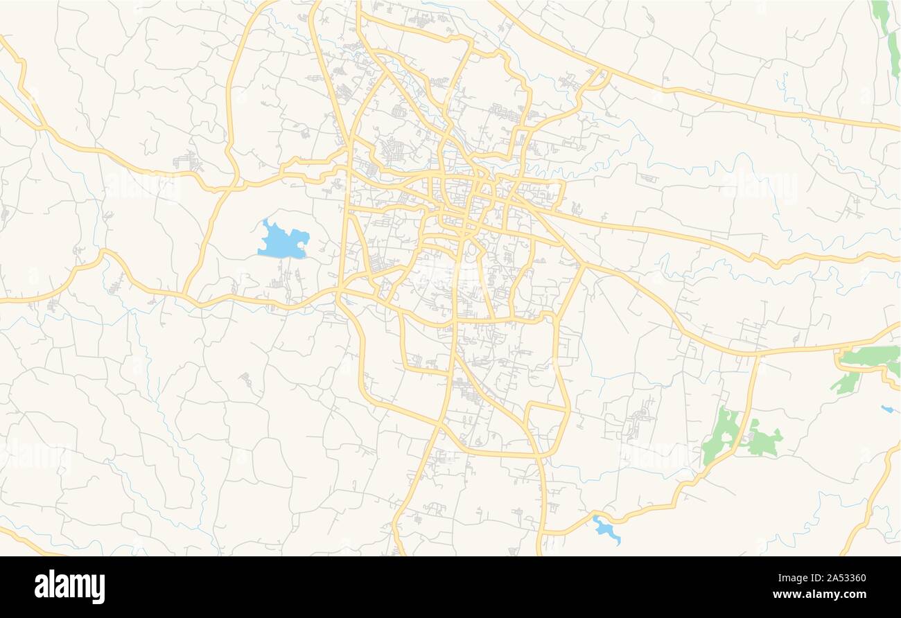 Printable street map of Tasikmalaya, Province West Java, Indonesia. Map template for business use. Stock Vectorhttps://www.alamy.com/image-license-details/?v=1https://www.alamy.com/printable-street-map-of-tasikmalaya-province-west-java-indonesia-map-template-for-business-use-image330138648.html
RF2A53360–Printable street map of Tasikmalaya, Province West Java, Indonesia. Map template for business use.
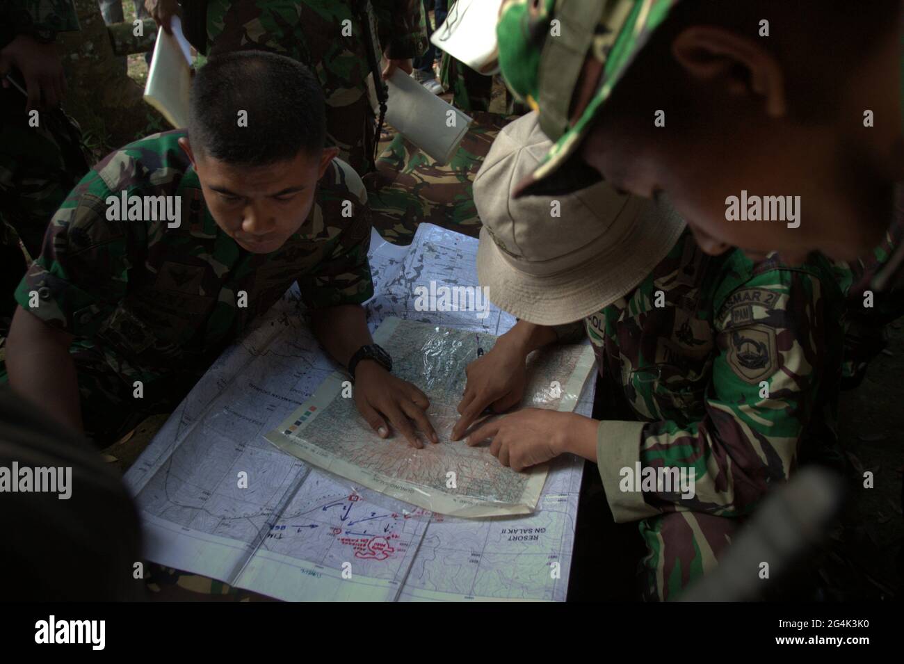 Mount Salak, West Java, Indonesia. May 10, 2012. Military personnels plotting the possible locations on the map, before the search mission for the Sukhoi Superjet 100 (SSJ-100) plane that crashed in the region on May 9. Stock Photohttps://www.alamy.com/image-license-details/?v=1https://www.alamy.com/mount-salak-west-java-indonesia-may-10-2012-military-personnels-plotting-the-possible-locations-on-the-map-before-the-search-mission-for-the-sukhoi-superjet-100-ssj-100-plane-that-crashed-in-the-region-on-may-9-image433137796.html
RM2G4K3K0–Mount Salak, West Java, Indonesia. May 10, 2012. Military personnels plotting the possible locations on the map, before the search mission for the Sukhoi Superjet 100 (SSJ-100) plane that crashed in the region on May 9.
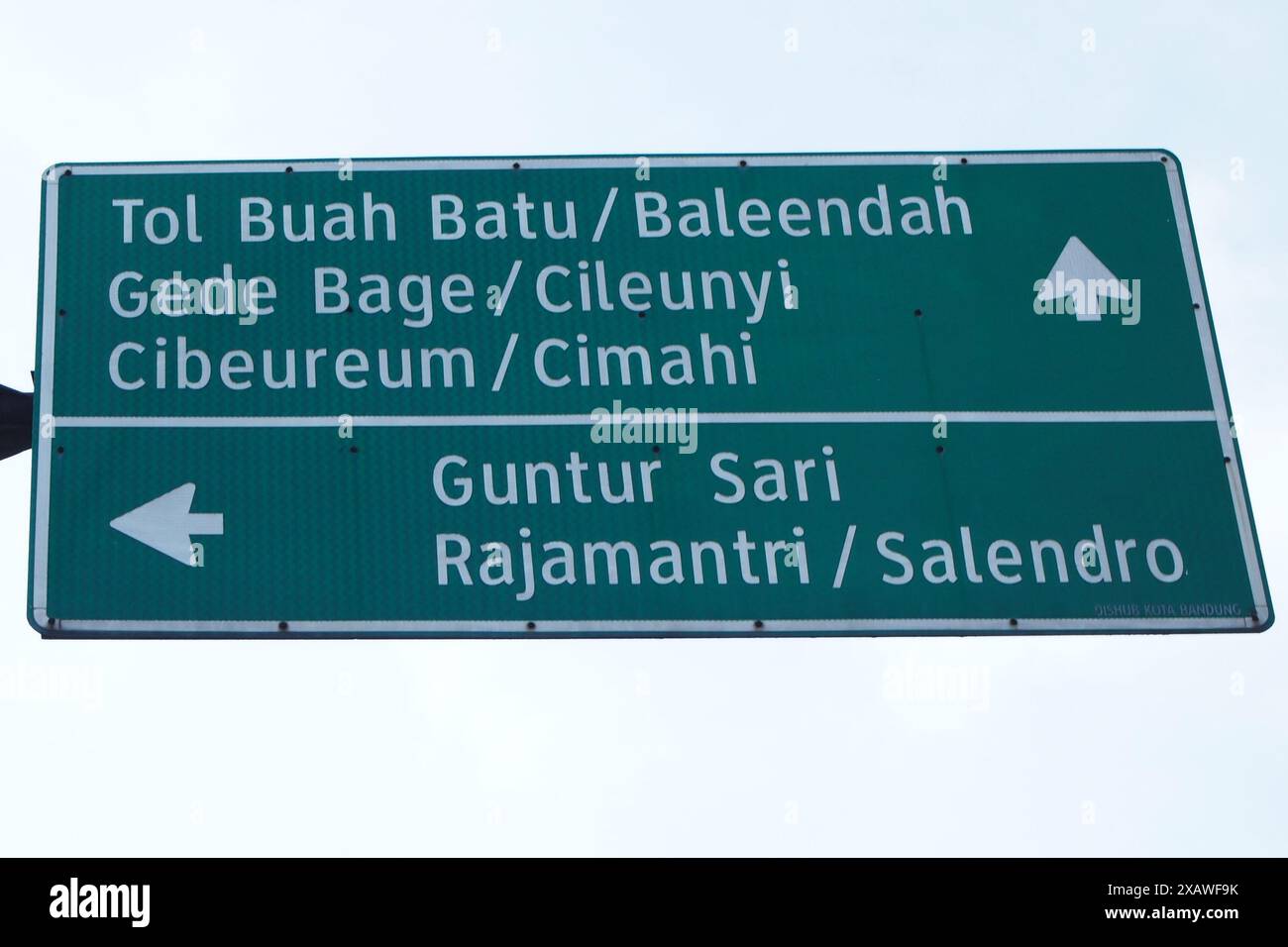 A green road sign pointing the way in the city of Bandung Stock Photohttps://www.alamy.com/image-license-details/?v=1https://www.alamy.com/a-green-road-sign-pointing-the-way-in-the-city-of-bandung-image609070271.html
RF2XAWF9K–A green road sign pointing the way in the city of Bandung
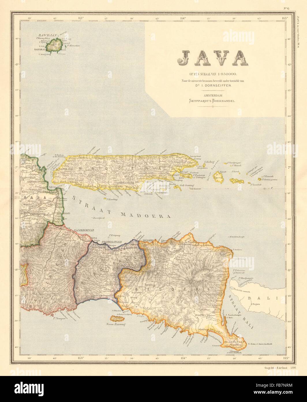 DUTCH EAST INDIES:Indonesia:East JAVA & Madura. Surabaya. DORNSEIFFEN, 1892 map Stock Photohttps://www.alamy.com/image-license-details/?v=1https://www.alamy.com/stock-photo-dutch-east-indiesindonesiaeast-java-madura-surabaya-dornseiffen-1892-92983848.html
RFFB7NRM–DUTCH EAST INDIES:Indonesia:East JAVA & Madura. Surabaya. DORNSEIFFEN, 1892 map
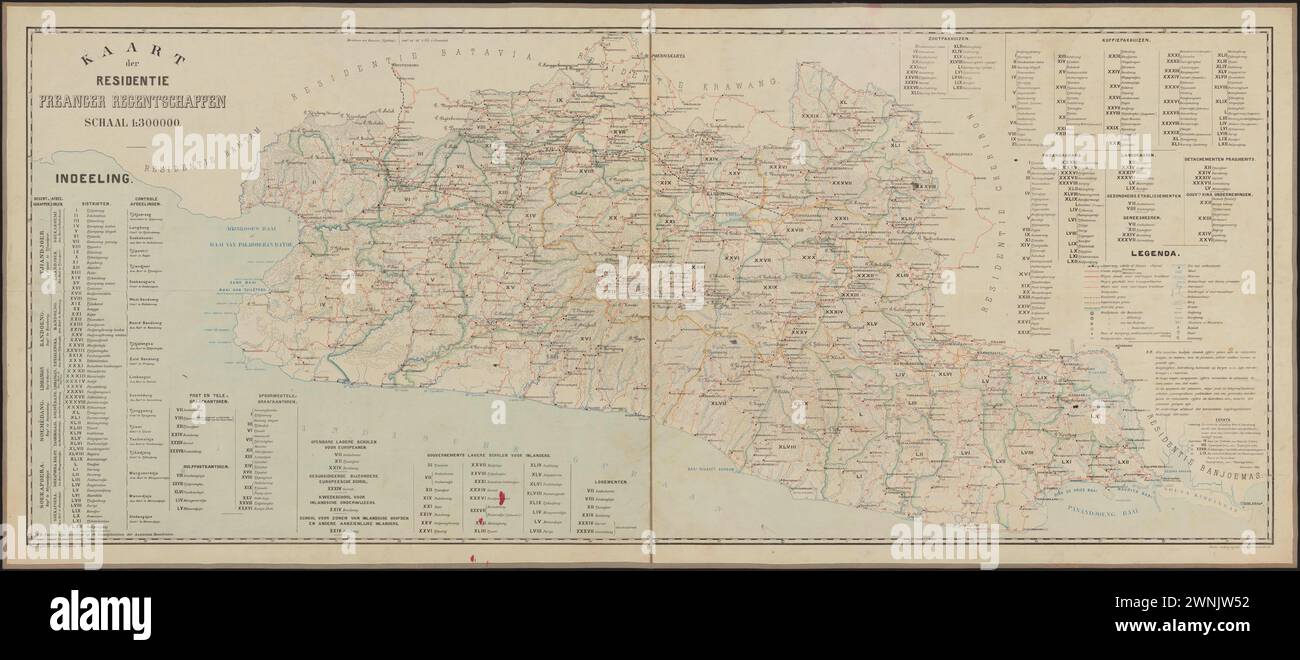 Old Maps of Preanger Regencies 19th Century Stock Photohttps://www.alamy.com/image-license-details/?v=1https://www.alamy.com/old-maps-of-preanger-regencies-19th-century-image598475166.html
RF2WNJW52–Old Maps of Preanger Regencies 19th Century
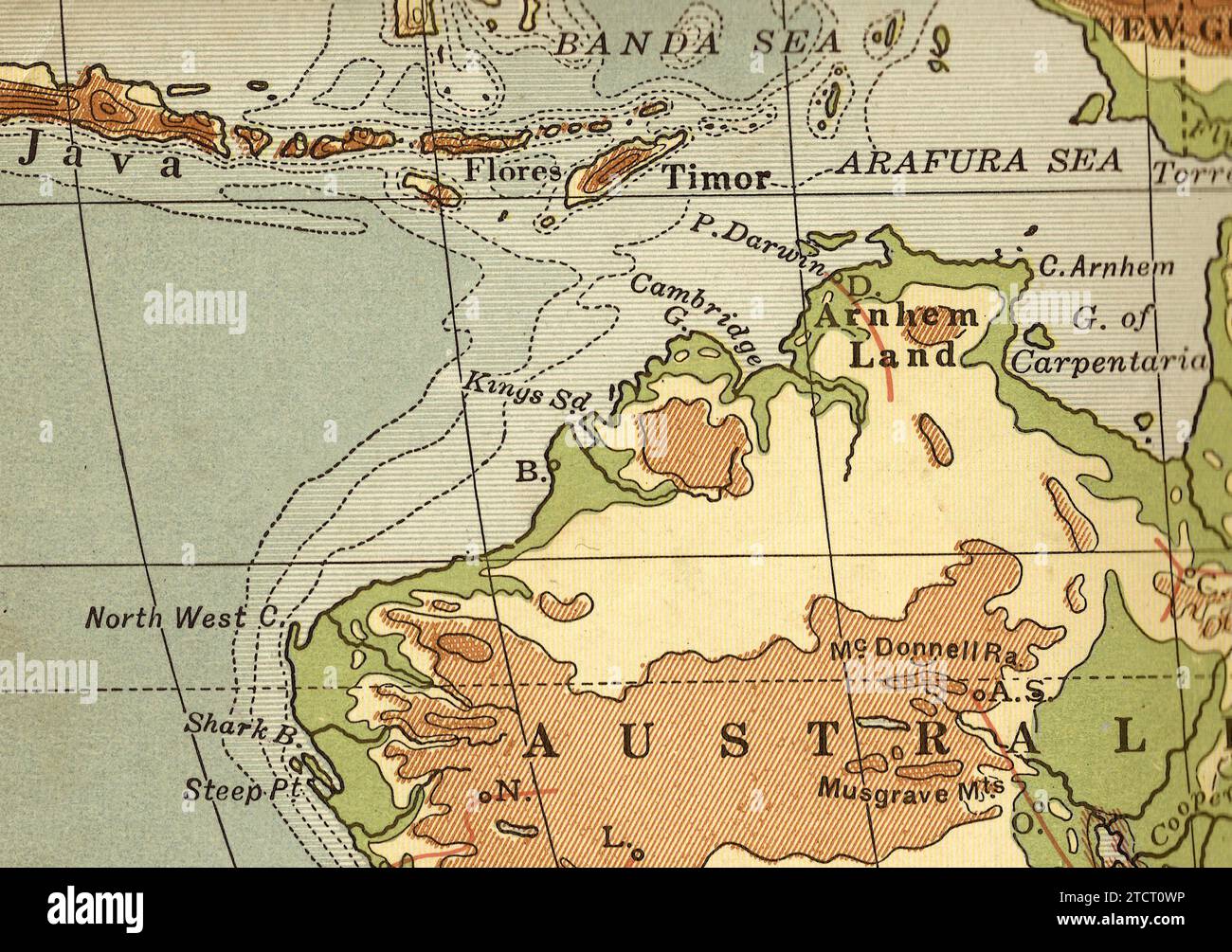 A vintage/antique geographical map in sepia of Australia, Java and Timor. Stock Photohttps://www.alamy.com/image-license-details/?v=1https://www.alamy.com/a-vintageantique-geographical-map-in-sepia-of-australia-java-and-timor-image575845586.html
RF2TCT0WP–A vintage/antique geographical map in sepia of Australia, Java and Timor.
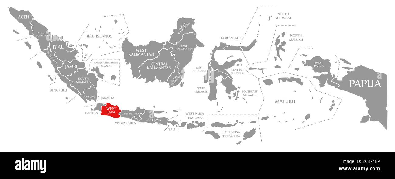 West Java red highlighted in map of Indonesia Stock Photohttps://www.alamy.com/image-license-details/?v=1https://www.alamy.com/west-java-red-highlighted-in-map-of-indonesia-image363418910.html
RF2C374EP–West Java red highlighted in map of Indonesia
 Map of Bandung City, West Java, Indonesia Stock Vectorhttps://www.alamy.com/image-license-details/?v=1https://www.alamy.com/map-of-bandung-city-west-java-indonesia-image599639789.html
RF2WRFXJN–Map of Bandung City, West Java, Indonesia
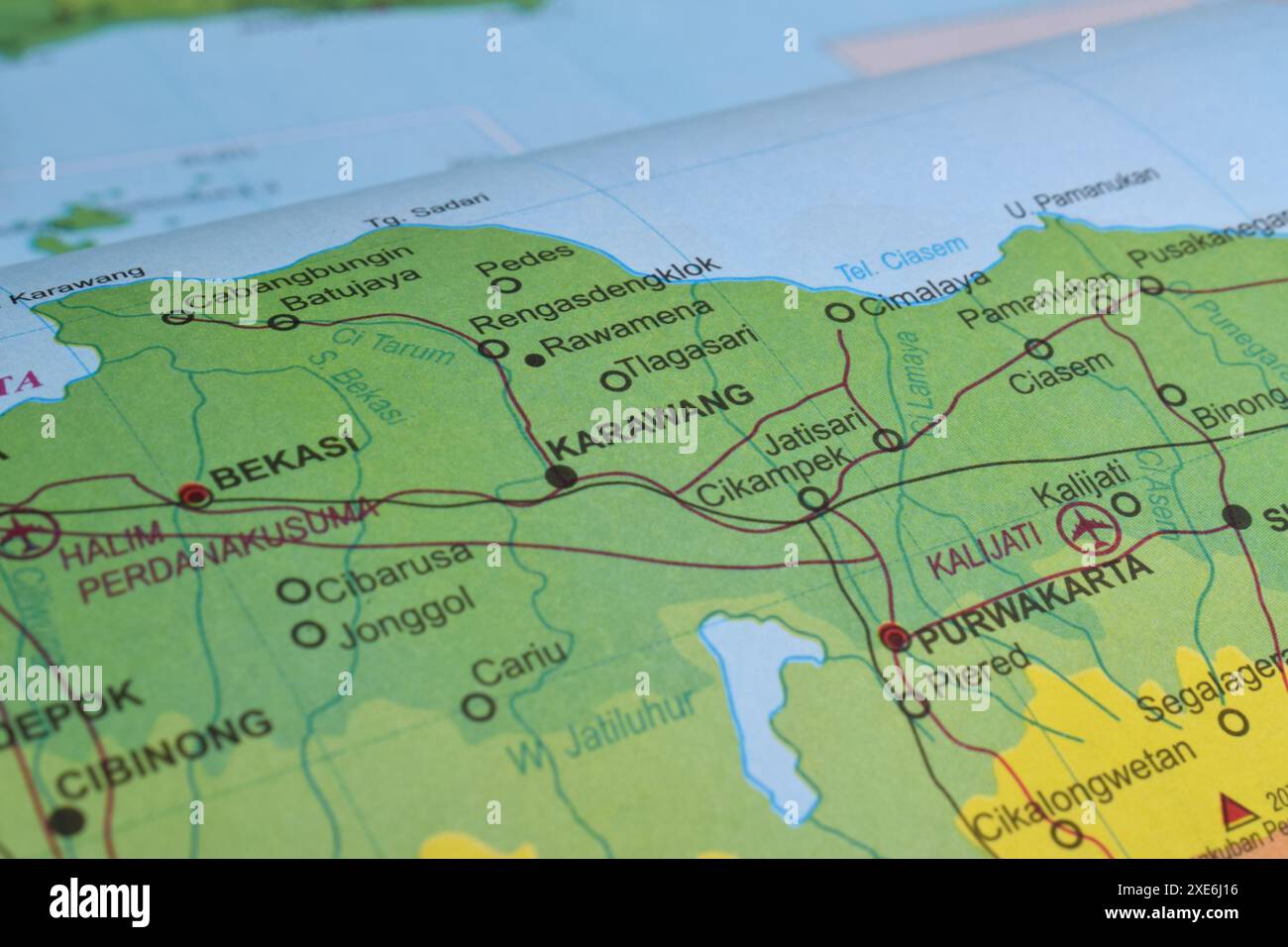 Map of Karawang, located in West Java Province, Indonesia Stock Photohttps://www.alamy.com/image-license-details/?v=1https://www.alamy.com/map-of-karawang-located-in-west-java-province-indonesia-image611113922.html
RF2XE6J16–Map of Karawang, located in West Java Province, Indonesia
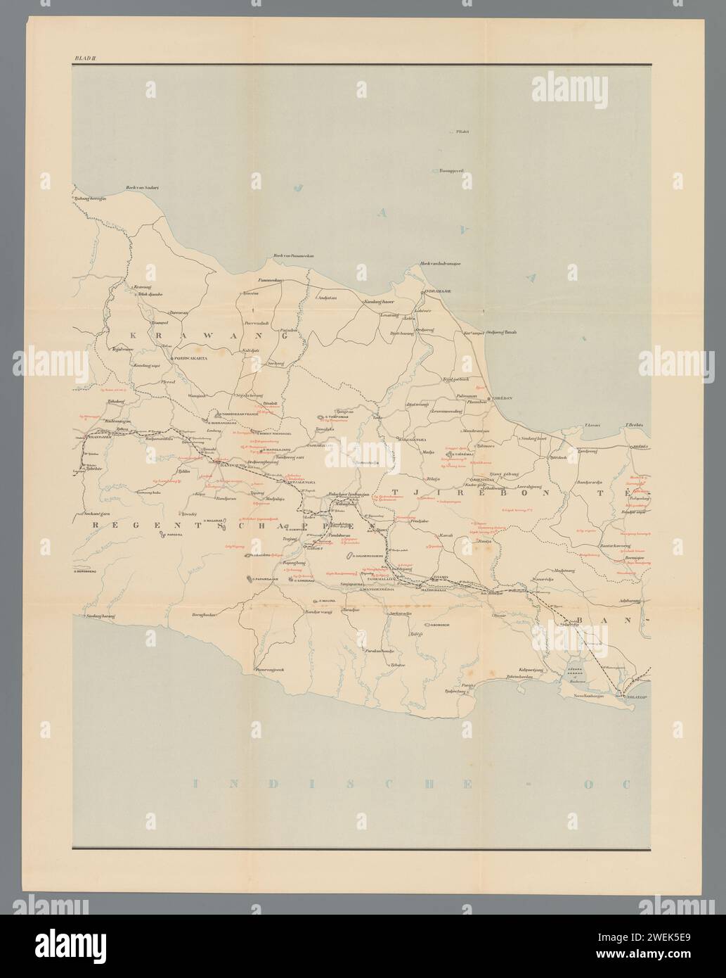 Map of West and Central Java, Middle Deel, Anonymous, 1890 - 1891 print Up to the top left: II. paper maps of separate countries or regions Java Stock Photohttps://www.alamy.com/image-license-details/?v=1https://www.alamy.com/map-of-west-and-central-java-middle-deel-anonymous-1890-1891-print-up-to-the-top-left-ii-paper-maps-of-separate-countries-or-regions-java-image594179105.html
RM2WEK5E9–Map of West and Central Java, Middle Deel, Anonymous, 1890 - 1891 print Up to the top left: II. paper maps of separate countries or regions Java
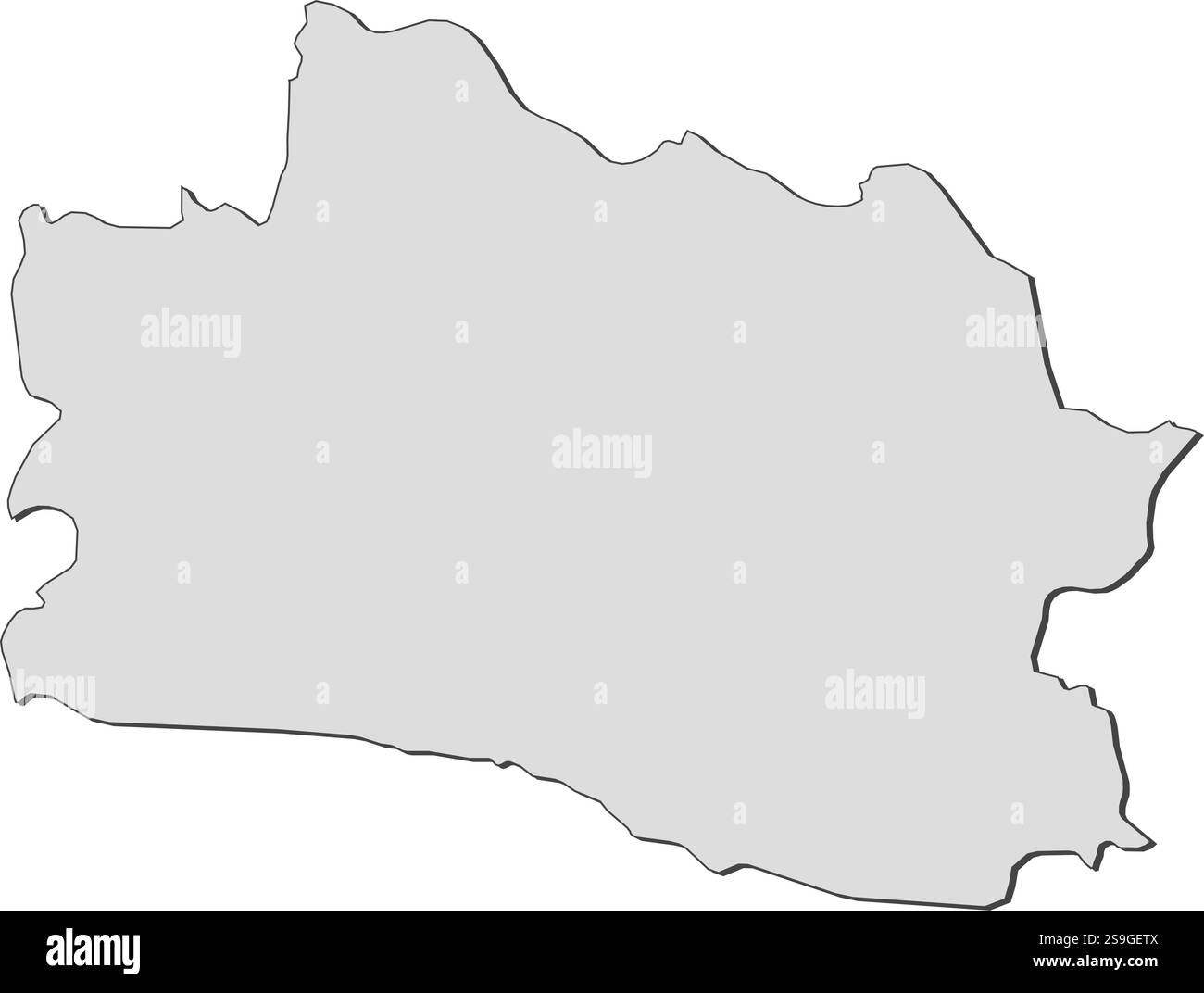 Map of West Java, a province of Indonesia. Stock Vectorhttps://www.alamy.com/image-license-details/?v=1https://www.alamy.com/map-of-west-java-a-province-of-indonesia-image642678426.html
RF2S9GETX–Map of West Java, a province of Indonesia.
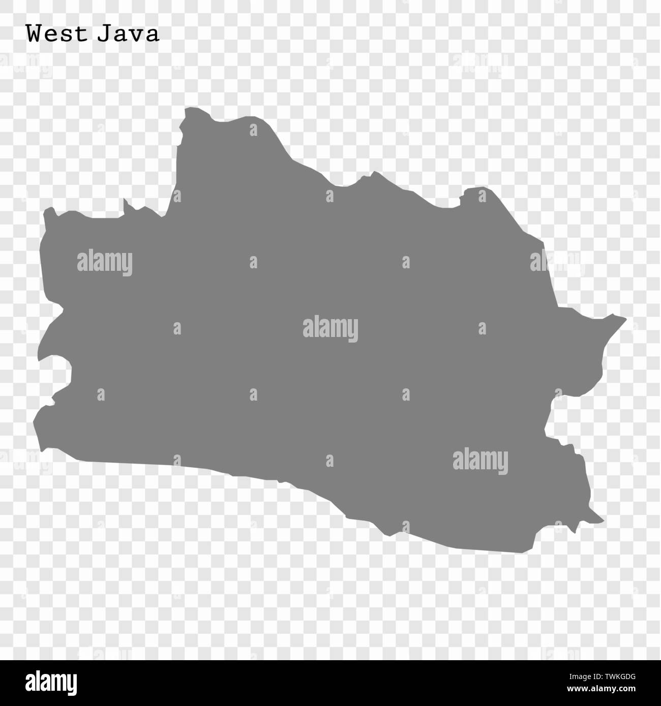 High Quality map of West Java is a province of Indonesia Stock Vectorhttps://www.alamy.com/image-license-details/?v=1https://www.alamy.com/high-quality-map-of-west-java-is-a-province-of-indonesia-image256741564.html
RFTWKGDG–High Quality map of West Java is a province of Indonesia
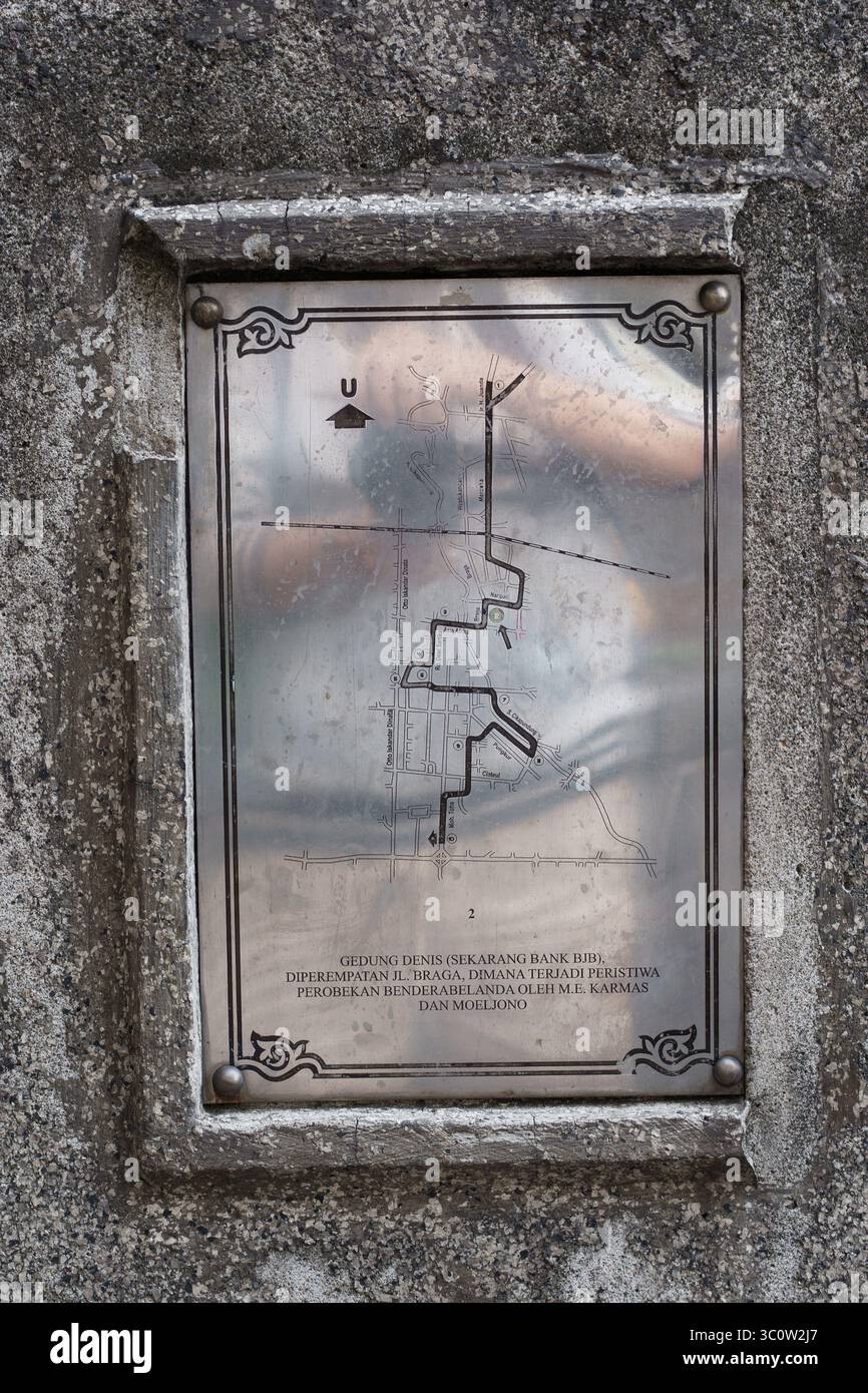 Bandung, indonesia, 21 July 2025. A historical memorial plaque made of steel, detailing the flag-tearing incident at Gedung Denis (Bank BJB). Stock Photohttps://www.alamy.com/image-license-details/?v=1https://www.alamy.com/bandung-indonesia-21-july-2025-a-historical-memorial-plaque-made-of-steel-detailing-the-flag-tearing-incident-at-gedung-denis-bank-bjb-image688965599.html
RF3C0W2J7–Bandung, indonesia, 21 July 2025. A historical memorial plaque made of steel, detailing the flag-tearing incident at Gedung Denis (Bank BJB).
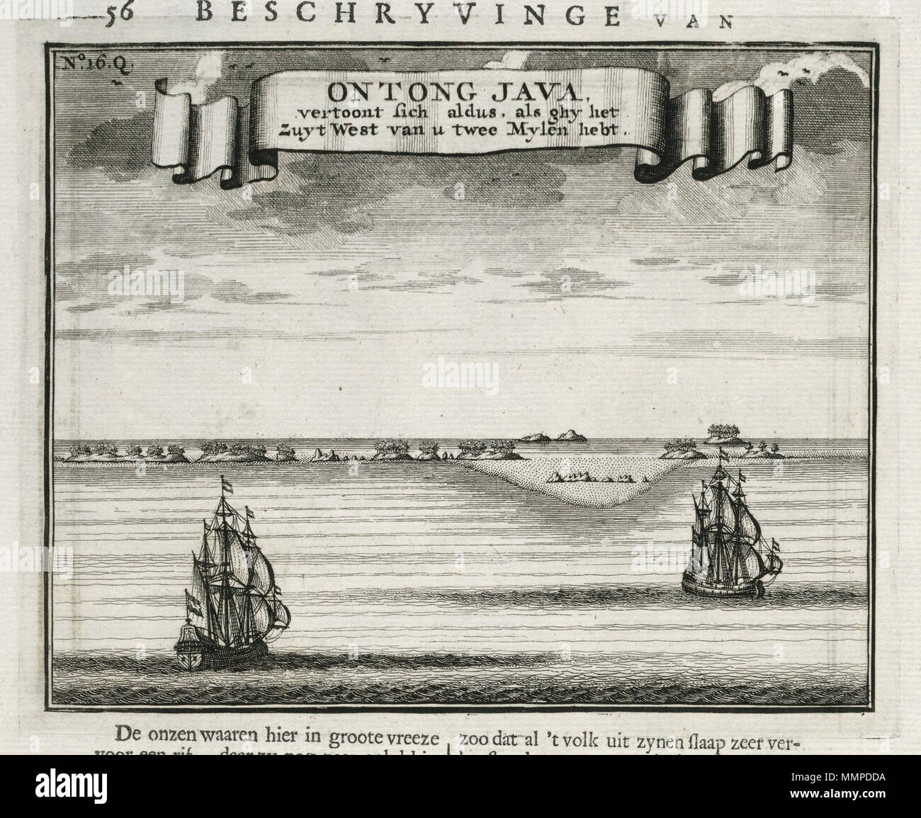 . Nederlands: Gezicht op Ontong Java. Ontong Java, vertoont sich aldus, als ghy het Zuyt West van u twee Mylen hebt. Linksboven: No: 16.Q. De afbeelding is afkomstig uit het werk 'Oud en Nieuw Oost-Indiën' van François Valentyn. English: View of Ontong Java. Ontong Java, vertoont sich aldus, als ghy het Zuyt West van u twee Mylen hebt. Top left: No: 16.Q. This plate is taken from the work 'Oud en Nieuw Oost-Indiën' by François Valentyn. Nederlands: Gezicht op Ontong Java English: View of Ontong Java . 1724. Creator:J. van Braam Creator:Gerard onder de Linden Nederlands: Anoniem / Anonymous ( Stock Photohttps://www.alamy.com/image-license-details/?v=1https://www.alamy.com/nederlands-gezicht-op-ontong-java-ontong-java-vertoont-sich-aldus-als-ghy-het-zuyt-west-van-u-twee-mylen-hebt-linksboven-no-16q-de-afbeelding-is-afkomstig-uit-het-werk-oud-en-nieuw-oost-indin-van-franois-valentyn-english-view-of-ontong-java-ontong-java-vertoont-sich-aldus-als-ghy-het-zuyt-west-van-u-twee-mylen-hebt-top-left-no-16q-this-plate-is-taken-from-the-work-oud-en-nieuw-oost-indin-by-franois-valentyn-nederlands-gezicht-op-ontong-java-english-view-of-ontong-java-1724-creatorj-van-braam-creatorgerard-onder-de-linden-nederlands-anoniem-anonymous-image184890310.html
RMMMPDDA–. Nederlands: Gezicht op Ontong Java. Ontong Java, vertoont sich aldus, als ghy het Zuyt West van u twee Mylen hebt. Linksboven: No: 16.Q. De afbeelding is afkomstig uit het werk 'Oud en Nieuw Oost-Indiën' van François Valentyn. English: View of Ontong Java. Ontong Java, vertoont sich aldus, als ghy het Zuyt West van u twee Mylen hebt. Top left: No: 16.Q. This plate is taken from the work 'Oud en Nieuw Oost-Indiën' by François Valentyn. Nederlands: Gezicht op Ontong Java English: View of Ontong Java . 1724. Creator:J. van Braam Creator:Gerard onder de Linden Nederlands: Anoniem / Anonymous (
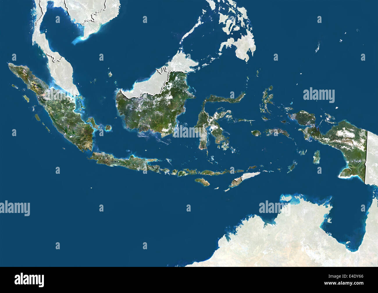 Indonesia, True Colour Satellite Image With Border and Mask Stock Photohttps://www.alamy.com/image-license-details/?v=1https://www.alamy.com/stock-photo-indonesia-true-colour-satellite-image-with-border-and-mask-71606814.html
RME4DY66–Indonesia, True Colour Satellite Image With Border and Mask
 Symbol Map of the Province Jawa Barat (Indonesia). Abstract map showing the state/province with a pattern of overlapping colorful squares like candies Stock Vectorhttps://www.alamy.com/image-license-details/?v=1https://www.alamy.com/symbol-map-of-the-province-jawa-barat-indonesia-abstract-map-showing-the-stateprovince-with-a-pattern-of-overlapping-colorful-squares-like-candies-image611837344.html
RF2XFBGNM–Symbol Map of the Province Jawa Barat (Indonesia). Abstract map showing the state/province with a pattern of overlapping colorful squares like candies
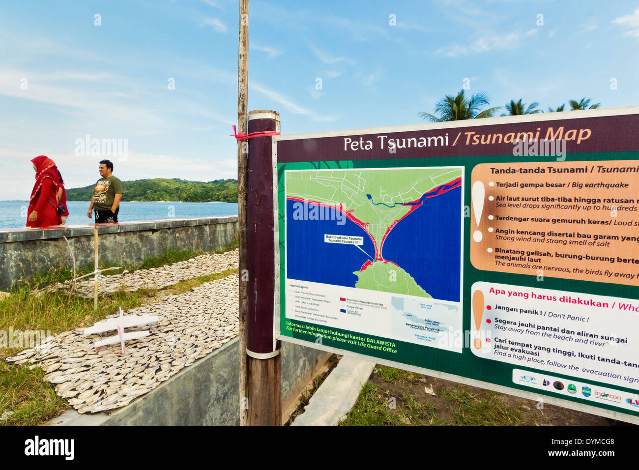 Tsunami map & list of danger signs to watch out for, at this popular south coast resort; Pangandaran, West Java, Java, Indonesia Stock Photohttps://www.alamy.com/image-license-details/?v=1https://www.alamy.com/tsunami-map-list-of-danger-signs-to-watch-out-for-at-this-popular-image68675720.html
RMDYMCG8–Tsunami map & list of danger signs to watch out for, at this popular south coast resort; Pangandaran, West Java, Java, Indonesia
RF2MXKYXD–Java round logo. Digital style shape of Java in dotted circle with island name. Tech icon of the island with gradiented dots.
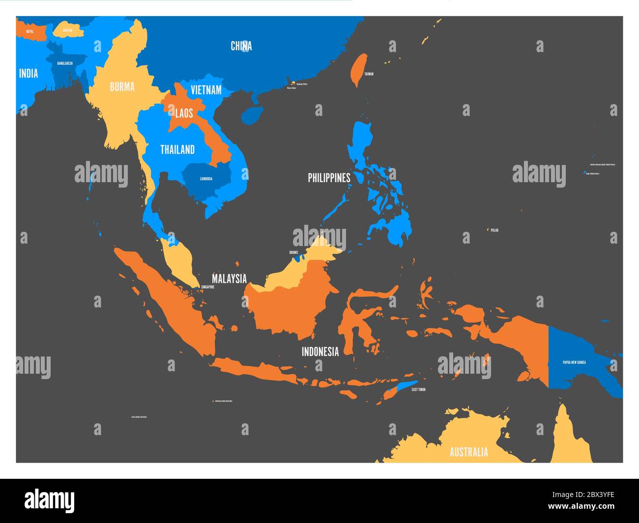 South East Asia political map in four colors with white country names labels. Simple flat vector illustration. Stock Vectorhttps://www.alamy.com/image-license-details/?v=1https://www.alamy.com/south-east-asia-political-map-in-four-colors-with-white-country-names-labels-simple-flat-vector-illustration-image360275874.html
RF2BX3YFE–South East Asia political map in four colors with white country names labels. Simple flat vector illustration.
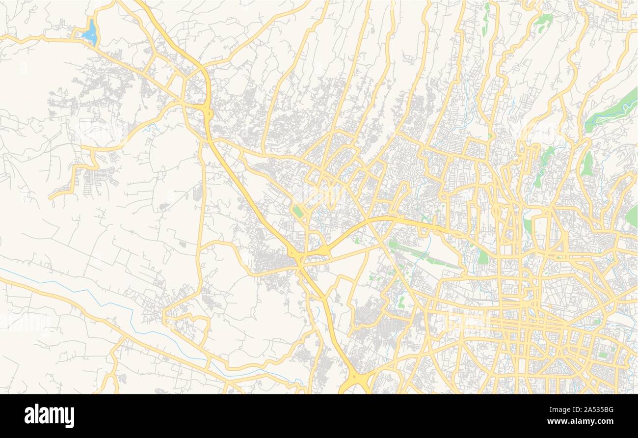 Printable street map of Cimahi, Province West Java, Indonesia. Map template for business use. Stock Vectorhttps://www.alamy.com/image-license-details/?v=1https://www.alamy.com/printable-street-map-of-cimahi-province-west-java-indonesia-map-template-for-business-use-image330140372.html
RF2A535BG–Printable street map of Cimahi, Province West Java, Indonesia. Map template for business use.
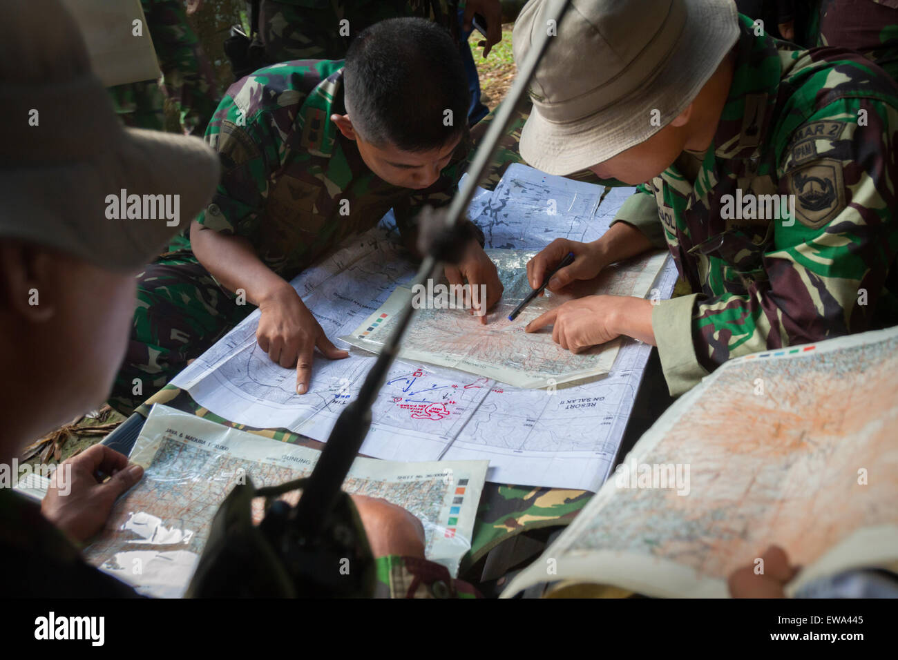 Mount Salak, West Java, Indonesia. May 10, 2012. Indonesian marines plotting the Sukhoi Superjet 100 crash site on map in Mount Salak region. Stock Photohttps://www.alamy.com/image-license-details/?v=1https://www.alamy.com/stock-photo-mount-salak-west-java-indonesia-may-10-2012-indonesian-marines-plotting-84430645.html
RMEWA445–Mount Salak, West Java, Indonesia. May 10, 2012. Indonesian marines plotting the Sukhoi Superjet 100 crash site on map in Mount Salak region.
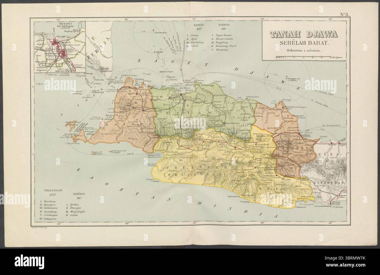 Map of West Java from Atlas sekolah Hindia Nederland. Stock Photohttps://www.alamy.com/image-license-details/?v=1https://www.alamy.com/map-of-west-java-from-atlas-sekolah-hindia-nederland-image685800295.html
RM3BRMW7K–Map of West Java from Atlas sekolah Hindia Nederland.
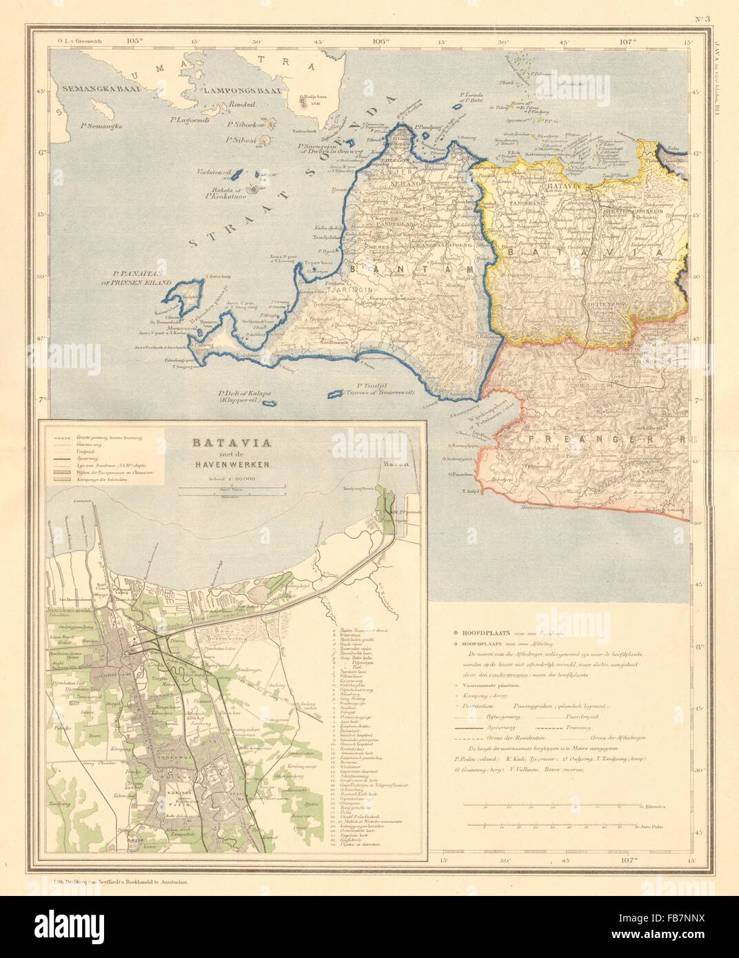 DUTCH EAST INDIES:Indonesia:W.JAVA Banten.Batavia Jakarta.DORNSEIFFEN, 1892 map Stock Photohttps://www.alamy.com/image-license-details/?v=1https://www.alamy.com/stock-photo-dutch-east-indiesindonesiawjava-bantenbatavia-jakartadornseiffen-1892-92983798.html
RFFB7NNX–DUTCH EAST INDIES:Indonesia:W.JAVA Banten.Batavia Jakarta.DORNSEIFFEN, 1892 map
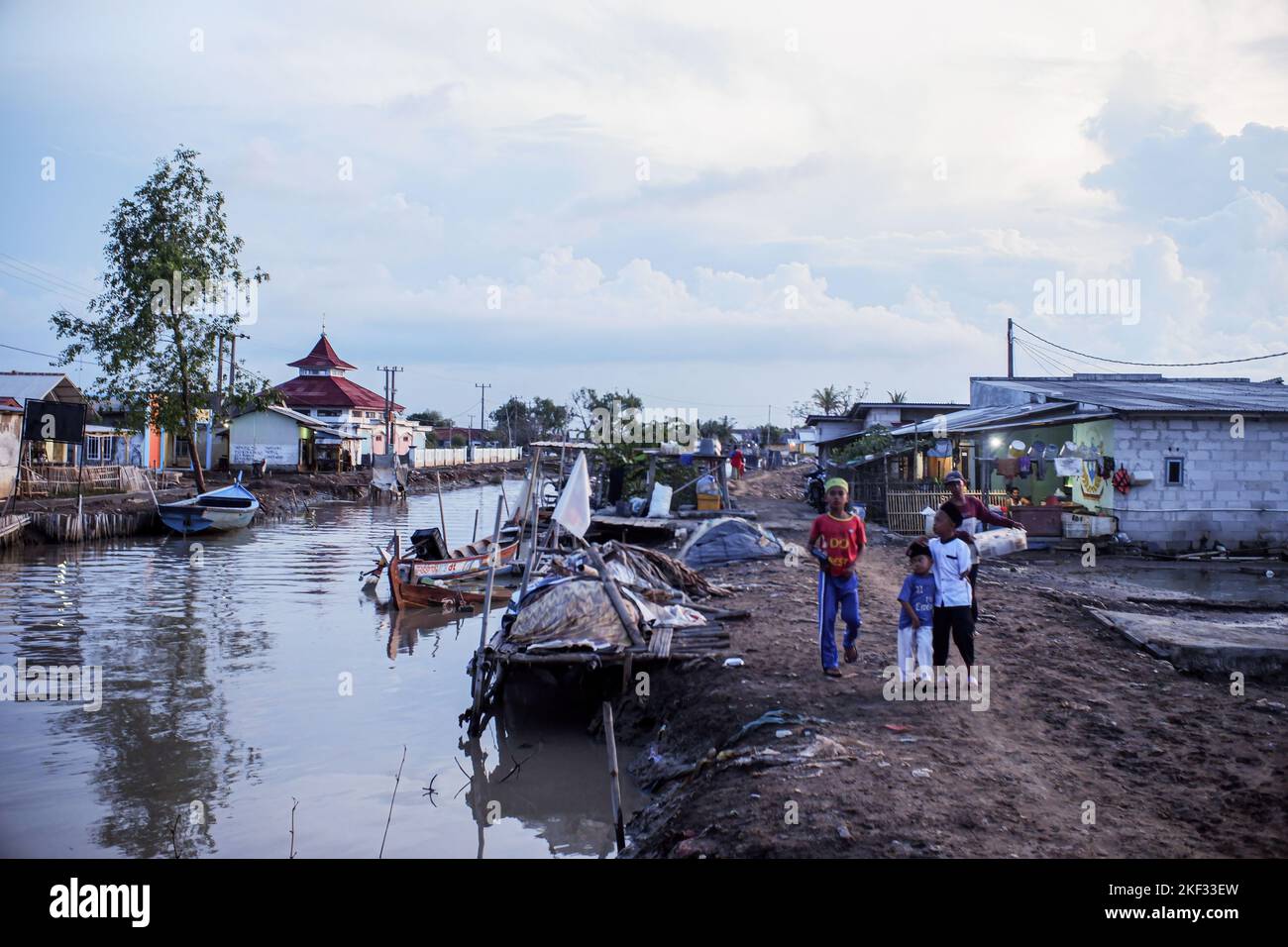 Community activities in the afternoon in Muara Gembong Village. Based on the Climate Central report, a number of areas in the West Java Coastal Coast are predicted to sink in the next 8 years. The threat can also be seen through the Climate Central map regarding the distribution of areas that will sink in 2030. The areas that are predicted to sink based on the Climate Central map are spread from Bekasi, Karawang, Subang, Indramayu to Cirebon. The threat to the Coastal Coast of West Java was mentioned by the Governor of West Java, Ridwan Kamil. Kang Emil, about 200 hectares of land in Bekasi Re Stock Photohttps://www.alamy.com/image-license-details/?v=1https://www.alamy.com/community-activities-in-the-afternoon-in-muara-gembong-village-based-on-the-climate-central-report-a-number-of-areas-in-the-west-java-coastal-coast-are-predicted-to-sink-in-the-next-8-years-the-threat-can-also-be-seen-through-the-climate-central-map-regarding-the-distribution-of-areas-that-will-sink-in-2030-the-areas-that-are-predicted-to-sink-based-on-the-climate-central-map-are-spread-from-bekasi-karawang-subang-indramayu-to-cirebon-the-threat-to-the-coastal-coast-of-west-java-was-mentioned-by-the-governor-of-west-java-ridwan-kamil-kang-emil-about-200-hectares-of-land-in-bekasi-re-image491178769.html
RM2KF33EW–Community activities in the afternoon in Muara Gembong Village. Based on the Climate Central report, a number of areas in the West Java Coastal Coast are predicted to sink in the next 8 years. The threat can also be seen through the Climate Central map regarding the distribution of areas that will sink in 2030. The areas that are predicted to sink based on the Climate Central map are spread from Bekasi, Karawang, Subang, Indramayu to Cirebon. The threat to the Coastal Coast of West Java was mentioned by the Governor of West Java, Ridwan Kamil. Kang Emil, about 200 hectares of land in Bekasi Re
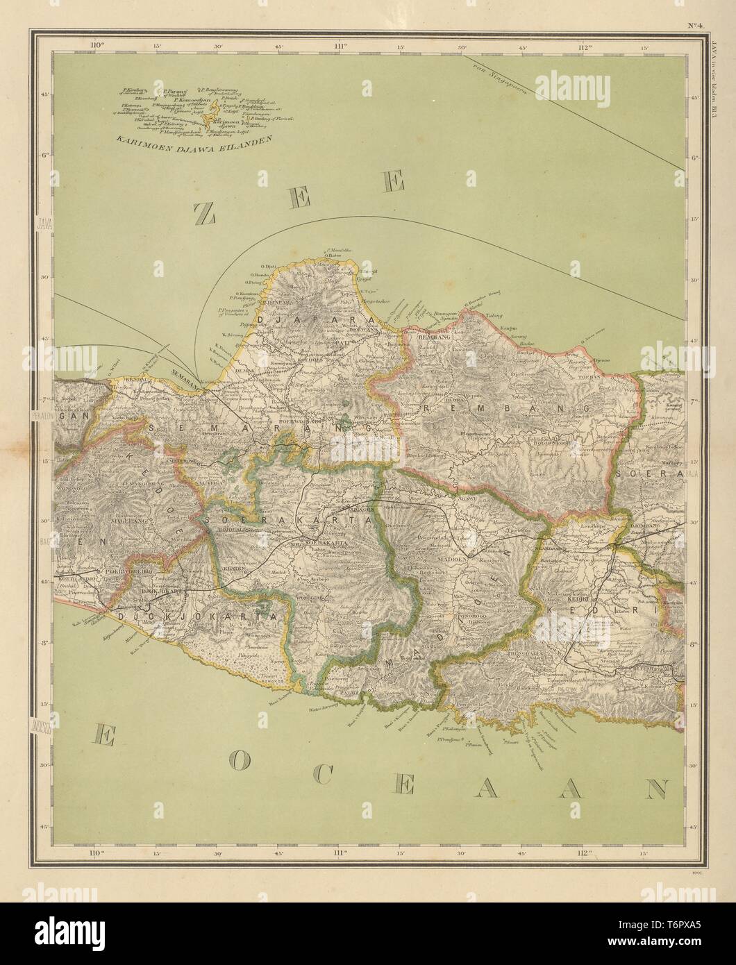 DUTCH EAST INDIES. Indonesia. JAVA. Yogyakarta Semarang. DORNSEIFFEN 1902 map Stock Photohttps://www.alamy.com/image-license-details/?v=1https://www.alamy.com/dutch-east-indies-indonesia-java-yogyakarta-semarang-dornseiffen-1902-map-image245136701.html
RFT6PXA5–DUTCH EAST INDIES. Indonesia. JAVA. Yogyakarta Semarang. DORNSEIFFEN 1902 map
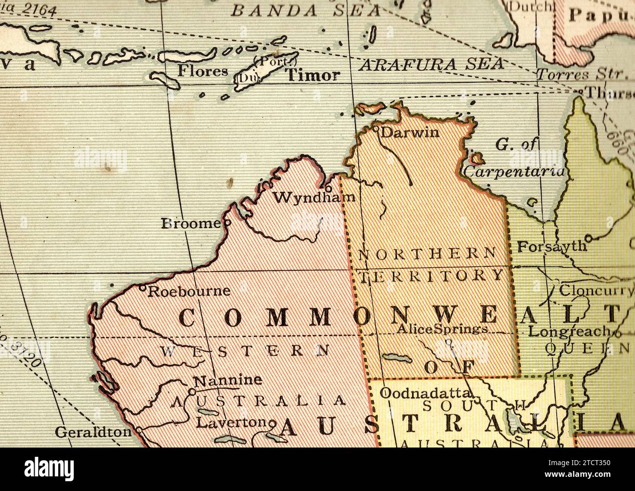 A vintage/antique political map in sepia of Australia, Java and Timor. Stock Photohttps://www.alamy.com/image-license-details/?v=1https://www.alamy.com/a-vintageantique-political-map-in-sepia-of-australia-java-and-timor-image575847356.html
RF2TCT350–A vintage/antique political map in sepia of Australia, Java and Timor.
 Map of Bandung City, West Java, Indonesia Stock Vectorhttps://www.alamy.com/image-license-details/?v=1https://www.alamy.com/map-of-bandung-city-west-java-indonesia-image566034376.html
RF2RTW2HC–Map of Bandung City, West Java, Indonesia
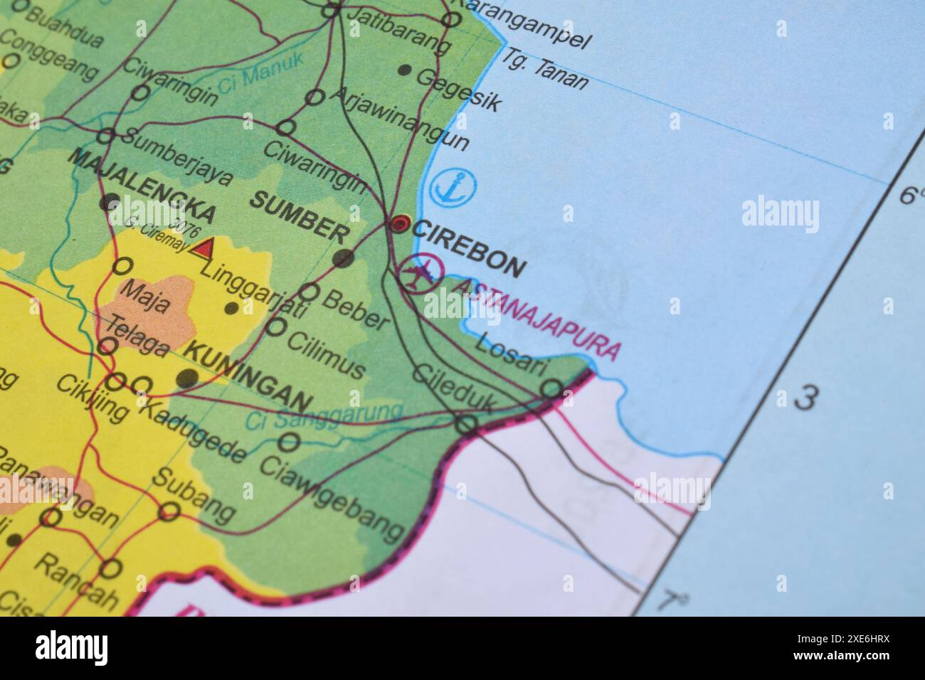 Map of Cirebon City, located in West Java Province, Indonesia Stock Photohttps://www.alamy.com/image-license-details/?v=1https://www.alamy.com/map-of-cirebon-city-located-in-west-java-province-indonesia-image611113774.html
RF2XE6HRX–Map of Cirebon City, located in West Java Province, Indonesia
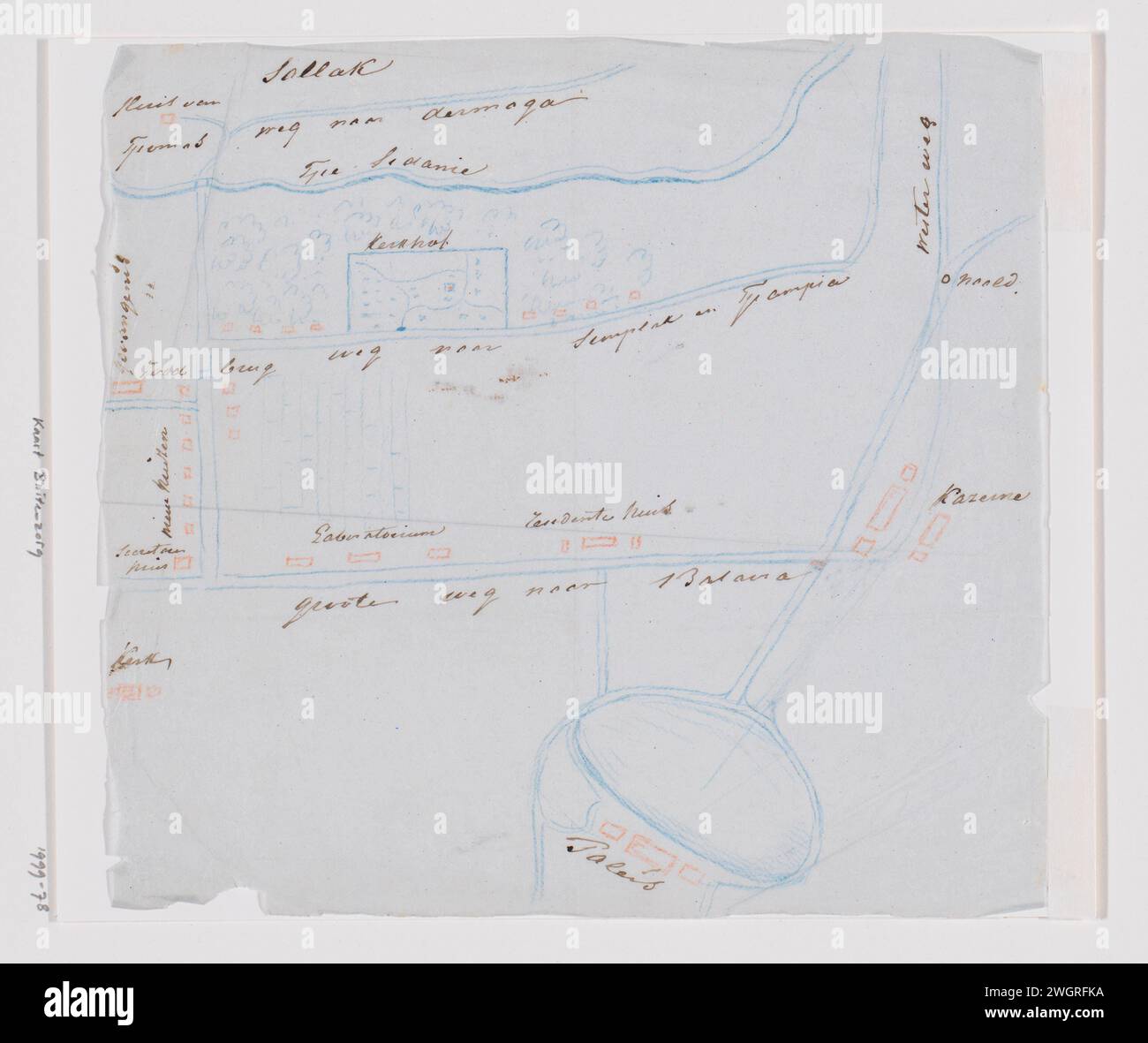 Topographic sketch map of Buitenzorg (Bogor), West-Java, Adrianus Johannes Bik, c. 1816 - c. 1846 drawing Topographic sketch card (map) from Buitenzorg (Bogor), West Java; Explanation with pen on liquid paper. Outdoor care blotting paper. pencil pen Stock Photohttps://www.alamy.com/image-license-details/?v=1https://www.alamy.com/topographic-sketch-map-of-buitenzorg-bogor-west-java-adrianus-johannes-bik-c-1816-c-1846-drawing-topographic-sketch-card-map-from-buitenzorg-bogor-west-java-explanation-with-pen-on-liquid-paper-outdoor-care-blotting-paper-pencil-pen-image595504206.html
RM2WGRFKA–Topographic sketch map of Buitenzorg (Bogor), West-Java, Adrianus Johannes Bik, c. 1816 - c. 1846 drawing Topographic sketch card (map) from Buitenzorg (Bogor), West Java; Explanation with pen on liquid paper. Outdoor care blotting paper. pencil pen
 Map of West Java, a province of Indonesia. Stock Vectorhttps://www.alamy.com/image-license-details/?v=1https://www.alamy.com/map-of-west-java-a-province-of-indonesia-image642683066.html
RF2S9GMPJ–Map of West Java, a province of Indonesia.
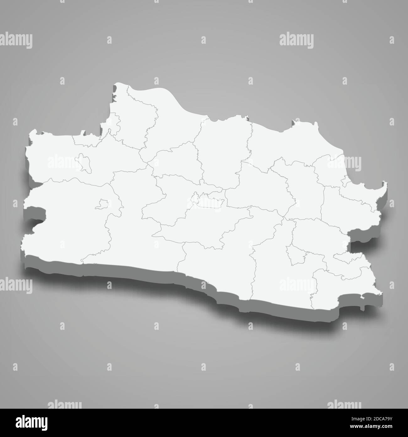 3d isometric map of West Java is a province of Indonesia, vector illustration Stock Vectorhttps://www.alamy.com/image-license-details/?v=1https://www.alamy.com/3d-isometric-map-of-west-java-is-a-province-of-indonesia-vector-illustration-image386229255.html
RF2DCA79Y–3d isometric map of West Java is a province of Indonesia, vector illustration
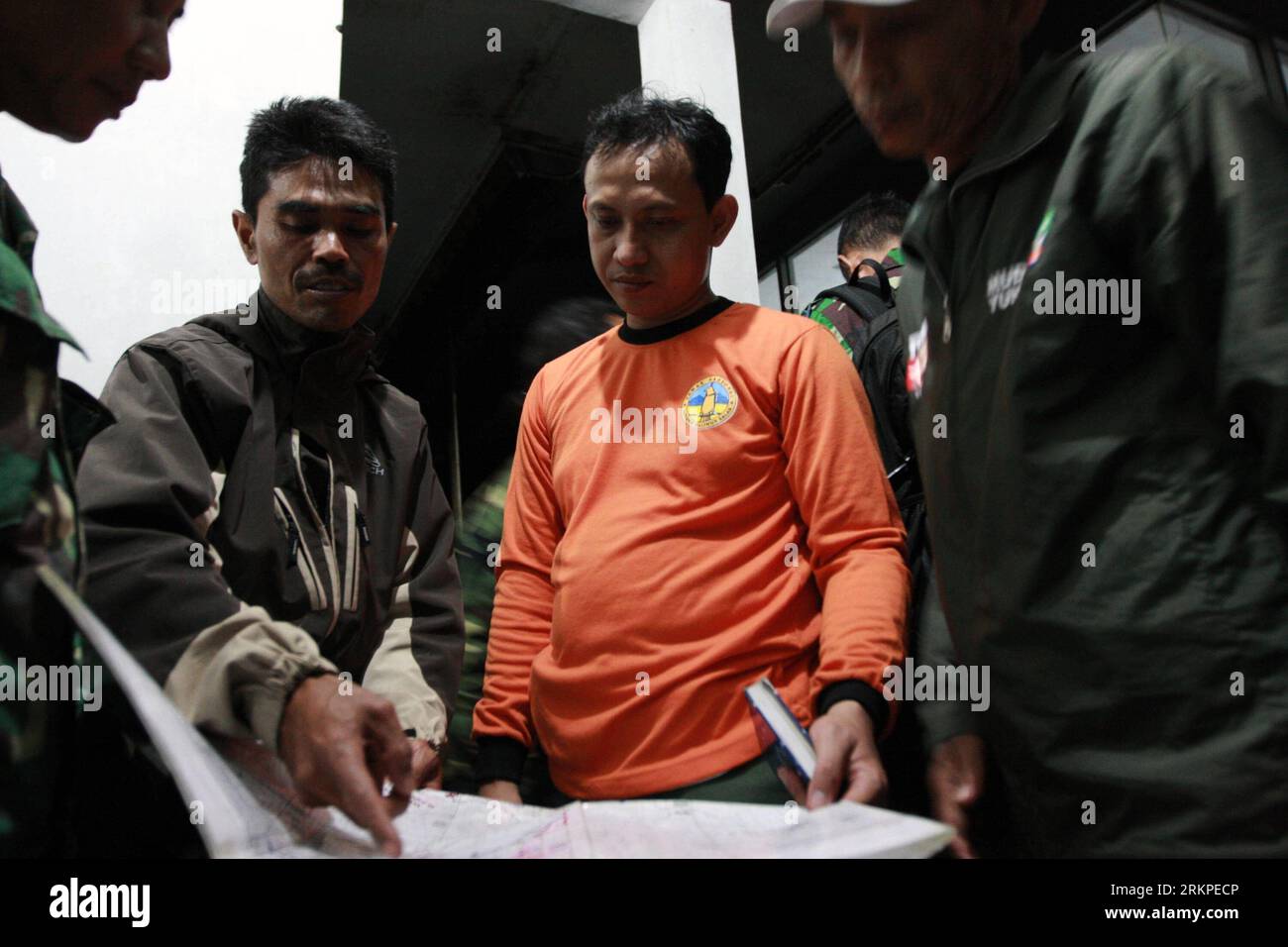 Bildnummer: 57973768 Datum: 10.05.2012 Copyright: imago/Xinhua (120510) -- SUKABUMI, May 10, 2012 (Xinhua) -- A search and Rescue member of National Parks Salak and Halimun Mountain (TNGHS) explains to the marines and volunteers the missing point of the Russian-made Sukhoi Jet-100 on a contour map of the Salak and Halimun mountain at Cidahu in West Java, Indonesia, May 10, 2012. Indonesian authorities said Wednesday that a Sukhoi Superjet 100 carrying Indonesian and Russian businessmen and officials of the Russian embassy in Jakarta lost contact while trying to descend from 10,000 feet to 6, Stock Photohttps://www.alamy.com/image-license-details/?v=1https://www.alamy.com/bildnummer-57973768-datum-10052012-copyright-imagoxinhua-120510-sukabumi-may-10-2012-xinhua-a-search-and-rescue-member-of-national-parks-salak-and-halimun-mountain-tnghs-explains-to-the-marines-and-volunteers-the-missing-point-of-the-russian-made-sukhoi-jet-100-on-a-contour-map-of-the-salak-and-halimun-mountain-at-cidahu-in-west-java-indonesia-may-10-2012-indonesian-authorities-said-wednesday-that-a-sukhoi-superjet-100-carrying-indonesian-and-russian-businessmen-and-officials-of-the-russian-embassy-in-jakarta-lost-contact-while-trying-to-descend-from-10000-feet-to-6-image562904518.html
RM2RKPECP–Bildnummer: 57973768 Datum: 10.05.2012 Copyright: imago/Xinhua (120510) -- SUKABUMI, May 10, 2012 (Xinhua) -- A search and Rescue member of National Parks Salak and Halimun Mountain (TNGHS) explains to the marines and volunteers the missing point of the Russian-made Sukhoi Jet-100 on a contour map of the Salak and Halimun mountain at Cidahu in West Java, Indonesia, May 10, 2012. Indonesian authorities said Wednesday that a Sukhoi Superjet 100 carrying Indonesian and Russian businessmen and officials of the Russian embassy in Jakarta lost contact while trying to descend from 10,000 feet to 6,
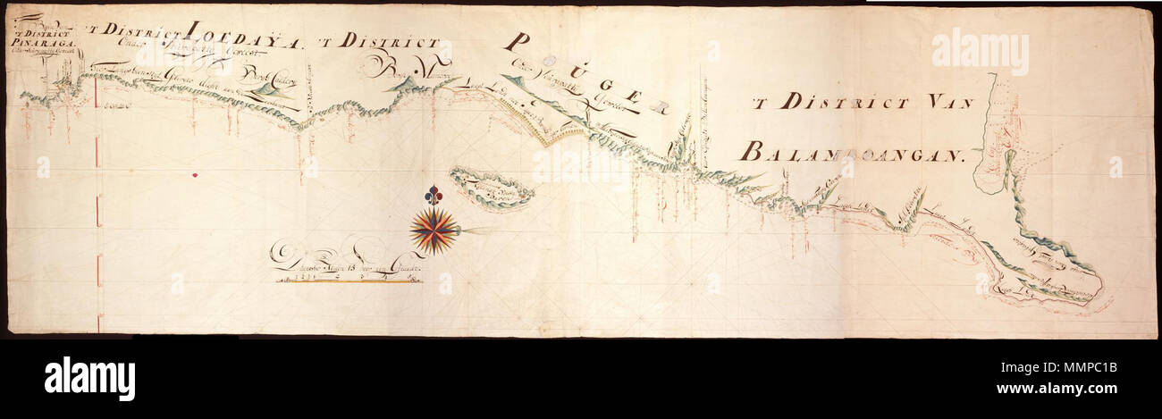 . Nederlands: Titel catalogus Leupe (NA): Kaart als voren, van het Clappers Eylandt tot aan de Oosthoeck, hiermee wordt bedoeld de titel van VEL0436: Kaart van de zuidkust van Java.... Rechtsonder genummerd 264. Notities verso: de zuijd kant van Java 4 Caarten. De kustlijn loopt van 'T West Eijndt of de eerste hoeck van Java tot Van Laage Afflopende hoeck. Achter de kustlijn liggen bergen hoog steijl Gebergte, Wijnkoops Bergen, Dit Langs heen 3 a 4 dubbele Gebergte. Voor de kust is een genummerde stippellijn met de vermelding geen grondt. Onderin is de schaalverdeling duijtsche Mijlen 15 voor Stock Photohttps://www.alamy.com/image-license-details/?v=1https://www.alamy.com/nederlands-titel-catalogus-leupe-na-kaart-als-voren-van-het-clappers-eylandt-tot-aan-de-oosthoeck-hiermee-wordt-bedoeld-de-titel-van-vel0436-kaart-van-de-zuidkust-van-java-rechtsonder-genummerd-264-notities-verso-de-zuijd-kant-van-java-4-caarten-de-kustlijn-loopt-van-t-west-eijndt-of-de-eerste-hoeck-van-java-tot-van-laage-afflopende-hoeck-achter-de-kustlijn-liggen-bergen-hoog-steijl-gebergte-wijnkoops-bergen-dit-langs-heen-3-a-4-dubbele-gebergte-voor-de-kust-is-een-genummerde-stippellijn-met-de-vermelding-geen-grondt-onderin-is-de-schaalverdeling-duijtsche-mijlen-15-voor-image184889191.html
RMMMPC1B–. Nederlands: Titel catalogus Leupe (NA): Kaart als voren, van het Clappers Eylandt tot aan de Oosthoeck, hiermee wordt bedoeld de titel van VEL0436: Kaart van de zuidkust van Java.... Rechtsonder genummerd 264. Notities verso: de zuijd kant van Java 4 Caarten. De kustlijn loopt van 'T West Eijndt of de eerste hoeck van Java tot Van Laage Afflopende hoeck. Achter de kustlijn liggen bergen hoog steijl Gebergte, Wijnkoops Bergen, Dit Langs heen 3 a 4 dubbele Gebergte. Voor de kust is een genummerde stippellijn met de vermelding geen grondt. Onderin is de schaalverdeling duijtsche Mijlen 15 voor
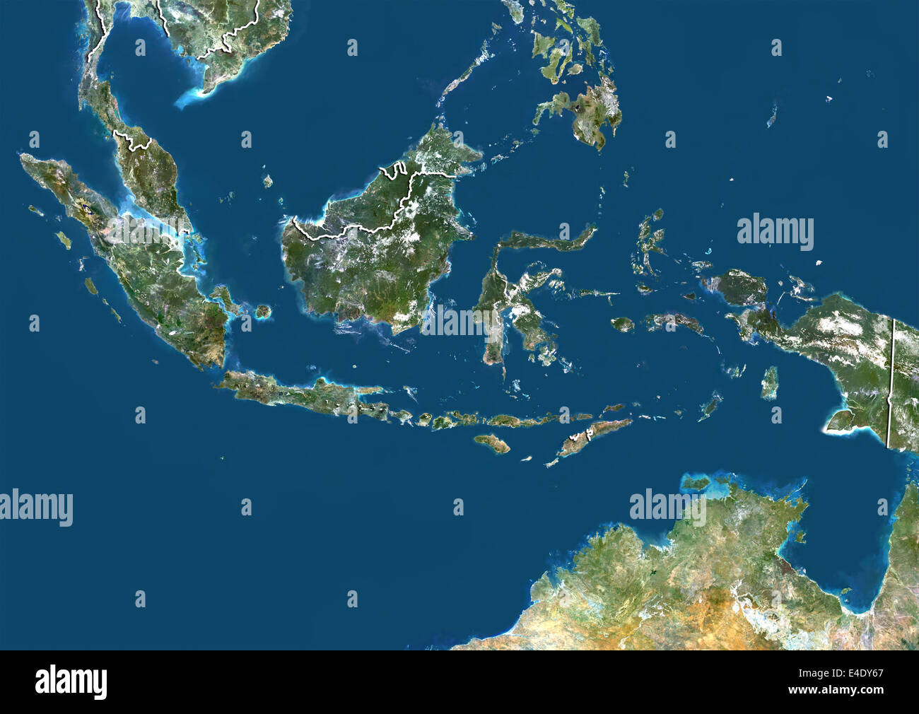 Indonesia, True Colour Satellite Image With Border Stock Photohttps://www.alamy.com/image-license-details/?v=1https://www.alamy.com/stock-photo-indonesia-true-colour-satellite-image-with-border-71606815.html
RME4DY67–Indonesia, True Colour Satellite Image With Border
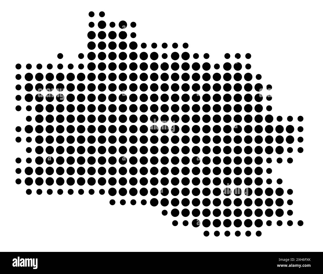 Symbol Map of the Province Jawa Barat (Indonesia) showing the state/province with a pattern of black circles Stock Vectorhttps://www.alamy.com/image-license-details/?v=1https://www.alamy.com/symbol-map-of-the-province-jawa-barat-indonesia-showing-the-stateprovince-with-a-pattern-of-black-circles-image612956251.html
RF2XH6FXK–Symbol Map of the Province Jawa Barat (Indonesia) showing the state/province with a pattern of black circles
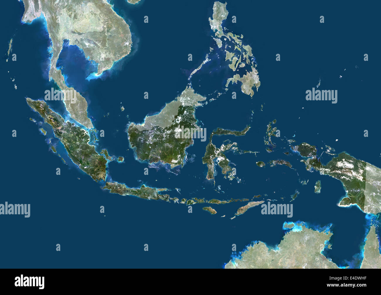 Indonesia, Asia, True Colour Satellite Image With Mask. Satellite view of Indonesia (with mask). This image was compiled from da Stock Photohttps://www.alamy.com/image-license-details/?v=1https://www.alamy.com/stock-photo-indonesia-asia-true-colour-satellite-image-with-mask-satellite-view-71605563.html
RME4DWHF–Indonesia, Asia, True Colour Satellite Image With Mask. Satellite view of Indonesia (with mask). This image was compiled from da
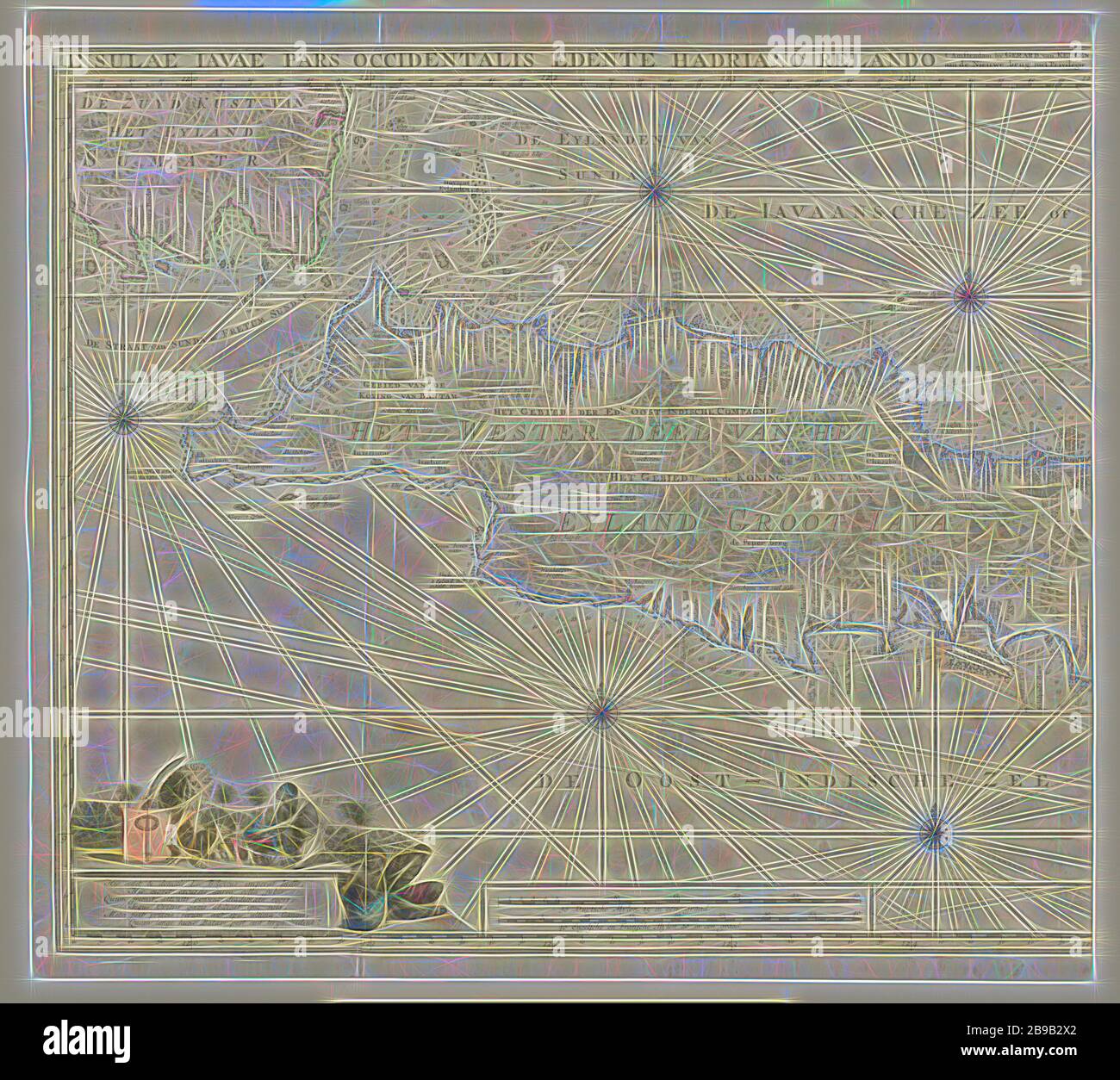 Map of the western part of Java, Insulae Iavae Pars Occidentalis Edente Hadriano Relando (title on object), Map of West Java and a tip of Sumatra (inks above). There are five compass roses. There are topographical details on the map: rice fields, mountains, lighthouses, elephants, etc. On the left a hymn on the Netherlands as a colonizing nation with an allegorical representation of the Dutch lion, to whom a Javanese man offers a gift, two handcuffed Javanese. Below the scale in German, French and English miles (1: 1.1 mill). Left half of a map of the entire island of Java, maps of separate co Stock Photohttps://www.alamy.com/image-license-details/?v=1https://www.alamy.com/map-of-the-western-part-of-java-insulae-iavae-pars-occidentalis-edente-hadriano-relando-title-on-object-map-of-west-java-and-a-tip-of-sumatra-inks-above-there-are-five-compass-roses-there-are-topographical-details-on-the-map-rice-fields-mountains-lighthouses-elephants-etc-on-the-left-a-hymn-on-the-netherlands-as-a-colonizing-nation-with-an-allegorical-representation-of-the-dutch-lion-to-whom-a-javanese-man-offers-a-gift-two-handcuffed-javanese-below-the-scale-in-german-french-and-english-miles-1-11-mill-left-half-of-a-map-of-the-entire-island-of-java-maps-of-separate-co-image349983034.html
RF2B9B2X2–Map of the western part of Java, Insulae Iavae Pars Occidentalis Edente Hadriano Relando (title on object), Map of West Java and a tip of Sumatra (inks above). There are five compass roses. There are topographical details on the map: rice fields, mountains, lighthouses, elephants, etc. On the left a hymn on the Netherlands as a colonizing nation with an allegorical representation of the Dutch lion, to whom a Javanese man offers a gift, two handcuffed Javanese. Below the scale in German, French and English miles (1: 1.1 mill). Left half of a map of the entire island of Java, maps of separate co
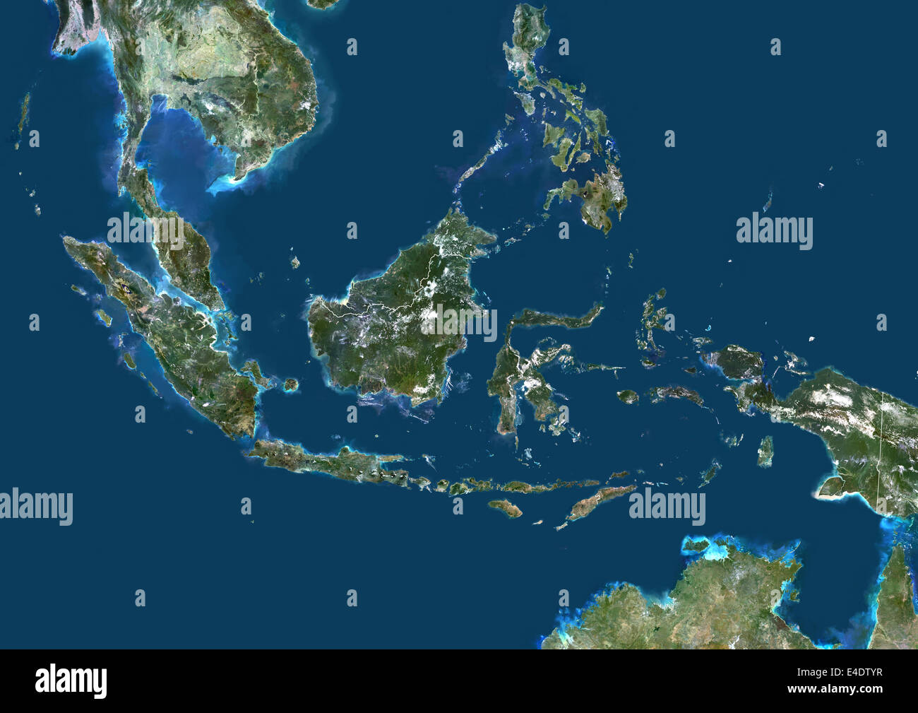 Indonesia, Asia, True Colour Satellite Image With Border. Satellite view of Indonesia (with border). This image was compiled fro Stock Photohttps://www.alamy.com/image-license-details/?v=1https://www.alamy.com/stock-photo-indonesia-asia-true-colour-satellite-image-with-border-satellite-view-71605067.html
RME4DTYR–Indonesia, Asia, True Colour Satellite Image With Border. Satellite view of Indonesia (with border). This image was compiled fro
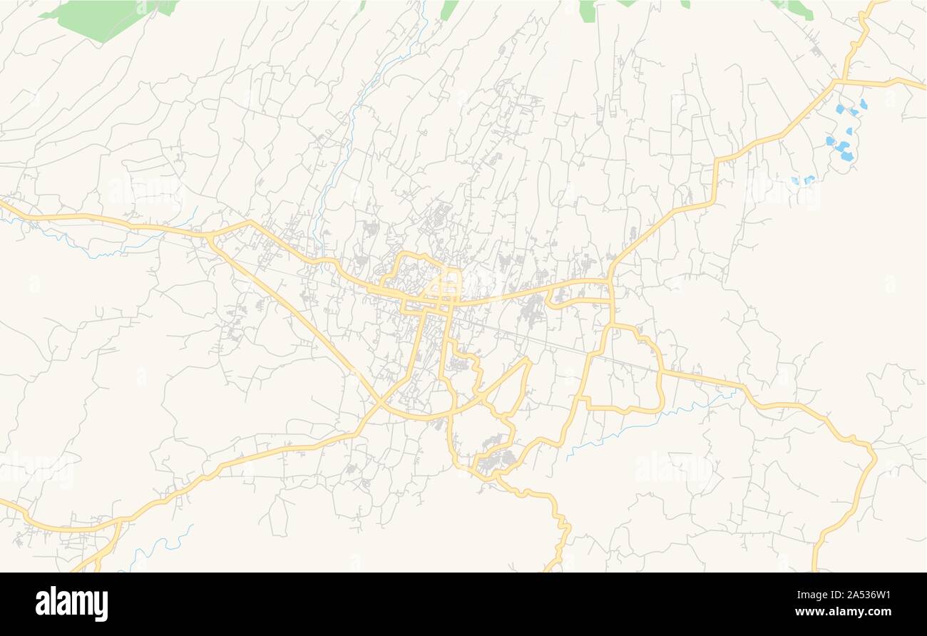 Printable street map of Sukabumi, Province West Java, Indonesia. Map template for business use. Stock Vectorhttps://www.alamy.com/image-license-details/?v=1https://www.alamy.com/printable-street-map-of-sukabumi-province-west-java-indonesia-map-template-for-business-use-image330141533.html
RF2A536W1–Printable street map of Sukabumi, Province West Java, Indonesia. Map template for business use.
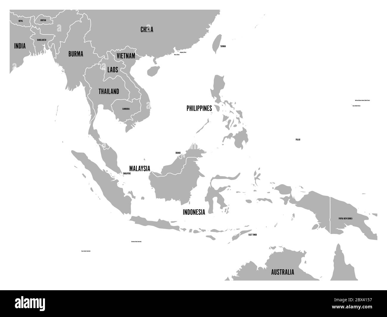 South East Asia political map. Grey land on white background with black country name labels. Simple flat vector illustration. Stock Vectorhttps://www.alamy.com/image-license-details/?v=1https://www.alamy.com/south-east-asia-political-map-grey-land-on-white-background-with-black-country-name-labels-simple-flat-vector-illustration-image360277155.html
RF2BX4157–South East Asia political map. Grey land on white background with black country name labels. Simple flat vector illustration.
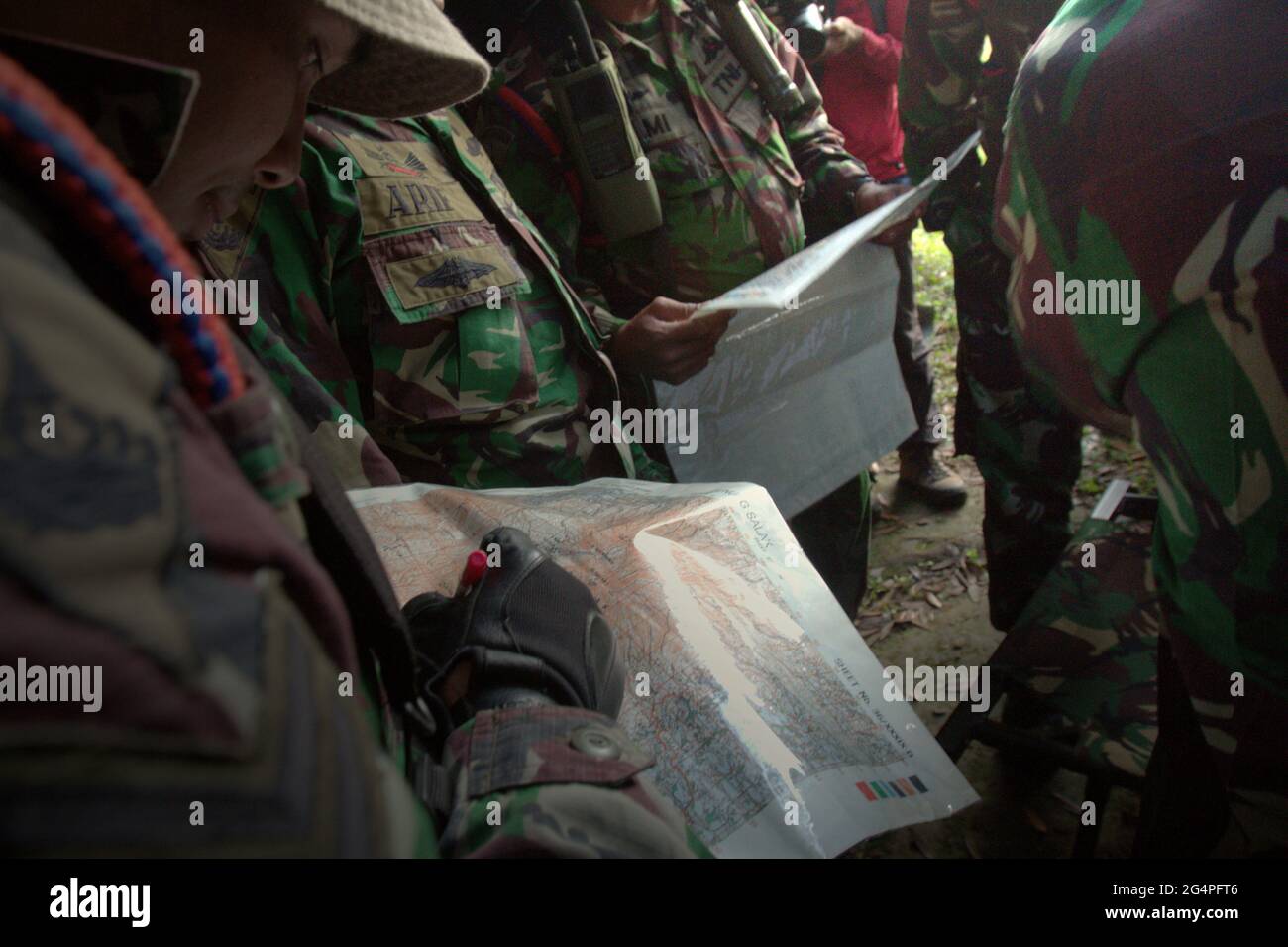 Mount Salak, West Java, Indonesia. May 10, 2012. Military personnels reading maps before the search mission for the Sukhoi Superjet 100 (SSJ-100) plane that crashed on May 9. Stock Photohttps://www.alamy.com/image-license-details/?v=1https://www.alamy.com/mount-salak-west-java-indonesia-may-10-2012-military-personnels-reading-maps-before-the-search-mission-for-the-sukhoi-superjet-100-ssj-100-plane-that-crashed-on-may-9-image433213206.html
RM2G4PFT6–Mount Salak, West Java, Indonesia. May 10, 2012. Military personnels reading maps before the search mission for the Sukhoi Superjet 100 (SSJ-100) plane that crashed on May 9.
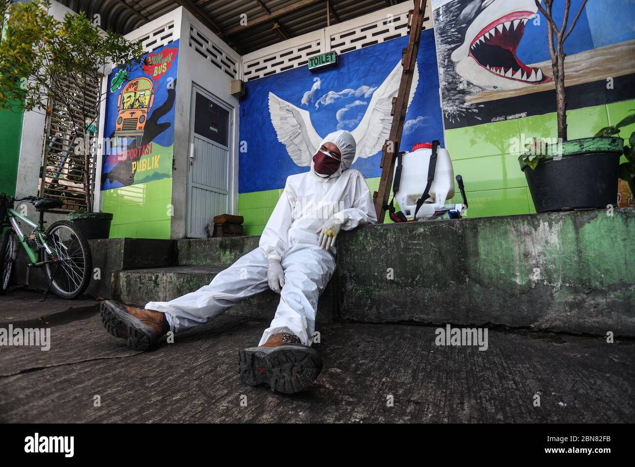 May 13, 2020, Bandung, West Java, Indonesia: The health officer uses self-protective clothing resting during the test swab the tests during the coronavirus disease (COVID-19) in Terminal. The test swab was executed randomly in several terminals to map more broadly the Covid-19 spread. (Credit Image: © Agvi Firdaus/ZUMA Wire) Stock Photohttps://www.alamy.com/image-license-details/?v=1https://www.alamy.com/may-13-2020-bandung-west-java-indonesia-the-health-officer-uses-self-protective-clothing-resting-during-the-test-swab-the-tests-during-the-coronavirus-disease-covid-19-in-terminal-the-test-swab-was-executed-randomly-in-several-terminals-to-map-more-broadly-the-covid-19-spread-credit-image-agvi-firdauszuma-wire-image357292751.html
RM2BN82FB–May 13, 2020, Bandung, West Java, Indonesia: The health officer uses self-protective clothing resting during the test swab the tests during the coronavirus disease (COVID-19) in Terminal. The test swab was executed randomly in several terminals to map more broadly the Covid-19 spread. (Credit Image: © Agvi Firdaus/ZUMA Wire)
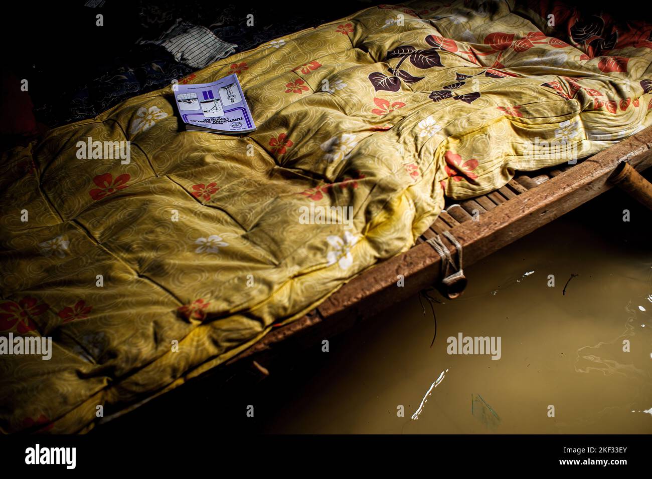 The tide of seawater enters the houses of residents in Muara Gembong Village. Based on the Climate Central report, a number of areas in the West Java Coastal Coast are predicted to sink in the next 8 years. The threat can also be seen through the Climate Central map regarding the distribution of areas that will sink in 2030. The areas that are predicted to sink based on the Climate Central map are spread from Bekasi, Karawang, Subang, Indramayu to Cirebon.The threat to the Coastal Coast of West Java was mentioned by the Governor of West Java, Ridwan Kamil. Kang Emil, about 200 hectares of land Stock Photohttps://www.alamy.com/image-license-details/?v=1https://www.alamy.com/the-tide-of-seawater-enters-the-houses-of-residents-in-muara-gembong-village-based-on-the-climate-central-report-a-number-of-areas-in-the-west-java-coastal-coast-are-predicted-to-sink-in-the-next-8-years-the-threat-can-also-be-seen-through-the-climate-central-map-regarding-the-distribution-of-areas-that-will-sink-in-2030-the-areas-that-are-predicted-to-sink-based-on-the-climate-central-map-are-spread-from-bekasi-karawang-subang-indramayu-to-cirebonthe-threat-to-the-coastal-coast-of-west-java-was-mentioned-by-the-governor-of-west-java-ridwan-kamil-kang-emil-about-200-hectares-of-land-image491178771.html
RM2KF33EY–The tide of seawater enters the houses of residents in Muara Gembong Village. Based on the Climate Central report, a number of areas in the West Java Coastal Coast are predicted to sink in the next 8 years. The threat can also be seen through the Climate Central map regarding the distribution of areas that will sink in 2030. The areas that are predicted to sink based on the Climate Central map are spread from Bekasi, Karawang, Subang, Indramayu to Cirebon.The threat to the Coastal Coast of West Java was mentioned by the Governor of West Java, Ridwan Kamil. Kang Emil, about 200 hectares of land
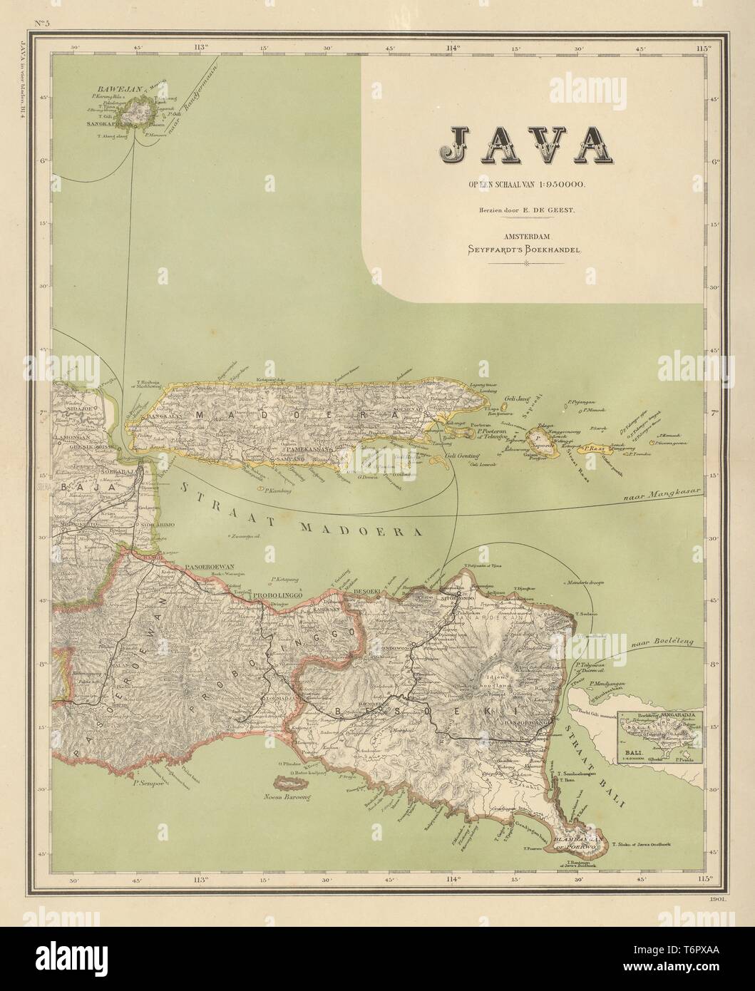 DUTCH EAST INDIES Indonesia. East JAVA. Madura Surabaya DORNSEIFFEN 1902 map Stock Photohttps://www.alamy.com/image-license-details/?v=1https://www.alamy.com/dutch-east-indies-indonesia-east-java-madura-surabaya-dornseiffen-1902-map-image245136706.html
RFT6PXAA–DUTCH EAST INDIES Indonesia. East JAVA. Madura Surabaya DORNSEIFFEN 1902 map
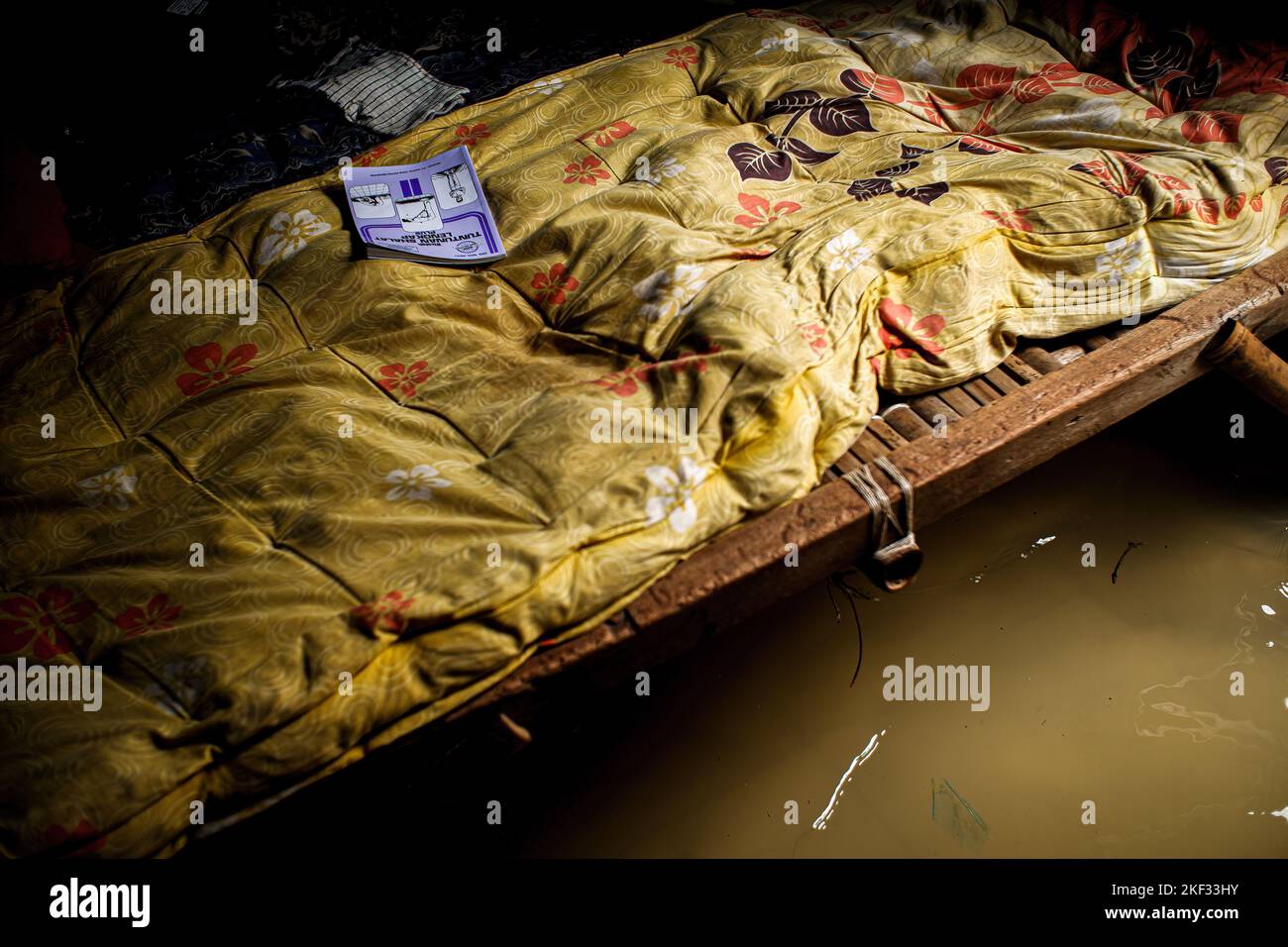 The tide of seawater enters the houses of residents in Muara Gembong Village. Based on the Climate Central report, a number of areas in the West Java Coastal Coast are predicted to sink in the next 8 years. The threat can also be seen through the Climate Central map regarding the distribution of areas that will sink in 2030. The areas that are predicted to sink based on the Climate Central map are spread from Bekasi, Karawang, Subang, Indramayu to Cirebon.The threat to the Coastal Coast of West Java was mentioned by the Governor of West Java, Ridwan Kamil. Kang Emil, about 200 hectares of land Stock Photohttps://www.alamy.com/image-license-details/?v=1https://www.alamy.com/the-tide-of-seawater-enters-the-houses-of-residents-in-muara-gembong-village-based-on-the-climate-central-report-a-number-of-areas-in-the-west-java-coastal-coast-are-predicted-to-sink-in-the-next-8-years-the-threat-can-also-be-seen-through-the-climate-central-map-regarding-the-distribution-of-areas-that-will-sink-in-2030-the-areas-that-are-predicted-to-sink-based-on-the-climate-central-map-are-spread-from-bekasi-karawang-subang-indramayu-to-cirebonthe-threat-to-the-coastal-coast-of-west-java-was-mentioned-by-the-governor-of-west-java-ridwan-kamil-kang-emil-about-200-hectares-of-land-image491178855.html
RM2KF33HY–The tide of seawater enters the houses of residents in Muara Gembong Village. Based on the Climate Central report, a number of areas in the West Java Coastal Coast are predicted to sink in the next 8 years. The threat can also be seen through the Climate Central map regarding the distribution of areas that will sink in 2030. The areas that are predicted to sink based on the Climate Central map are spread from Bekasi, Karawang, Subang, Indramayu to Cirebon.The threat to the Coastal Coast of West Java was mentioned by the Governor of West Java, Ridwan Kamil. Kang Emil, about 200 hectares of land
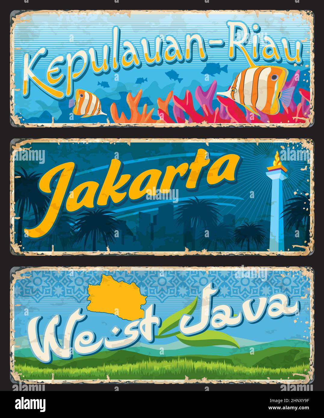 West Java, Jakarta and Kepulauan-Riau indonesian travel plates and stickers. Indonesia province grunge banners, asian journey souvenir card or vector Stock Vectorhttps://www.alamy.com/image-license-details/?v=1https://www.alamy.com/west-java-jakarta-and-kepulauan-riau-indonesian-travel-plates-and-stickers-indonesia-province-grunge-banners-asian-journey-souvenir-card-or-vector-image460969531.html
RF2HNXY9F–West Java, Jakarta and Kepulauan-Riau indonesian travel plates and stickers. Indonesia province grunge banners, asian journey souvenir card or vector