Lee county Stock Photos and Images
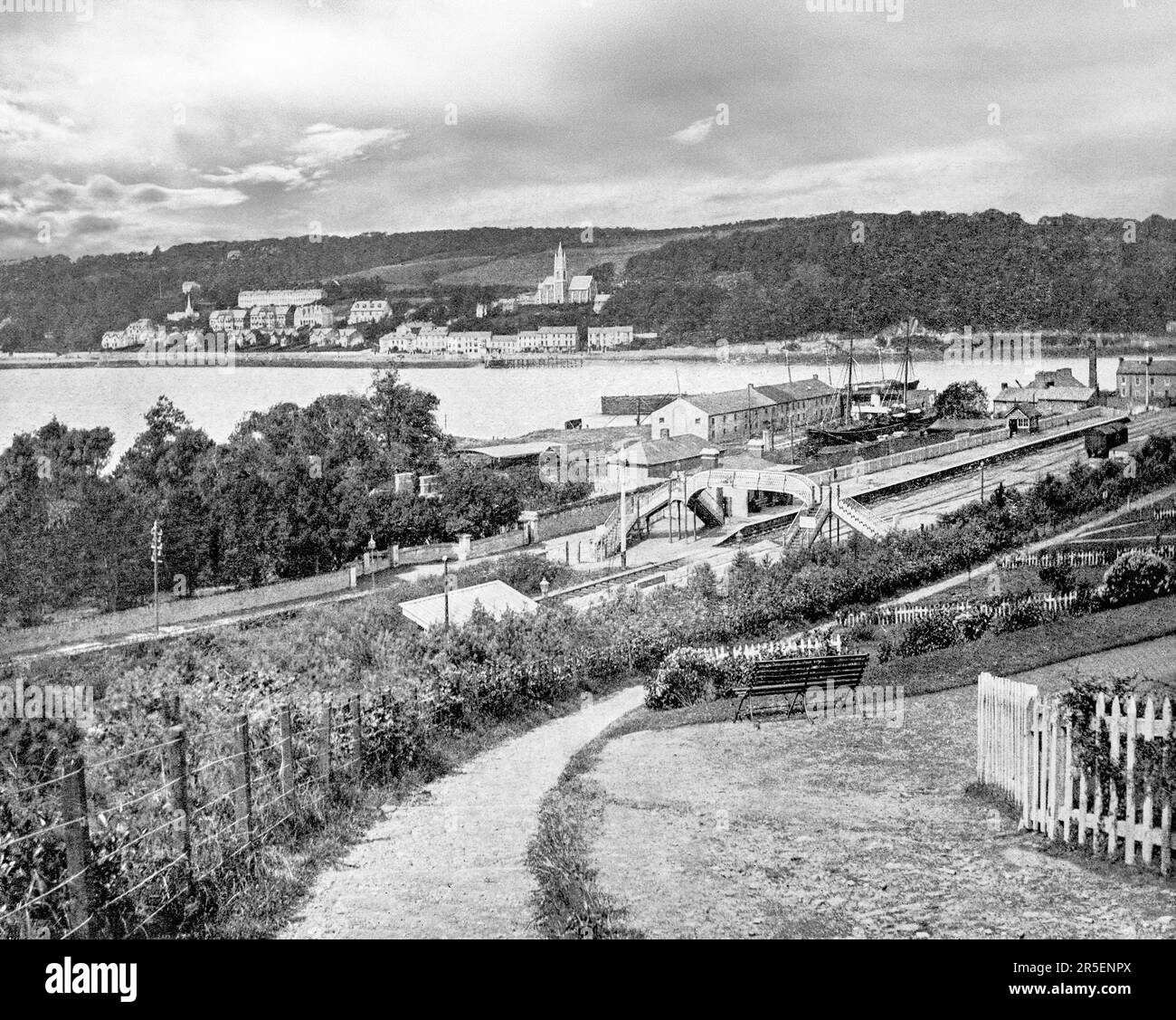 A late 19th century view of the waterfront and railway station in Monkstown, a village in County Cork, Ireland. It lies on the estuary of the River Lee, facing Great Island and looking onto Monkstown Bay. The name of the village is said to derive from an early monastic site near to where Monkstown Castle now stands, altough no archaeological evidence remains for the monastery. Stock Photohttps://www.alamy.com/image-license-details/?v=1https://www.alamy.com/a-late-19th-century-view-of-the-waterfront-and-railway-station-in-monkstown-a-village-in-county-cork-ireland-it-lies-on-the-estuary-of-the-river-lee-facing-great-island-and-looking-onto-monkstown-bay-the-name-of-the-village-is-said-to-derive-from-an-early-monastic-site-near-to-where-monkstown-castle-now-stands-altough-no-archaeological-evidence-remains-for-the-monastery-image554129490.html
RM2R5ENPX–A late 19th century view of the waterfront and railway station in Monkstown, a village in County Cork, Ireland. It lies on the estuary of the River Lee, facing Great Island and looking onto Monkstown Bay. The name of the village is said to derive from an early monastic site near to where Monkstown Castle now stands, altough no archaeological evidence remains for the monastery.
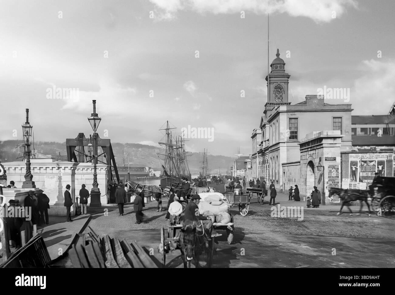 A late 19th-century photograph of Cork City docks on the River Lee, Ireland. At the time it was the leading commercial port of Ireland. The export and imports were considerable and today the port also includes Tivoli loading docks in the eastern suburbs, Cobh on the south of Great Island and Ringaskiddy on the west side of the harbour. Stock Photohttps://www.alamy.com/image-license-details/?v=1https://www.alamy.com/a-late-19th-century-photograph-of-cork-city-docks-on-the-river-lee-ireland-at-the-time-it-was-the-leading-commercial-port-of-ireland-the-export-and-imports-were-considerable-and-today-the-port-also-includes-tivoli-loading-docks-in-the-eastern-suburbs-cobh-on-the-south-of-great-island-and-ringaskiddy-on-the-west-side-of-the-harbour-image679400788.html
RM3BD9AHT–A late 19th-century photograph of Cork City docks on the River Lee, Ireland. At the time it was the leading commercial port of Ireland. The export and imports were considerable and today the port also includes Tivoli loading docks in the eastern suburbs, Cobh on the south of Great Island and Ringaskiddy on the west side of the harbour.
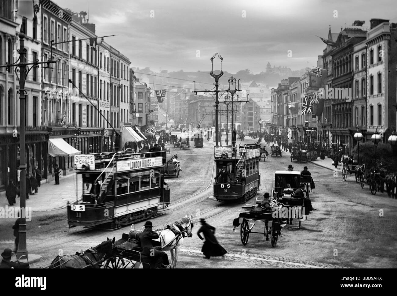 A late 19th-century photograph of St Patrick's Street aka Patrick's Street in Cork City, featuring trams of the Cork Electric Tramways and Lighting Company. The street dates from the late 18th century, when the city expanded beyond the walls of the ancient city, and the city centre of Cork was formed by the spanning of the river channels of the Lee, between marshy islands. Stock Photohttps://www.alamy.com/image-license-details/?v=1https://www.alamy.com/a-late-19th-century-photograph-of-st-patricks-street-aka-patricks-street-in-cork-city-featuring-trams-of-the-cork-electric-tramways-and-lighting-company-the-street-dates-from-the-late-18th-century-when-the-city-expanded-beyond-the-walls-of-the-ancient-city-and-the-city-centre-of-cork-was-formed-by-the-spanning-of-the-river-channels-of-the-lee-between-marshy-islands-image679400790.html
RM3BD9AHX–A late 19th-century photograph of St Patrick's Street aka Patrick's Street in Cork City, featuring trams of the Cork Electric Tramways and Lighting Company. The street dates from the late 18th century, when the city expanded beyond the walls of the ancient city, and the city centre of Cork was formed by the spanning of the river channels of the Lee, between marshy islands.
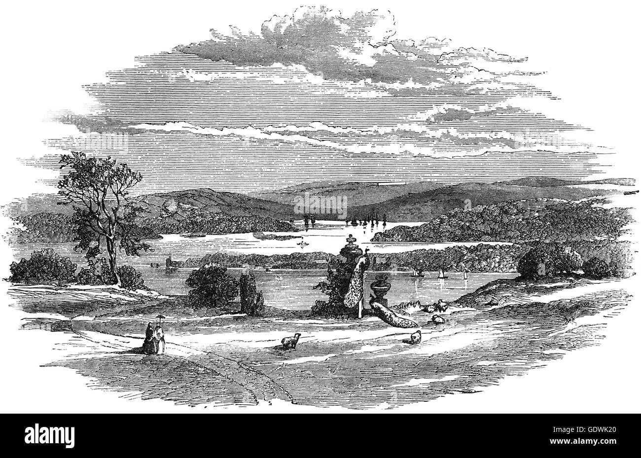 An early 19th Century view of Cork Harbour, near Cork City, Ireland Stock Photohttps://www.alamy.com/image-license-details/?v=1https://www.alamy.com/stock-photo-an-early-19th-century-view-of-cork-harbour-near-cork-city-ireland-111816488.html
RMGDWK20–An early 19th Century view of Cork Harbour, near Cork City, Ireland
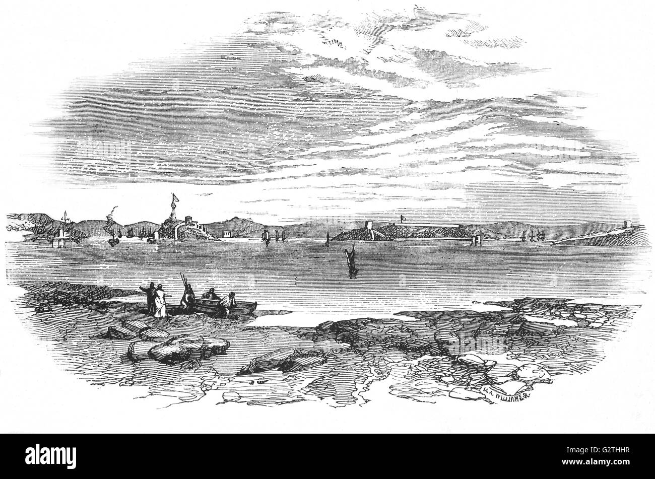 Cork River where Sir Walter Raleigh was detained by bad weather in 1618. Stock Photohttps://www.alamy.com/image-license-details/?v=1https://www.alamy.com/stock-photo-cork-river-where-sir-walter-raleigh-was-detained-by-bad-weather-in-105032195.html
RMG2THHR–Cork River where Sir Walter Raleigh was detained by bad weather in 1618.
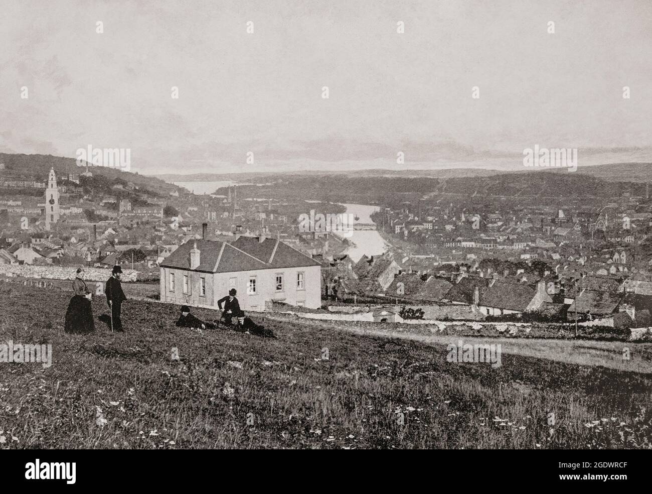 A late 19th century overview of Cork City, the second largest city, located in the south-west of Ireland. To the left is St Annes Shandon church tower and centre the River Lee crossed by St Patrick's Bridge. Stock Photohttps://www.alamy.com/image-license-details/?v=1https://www.alamy.com/a-late-19th-century-overview-of-cork-city-the-second-largest-city-located-in-the-south-west-of-ireland-to-the-left-is-st-annes-shandon-church-tower-and-centre-the-river-lee-crossed-by-st-patricks-bridge-image438816911.html
RM2GDWRCF–A late 19th century overview of Cork City, the second largest city, located in the south-west of Ireland. To the left is St Annes Shandon church tower and centre the River Lee crossed by St Patrick's Bridge.
 19th Century view of Blackrock Castle, a castellated fortification located at Blackrock, about 2 km from the centre of Cork city on the banks of the River Lee in Ireland. Originally developed as a coastal defence fortification in the 16th century to protect upper Cork Harbour and port. In 2007, the 'Cosmos at the Castle' project opened to create a 'centre for scientific research, outreach and communication'.The castle's observatory houses an interactive astronomy center which is open to the public. Stock Photohttps://www.alamy.com/image-license-details/?v=1https://www.alamy.com/stock-photo-19th-century-view-of-blackrock-castle-a-castellated-fortification-126555202.html
RMH9W2CJ–19th Century view of Blackrock Castle, a castellated fortification located at Blackrock, about 2 km from the centre of Cork city on the banks of the River Lee in Ireland. Originally developed as a coastal defence fortification in the 16th century to protect upper Cork Harbour and port. In 2007, the 'Cosmos at the Castle' project opened to create a 'centre for scientific research, outreach and communication'.The castle's observatory houses an interactive astronomy center which is open to the public.
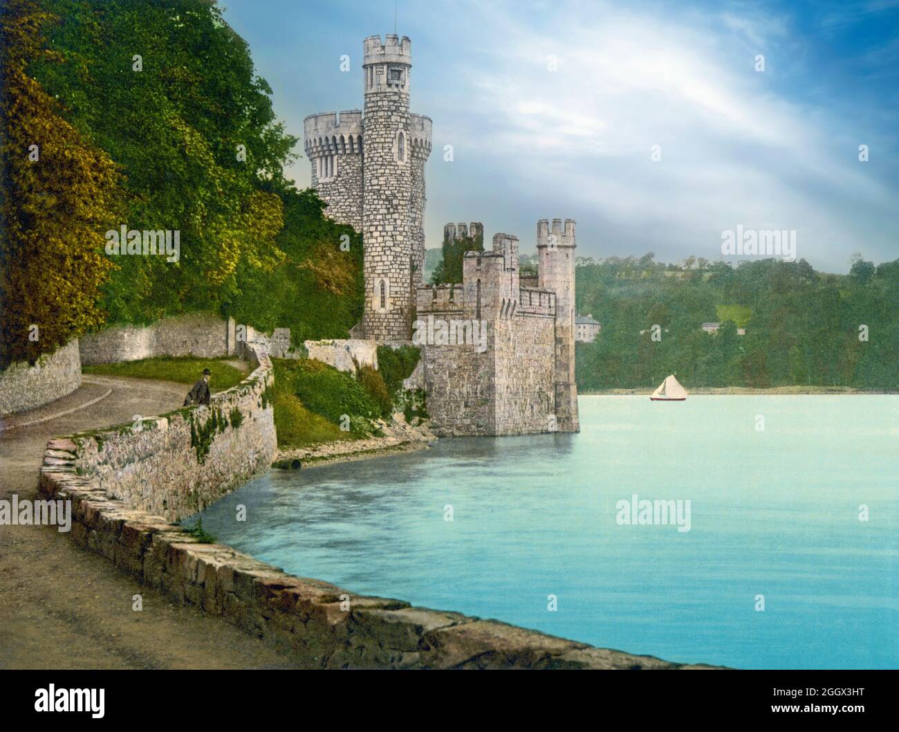 An early 20th century view of Blackrock Castle at Blackrock, about 2 km from Cork City centre on the banks of the River Lee in Ireland, developed as a coastal defence fortification in the 16th century to protect upper Cork Harbour and port. In the 20th century it was used as a private residence, offices, rowing club headquarters, and restaurant. The building was reacquired by Cork Corporation in 2001, and work commenced on renovating and re-purposing the complex as an observatory and museum. Stock Photohttps://www.alamy.com/image-license-details/?v=1https://www.alamy.com/an-early-20th-century-view-of-blackrock-castle-at-blackrock-about-2-km-from-cork-city-centre-on-the-banks-of-the-river-lee-in-ireland-developed-as-a-coastal-defence-fortification-in-the-16th-century-to-protect-upper-cork-harbour-and-port-in-the-20th-century-it-was-used-as-a-private-residence-offices-rowing-club-headquarters-and-restaurant-the-building-was-reacquired-by-cork-corporation-in-2001-and-work-commenced-on-renovating-and-re-purposing-the-complex-as-an-observatory-and-museum-image440667300.html
RM2GGX3HT–An early 20th century view of Blackrock Castle at Blackrock, about 2 km from Cork City centre on the banks of the River Lee in Ireland, developed as a coastal defence fortification in the 16th century to protect upper Cork Harbour and port. In the 20th century it was used as a private residence, offices, rowing club headquarters, and restaurant. The building was reacquired by Cork Corporation in 2001, and work commenced on renovating and re-purposing the complex as an observatory and museum.
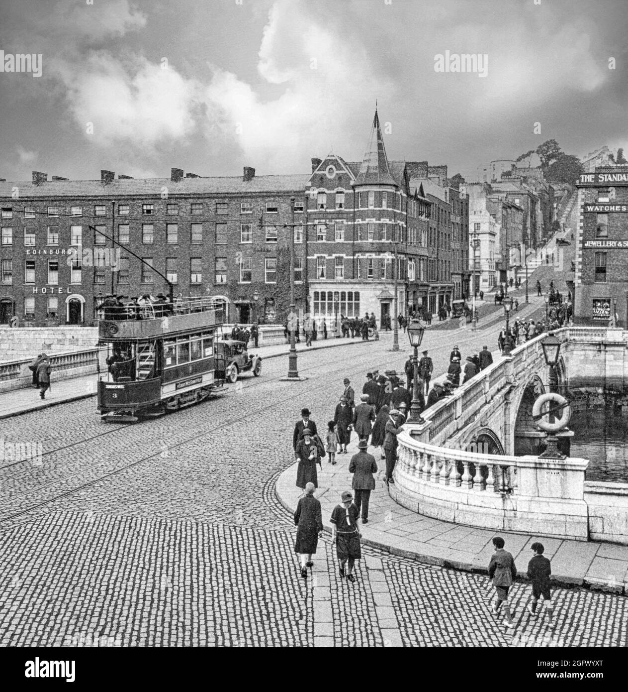 An early 20th century view of an electric tram crossing Patrick's Bridge over the River Lee in Cork City, Ireland. The first bridge, completed in 1789 and incorporating a portcullis to regulate ship traffic underneath the bridge was destroyed by a severe flood in 1853. A temporary timber bridge, was put in place and the present bridge opened in 1861, remains one of the best-known landmarks in Cork. Stock Photohttps://www.alamy.com/image-license-details/?v=1https://www.alamy.com/an-early-20th-century-view-of-an-electric-tram-crossing-patricks-bridge-over-the-river-lee-in-cork-city-ireland-the-first-bridge-completed-in-1789-and-incorporating-a-portcullis-to-regulate-ship-traffic-underneath-the-bridge-was-destroyed-by-a-severe-flood-in-1853-a-temporary-timber-bridge-was-put-in-place-and-the-present-bridge-opened-in-1861-remains-one-of-the-best-known-landmarks-in-cork-image440049760.html
RM2GFWYXT–An early 20th century view of an electric tram crossing Patrick's Bridge over the River Lee in Cork City, Ireland. The first bridge, completed in 1789 and incorporating a portcullis to regulate ship traffic underneath the bridge was destroyed by a severe flood in 1853. A temporary timber bridge, was put in place and the present bridge opened in 1861, remains one of the best-known landmarks in Cork.
 An 18th Century view of the 18th Century Church of Ireland Shandon, or the Church of St Anne, located in the Shandon district of Cork city in Ireland. It is situated a top a hill overlooking the River Lee, and the church tower is a noted landmark and symbol of the city. Stock Photohttps://www.alamy.com/image-license-details/?v=1https://www.alamy.com/stock-photo-an-18th-century-view-of-the-18th-century-church-of-ireland-shandon-110917755.html
RMGCCMMB–An 18th Century view of the 18th Century Church of Ireland Shandon, or the Church of St Anne, located in the Shandon district of Cork city in Ireland. It is situated a top a hill overlooking the River Lee, and the church tower is a noted landmark and symbol of the city.
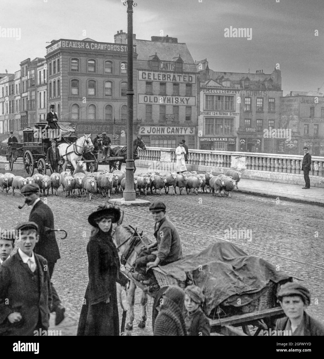 An early 20th century view of a stage coach held up by sheep on their way to market over St Patrick's Bridge in Cork City, Ireland. The first bridge, completed in 1789 and incorporating a portcullis to regulate ship traffic underneath the bridge was destroyed by a severe flood in 1853. A temporary timber bridge, was put in place and the present bridge opened in 1861, remains one of the best-known landmarks in Cork. Stock Photohttps://www.alamy.com/image-license-details/?v=1https://www.alamy.com/an-early-20th-century-view-of-a-stage-coach-held-up-by-sheep-on-their-way-to-market-over-st-patricks-bridge-in-cork-city-ireland-the-first-bridge-completed-in-1789-and-incorporating-a-portcullis-to-regulate-ship-traffic-underneath-the-bridge-was-destroyed-by-a-severe-flood-in-1853-a-temporary-timber-bridge-was-put-in-place-and-the-present-bridge-opened-in-1861-remains-one-of-the-best-known-landmarks-in-cork-image440049777.html
RM2GFWYYD–An early 20th century view of a stage coach held up by sheep on their way to market over St Patrick's Bridge in Cork City, Ireland. The first bridge, completed in 1789 and incorporating a portcullis to regulate ship traffic underneath the bridge was destroyed by a severe flood in 1853. A temporary timber bridge, was put in place and the present bridge opened in 1861, remains one of the best-known landmarks in Cork.
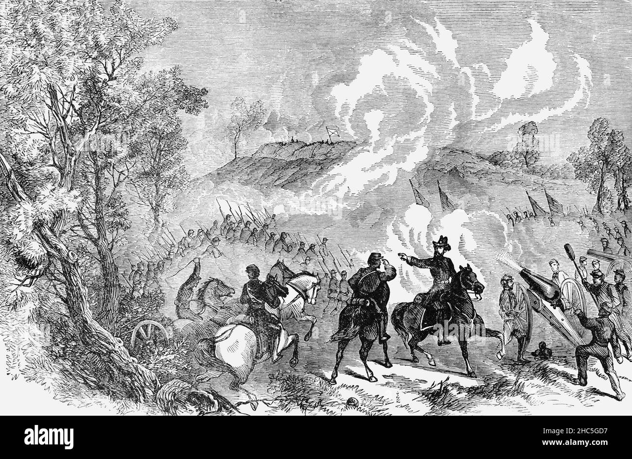 A late 19th Century illustration of the inconclusive Battle of Spotsylvania Court House, Virginia, USA, the second major engagement in Lt. Gen. Ulysses S. Grant’s Overland Campaign, a major Union offensive to chase down Robert E. Lee, destroy his forces, and defeat the Confederacy. The battle took place over 12 days and cost 18,000 Union and 12,000 Confederate casualties. Union troops tried repeatedly but failed to break the Confederate line. Grant ultimately disengaged from the fight and ordered his men to continue their march south. Stock Photohttps://www.alamy.com/image-license-details/?v=1https://www.alamy.com/a-late-19th-century-illustration-of-the-inconclusive-battle-of-spotsylvania-court-house-virginia-usa-the-second-major-engagement-in-lt-gen-ulysses-s-grants-overland-campaign-a-major-union-offensive-to-chase-down-robert-e-lee-destroy-his-forces-and-defeat-the-confederacy-the-battle-took-place-over-12-days-and-cost-18000-union-and-12000-confederate-casualties-union-troops-tried-repeatedly-but-failed-to-break-the-confederate-line-grant-ultimately-disengaged-from-the-fight-and-ordered-his-men-to-continue-their-march-south-image454968115.html
RM2HC5GD7–A late 19th Century illustration of the inconclusive Battle of Spotsylvania Court House, Virginia, USA, the second major engagement in Lt. Gen. Ulysses S. Grant’s Overland Campaign, a major Union offensive to chase down Robert E. Lee, destroy his forces, and defeat the Confederacy. The battle took place over 12 days and cost 18,000 Union and 12,000 Confederate casualties. Union troops tried repeatedly but failed to break the Confederate line. Grant ultimately disengaged from the fight and ordered his men to continue their march south.