Quick filters:
Guaymas map Stock Photos and Images
 Map showing the bay and surrounding areas of Guaymas, Sonora, Mexico, 1854. From Voyage to Mexico by M.E. Vigneaux, 1854-1855. Featured in Le Tour du Monde, published 1862. Stock Photohttps://www.alamy.com/image-license-details/?v=1https://www.alamy.com/map-showing-the-bay-and-surrounding-areas-of-guaymas-sonora-mexico-1854-from-voyage-to-mexico-by-me-vigneaux-1854-1855-featured-in-le-tour-du-monde-published-1862-image678778302.html
RM3BC90J6–Map showing the bay and surrounding areas of Guaymas, Sonora, Mexico, 1854. From Voyage to Mexico by M.E. Vigneaux, 1854-1855. Featured in Le Tour du Monde, published 1862.
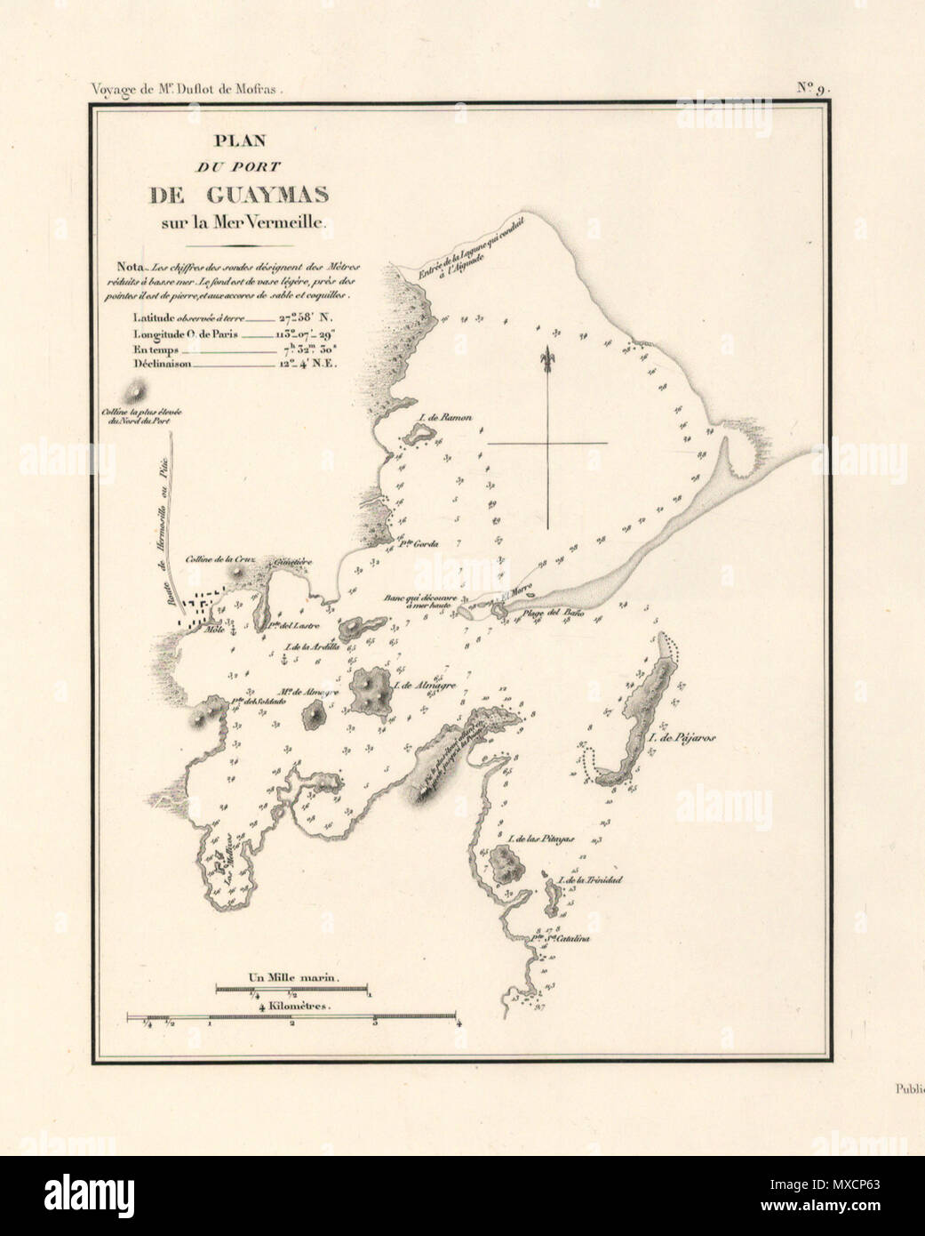 . Español: Mapa de Guaymas en 1844 . 16 October 2008. varios 257 Guaymas en 1844 Stock Photohttps://www.alamy.com/image-license-details/?v=1https://www.alamy.com/espaol-mapa-de-guaymas-en-1844-16-october-2008-varios-257-guaymas-en-1844-image188365579.html
RMMXCP63–. Español: Mapa de Guaymas en 1844 . 16 October 2008. varios 257 Guaymas en 1844
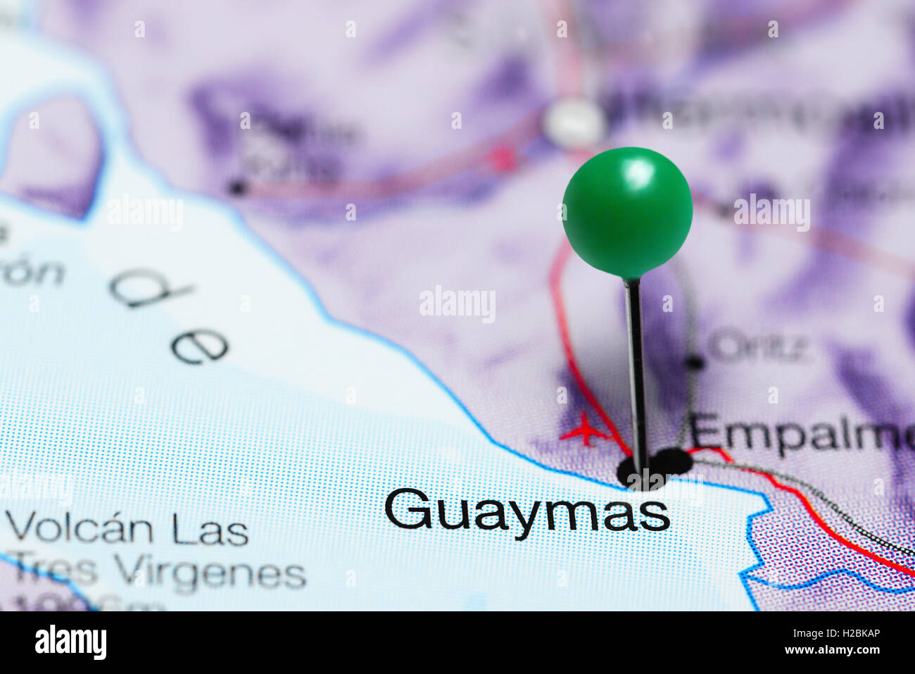 Guaymas pinned on a map of Mexico Stock Photohttps://www.alamy.com/image-license-details/?v=1https://www.alamy.com/stock-photo-guaymas-pinned-on-a-map-of-mexico-121958558.html
RFH2BKAP–Guaymas pinned on a map of Mexico
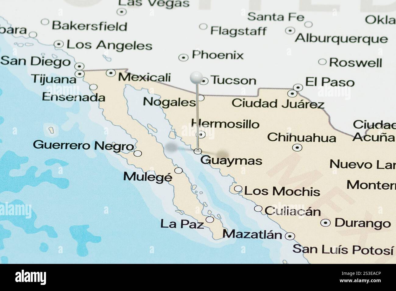 Macro photo of a white pin needle into Guaymas of Mexico political map Stock Photohttps://www.alamy.com/image-license-details/?v=1https://www.alamy.com/macro-photo-of-a-white-pin-needle-into-guaymas-of-mexico-political-map-image638943110.html
RF2S3EACP–Macro photo of a white pin needle into Guaymas of Mexico political map
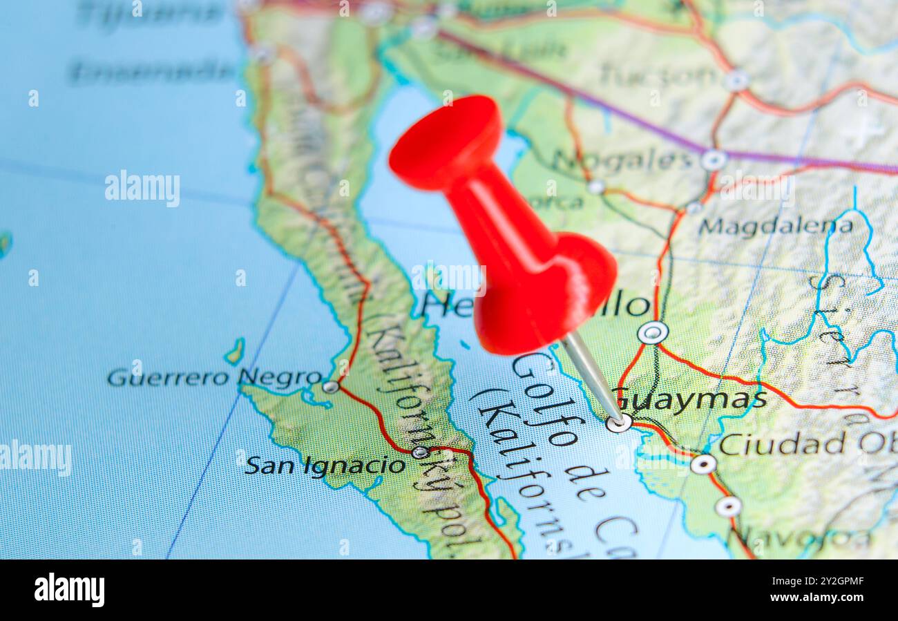 Guaymas, Mexico pin on map Stock Photohttps://www.alamy.com/image-license-details/?v=1https://www.alamy.com/guaymas-mexico-pin-on-map-image621171615.html
RF2Y2GPMF–Guaymas, Mexico pin on map
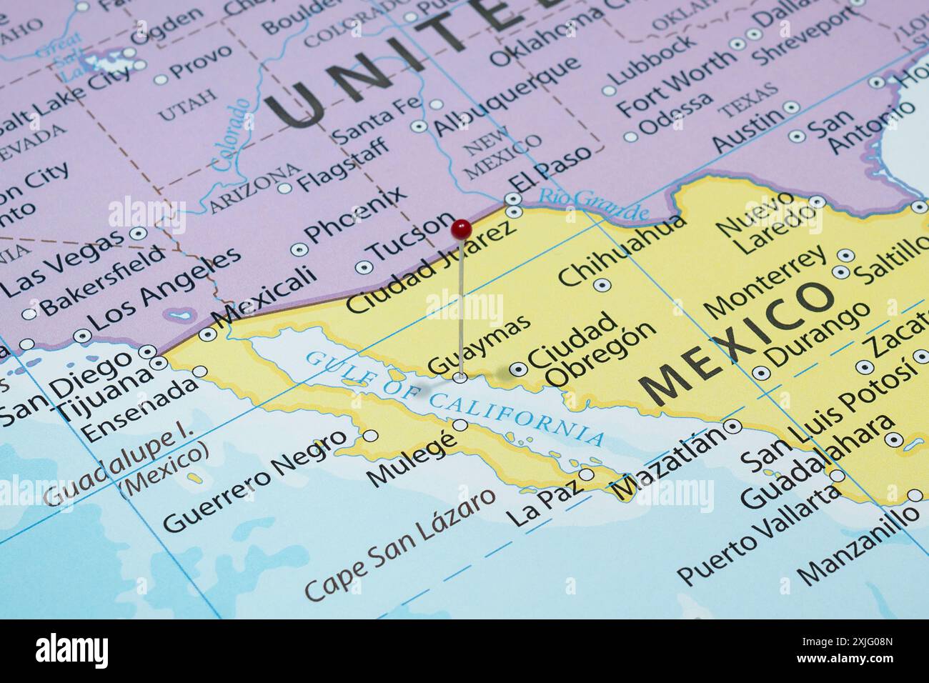 Close up to a Guaymas city with a red pin needle into Mexico country political map Stock Photohttps://www.alamy.com/image-license-details/?v=1https://www.alamy.com/close-up-to-a-guaymas-city-with-a-red-pin-needle-into-mexico-country-political-map-image613778165.html
RF2XJG08N–Close up to a Guaymas city with a red pin needle into Mexico country political map
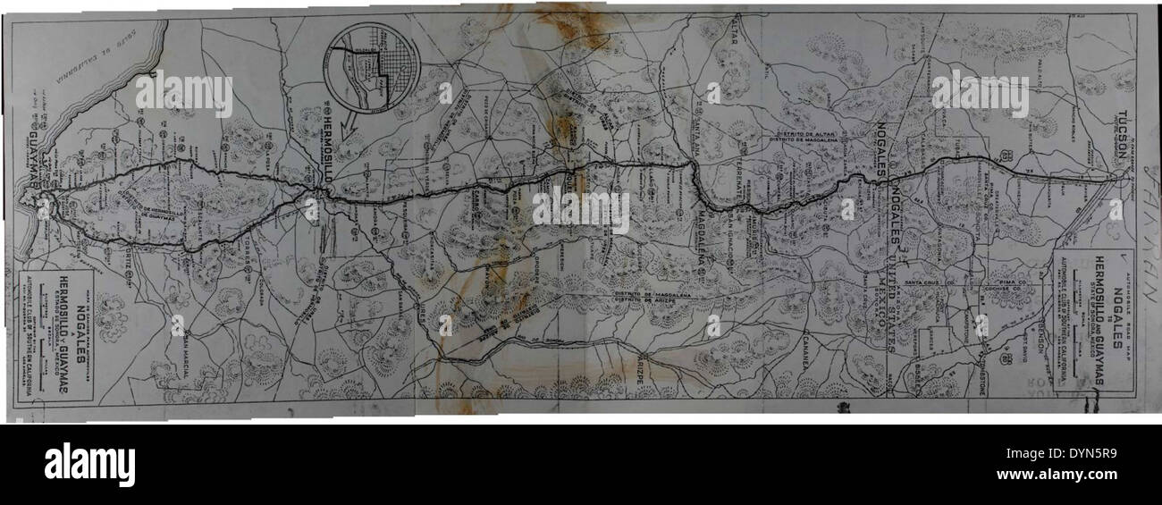 This map, part of the Theodore Gildred Special Collection, details the route between Nogales, Hermosillo, and Guaymas in Mexico. It provides insight into the region's geography and its significance during early aviation and exploration. Stock Photohttps://www.alamy.com/image-license-details/?v=1https://www.alamy.com/this-map-part-of-the-theodore-gildred-special-collection-details-the-image68692381.html
RMDYN5R9–This map, part of the Theodore Gildred Special Collection, details the route between Nogales, Hermosillo, and Guaymas in Mexico. It provides insight into the region's geography and its significance during early aviation and exploration.
![Relief shown by hachures and spot heights; depths shown by soundings. Covers the coast from Trinidad Bay, north of San Francisco, to Cape Corrientes, south of San Blas. Scale [ca. 1:1,950,000] (W 131⁰--W 102⁰/N 42⁰--N 16⁰) Inset maps: Entrance of San Francisco Harbour. Scale [ca. 1:62,000] -- Harbour of San Francisco / by Captn. F.W. Beechey, R.N., F.R.S. Scale [ca. 1:400,000] -- Bay of Monterey / by M. de Tessan of the French Navy. Scale [ca. 1:140,000] -- Guaymas / by M. de Fisquet of the French Navy. Scale [ca. 1:150,000] -- Magdalen Bay / by M. de Tessan of the French Navy. Scale [ca. 1:43 Stock Photo Relief shown by hachures and spot heights; depths shown by soundings. Covers the coast from Trinidad Bay, north of San Francisco, to Cape Corrientes, south of San Blas. Scale [ca. 1:1,950,000] (W 131⁰--W 102⁰/N 42⁰--N 16⁰) Inset maps: Entrance of San Francisco Harbour. Scale [ca. 1:62,000] -- Harbour of San Francisco / by Captn. F.W. Beechey, R.N., F.R.S. Scale [ca. 1:400,000] -- Bay of Monterey / by M. de Tessan of the French Navy. Scale [ca. 1:140,000] -- Guaymas / by M. de Fisquet of the French Navy. Scale [ca. 1:150,000] -- Magdalen Bay / by M. de Tessan of the French Navy. Scale [ca. 1:43 Stock Photo](https://c8.alamy.com/comp/2AA9ARN/relief-shown-by-hachures-and-spot-heights-depths-shown-by-soundings-covers-the-coast-from-trinidad-bay-north-of-san-francisco-to-cape-corrientes-south-of-san-blas-scale-ca-11950000-w-131-w-102n-42-n-16-inset-maps-entrance-of-san-francisco-harbour-scale-ca-162000-harbour-of-san-francisco-by-captn-fw-beechey-rn-frs-scale-ca-1400000-bay-of-monterey-by-m-de-tessan-of-the-french-navy-scale-ca-1140000-guaymas-by-m-de-fisquet-of-the-french-navy-scale-ca-1150000-magdalen-bay-by-m-de-tessan-of-the-french-navy-scale-ca-143-2AA9ARN.jpg) Relief shown by hachures and spot heights; depths shown by soundings. Covers the coast from Trinidad Bay, north of San Francisco, to Cape Corrientes, south of San Blas. Scale [ca. 1:1,950,000] (W 131⁰--W 102⁰/N 42⁰--N 16⁰) Inset maps: Entrance of San Francisco Harbour. Scale [ca. 1:62,000] -- Harbour of San Francisco / by Captn. F.W. Beechey, R.N., F.R.S. Scale [ca. 1:400,000] -- Bay of Monterey / by M. de Tessan of the French Navy. Scale [ca. 1:140,000] -- Guaymas / by M. de Fisquet of the French Navy. Scale [ca. 1:150,000] -- Magdalen Bay / by M. de Tessan of the French Navy. Scale [ca. 1:43 Stock Photohttps://www.alamy.com/image-license-details/?v=1https://www.alamy.com/relief-shown-by-hachures-and-spot-heights-depths-shown-by-soundings-covers-the-coast-from-trinidad-bay-north-of-san-francisco-to-cape-corrientes-south-of-san-blas-scale-ca-11950000-w-131-w-102n-42-n-16-inset-maps-entrance-of-san-francisco-harbour-scale-ca-162000-harbour-of-san-francisco-by-captn-fw-beechey-rn-frs-scale-ca-1400000-bay-of-monterey-by-m-de-tessan-of-the-french-navy-scale-ca-1140000-guaymas-by-m-de-fisquet-of-the-french-navy-scale-ca-1150000-magdalen-bay-by-m-de-tessan-of-the-french-navy-scale-ca-143-image333349625.html
Relief shown by hachures and spot heights; depths shown by soundings. Covers the coast from Trinidad Bay, north of San Francisco, to Cape Corrientes, south of San Blas. Scale [ca. 1:1,950,000] (W 131⁰--W 102⁰/N 42⁰--N 16⁰) Inset maps: Entrance of San Francisco Harbour. Scale [ca. 1:62,000] -- Harbour of San Francisco / by Captn. F.W. Beechey, R.N., F.R.S. Scale [ca. 1:400,000] -- Bay of Monterey / by M. de Tessan of the French Navy. Scale [ca. 1:140,000] -- Guaymas / by M. de Fisquet of the French Navy. Scale [ca. 1:150,000] -- Magdalen Bay / by M. de Tessan of the French Navy. Scale [ca. 1:43 Stock Photohttps://www.alamy.com/image-license-details/?v=1https://www.alamy.com/relief-shown-by-hachures-and-spot-heights-depths-shown-by-soundings-covers-the-coast-from-trinidad-bay-north-of-san-francisco-to-cape-corrientes-south-of-san-blas-scale-ca-11950000-w-131-w-102n-42-n-16-inset-maps-entrance-of-san-francisco-harbour-scale-ca-162000-harbour-of-san-francisco-by-captn-fw-beechey-rn-frs-scale-ca-1400000-bay-of-monterey-by-m-de-tessan-of-the-french-navy-scale-ca-1140000-guaymas-by-m-de-fisquet-of-the-french-navy-scale-ca-1150000-magdalen-bay-by-m-de-tessan-of-the-french-navy-scale-ca-143-image333349625.htmlRM2AA9ARN–Relief shown by hachures and spot heights; depths shown by soundings. Covers the coast from Trinidad Bay, north of San Francisco, to Cape Corrientes, south of San Blas. Scale [ca. 1:1,950,000] (W 131⁰--W 102⁰/N 42⁰--N 16⁰) Inset maps: Entrance of San Francisco Harbour. Scale [ca. 1:62,000] -- Harbour of San Francisco / by Captn. F.W. Beechey, R.N., F.R.S. Scale [ca. 1:400,000] -- Bay of Monterey / by M. de Tessan of the French Navy. Scale [ca. 1:140,000] -- Guaymas / by M. de Fisquet of the French Navy. Scale [ca. 1:150,000] -- Magdalen Bay / by M. de Tessan of the French Navy. Scale [ca. 1:43
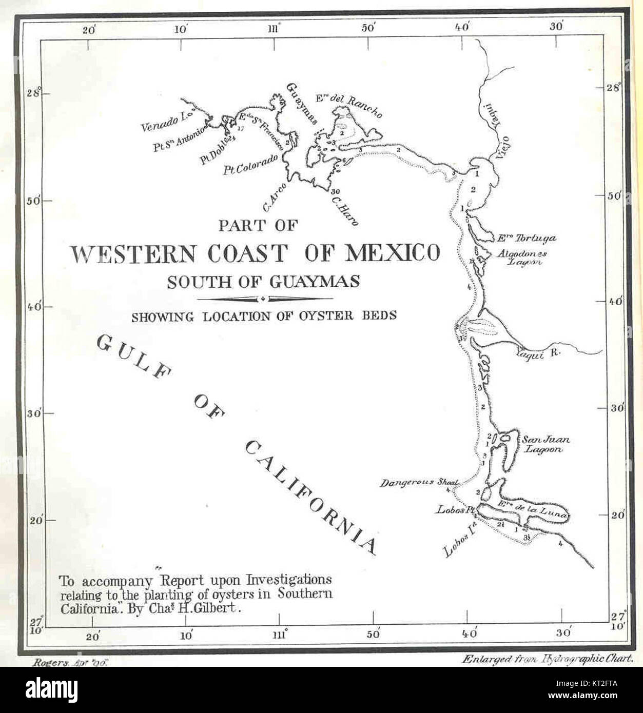 This map depicts part of the western coast of Mexico, located south of Guaymas. The region is known for its coastal geography, marine ecosystems, and historical significance as part of Mexico’s Pacific coastline. Stock Photohttps://www.alamy.com/image-license-details/?v=1https://www.alamy.com/stock-image-this-map-depicts-part-of-the-western-coast-of-mexico-located-south-169701402.html
RMKT2FTA–This map depicts part of the western coast of Mexico, located south of Guaymas. The region is known for its coastal geography, marine ecosystems, and historical significance as part of Mexico’s Pacific coastline.
 Geographic map of Golfo de California Stock Photohttps://www.alamy.com/image-license-details/?v=1https://www.alamy.com/geographic-map-of-golfo-de-california-image369001648.html
RF2CC9DA8–Geographic map of Golfo de California
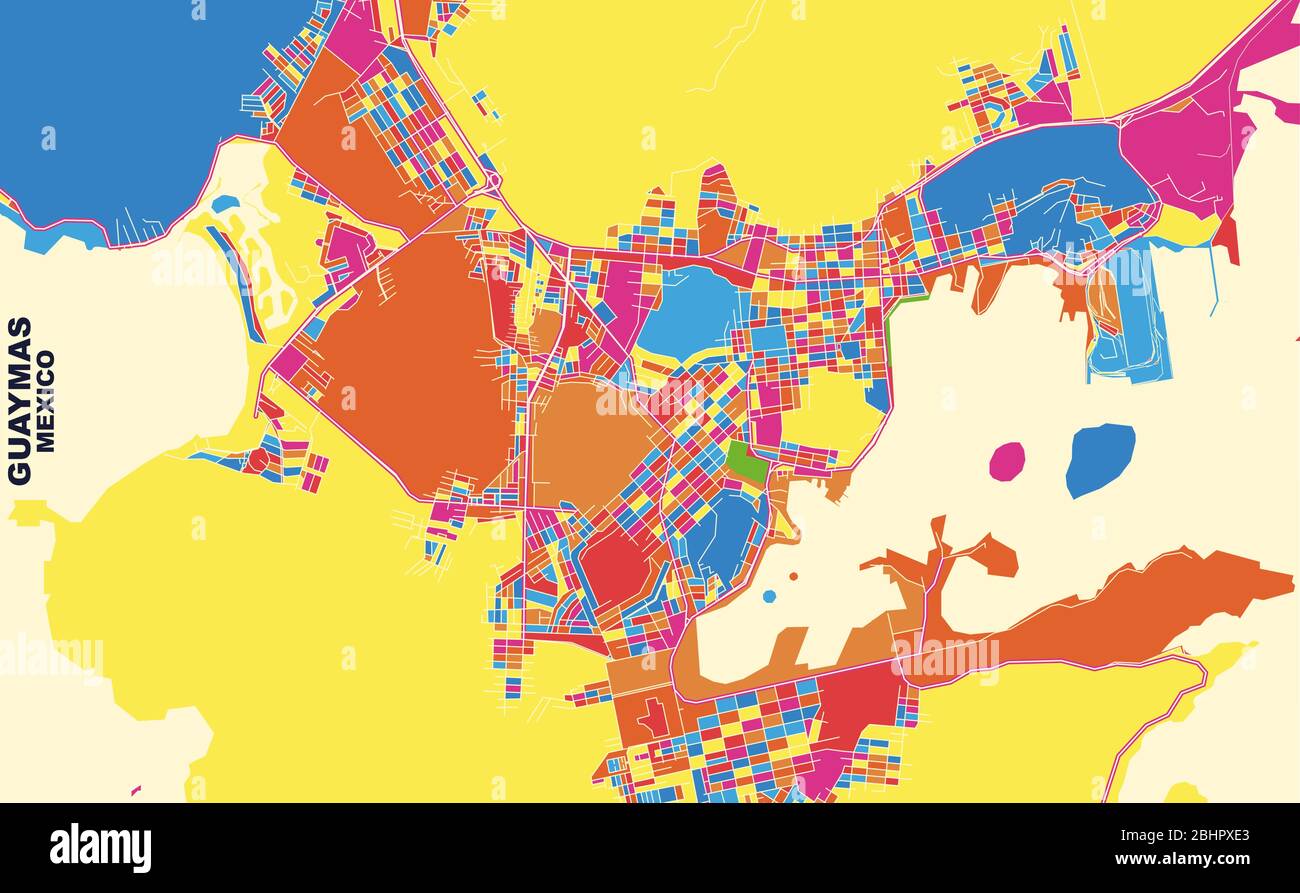 Colorful vector map of Guaymas, Sonora, Mexico. Art Map template for selfprinting wall art in landscape format. Stock Vectorhttps://www.alamy.com/image-license-details/?v=1https://www.alamy.com/colorful-vector-map-of-guaymas-sonora-mexico-art-map-template-for-selfprinting-wall-art-in-landscape-format-image355160235.html
RF2BHPXE3–Colorful vector map of Guaymas, Sonora, Mexico. Art Map template for selfprinting wall art in landscape format.
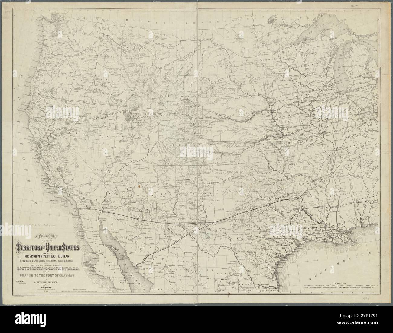 Map of the territory of the United States from the Mississippi River to the Pacific Ocean: prepared particularly to show the route adopted for the (Memphis, El-Paso and Pacific or) Southern Trans-Continental R.R. and its branch to the port of Guaymas in northern Mexico 1868 by Woods, W. L. (William L.) Stock Photohttps://www.alamy.com/image-license-details/?v=1https://www.alamy.com/map-of-the-territory-of-the-united-states-from-the-mississippi-river-to-the-pacific-ocean-prepared-particularly-to-show-the-route-adopted-for-the-memphis-el-paso-and-pacific-or-southern-trans-continental-rr-and-its-branch-to-the-port-of-guaymas-in-northern-mexico-1868-by-woods-w-l-william-l-image633123373.html
RM2YP1791–Map of the territory of the United States from the Mississippi River to the Pacific Ocean: prepared particularly to show the route adopted for the (Memphis, El-Paso and Pacific or) Southern Trans-Continental R.R. and its branch to the port of Guaymas in northern Mexico 1868 by Woods, W. L. (William L.)
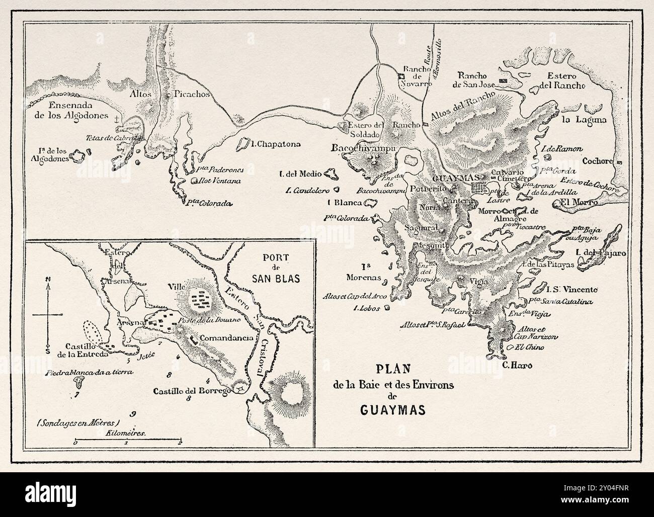 Old Map of the bay and surroundings of Guaymas, Mexican state of Sonora, Mexico. Travel in Mexico, 1854-1855 by Ernest Vigneaux. Le Tour du Monde 1862 Stock Photohttps://www.alamy.com/image-license-details/?v=1https://www.alamy.com/old-map-of-the-bay-and-surroundings-of-guaymas-mexican-state-of-sonora-mexico-travel-in-mexico-1854-1855-by-ernest-vigneaux-le-tour-du-monde-1862-image619673427.html
RM2Y04FNR–Old Map of the bay and surroundings of Guaymas, Mexican state of Sonora, Mexico. Travel in Mexico, 1854-1855 by Ernest Vigneaux. Le Tour du Monde 1862
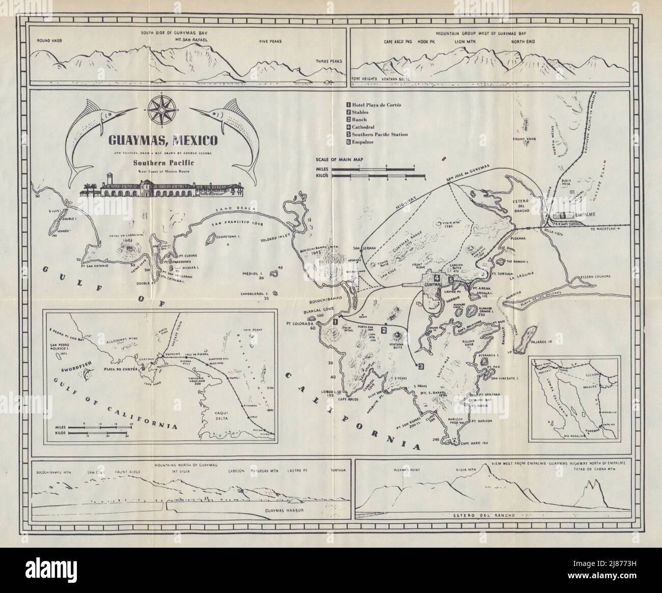 Plano de GUAYMAS, Mexico. Coastal profiles. Swordfish sport fishing 1938 map Stock Photohttps://www.alamy.com/image-license-details/?v=1https://www.alamy.com/plano-de-guaymas-mexico-coastal-profiles-swordfish-sport-fishing-1938-map-image469756437.html
RF2J8773H–Plano de GUAYMAS, Mexico. Coastal profiles. Swordfish sport fishing 1938 map
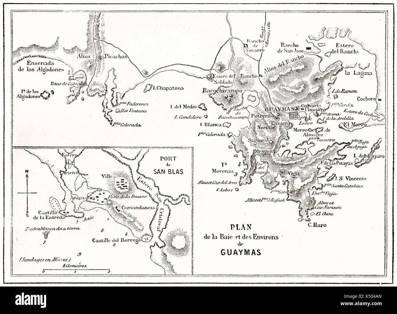 Ancient topographic map of Guaymas bay Mexico. By unidentified author published on Le Tour du Monde Paris 1862 Stock Photohttps://www.alamy.com/image-license-details/?v=1https://www.alamy.com/ancient-topographic-map-of-guaymas-bay-mexico-by-unidentified-author-image157970029.html
RFK504AN–Ancient topographic map of Guaymas bay Mexico. By unidentified author published on Le Tour du Monde Paris 1862
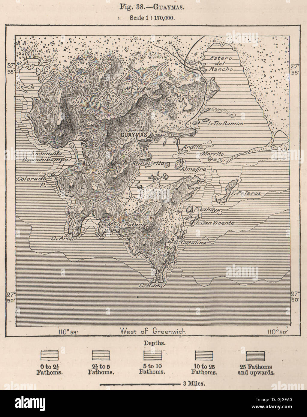 Guaymas. Mexico, 1885 antique map Stock Photohttps://www.alamy.com/image-license-details/?v=1https://www.alamy.com/stock-photo-guaymas-mexico-1885-antique-map-114688504.html
RFGJGEA0–Guaymas. Mexico, 1885 antique map
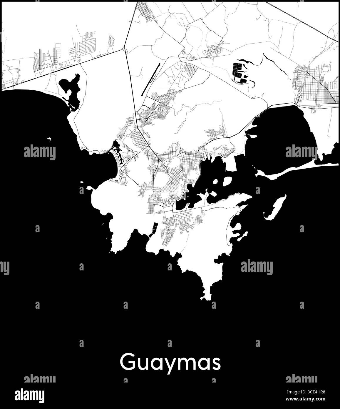 Guaymas city map, Mexico - Topographic vector map poster Stock Vectorhttps://www.alamy.com/image-license-details/?v=1https://www.alamy.com/guaymas-city-map-mexico-topographic-vector-map-poster-image697121692.html
RF3CE4HR8–Guaymas city map, Mexico - Topographic vector map poster
 . Bulletin of the Southern California Academy of Sciences. Science; Natural history; Natural history. Bulletin, So. Calif. Academy of Sciences Vol. 57, Part 2, 1958 • Specijuens from tne Hancock Collection. + Reported by Burch (19U5) and others. D Reported by Lowe (193U), Todos Santos Bay +. Abreojos Point* PLATE 35 Map of wesiern North America showing the locations from which A. californica has been recorded and those of the present report. Abreojos Point on the coast side of Baja California, Agua Verde Bay on the inner peninsular side and Guaymas on the Sonoran coast. Representative specimen Stock Photohttps://www.alamy.com/image-license-details/?v=1https://www.alamy.com/bulletin-of-the-southern-california-academy-of-sciences-science-natural-history-natural-history-bulletin-so-calif-academy-of-sciences-vol-57-part-2-1958-specijuens-from-tne-hancock-collection-reported-by-burch-19u5-and-others-d-reported-by-lowe-193u-todos-santos-bay-abreojos-point-plate-35-map-of-wesiern-north-america-showing-the-locations-from-which-a-californica-has-been-recorded-and-those-of-the-present-report-abreojos-point-on-the-coast-side-of-baja-california-agua-verde-bay-on-the-inner-peninsular-side-and-guaymas-on-the-sonoran-coast-representative-specimen-image233864188.html
RMRGDC4C–. Bulletin of the Southern California Academy of Sciences. Science; Natural history; Natural history. Bulletin, So. Calif. Academy of Sciences Vol. 57, Part 2, 1958 • Specijuens from tne Hancock Collection. + Reported by Burch (19U5) and others. D Reported by Lowe (193U), Todos Santos Bay +. Abreojos Point* PLATE 35 Map of wesiern North America showing the locations from which A. californica has been recorded and those of the present report. Abreojos Point on the coast side of Baja California, Agua Verde Bay on the inner peninsular side and Guaymas on the Sonoran coast. Representative specimen
 Guaymas, Mazatlan Mexican city travel stickers and plates, vector luggage tags. Mexico states tin signs with city landmarks, flags and emblems or taline slogans on metal grunge plate signs Stock Vectorhttps://www.alamy.com/image-license-details/?v=1https://www.alamy.com/guaymas-mazatlan-mexican-city-travel-stickers-and-plates-vector-luggage-tags-mexico-states-tin-signs-with-city-landmarks-flags-and-emblems-or-taline-slogans-on-metal-grunge-plate-signs-image471939368.html
RF2JBPKDC–Guaymas, Mazatlan Mexican city travel stickers and plates, vector luggage tags. Mexico states tin signs with city landmarks, flags and emblems or taline slogans on metal grunge plate signs
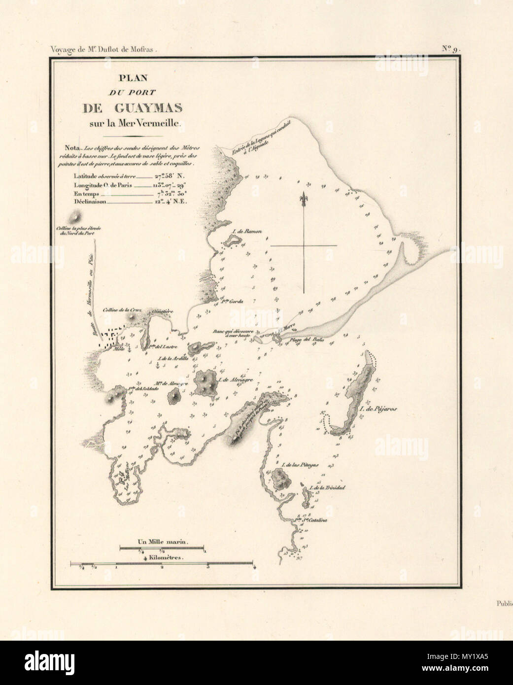 . Español: Mapa de Guaymas en 1844 . 16 October 2008. varios 221 Guaymas en 1844 Stock Photohttps://www.alamy.com/image-license-details/?v=1https://www.alamy.com/espaol-mapa-de-guaymas-en-1844-16-october-2008-varios-221-guaymas-en-1844-image188742013.html
RMMY1XA5–. Español: Mapa de Guaymas en 1844 . 16 October 2008. varios 221 Guaymas en 1844
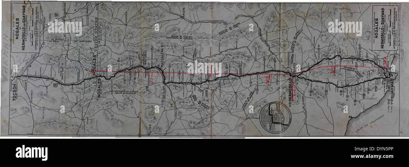 Nogales Hermosillo y Guaymas Map Stock Photohttps://www.alamy.com/image-license-details/?v=1https://www.alamy.com/nogales-hermosillo-y-guaymas-map-image68692366.html
RMDYN5PP–Nogales Hermosillo y Guaymas Map
![Relief shown by hachures and spot heights; depths shown by soundings. Covers the coast from Trinidad Bay, north of San Francisco, to Cape Corrientes, south of San Blas. Scale [ca. 1:1,950,000] (W 131⁰--W 102⁰/N 42⁰--N 16⁰) Inset maps: Entrance of San Francisco Harbour. Scale [ca. 1:62,000] -- Harbour of San Francisco / by Captn. F.W. Beechey, R.N., F.R.S. Scale [ca. 1:400,000] -- Bay of Monterey / by M. de Tessan of the French Navy. Scale [ca. 1:140,000] -- Guaymas / by M. de Fisquet of the French Navy. Scale [ca. 1:150,000] -- Magdalen Bay / by M. de Tessan of the French Navy. Scale [ca. 1:43 Stock Photo Relief shown by hachures and spot heights; depths shown by soundings. Covers the coast from Trinidad Bay, north of San Francisco, to Cape Corrientes, south of San Blas. Scale [ca. 1:1,950,000] (W 131⁰--W 102⁰/N 42⁰--N 16⁰) Inset maps: Entrance of San Francisco Harbour. Scale [ca. 1:62,000] -- Harbour of San Francisco / by Captn. F.W. Beechey, R.N., F.R.S. Scale [ca. 1:400,000] -- Bay of Monterey / by M. de Tessan of the French Navy. Scale [ca. 1:140,000] -- Guaymas / by M. de Fisquet of the French Navy. Scale [ca. 1:150,000] -- Magdalen Bay / by M. de Tessan of the French Navy. Scale [ca. 1:43 Stock Photo](https://c8.alamy.com/comp/2AA9ARR/relief-shown-by-hachures-and-spot-heights-depths-shown-by-soundings-covers-the-coast-from-trinidad-bay-north-of-san-francisco-to-cape-corrientes-south-of-san-blas-scale-ca-11950000-w-131-w-102n-42-n-16-inset-maps-entrance-of-san-francisco-harbour-scale-ca-162000-harbour-of-san-francisco-by-captn-fw-beechey-rn-frs-scale-ca-1400000-bay-of-monterey-by-m-de-tessan-of-the-french-navy-scale-ca-1140000-guaymas-by-m-de-fisquet-of-the-french-navy-scale-ca-1150000-magdalen-bay-by-m-de-tessan-of-the-french-navy-scale-ca-143-2AA9ARR.jpg) Relief shown by hachures and spot heights; depths shown by soundings. Covers the coast from Trinidad Bay, north of San Francisco, to Cape Corrientes, south of San Blas. Scale [ca. 1:1,950,000] (W 131⁰--W 102⁰/N 42⁰--N 16⁰) Inset maps: Entrance of San Francisco Harbour. Scale [ca. 1:62,000] -- Harbour of San Francisco / by Captn. F.W. Beechey, R.N., F.R.S. Scale [ca. 1:400,000] -- Bay of Monterey / by M. de Tessan of the French Navy. Scale [ca. 1:140,000] -- Guaymas / by M. de Fisquet of the French Navy. Scale [ca. 1:150,000] -- Magdalen Bay / by M. de Tessan of the French Navy. Scale [ca. 1:43 Stock Photohttps://www.alamy.com/image-license-details/?v=1https://www.alamy.com/relief-shown-by-hachures-and-spot-heights-depths-shown-by-soundings-covers-the-coast-from-trinidad-bay-north-of-san-francisco-to-cape-corrientes-south-of-san-blas-scale-ca-11950000-w-131-w-102n-42-n-16-inset-maps-entrance-of-san-francisco-harbour-scale-ca-162000-harbour-of-san-francisco-by-captn-fw-beechey-rn-frs-scale-ca-1400000-bay-of-monterey-by-m-de-tessan-of-the-french-navy-scale-ca-1140000-guaymas-by-m-de-fisquet-of-the-french-navy-scale-ca-1150000-magdalen-bay-by-m-de-tessan-of-the-french-navy-scale-ca-143-image333349627.html
Relief shown by hachures and spot heights; depths shown by soundings. Covers the coast from Trinidad Bay, north of San Francisco, to Cape Corrientes, south of San Blas. Scale [ca. 1:1,950,000] (W 131⁰--W 102⁰/N 42⁰--N 16⁰) Inset maps: Entrance of San Francisco Harbour. Scale [ca. 1:62,000] -- Harbour of San Francisco / by Captn. F.W. Beechey, R.N., F.R.S. Scale [ca. 1:400,000] -- Bay of Monterey / by M. de Tessan of the French Navy. Scale [ca. 1:140,000] -- Guaymas / by M. de Fisquet of the French Navy. Scale [ca. 1:150,000] -- Magdalen Bay / by M. de Tessan of the French Navy. Scale [ca. 1:43 Stock Photohttps://www.alamy.com/image-license-details/?v=1https://www.alamy.com/relief-shown-by-hachures-and-spot-heights-depths-shown-by-soundings-covers-the-coast-from-trinidad-bay-north-of-san-francisco-to-cape-corrientes-south-of-san-blas-scale-ca-11950000-w-131-w-102n-42-n-16-inset-maps-entrance-of-san-francisco-harbour-scale-ca-162000-harbour-of-san-francisco-by-captn-fw-beechey-rn-frs-scale-ca-1400000-bay-of-monterey-by-m-de-tessan-of-the-french-navy-scale-ca-1140000-guaymas-by-m-de-fisquet-of-the-french-navy-scale-ca-1150000-magdalen-bay-by-m-de-tessan-of-the-french-navy-scale-ca-143-image333349627.htmlRM2AA9ARR–Relief shown by hachures and spot heights; depths shown by soundings. Covers the coast from Trinidad Bay, north of San Francisco, to Cape Corrientes, south of San Blas. Scale [ca. 1:1,950,000] (W 131⁰--W 102⁰/N 42⁰--N 16⁰) Inset maps: Entrance of San Francisco Harbour. Scale [ca. 1:62,000] -- Harbour of San Francisco / by Captn. F.W. Beechey, R.N., F.R.S. Scale [ca. 1:400,000] -- Bay of Monterey / by M. de Tessan of the French Navy. Scale [ca. 1:140,000] -- Guaymas / by M. de Fisquet of the French Navy. Scale [ca. 1:150,000] -- Magdalen Bay / by M. de Tessan of the French Navy. Scale [ca. 1:43
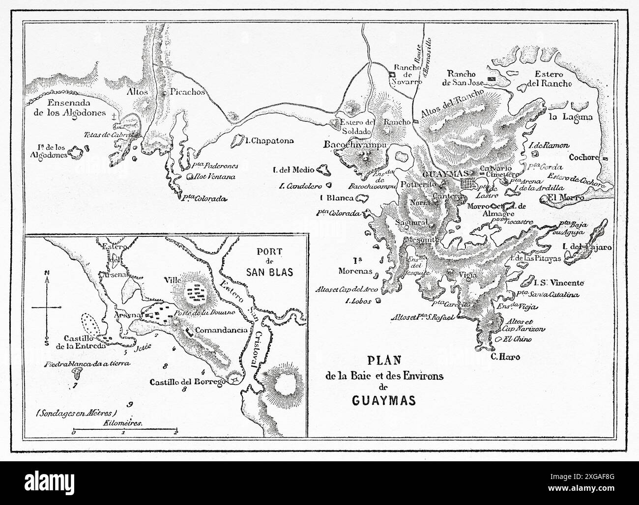 Old Map of the bay and surroundings of Guaymas, Mexican state of Sonora, Mexico. Travel in Mexico, 1854-1855 by Ernest Vigneaux. Le Tour du Monde 1862 Stock Photohttps://www.alamy.com/image-license-details/?v=1https://www.alamy.com/old-map-of-the-bay-and-surroundings-of-guaymas-mexican-state-of-sonora-mexico-travel-in-mexico-1854-1855-by-ernest-vigneaux-le-tour-du-monde-1862-image612428896.html
RM2XGAF8G–Old Map of the bay and surroundings of Guaymas, Mexican state of Sonora, Mexico. Travel in Mexico, 1854-1855 by Ernest Vigneaux. Le Tour du Monde 1862
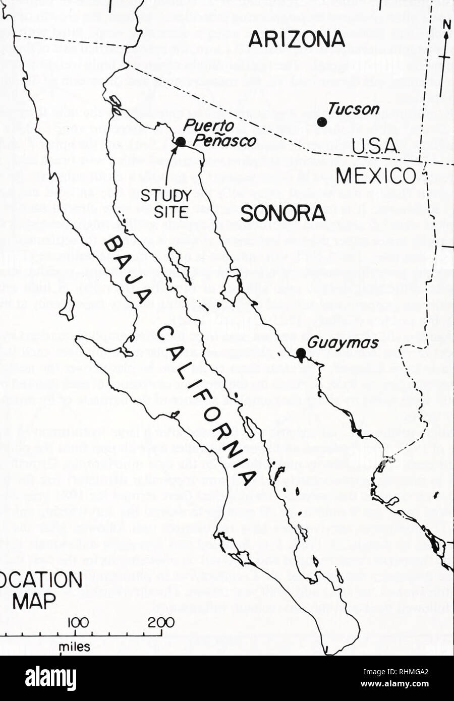 . The Biological bulletin. Biology; Zoology; Biology; Marine Biology. BARNACLE REPRODUCTIVE ECOLOGY 411 115 no 25-— ARIZONA Puerto "^ ^Penasco Tucson MEXIC01 SONORA o. Guaymas LOCATION MAP 100 200 miles 30 25 115 IK) FIGURE 1. The study site, 10 km NW of Puerto Penasco. anisopoma and T. stalactifera. These quadrats were photographed monthly, using a fixed focal length and focus to ensure the same perspective. Accuracy was checked against an included scale. The most common measure of growth in barnacles is the. Please note that these images are extracted from scanned page images that may h Stock Photohttps://www.alamy.com/image-license-details/?v=1https://www.alamy.com/the-biological-bulletin-biology-zoology-biology-marine-biology-barnacle-reproductive-ecology-411-115-no-25-arizona-puerto-quot-penasco-tucson-mexic01-sonora-o-guaymas-location-map-100-200-miles-30-25-115-ik-figure-1-the-study-site-10-km-nw-of-puerto-penasco-anisopoma-and-t-stalactifera-these-quadrats-were-photographed-monthly-using-a-fixed-focal-length-and-focus-to-ensure-the-same-perspective-accuracy-was-checked-against-an-included-scale-the-most-common-measure-of-growth-in-barnacles-is-the-please-note-that-these-images-are-extracted-from-scanned-page-images-that-may-h-image234635802.html
RMRHMGA2–. The Biological bulletin. Biology; Zoology; Biology; Marine Biology. BARNACLE REPRODUCTIVE ECOLOGY 411 115 no 25-— ARIZONA Puerto "^ ^Penasco Tucson MEXIC01 SONORA o. Guaymas LOCATION MAP 100 200 miles 30 25 115 IK) FIGURE 1. The study site, 10 km NW of Puerto Penasco. anisopoma and T. stalactifera. These quadrats were photographed monthly, using a fixed focal length and focus to ensure the same perspective. Accuracy was checked against an included scale. The most common measure of growth in barnacles is the. Please note that these images are extracted from scanned page images that may h
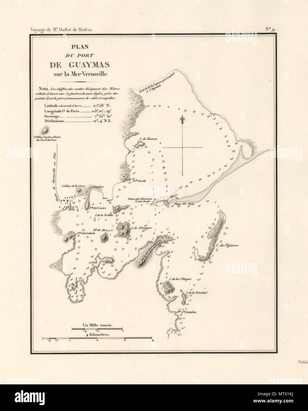 . Español: Mapa de Guaymas en 1844 . 16 October 2008. varios 256 Guaymas en 1844 Stock Photohttps://www.alamy.com/image-license-details/?v=1https://www.alamy.com/espaol-mapa-de-guaymas-en-1844-16-october-2008-varios-256-guaymas-en-1844-image187427510.html
RMMTX1KJ–. Español: Mapa de Guaymas en 1844 . 16 October 2008. varios 256 Guaymas en 1844
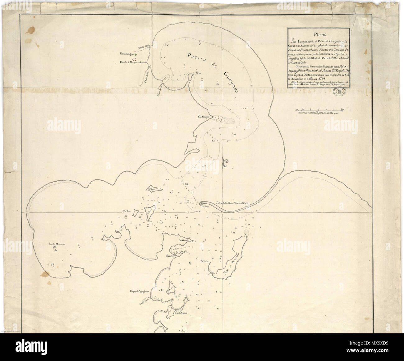 . Español: Mapa de Guaymas en 1795 . 16 October 2015. varios 257 Guaymas 1795 Stock Photohttps://www.alamy.com/image-license-details/?v=1https://www.alamy.com/espaol-mapa-de-guaymas-en-1795-16-october-2015-varios-257-guaymas-1795-image188303061.html
RMMX9XD9–. Español: Mapa de Guaymas en 1795 . 16 October 2015. varios 257 Guaymas 1795
![Relief shown by hachures and spot heights; depths shown by soundings. Covers the coast from Trinidad Bay, north of San Francisco, to Cape Corrientes, south of San Blas. Scale [ca. 1:1,950,000] (W 131⁰--W 102⁰/N 42⁰--N 16⁰) Inset maps: Entrance of San Francisco Harbour. Scale [ca. 1:62,000] -- Harbour of San Francisco / by Captn. F.W. Beechey, R.N., F.R.S. Scale [ca. 1:400,000] -- Bay of Monterey / by M. de Tessan of the French Navy. Scale [ca. 1:140,000] -- Guaymas / by M. de Fisquet of the French Navy. Scale [ca. 1:150,000] -- Magdalen Bay / by M. de Tessan of the French Navy. Scale [ca. 1:43 Stock Photo Relief shown by hachures and spot heights; depths shown by soundings. Covers the coast from Trinidad Bay, north of San Francisco, to Cape Corrientes, south of San Blas. Scale [ca. 1:1,950,000] (W 131⁰--W 102⁰/N 42⁰--N 16⁰) Inset maps: Entrance of San Francisco Harbour. Scale [ca. 1:62,000] -- Harbour of San Francisco / by Captn. F.W. Beechey, R.N., F.R.S. Scale [ca. 1:400,000] -- Bay of Monterey / by M. de Tessan of the French Navy. Scale [ca. 1:140,000] -- Guaymas / by M. de Fisquet of the French Navy. Scale [ca. 1:150,000] -- Magdalen Bay / by M. de Tessan of the French Navy. Scale [ca. 1:43 Stock Photo](https://c8.alamy.com/comp/2AA9ARM/relief-shown-by-hachures-and-spot-heights-depths-shown-by-soundings-covers-the-coast-from-trinidad-bay-north-of-san-francisco-to-cape-corrientes-south-of-san-blas-scale-ca-11950000-w-131-w-102n-42-n-16-inset-maps-entrance-of-san-francisco-harbour-scale-ca-162000-harbour-of-san-francisco-by-captn-fw-beechey-rn-frs-scale-ca-1400000-bay-of-monterey-by-m-de-tessan-of-the-french-navy-scale-ca-1140000-guaymas-by-m-de-fisquet-of-the-french-navy-scale-ca-1150000-magdalen-bay-by-m-de-tessan-of-the-french-navy-scale-ca-143-2AA9ARM.jpg) Relief shown by hachures and spot heights; depths shown by soundings. Covers the coast from Trinidad Bay, north of San Francisco, to Cape Corrientes, south of San Blas. Scale [ca. 1:1,950,000] (W 131⁰--W 102⁰/N 42⁰--N 16⁰) Inset maps: Entrance of San Francisco Harbour. Scale [ca. 1:62,000] -- Harbour of San Francisco / by Captn. F.W. Beechey, R.N., F.R.S. Scale [ca. 1:400,000] -- Bay of Monterey / by M. de Tessan of the French Navy. Scale [ca. 1:140,000] -- Guaymas / by M. de Fisquet of the French Navy. Scale [ca. 1:150,000] -- Magdalen Bay / by M. de Tessan of the French Navy. Scale [ca. 1:43 Stock Photohttps://www.alamy.com/image-license-details/?v=1https://www.alamy.com/relief-shown-by-hachures-and-spot-heights-depths-shown-by-soundings-covers-the-coast-from-trinidad-bay-north-of-san-francisco-to-cape-corrientes-south-of-san-blas-scale-ca-11950000-w-131-w-102n-42-n-16-inset-maps-entrance-of-san-francisco-harbour-scale-ca-162000-harbour-of-san-francisco-by-captn-fw-beechey-rn-frs-scale-ca-1400000-bay-of-monterey-by-m-de-tessan-of-the-french-navy-scale-ca-1140000-guaymas-by-m-de-fisquet-of-the-french-navy-scale-ca-1150000-magdalen-bay-by-m-de-tessan-of-the-french-navy-scale-ca-143-image333349624.html
Relief shown by hachures and spot heights; depths shown by soundings. Covers the coast from Trinidad Bay, north of San Francisco, to Cape Corrientes, south of San Blas. Scale [ca. 1:1,950,000] (W 131⁰--W 102⁰/N 42⁰--N 16⁰) Inset maps: Entrance of San Francisco Harbour. Scale [ca. 1:62,000] -- Harbour of San Francisco / by Captn. F.W. Beechey, R.N., F.R.S. Scale [ca. 1:400,000] -- Bay of Monterey / by M. de Tessan of the French Navy. Scale [ca. 1:140,000] -- Guaymas / by M. de Fisquet of the French Navy. Scale [ca. 1:150,000] -- Magdalen Bay / by M. de Tessan of the French Navy. Scale [ca. 1:43 Stock Photohttps://www.alamy.com/image-license-details/?v=1https://www.alamy.com/relief-shown-by-hachures-and-spot-heights-depths-shown-by-soundings-covers-the-coast-from-trinidad-bay-north-of-san-francisco-to-cape-corrientes-south-of-san-blas-scale-ca-11950000-w-131-w-102n-42-n-16-inset-maps-entrance-of-san-francisco-harbour-scale-ca-162000-harbour-of-san-francisco-by-captn-fw-beechey-rn-frs-scale-ca-1400000-bay-of-monterey-by-m-de-tessan-of-the-french-navy-scale-ca-1140000-guaymas-by-m-de-fisquet-of-the-french-navy-scale-ca-1150000-magdalen-bay-by-m-de-tessan-of-the-french-navy-scale-ca-143-image333349624.htmlRM2AA9ARM–Relief shown by hachures and spot heights; depths shown by soundings. Covers the coast from Trinidad Bay, north of San Francisco, to Cape Corrientes, south of San Blas. Scale [ca. 1:1,950,000] (W 131⁰--W 102⁰/N 42⁰--N 16⁰) Inset maps: Entrance of San Francisco Harbour. Scale [ca. 1:62,000] -- Harbour of San Francisco / by Captn. F.W. Beechey, R.N., F.R.S. Scale [ca. 1:400,000] -- Bay of Monterey / by M. de Tessan of the French Navy. Scale [ca. 1:140,000] -- Guaymas / by M. de Fisquet of the French Navy. Scale [ca. 1:150,000] -- Magdalen Bay / by M. de Tessan of the French Navy. Scale [ca. 1:43
 . Annual report - Western Society of Malacologists. Mollusks; Mollusks. FIGURE 1. GEOGRAPHIC INDEX MAP, MODERN AND ANCESTRAL GULF OF CALIFORNIA MEXICO: A-G, Isla Angel de la Guaida; BAd, Bahia Adair; BK, Bahia Kino; CP, Ceno Prieto geotheimal field; CR, Consag Rock; E, Ensenada; G, Guaymas; M, Mexicali; Ani, Bahia las Animas; Ang, Bahfa de los Angeles; P, Isla Pallida; Pu, Pueilecitos; PL, Puerto Libertad; PP. Puerto Peiiasco and Bahia Choila (Choya Bay); PSF, Punta San Fiancisquito; SC, Siena de los Cucupas; SE, Isla San Esteban; SF. San Felipe; SSPM. Siena San Pedro Martir; SLG, Bahia San Lu Stock Photohttps://www.alamy.com/image-license-details/?v=1https://www.alamy.com/annual-report-western-society-of-malacologists-mollusks-mollusks-figure-1-geographic-index-map-modern-and-ancestral-gulf-of-california-mexico-a-g-isla-angel-de-la-guaida-bad-bahia-adair-bk-bahia-kino-cp-ceno-prieto-geotheimal-field-cr-consag-rock-e-ensenada-g-guaymas-m-mexicali-ani-bahia-las-animas-ang-bahfa-de-los-angeles-p-isla-pallida-pu-pueilecitos-pl-puerto-libertad-pp-puerto-peiiasco-and-bahia-choila-choya-bay-psf-punta-san-fiancisquito-sc-siena-de-los-cucupas-se-isla-san-esteban-sf-san-felipe-sspm-siena-san-pedro-martir-slg-bahia-san-lu-image236282442.html
RMRMBGJJ–. Annual report - Western Society of Malacologists. Mollusks; Mollusks. FIGURE 1. GEOGRAPHIC INDEX MAP, MODERN AND ANCESTRAL GULF OF CALIFORNIA MEXICO: A-G, Isla Angel de la Guaida; BAd, Bahia Adair; BK, Bahia Kino; CP, Ceno Prieto geotheimal field; CR, Consag Rock; E, Ensenada; G, Guaymas; M, Mexicali; Ani, Bahia las Animas; Ang, Bahfa de los Angeles; P, Isla Pallida; Pu, Pueilecitos; PL, Puerto Libertad; PP. Puerto Peiiasco and Bahia Choila (Choya Bay); PSF, Punta San Fiancisquito; SC, Siena de los Cucupas; SE, Isla San Esteban; SF. San Felipe; SSPM. Siena San Pedro Martir; SLG, Bahia San Lu
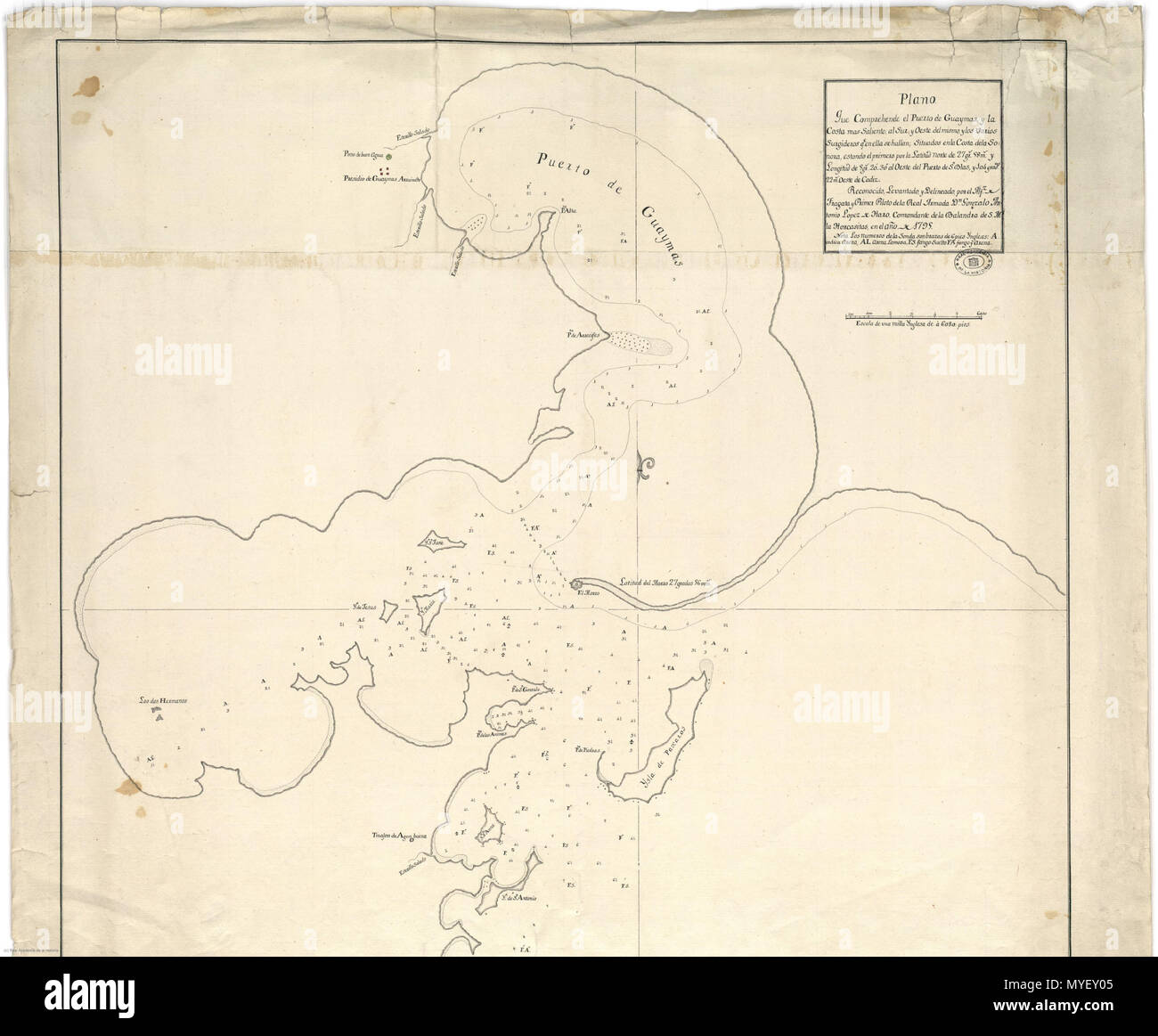 . Español: Mapa de Guaymas en 1795 . 16 October 2015. varios 221 Guaymas 1795 Stock Photohttps://www.alamy.com/image-license-details/?v=1https://www.alamy.com/espaol-mapa-de-guaymas-en-1795-16-october-2015-varios-221-guaymas-1795-image189027893.html
RMMYEY05–. Español: Mapa de Guaymas en 1795 . 16 October 2015. varios 221 Guaymas 1795
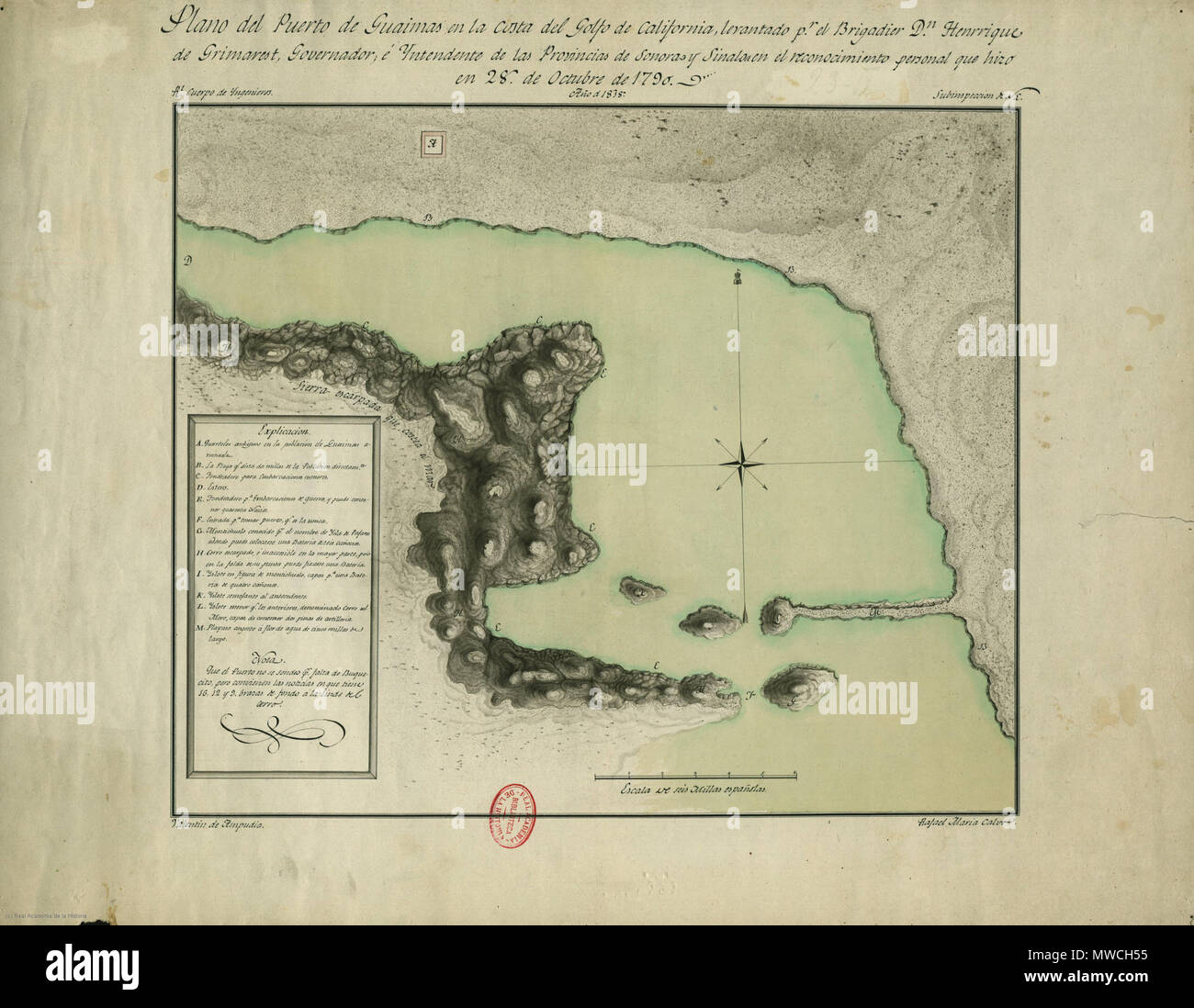 . Español: Mapa de Guaymas en 1790 . 16 October 2015. varios 256 Guaymas 1790 Stock Photohttps://www.alamy.com/image-license-details/?v=1https://www.alamy.com/espaol-mapa-de-guaymas-en-1790-16-october-2015-varios-256-guaymas-1790-image187746977.html
RMMWCH55–. Español: Mapa de Guaymas en 1790 . 16 October 2015. varios 256 Guaymas 1790
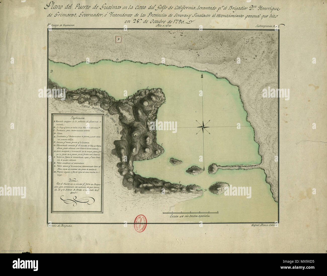 . Español: Mapa de Guaymas en 1790 . 16 October 2015. varios 257 Guaymas 1790 Stock Photohttps://www.alamy.com/image-license-details/?v=1https://www.alamy.com/espaol-mapa-de-guaymas-en-1790-16-october-2015-varios-257-guaymas-1790-image188303057.html
RMMX9XD5–. Español: Mapa de Guaymas en 1790 . 16 October 2015. varios 257 Guaymas 1790
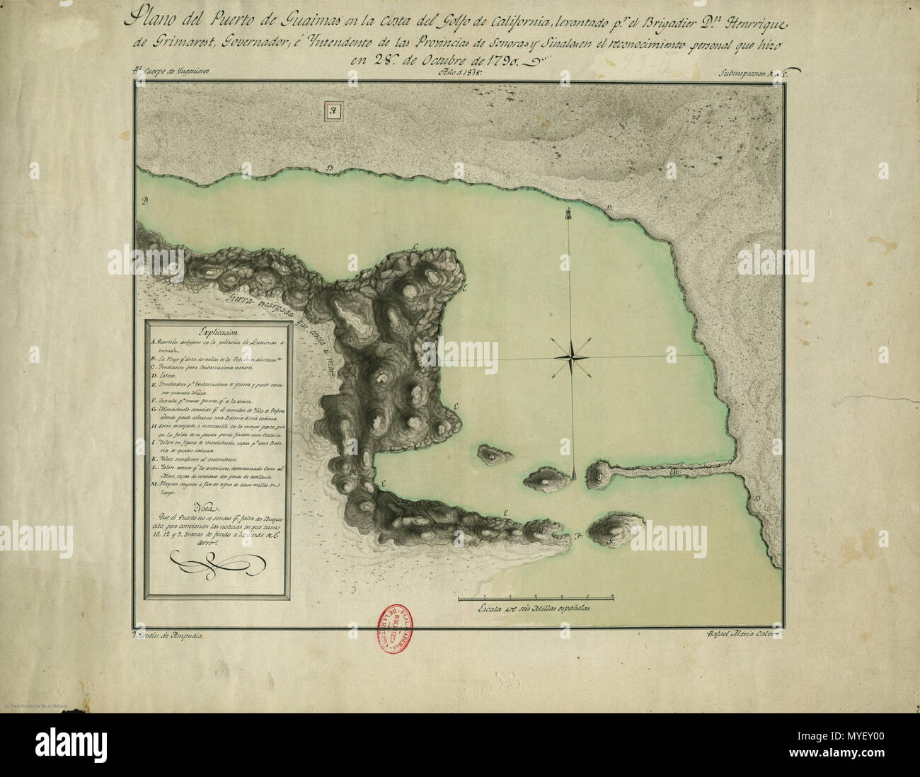 . Español: Mapa de Guaymas en 1790 . 16 October 2015. varios 221 Guaymas 1790 Stock Photohttps://www.alamy.com/image-license-details/?v=1https://www.alamy.com/espaol-mapa-de-guaymas-en-1790-16-october-2015-varios-221-guaymas-1790-image189027888.html
RMMYEY00–. Español: Mapa de Guaymas en 1790 . 16 October 2015. varios 221 Guaymas 1790
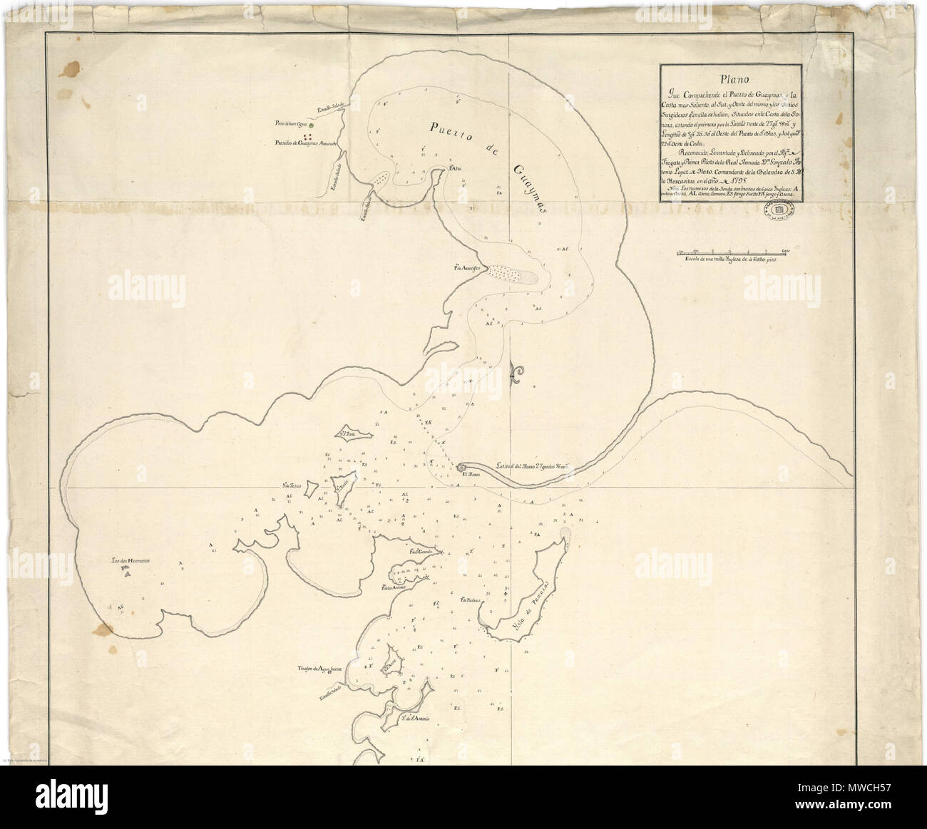 . Español: Mapa de Guaymas en 1795 . 16 October 2015. varios 256 Guaymas 1795 Stock Photohttps://www.alamy.com/image-license-details/?v=1https://www.alamy.com/espaol-mapa-de-guaymas-en-1795-16-october-2015-varios-256-guaymas-1795-image187746979.html
RMMWCH57–. Español: Mapa de Guaymas en 1795 . 16 October 2015. varios 256 Guaymas 1795
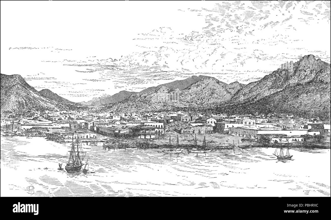 1753 TLM D659 Town and harbour of Guaymas Stock Photohttps://www.alamy.com/image-license-details/?v=1https://www.alamy.com/1753-tlm-d659-town-and-harbour-of-guaymas-image213677588.html
RMPBHRXC–1753 TLM D659 Town and harbour of Guaymas
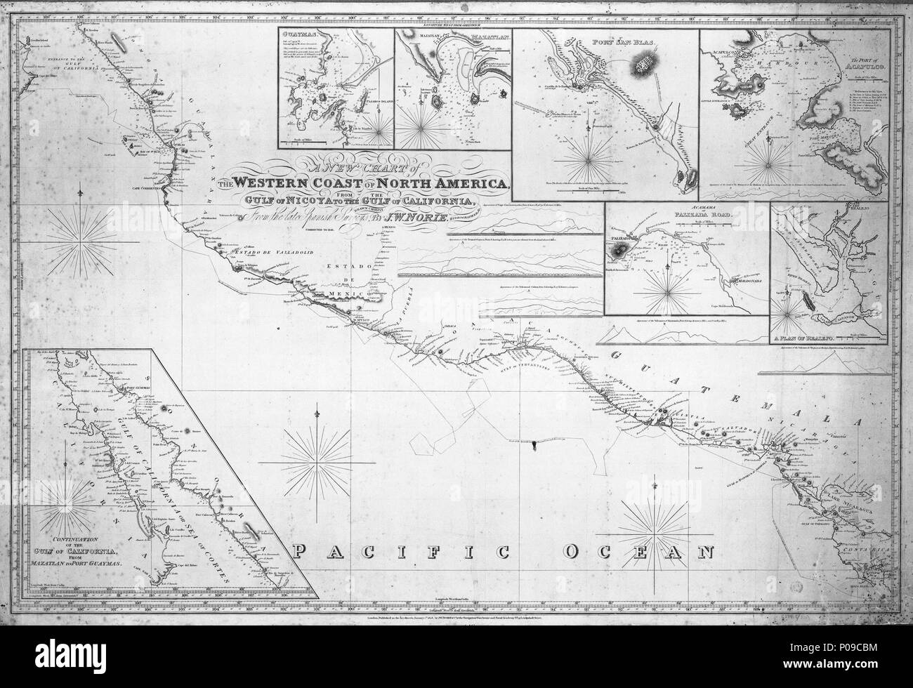 . English: A new chart of the western coast of North America. From the Gulf of Nicova to the Gulf of of California.Scale: circa 1:2,750,000. Blue-backed, linen edged chart with seven insets and five views. Track of the Spanish Corvettes Descumbierta and Atrevida 1791. Longitude West of Greenwich. Longitude West of Cadiz. Insets: 1. Guaymas circa 1:75,000 (bar); 2. Mazatlan circa 1:30,000 (bar); 3. Port San blas circa 1:27,000 (bar); 4. The Port of Acapulco circa 1:50,000 (bar); 5. Acamama or Palizada Road circa 1:240,000 (bar); 6. A Plan of Realjo circa 1:75,000 (bar); 7. Continuation of the Stock Photohttps://www.alamy.com/image-license-details/?v=1https://www.alamy.com/english-a-new-chart-of-the-western-coast-of-north-america-from-the-gulf-of-nicova-to-the-gulf-of-of-californiascale-circa-12750000-blue-backed-linen-edged-chart-with-seven-insets-and-five-views-track-of-the-spanish-corvettes-descumbierta-and-atrevida-1791-longitude-west-of-greenwich-longitude-west-of-cadiz-insets-1-guaymas-circa-175000-bar-2-mazatlan-circa-130000-bar-3-port-san-blas-circa-127000-bar-4-the-port-of-acapulco-circa-150000-bar-5-acamama-or-palizada-road-circa-1240000-bar-6-a-plan-of-realjo-circa-175000-bar-7-continuation-of-the-image206731720.html
RMP09CBM–. English: A new chart of the western coast of North America. From the Gulf of Nicova to the Gulf of of California.Scale: circa 1:2,750,000. Blue-backed, linen edged chart with seven insets and five views. Track of the Spanish Corvettes Descumbierta and Atrevida 1791. Longitude West of Greenwich. Longitude West of Cadiz. Insets: 1. Guaymas circa 1:75,000 (bar); 2. Mazatlan circa 1:30,000 (bar); 3. Port San blas circa 1:27,000 (bar); 4. The Port of Acapulco circa 1:50,000 (bar); 5. Acamama or Palizada Road circa 1:240,000 (bar); 6. A Plan of Realjo circa 1:75,000 (bar); 7. Continuation of the