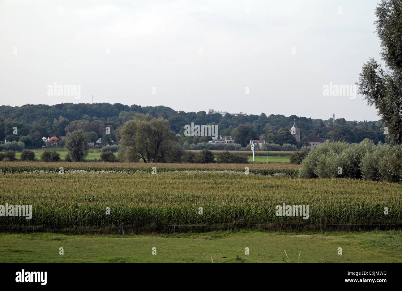
Ground over which the Operation Berlin evacuation took place in September 1944, Oosterbeek, Arnhem, Netherlands. (See notes)
RMID:Image ID:E6JMWG
Image details
Contributor:
Maurice SavageImage ID:
E6JMWGFile size:
49 MB (2.3 MB Compressed download)Releases:
Model - no | Property - noDo I need a release?Dimensions:
5109 x 3354 px | 43.3 x 28.4 cm | 17 x 11.2 inches | 300dpiDate taken:
1 August 2014Location:
Driel, NetherlandsMore information:
VIew north from the south bank towards the Oosterbeek (Lonsdale) Church (off centre right). Operation Berlin was the evacuation of the British 1st Airborne troops from the Oosterbeek perimeter on 25/26th September 1944. This is the patch of ground over which the evacuation took place. This image looks from the Royal Engineers Memorial on the south bank of the Lower Rhine towards Oosterbeek. The Lower Rhine runs across this image (see the white channel maker pole just to the right of centre) with the area on the north bank inside the Oosterbeek perimeter.