
Historic ceramic tiled map showing old Lancashire and Yorkshire Railway routes preserved inside Manchester Victoria railway station.
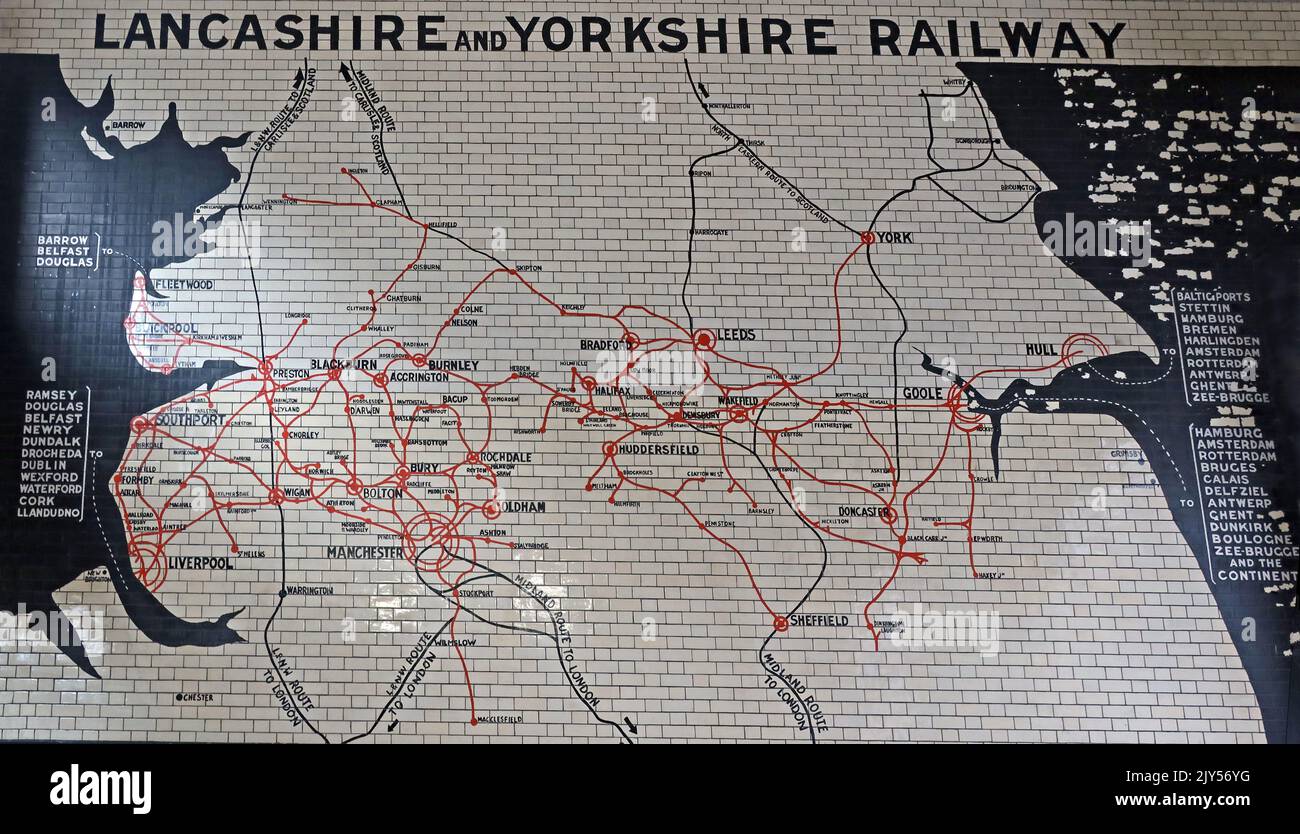
Image details
Contributor:
Tony SmithImage ID:
2JY56YGFile size:
40.1 MB (2 MB Compressed download)Releases:
Model - no | Property - noDo I need a release?Dimensions:
4948 x 2832 px | 41.9 x 24 cm | 16.5 x 9.4 inches | 300dpiDate taken:
8 September 2022Location:
Victoria Railway Station, Manchester, England, UK, M3 1WYMore information:
Historic ceramic tile route map of the Lancashire and Yorkshire Railway is displayed on an entrance wall inside Manchester Victoria railway station in Manchester, England. The large wall-mounted map is formed from white glazed tiles with black lettering, red railway lines and dark coastal silhouettes, creating a striking piece of preserved railway cartography within one of the city’s major rail termini. The map records the extensive railway system once operated by the Lancashire and Yorkshire Railway across northern England. Visible destinations and route points include Liverpool, Manchester, Preston, Blackburn, Burnley, Bolton, Oldham, Huddersfield, Leeds, York, Goole, Hull and Sheffield, with coastal and resort connections including Southport, Blackpool, Fleetwood, Barrow, Scarborough and Bridlington. The design shows how the company connected industrial towns, ports, seaside resorts and cross-Pennine communities before the later reorganisation of Britain’s railways. Manchester Victoria was opened in the nineteenth century and became closely associated with the Lancashire and Yorkshire Railway. The surviving tiled map is an important piece of railwayana, combining practical route information, corporate identity and decorative public art. Historic England’s listing for Victoria station specifically notes the surviving interior features, including mosaic decoration and a map of the Lancashire and Yorkshire railway system in tilework. The image illustrates both transport heritage and the civic pride once invested in railway architecture. Unlike modern digital departure boards and simplified network diagrams, the tiled map presents rail geography as a permanent architectural feature. Its survival inside a working station gives passengers and visitors a direct visual link with the era of regional railway companies, steam-age travel and the commercial growth of Manchester and the wider north of England. The photograph is suitable for editorial use covering BR

