
Old route map in tiles, Victoria Railway Station, Manchester, England, UK, M3 1WY - Greater Manchester services, Bolton,Bury,Oldham,Rochdale,Burnley,
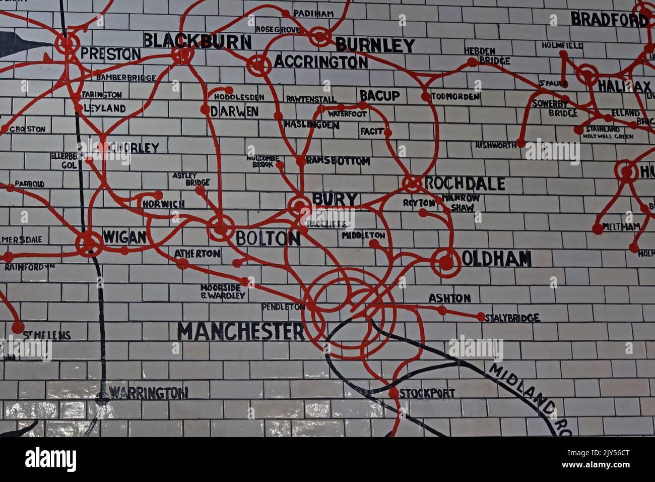
Image details
Contributor:
Tony SmithImage ID:
2JY56CTFile size:
57.1 MB (2.2 MB Compressed download)Releases:
Model - no | Property - noDo I need a release?Dimensions:
5472 x 3648 px | 46.3 x 30.9 cm | 18.2 x 12.2 inches | 300dpiDate taken:
26 August 2022Location:
Victoria Railway Station, Manchester, England, UK, M3 1WYMore information:
Detail of the historic glazed-tile route map inside Manchester Victoria railway station in Manchester city centre, Greater Manchester, England. The image shows part of the former Lancashire and Yorkshire Railway network rendered in bold red and black lines across a grid of white ceramic tiles. Visible destinations include Manchester, Bolton, Wigan, Oldham, Rochdale, Burnley, Blackburn, Accrington, Chorley, Darwen, Preston, Halifax, Stockport, Ashton, Ramsbottom, Bacup, Todmorden and Hebden Bridge, together with smaller stations and junctions that once formed an extensive regional railway system. The map dates from the Edwardian rebuilding of Manchester Victoria around 1904 and reflects the importance of the station as a principal hub and administrative centre of the Lancashire and Yorkshire Railway. Its coloured routes, station circles and carefully lettered place names provide a striking example of early twentieth-century railway cartography, public information design and decorative station architecture. The surviving mural is both a historical diagram and a substantial piece of transport heritage, recording rail connections across industrial Lancashire, Yorkshire and the towns that later became Greater Manchester. The close view emphasises the handmade tiled surface, aged grout lines, route intersections and dense concentration of railway lines around Manchester. It also illustrates how railways linked major manufacturing centres, market towns and communities during the expansion of industrial northern England. Preserved within a modern interchange used by National Rail and Metrolink passengers, the map offers a visible connection between contemporary travel and the region's railway past. Photographed indoors under station lighting, the scene has an archival documentary character suitable for editorial subjects including railway history, Manchester heritage, historic mapping, station restoration, public transport, industrial archaeology and tourism.

