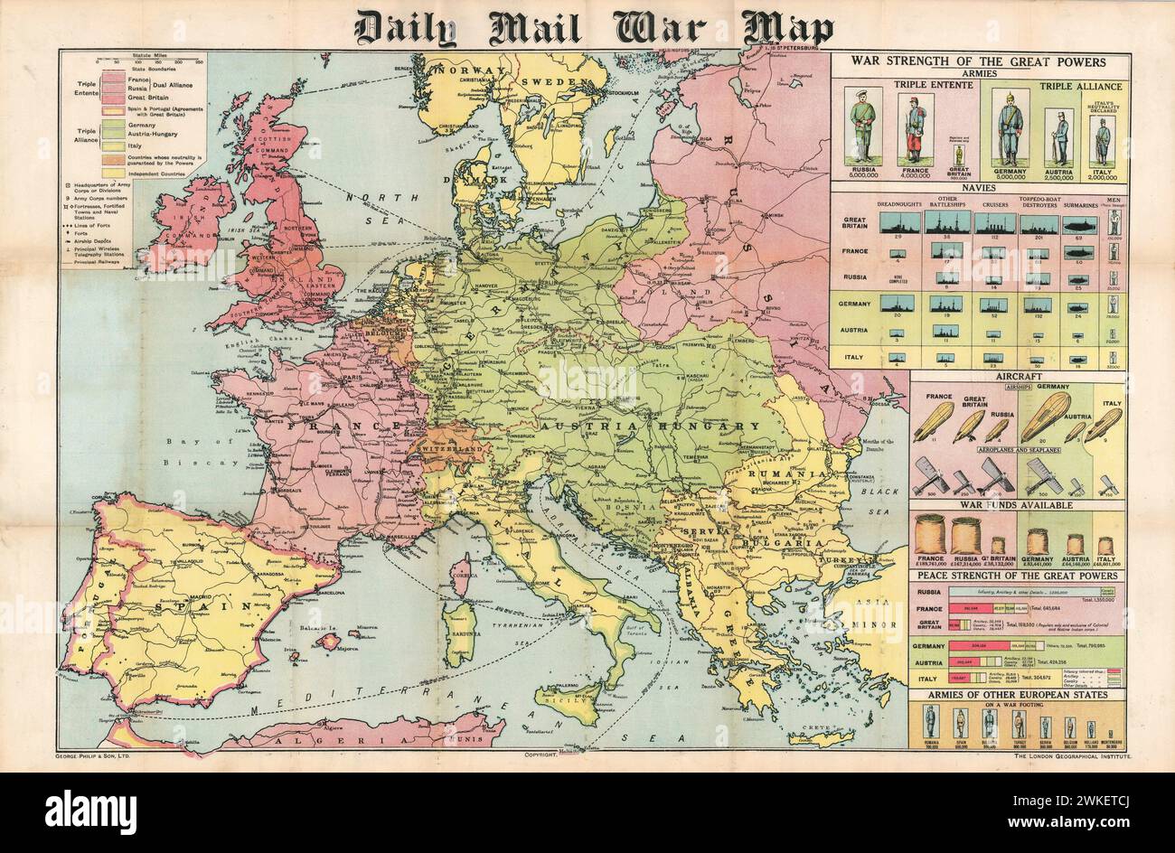
Vintage Illustrated Daily Mail War Map. Map of Europe 1914. Uses infographics to compare the armies and navies of European countries at the outbreak of World War I. George Philip and Sons map of Europe at start of the Great War, showing colours to highlight the two alliances, and a third one for the “neutral” countries.
RMID:Image ID:2WKETCJ
Image details
Contributor:
EMU history / Alamy Stock PhotoImage ID:
2WKETCJFile size:
135.9 MB (9.4 MB Compressed download)Releases:
Model - no | Property - noDo I need a release?Dimensions:
8500 x 5588 px | 72 x 47.3 cm | 28.3 x 18.6 inches | 300dpiMore information:
This image is a public domain image, which means either that copyright has expired in the image or the copyright holder has waived their copyright. Alamy charges you a fee for access to the high resolution copy of the image.
This image could have imperfections as it’s either historical or reportage.
research provided that image to be a part of the public domain under local laws of work, it is recommended to ensure that there are no restrictions for other legislations.