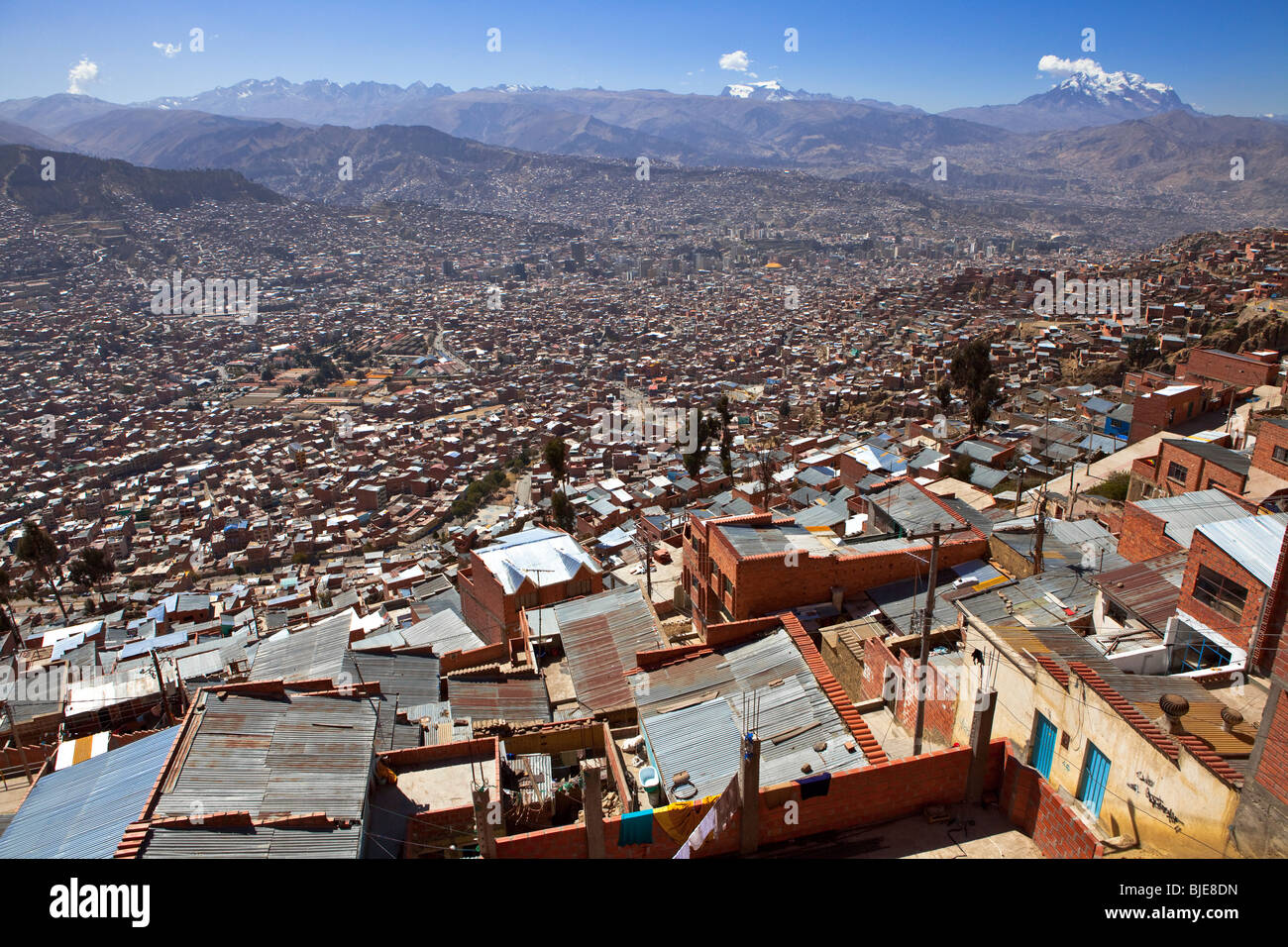
View of La Paz and from El Alto suburb, favela, Bolivia, South America
Image details
Contributor:
Thibaut PETIT-BARA / Alamy Stock PhotoImage ID:
BJE8DNFile size:
60.2 MB (4.6 MB Compressed download)Releases:
Model - no | Property - noDo I need a release?Dimensions:
5616 x 3744 px | 47.5 x 31.7 cm | 18.7 x 12.5 inches | 300dpiDate taken:
20 August 2009Location:
El Alto, La Paz, Lapaz, Bolivia, South AmericaMore information:
At one time merely a suburb of adjacent La Paz, Bolivia, on the Altiplano highlands, the city of El Alto (Spanish for The Heights) is today one of Bolivia's largest and fastest-growing urban centers. As of the 2001 census, the population was 649, 958. In 2010, the population may be nearly 900, 000, or more. The city contains La Paz's El Alto International Airport. El Alto is one of the highest major cities in the world, up to 4150 meters (13, 615 feet) above sea level. It has a cold climate, reaching the maximum temperature of 17 degrees Celsius (62 °F) in summer. It is the fastest-growing city in Bolivia, due to a trend of movement from Bolivia's rural areas to the La Paz region that started with the rural reform of 1952 and increased in the last 10 years. El Alto is the largest city in Latin America which has a mostly Amerindian population. About 76% of its inhabitants are Aymara, 9% are Quechua, 15% are Mestizo (descendants of Amerindian and White Europeans) and less than .1% are Criollos (of European descent).[citation needed]. El Alto is known as La Paz's bedroom community, though recent growth of commerce and industry has led some local authorities to claim the title of "Bolivia's Economic Capital." The dry and inclement plain above La Paz was uninhabited until 1903, when the newly built railways from Lake Titicaca and Arica reached the rim of the canyon, where the La Paz terminus, railyards and depots were built along with a settlement of railway workers (a spur line down into the canyon opened in 1905). In 1925 the airfield was built as base for the new air force, which attracted additional settlement. In 1939 El Alto's first elementary school opened. El Alto started to grow tremendously in the 1950s, when the settlement was connected to La Paz' water supply (before that all water had to be transported from La Paz in tanker vehicles) and building land in the canyon became more and more short and expensive.