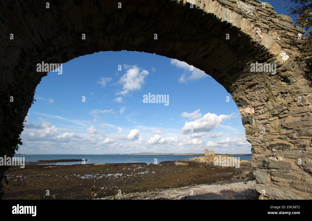
The Wales Coastal Path in North Wales. Picturesque view from the Anglesey west coast section of the Wales Coastal Path.
Image details
Contributor:
UK City Images / Alamy Stock PhotoImage ID:
E9CMT2File size:
56.4 MB (2.3 MB Compressed download)Releases:
Model - no | Property - noDo I need a release?Dimensions:
5553 x 3548 px | 47 x 30 cm | 18.5 x 11.8 inches | 300dpiDate taken:
2014Location:
UK, Wales, Anglesey, Holy Island, Penrhos Coastal ParkPhotographer:
UK Rural Images WalesMore information:
The Wales Coastal Path in North Wales. Picturesque autumnal view from the Anglesey west coast section of the Wales Coastal Path on Holy Island. Image shows Ynys Peibio seen through a stone arch from Penrhos Coastal Park. The landmark was possibly constructed as a shipping navigational aid to enter Holyhead Harbour. The route is part of the Anglesey Coastal Path Walk, which is a 124 mile long distance footpathwalk which formerly starts and ends in Holyhead on Holy Island. The Wales Coastal Path was developed in partnership with the Welsh Government, the Countryside Council for Wales, sixteen local authorities and two National Parks. Opened in May 2012, the 870 mile path (1, 400 km) runs from the market town of Chepstow to the Cheshire border on the River Dee.