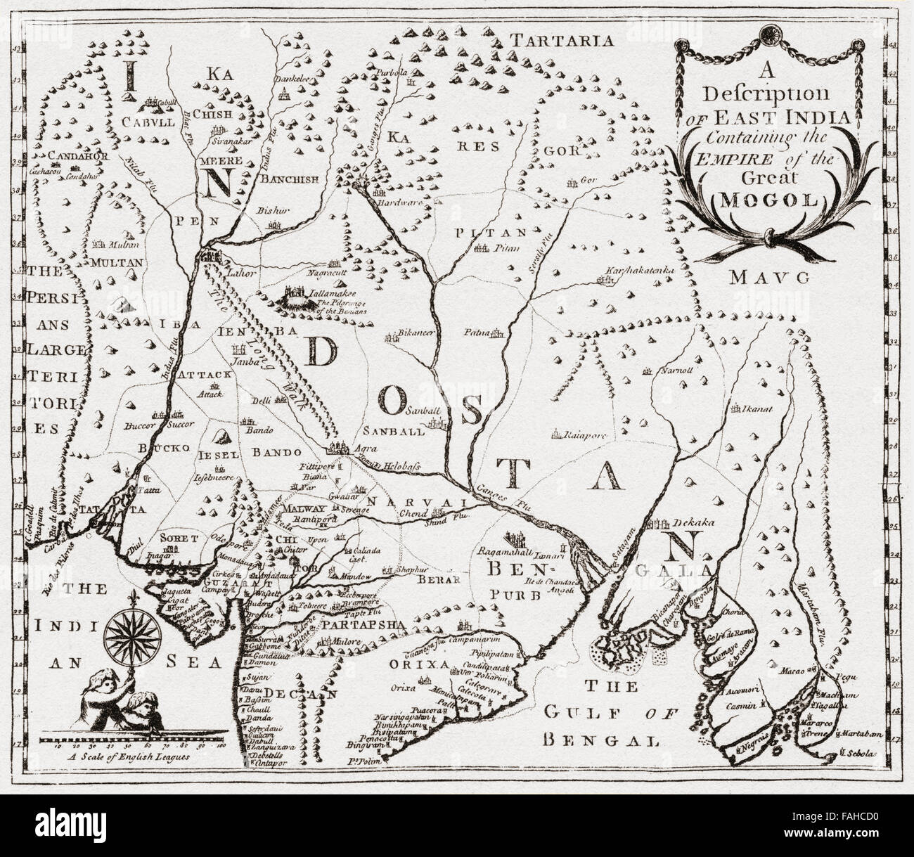
Map showing the territories in east India of Nur-ud-din Mohammad Salim, known by his imperial name Jahangir, 1569 –1627. Fourth Mughal Emperor. After the engraving from Edward Terry's Voyage to East India, 1655.
RMID:Image ID:FAHCD0
Image details
Contributor:
Classic Image / Alamy Stock PhotoImage ID:
FAHCD0File size:
58.2 MB (3.2 MB Compressed download)Releases:
Model - no | Property - noDo I need a release?Dimensions:
4839 x 4206 px | 41 x 35.6 cm | 16.1 x 14 inches | 300dpiDate taken:
1 January 1942More information:
This image could have imperfections as it’s either historical or reportage.
Map showing the territories in east India of Nur-ud-din Mohammad Salim, known by his imperial name Jahangir, 1569 –1627. Fourth Mughal Emperor. After the engraving from Edward Terry's Voyage to East India, 1655. From British Merchant Adventurers, published 1942.