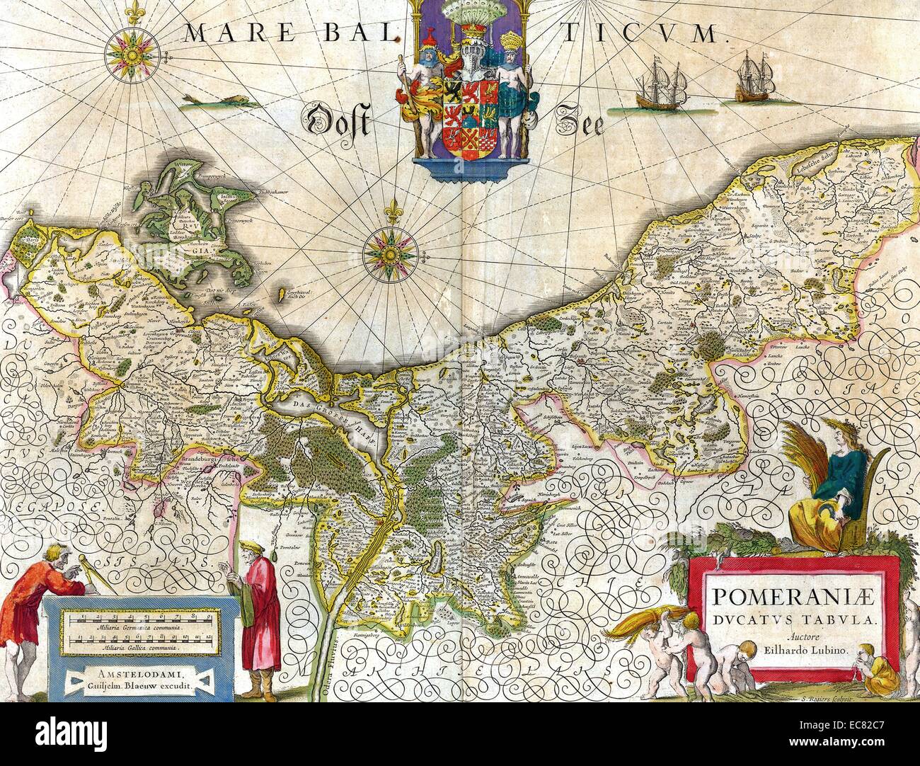
Map of the historical Duchy of Pomerania. The Duchy of Pomerania 12th century – 1637; was a duchy in Pomerania on the southern coast of the Baltic Sea, ruled by dukes of the House of Pomerania (Griffins). Dated 1635
RMID:Image ID:EC82C7
Image details
Contributor:
World History Archive / Alamy Stock PhotoImage ID:
EC82C7File size:
60 MB (4.8 MB Compressed download)Releases:
Model - no | Property - noDo I need a release?Dimensions:
5241 x 4001 px | 44.4 x 33.9 cm | 17.5 x 13.3 inches | 300dpiDate taken:
19 October 1904Photographer:
World History ArchiveMore information:
This image could have imperfections as it’s either historical or reportage.
Map of the historical Duchy of Pomerania. The Duchy of Pomerania 12th century – 1637; was a duchy in Pomerania on the southern coast of the Baltic Sea, ruled by dukes of the House of Pomerania (Griffins). Dated 1635