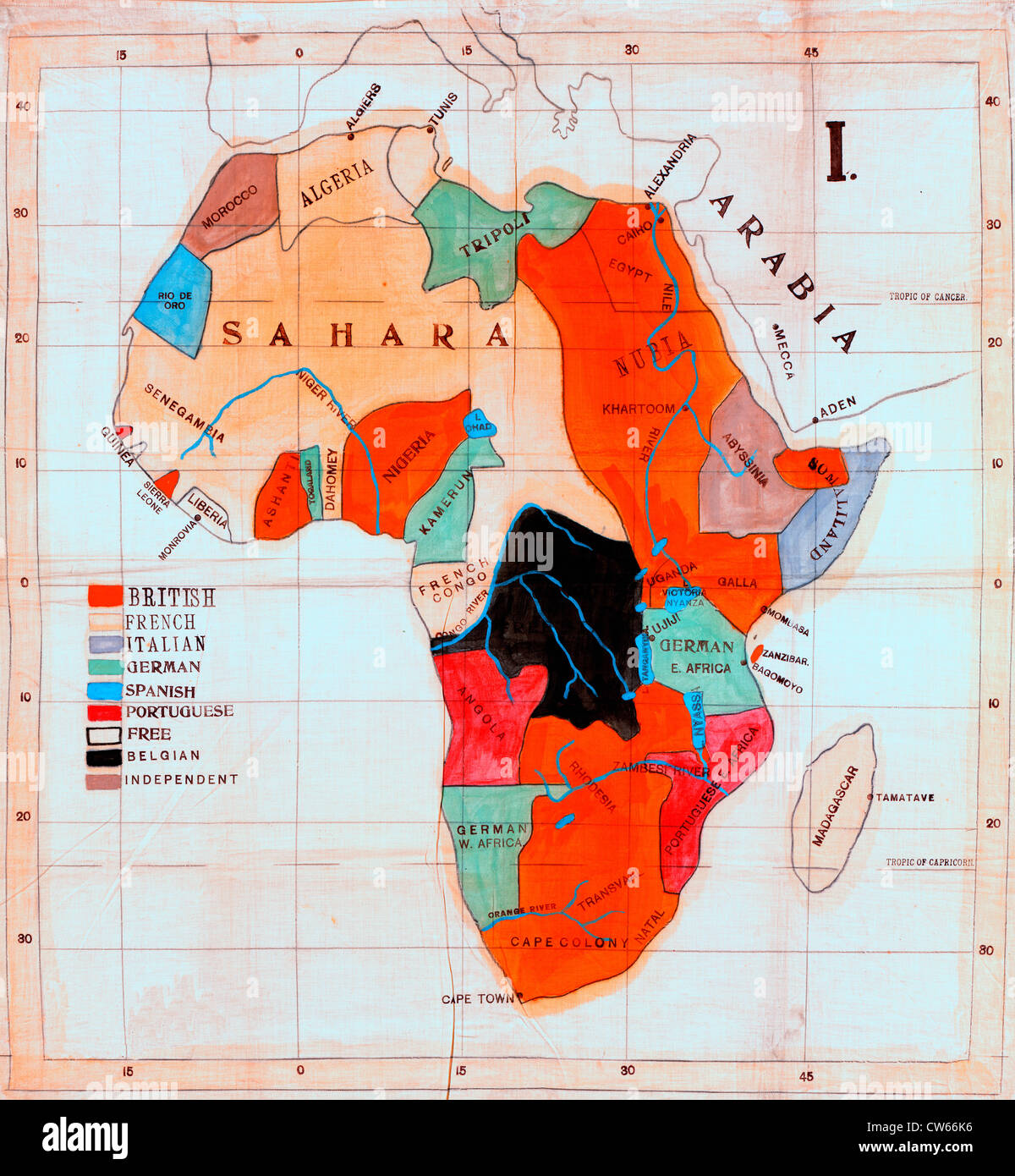
Map of Africa showing European colonies and independent countries in Africa, circa 1908.
RMID:Image ID:CW66K6
Image details
Contributor:
Niday Picture Library / Alamy Stock PhotoImage ID:
CW66K6File size:
111.5 MB (10.4 MB Compressed download)Releases:
Model - no | Property - noDo I need a release?Dimensions:
6000 x 6497 px | 50.8 x 55 cm | 20 x 21.7 inches | 300dpiMore information:
This image could have imperfections as it’s either historical or reportage.