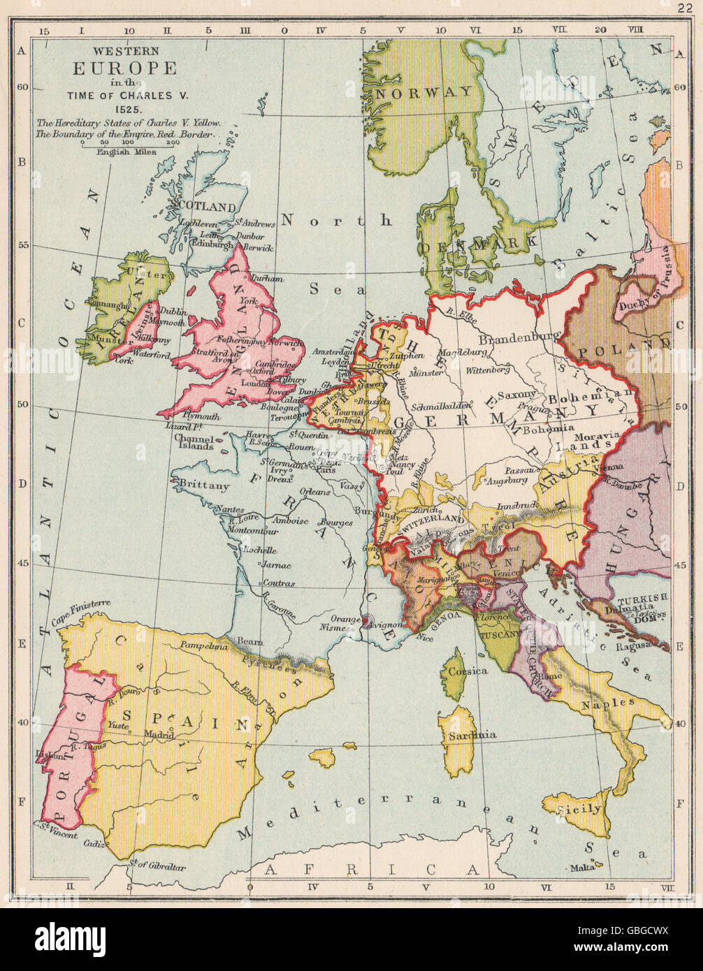
HOLY ROMAN EMPIRE 1525: Western Europe in the time of Charles V, 1907 old map
RFID:Image ID:GBGCWX
Image details
Contributor:
Antiqua Print Gallery / Alamy Stock PhotoImage ID:
GBGCWXFile size:
10.8 MB (928 KB Compressed download)Releases:
Model - no | Property - noDo I need a release?Dimensions:
1711 x 2210 px | 29 x 37.4 cm | 11.4 x 14.7 inches | 150dpiDate taken:
1907Location:
EuropeMore information:
This image could have imperfections as it’s either historical or reportage.
'Western Europe in the time of Charles V. 1525'. Artist/engraver/cartographer: Unsigned. Provenance: "A School Atlas of English History"; Edited by Samuel Rawson Gardiner; Published by Longmans, Green, & Co., London. Type: Antique colour map.