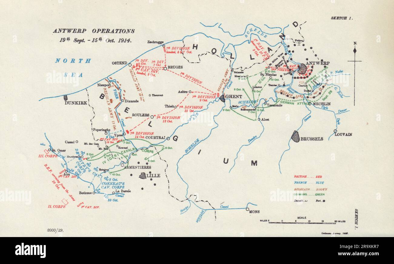
Siege of Antwerp. Operations 19th Sept-15th Oct 1914. First World War. 1925 map
RFID:Image ID:2R9XKR7
Image details
Contributor:
Antiqua Print Gallery / Alamy Stock PhotoImage ID:
2R9XKR7File size:
39.2 MB (1.5 MB Compressed download)Releases:
Model - no | Property - noDo I need a release?Dimensions:
4773 x 2874 px | 40.4 x 24.3 cm | 15.9 x 9.6 inches | 300dpiDate taken:
1925Location:
Belgium & Hauts-de-FranceMore information:
This image could have imperfections as it’s either historical or reportage.
Antwerp Operations 19th Sept.-15th. Oct. 1914 [Siege of Antwerp]. Artist/engraver/cartographer: Map compiled by Major Archibald Frank Becke. Published by Ordnance Survey 1923. Provenance: "History of the Great War based on Official Documents by the Direction of the Historical Section of the Committee of Imperial Defence. Military Operations France and Belgium, 1914". Compiled by Brigadier-General Sir James E. Edmonds. Maps and Sketches compiled by Major A. F. Becke. Published by MacMillan and Co; Limited St. Martin's Street, London 1925. Type: Antique military history map.