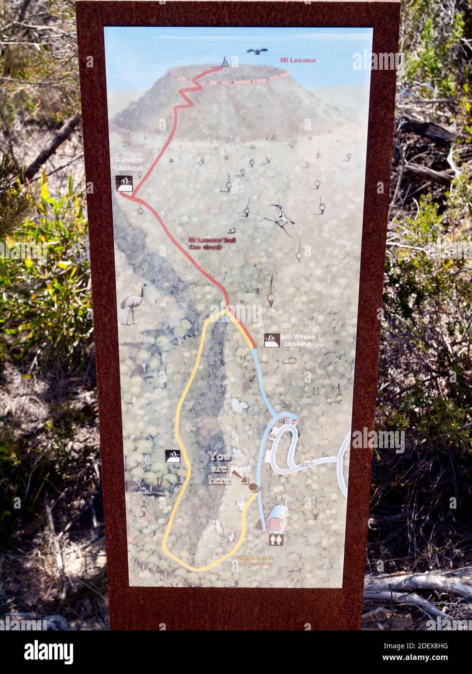
Map of the summit walking trail up Mt Lesueur (313m), highpoint of Lesueur National Park, a biodiversity hotspot on the Turquoise Coast.
RFID:Image ID:2DEX8HG
Image details
Contributor:
steve waters / Alamy Stock PhotoImage ID:
2DEX8HGFile size:
51.5 MB (2.6 MB Compressed download)Releases:
Model - no | Property - noDo I need a release?Dimensions:
3675 x 4900 px | 31.1 x 41.5 cm | 12.3 x 16.3 inches | 300dpiDate taken:
17 October 2010Location:
Lesueur National Park, Turquoise Coast, Western Australia, AustraliaMore information:
Lesueur National Park is a recognized biodiversity hotspot on the "kwongan" coastal heath just inland from Western Australia's Turquoise Coast region.There are over 900 species in this small park, many of them endemic. The park is named after Charles-Alexandre Lesueur, a natural history artist aboard the French research ship the Naturaliste on Jacques Hamelin’s 1801 expedition.