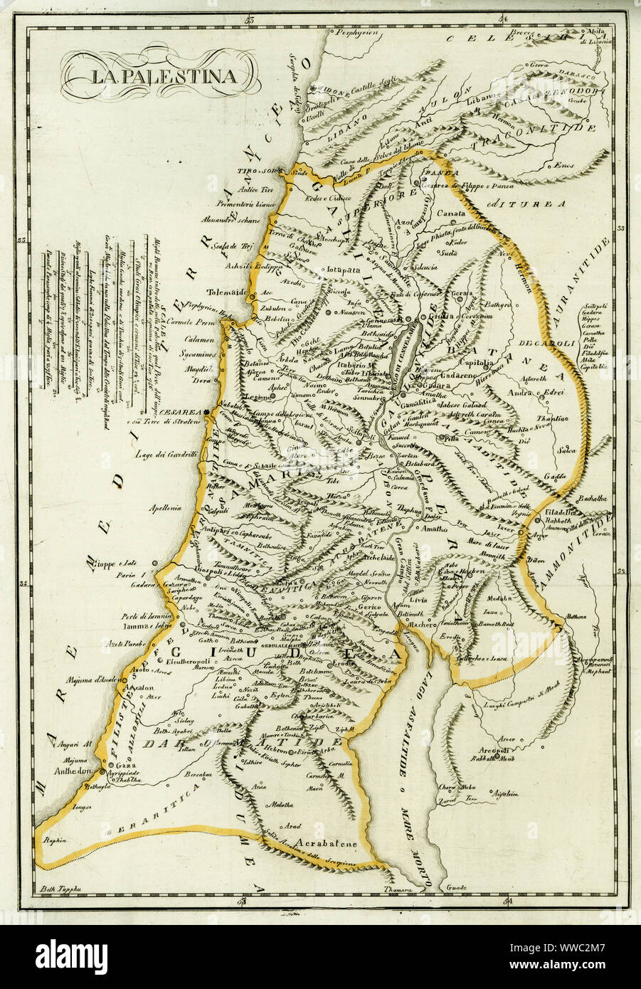
Map of Palestine, circa 1800. From Gaza and Ashkelon in the south to Tyre and Sidon (Lebanon) in the north. La Palestina. Handcoloured copperplate engraving after Giulio Ferrario in his Costumes Ancient and Modern of the Peoples of the World, Il Costume Antico e Modern o Story, Florence, 1833.
RMID:Image ID:WWC2M7
Image details
Contributor:
Florilegius / Alamy Stock PhotoImage ID:
WWC2M7File size:
96.5 MB (5.9 MB Compressed download)Releases:
Model - no | Property - noDo I need a release?Dimensions:
4837 x 6976 px | 41 x 59.1 cm | 16.1 x 23.3 inches | 300dpiDate taken:
1821Photographer:
FlorilegiusMore information:
This image could have imperfections as it’s either historical or reportage.