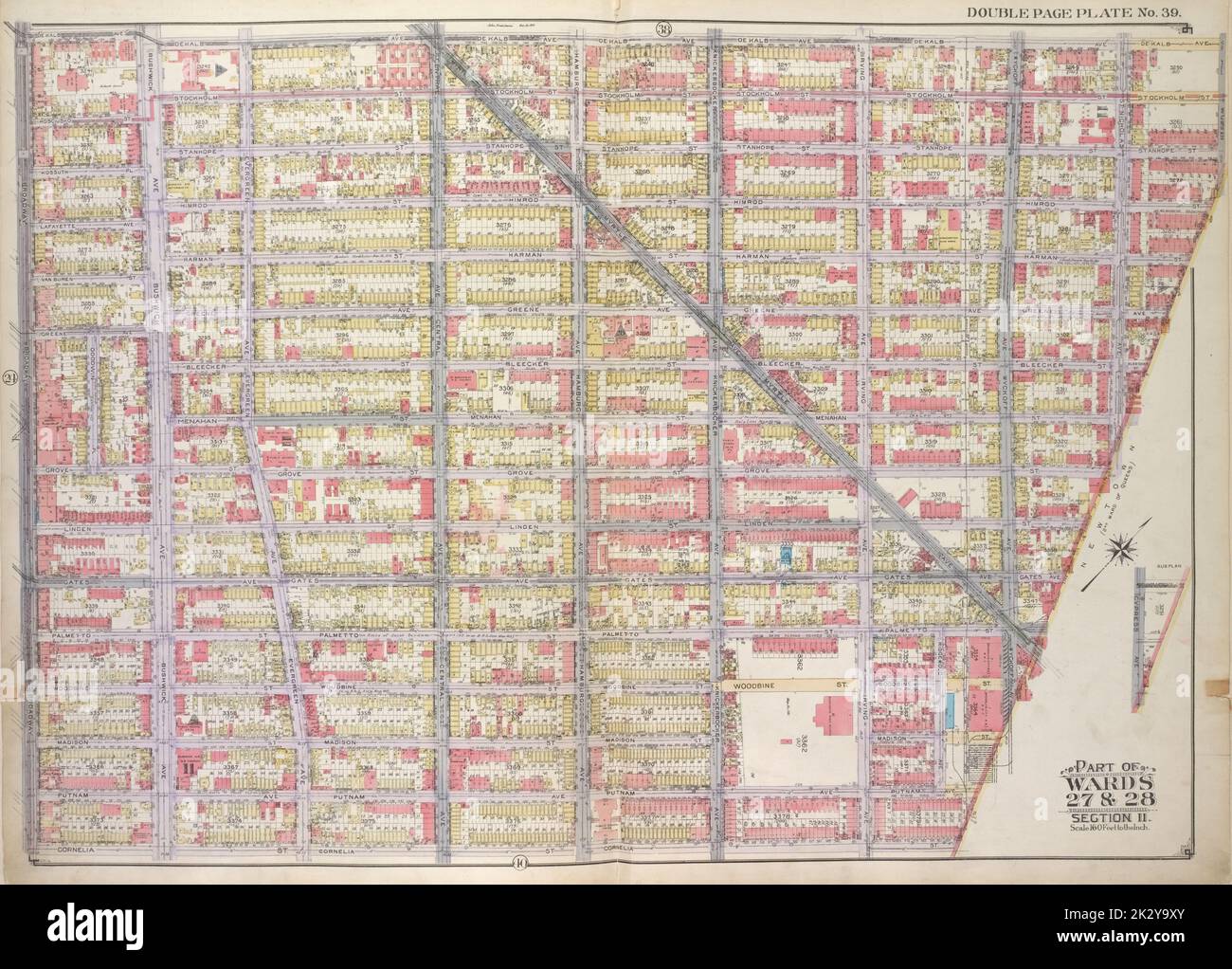
E.B. Hyde & Co.. Cartographic, Maps. 1916. Lionel Pincus and Princess Firyal Map Division. Brooklyn (New York, N.Y.), Real property , New York (State) , New York Brooklyn, Vol. 1, 2nd Part, Double Page Plate No. 39; Part of Wards 27 & 28, Section 11; Map bounded by De Kalb Ave., Stockholm St., Stanhope St., Himrod St., Harman St., Greene Ave., Bleeker St., Menahan St.; Including Grove St., Linden St., Gates Ave., Palmetto St., Myrtle Ave., Wyckoff Ave., Cornelia St., Broadway
RMID:Image ID:2K2Y9XY
Image details
Contributor:
Ny/piemags / Alamy Stock PhotoImage ID:
2K2Y9XYFile size:
71.7 MB (4.8 MB Compressed download)Releases:
Model - no | Property - noDo I need a release?Dimensions:
5911 x 4242 px | 50 x 35.9 cm | 19.7 x 14.1 inches | 300dpiMore information:
This image is a public domain image, which means either that copyright has expired in the image or the copyright holder has waived their copyright. Alamy charges you a fee for access to the high resolution copy of the image.
This image could have imperfections as it’s either historical or reportage.