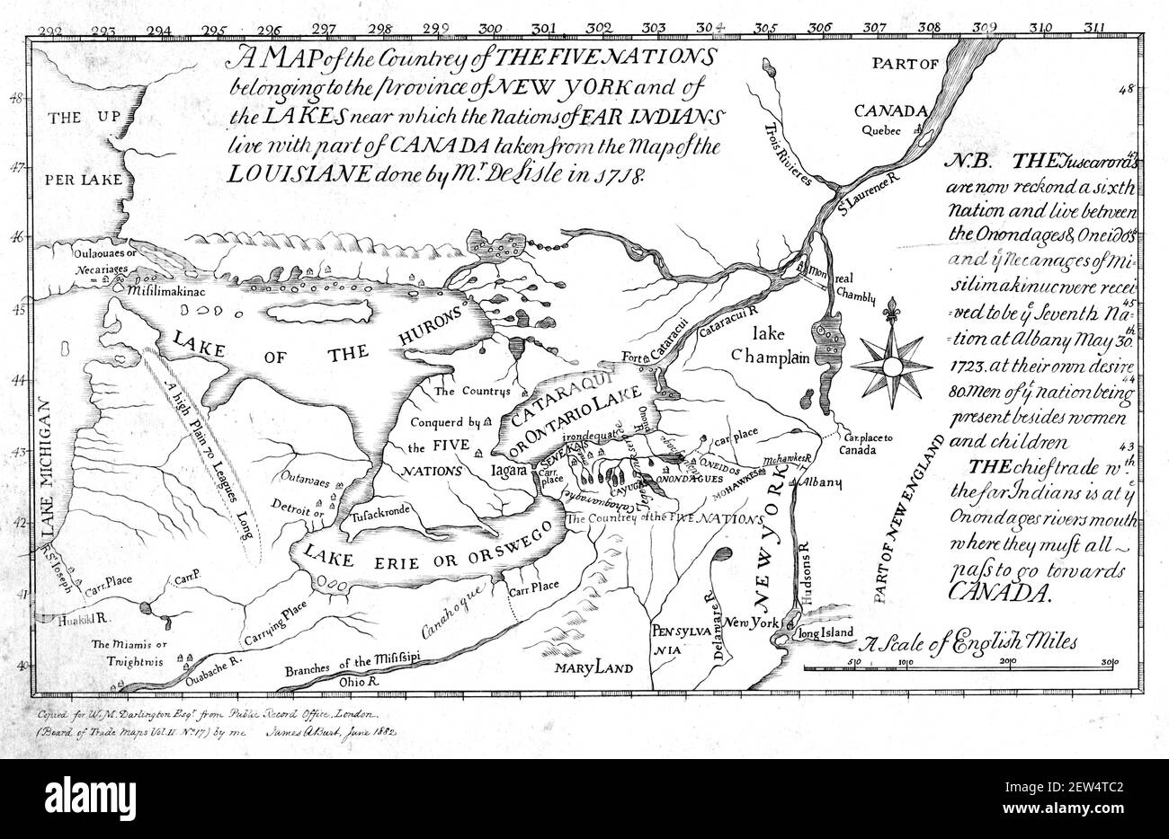
A 1730 map of the Iroquois Confederacy (also known as the Five Nations or the Iroquois League).
Image details
Contributor:
IanDagnall Computing / Alamy Stock PhotoImage ID:
2EW4TC2File size:
45.9 MB (1.8 MB Compressed download)Releases:
Model - no | Property - noDo I need a release?Dimensions:
4970 x 3230 px | 42.1 x 27.3 cm | 16.6 x 10.8 inches | 300dpiDate taken:
2 March 2021More information:
This image could have imperfections as it’s either historical or reportage.
A 1730 map of the Iroquois Confederacy (also known as the Five Nations or the Iroquois League). The Iroquois Confederacy or Haudenosaunee is believed to have been founded by the Great Peacemaker at an unknown date, estimated to have been sometime between 1450 and 1660, bringing together five distinct nations in the southern Great Lakes area into "The Great League of Peace". Some research, however, suggests the founding occurred in 1142. Each nation within this Iroquoian confederacy had a distinct language, territory, and function in the League. Iroquois power at its peak extended into present-day Canada, westward along the Great Lakes and down both sides of the Allegheny mountains into present-day Virginia and Kentucky and into the Ohio Valley. The original Iroquois League (as the French knew them) or Five Nations (as the British knew them), occupied large areas of present-day New York State up to the St. Lawrence River, west of the Hudson River, and south into northwestern Pennsylvania. From east to west, the League was composed of the Mohawk, Oneida, Onondaga, Cayuga, and Seneca nations. In or close to 1722, the Tuscarora tribe joined the League. (Courtesy, Wikipedia)