
Creamfields and Dreamfields Glamping traffic direction sign at Daresbury, Cheshire, routing other event vehicles towards the M56 during festival.
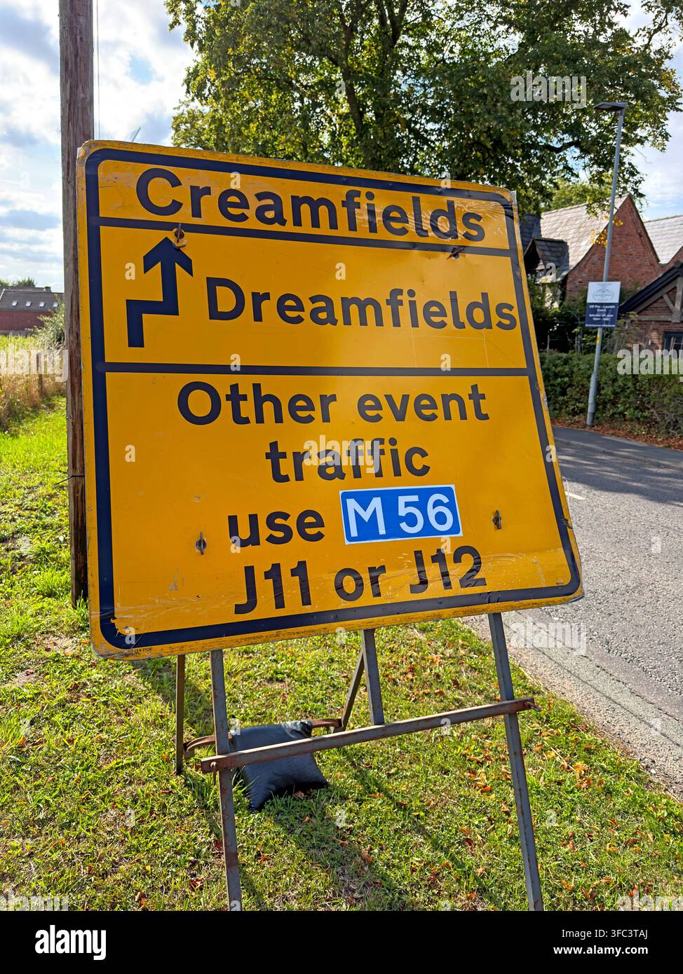
Image details
Contributor:
Tony SmithImage ID:
3FC3TAJFile size:
78.7 MB (4.5 MB Compressed download)Releases:
Model - no | Property - noDo I need a release?Dimensions:
4541 x 6055 px | 38.4 x 51.3 cm | 15.1 x 20.2 inches | 300dpiDate taken:
25 August 2026Location:
Daresbury, Cheshire, England, UKMore information:
. A temporary yellow Creamfields and Dreamfields direction sign beside a Cheshire lane separates festival traffic, pointing Creamfields one way while telling other event vehicles to use the M56 at junctions 11 or 12. Dreamfields is the premium campsite, with tipis, crew huts, Airstream-style units and luxury bell tents plus hot showers, conventional toilets, a pamper area, 24-hour reception and security, a dedicated entrance and parking. The sign therefore represents both traffic management and the growth of 'glamping' as part of modern British festival culture. Creamfields moved to Daresbury in 2006 and celebrates 20 years at the Cheshire site in 2026. Its origins lie in Liverpool's Cream club night at Nation from 1992 and the first Creamfields festival at Winchester in 1998. The event now creates a temporary city of stages, campsites, bars, welfare facilities, roads and service compounds, with up to 80, 000 fans expected across the August Bank Holiday weekend. The 2026 line-up ranges from Calvin Harris, Swedish House Mafia, Disclosure, Armin van Buuren and Tiësto to Carl Cox, Underworld, Fatboy Slim, Becky Hill, Amelie Lens, Fisher and Martin Garrix. Official travel guidance tells motorists to follow event signage rather than sat-nav routes, an important point on narrow rural roads around Daresbury, and local restrictions are used to reduce congestion and protect residents. Police security work is equally visible behind the scenes: Cheshire Constabulary reported finding drugs including ecstasy, MDMA, ketamine and about 204 nitrous-oxide canisters buried on the site before the 2026 gates opened. This photograph can illustrate luxury camping, festival accommodation, motorway access, temporary wayfinding, glamping, tourism logistics, event traffic, rural infrastructure and the increasingly sophisticated hospitality economy surrounding large-scale live music. The image also records how temporary motorway routing is used to protect minor Cheshire lanes.

