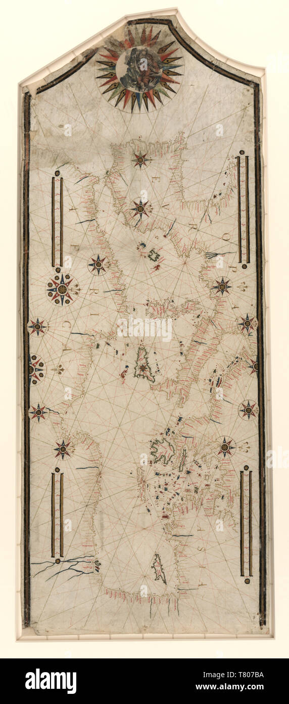
Portolan Chart, Mediterranean and European Seaports, 1550
RMID:Image ID:T807BA
Image details
Contributor:
Science History Images / Alamy Stock PhotoImage ID:
T807BAFile size:
38.8 MB (1.9 MB Compressed download)Releases:
Model - no | Property - noDo I need a release?Dimensions:
2446 x 5550 px | 20.7 x 47 cm | 8.2 x 18.5 inches | 300dpiDate taken:
4 August 2010Photographer:
Science History ImagesMore information:
This image could have imperfections as it’s either historical or reportage.
Portolan chart of the Mediterranean and connecting seas with seaport names given for all coastlines. Does not cover Black Sea. Oriented with north to the right (indicated by fleurs-de-lys). Contains 11 compass roses in a circle centered on Sicily, 2 additional roses in Iberia, and rhumb lines connecting all roses and some central points without roses, No cartographer credited, 1550.