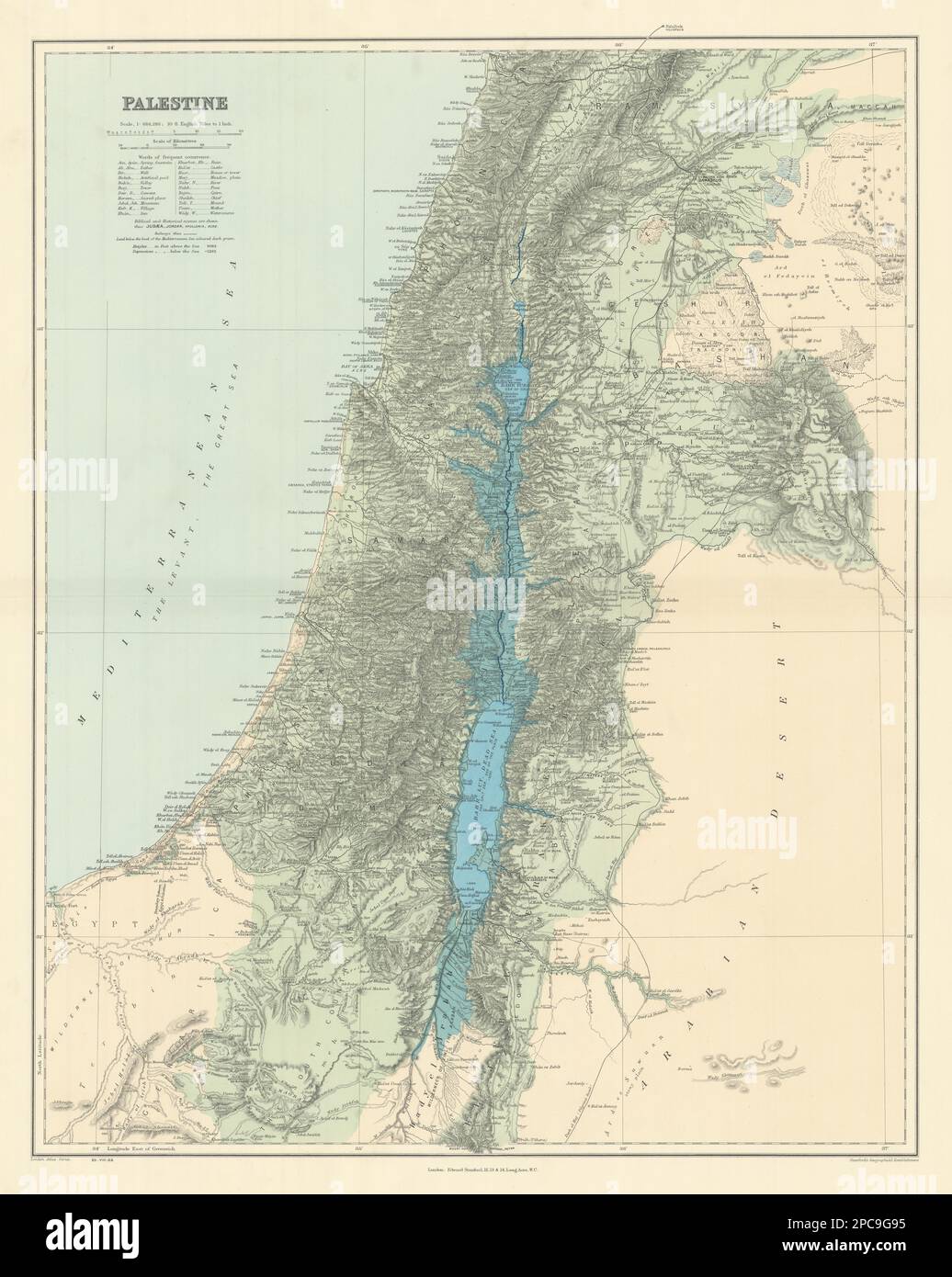
Palestine Holy Land Israel. Biblical & historical names. STANFORD 1904 old map
RFID:Image ID:2PC9G95
Image details
Contributor:
Antiqua Print Gallery / Alamy Stock PhotoImage ID:
2PC9G95File size:
332 MB (17.8 MB Compressed download)Releases:
Model - no | Property - noDo I need a release?Dimensions:
9621 x 12063 px | 81.5 x 102.1 cm | 32.1 x 40.2 inches | 300dpiDate taken:
1904Location:
PalestineMore information:
This image could have imperfections as it’s either historical or reportage.
Palestine. Artist/engraver/cartographer: Stanford's Geographical Establishment. Provenance: "Stanford's London Atlas of Universal Geography", folio edition. London, Edward Stanford, Geographer to Her Majesty. 26 & 27 Cockspur Street, Charing Cross, S.W. Type: Large (folio) antique atlas map.