Quick filters:
Ozone layer antarctica Stock Photos and Images
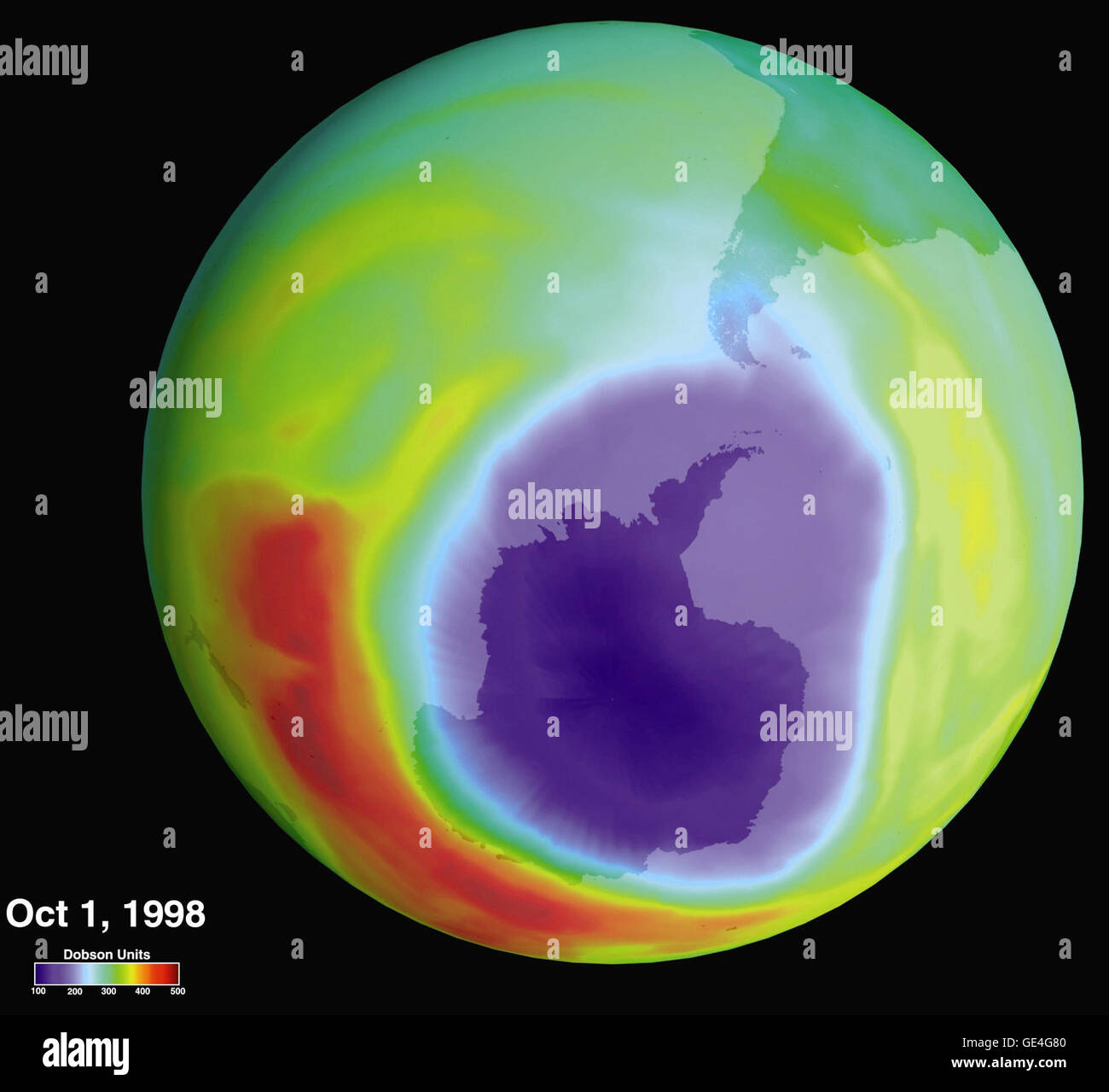 In 1985, the discovery of a significant ozone layer depletion over Antarctica led to a worldwide effort to reduce the use of CFCs. This image, taken by Goddard Space Flight Center, shows ozone levels with blue/purple areas indicating lower concentrations and red areas indicating higher levels. Stock Photohttps://www.alamy.com/image-license-details/?v=1https://www.alamy.com/stock-photo-in-1985-the-discovery-of-a-significant-ozone-layer-depletion-over-111967968.html
RMGE4G80–In 1985, the discovery of a significant ozone layer depletion over Antarctica led to a worldwide effort to reduce the use of CFCs. This image, taken by Goddard Space Flight Center, shows ozone levels with blue/purple areas indicating lower concentrations and red areas indicating higher levels.
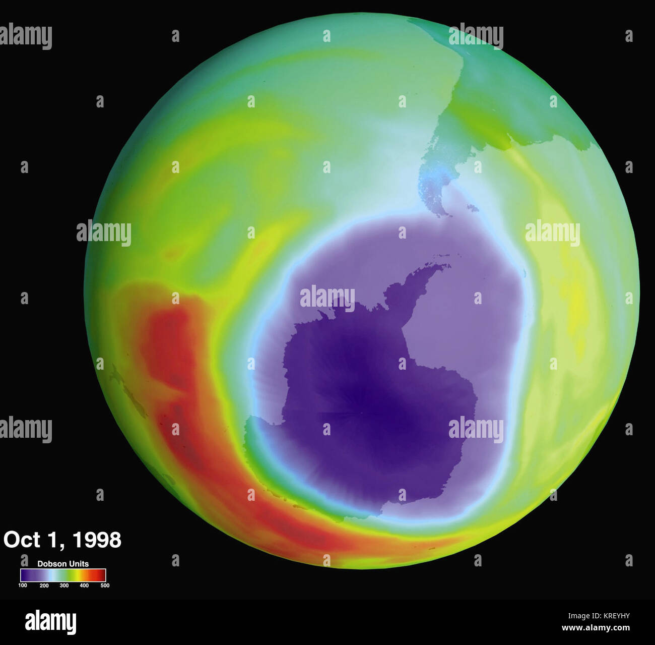 Hole in the Ozone Layer Over Antarctica - GPN-2002-000117 Stock Photohttps://www.alamy.com/image-license-details/?v=1https://www.alamy.com/stock-image-hole-in-the-ozone-layer-over-antarctica-gpn-2002-000117-169359399.html
RMKREYHY–Hole in the Ozone Layer Over Antarctica - GPN-2002-000117
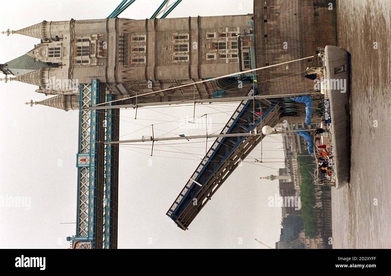 British polar explorer, Professor Robert Swan OBE, who walked under the hole in the South Pole's ozone layer and felt the skin peel off his face, sails his new iceship, the 120 foot sailing yacht Antarctica into London today (Friday), to start a new expedition to help save the Antarctic from ecological disaster. See PA Story ENVIRONMENT Antartica. Photo by David Cheskin. Stock Photohttps://www.alamy.com/image-license-details/?v=1https://www.alamy.com/british-polar-explorer-professor-robert-swan-obe-who-walked-under-the-hole-in-the-south-poles-ozone-layer-and-felt-the-skin-peel-off-his-face-sails-his-new-iceship-the-120-foot-sailing-yacht-antarctica-into-london-today-friday-to-start-a-new-expedition-to-help-save-the-antarctic-from-ecological-disaster-see-pa-story-environment-antartica-photo-by-david-cheskin-image380449763.html
RM2D2XYFF–British polar explorer, Professor Robert Swan OBE, who walked under the hole in the South Pole's ozone layer and felt the skin peel off his face, sails his new iceship, the 120 foot sailing yacht Antarctica into London today (Friday), to start a new expedition to help save the Antarctic from ecological disaster. See PA Story ENVIRONMENT Antartica. Photo by David Cheskin.
 Total Ozone Mapping Spectrometers (TOMS) Ozone Data from Nimbus - 7 Satellite Maps Comparing Depletion 'Hole' Over Antarctica Between August 1st 1992 Stock Photohttps://www.alamy.com/image-license-details/?v=1https://www.alamy.com/stock-photo-total-ozone-mapping-spectrometers-toms-ozone-data-from-nimbus-7-satellite-12130883.html
RMA8M2DT–Total Ozone Mapping Spectrometers (TOMS) Ozone Data from Nimbus - 7 Satellite Maps Comparing Depletion 'Hole' Over Antarctica Between August 1st 1992
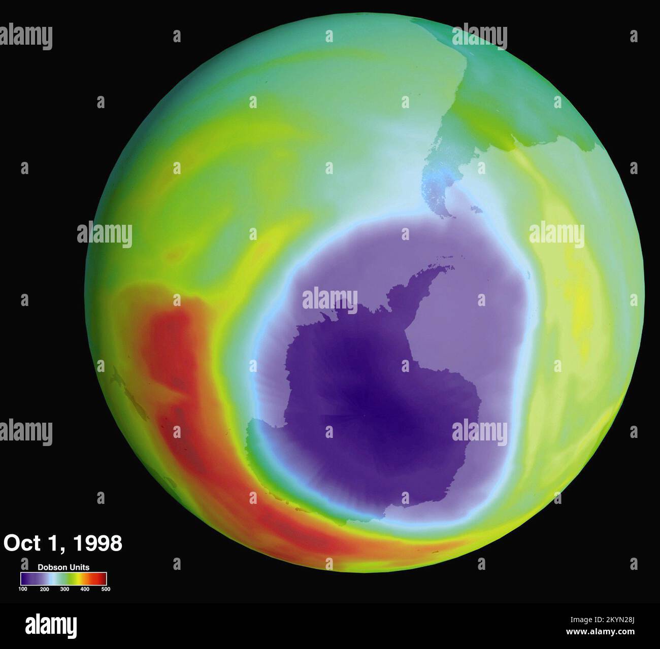 In 1985, a British scientist working in Antarctica discovered a 40 percent loss in the ozone layer over the continent. When Goddard Space Flight The hole in the Ozone layer. Center researchers reviewed their data, they confirmed the ozone loss. Since then, scientists have relied on instrumentation developed by Goddard to keep track of the environmental phenomenon, which in the 1990s prompted a worldwide ban on chlorofluorocarbons (CFCs), Stock Photohttps://www.alamy.com/image-license-details/?v=1https://www.alamy.com/in-1985-a-british-scientist-working-in-antarctica-discovered-a-40-percent-loss-in-the-ozone-layer-over-the-continent-when-goddard-space-flight-the-hole-in-the-ozone-layer-center-researchers-reviewed-their-data-they-confirmed-the-ozone-loss-since-then-scientists-have-relied-on-instrumentation-developed-by-goddard-to-keep-track-of-the-environmental-phenomenon-which-in-the-1990s-prompted-a-worldwide-ban-on-chlorofluorocarbons-cfcs-image498948818.html
RM2KYN28J–In 1985, a British scientist working in Antarctica discovered a 40 percent loss in the ozone layer over the continent. When Goddard Space Flight The hole in the Ozone layer. Center researchers reviewed their data, they confirmed the ozone loss. Since then, scientists have relied on instrumentation developed by Goddard to keep track of the environmental phenomenon, which in the 1990s prompted a worldwide ban on chlorofluorocarbons (CFCs),
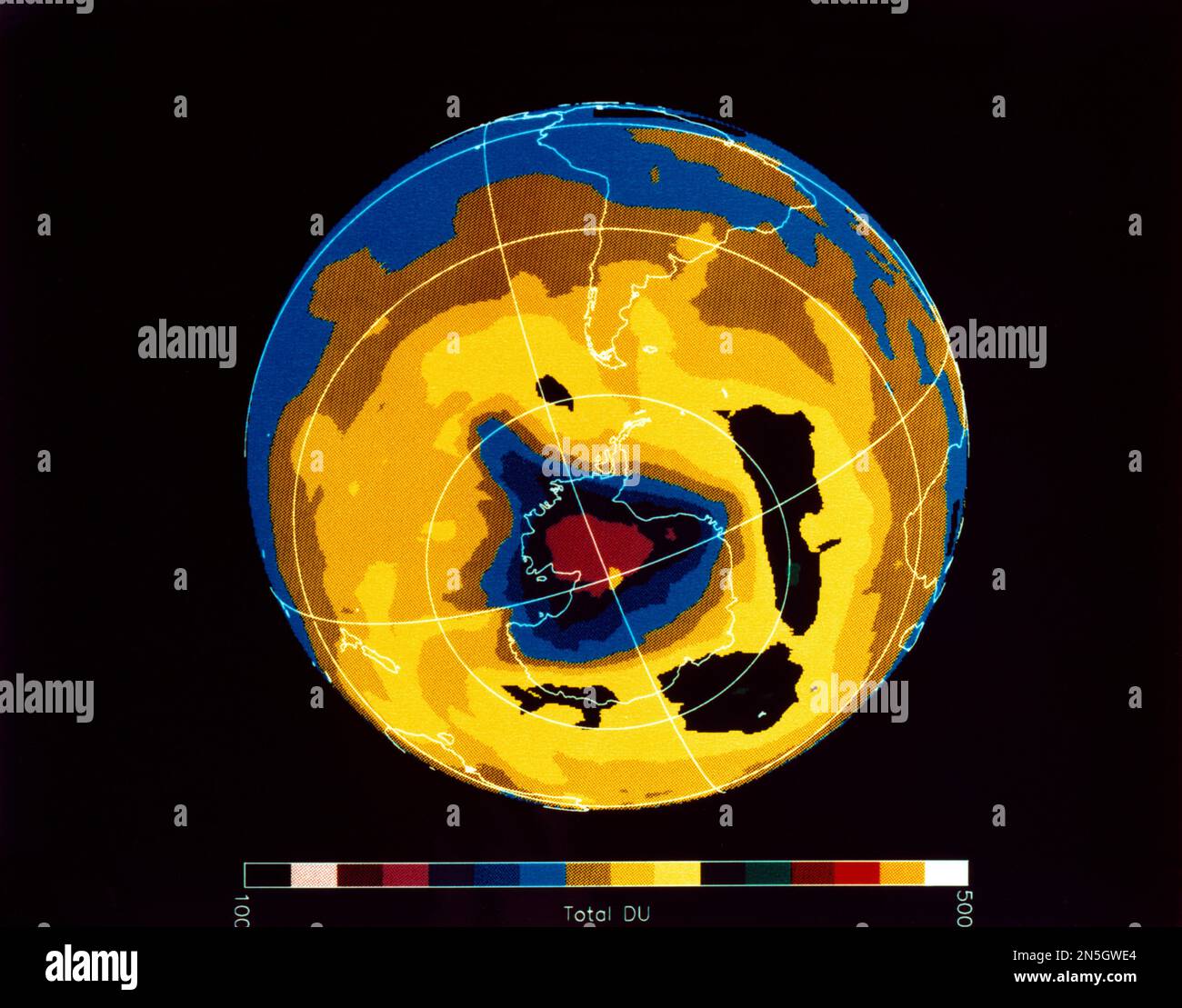 Total Ozone Mapping Spectrometers (TOMS) Ozone Data from Nimbus - 7 Satellite Depletion 'Hole' Over Antarctica on 30th November 1992 Stock Photohttps://www.alamy.com/image-license-details/?v=1https://www.alamy.com/total-ozone-mapping-spectrometers-toms-ozone-data-from-nimbus-7-satellite-depletion-hole-over-antarctica-on-30th-november-1992-image519755548.html
RM2N5GWE4–Total Ozone Mapping Spectrometers (TOMS) Ozone Data from Nimbus - 7 Satellite Depletion 'Hole' Over Antarctica on 30th November 1992
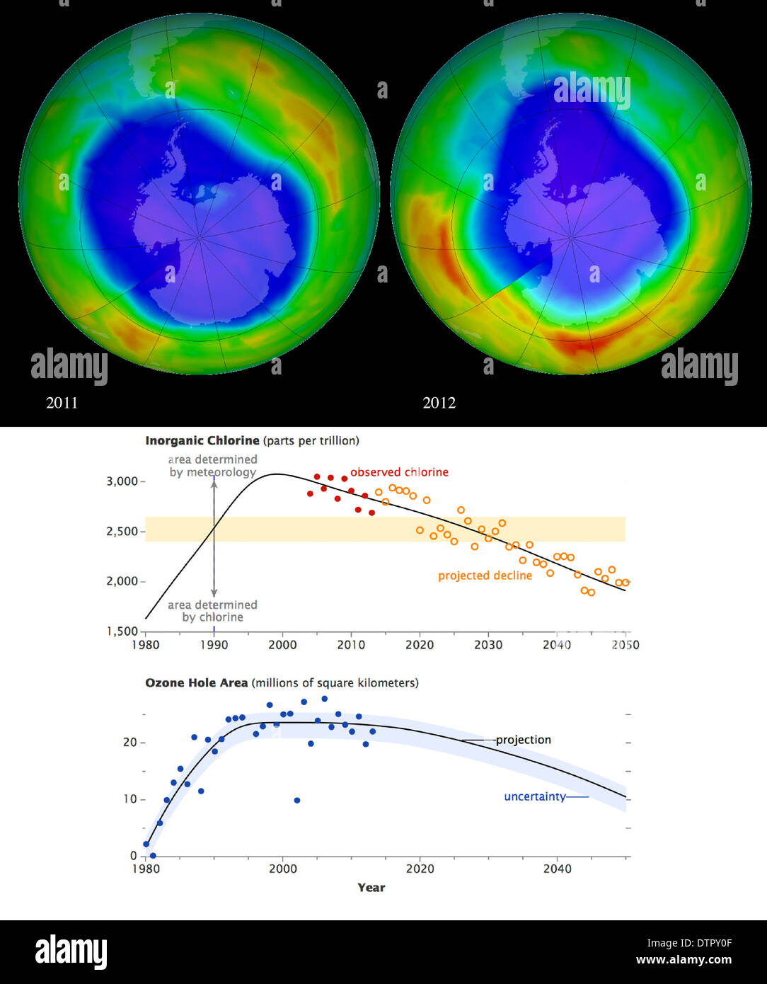 Comparison images of the ozone hole over Antarctica in 2011 and 2012. 2012's was smaller so is it recovering? Stock Photohttps://www.alamy.com/image-license-details/?v=1https://www.alamy.com/comparison-images-of-the-ozone-hole-over-antarctica-in-2011-and-2012-image66886975.html
RMDTPY0F–Comparison images of the ozone hole over Antarctica in 2011 and 2012. 2012's was smaller so is it recovering?
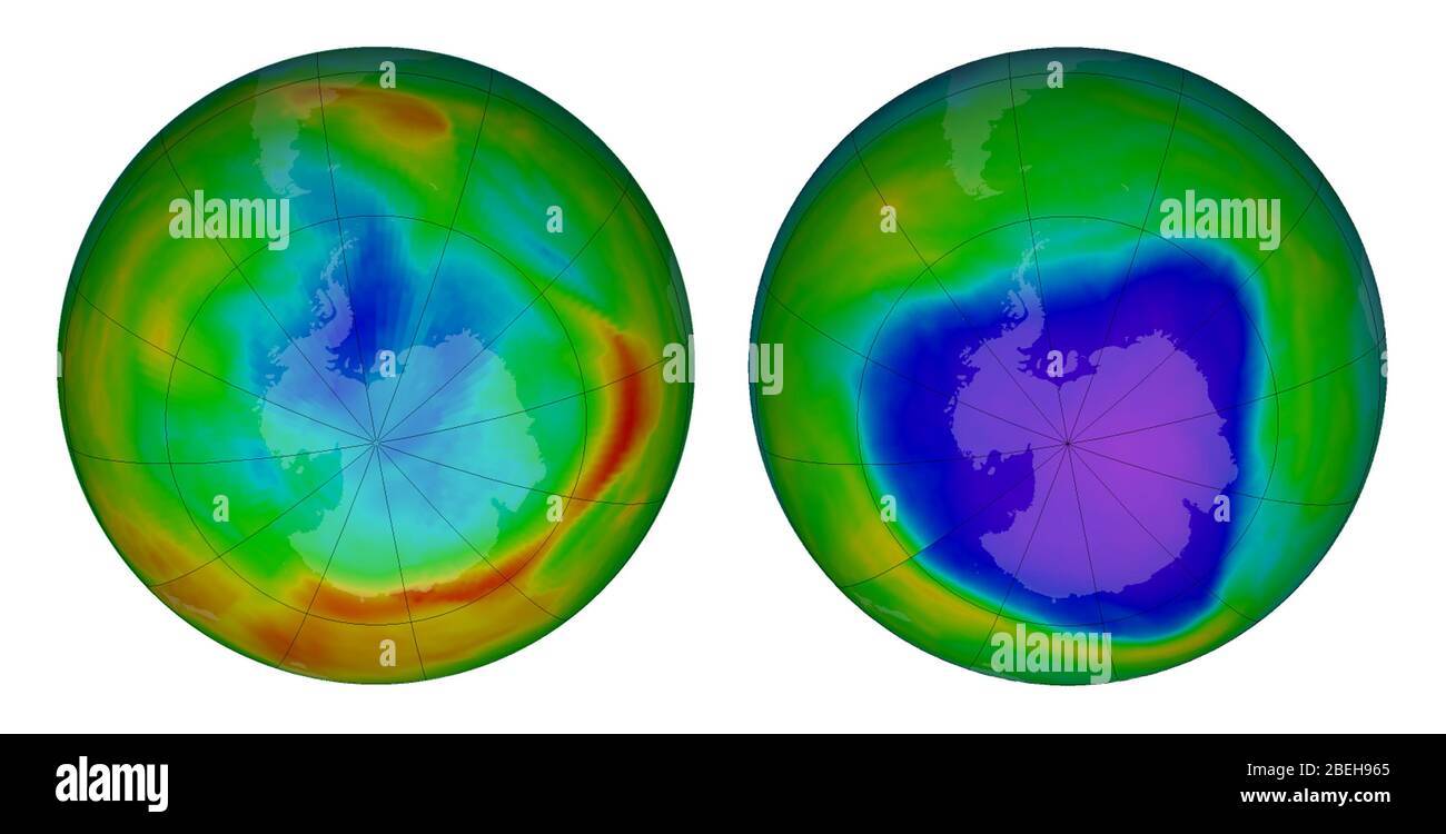 Antarctic Ozone Hole, 1979 and 2015 Stock Photohttps://www.alamy.com/image-license-details/?v=1https://www.alamy.com/antarctic-ozone-hole-1979-and-2015-image353192957.html
RM2BEH965–Antarctic Ozone Hole, 1979 and 2015
 The annual Antarctic ozone hole reached an average area of 23.2 million square kilometers between September 7, 2022, and October 13, 2022. This deplet Stock Photohttps://www.alamy.com/image-license-details/?v=1https://www.alamy.com/the-annual-antarctic-ozone-hole-reached-an-average-area-of-232-million-square-kilometers-between-september-7-2022-and-october-13-2022-this-deplet-image490489602.html
RM2KDYMDP–The annual Antarctic ozone hole reached an average area of 23.2 million square kilometers between September 7, 2022, and October 13, 2022. This deplet
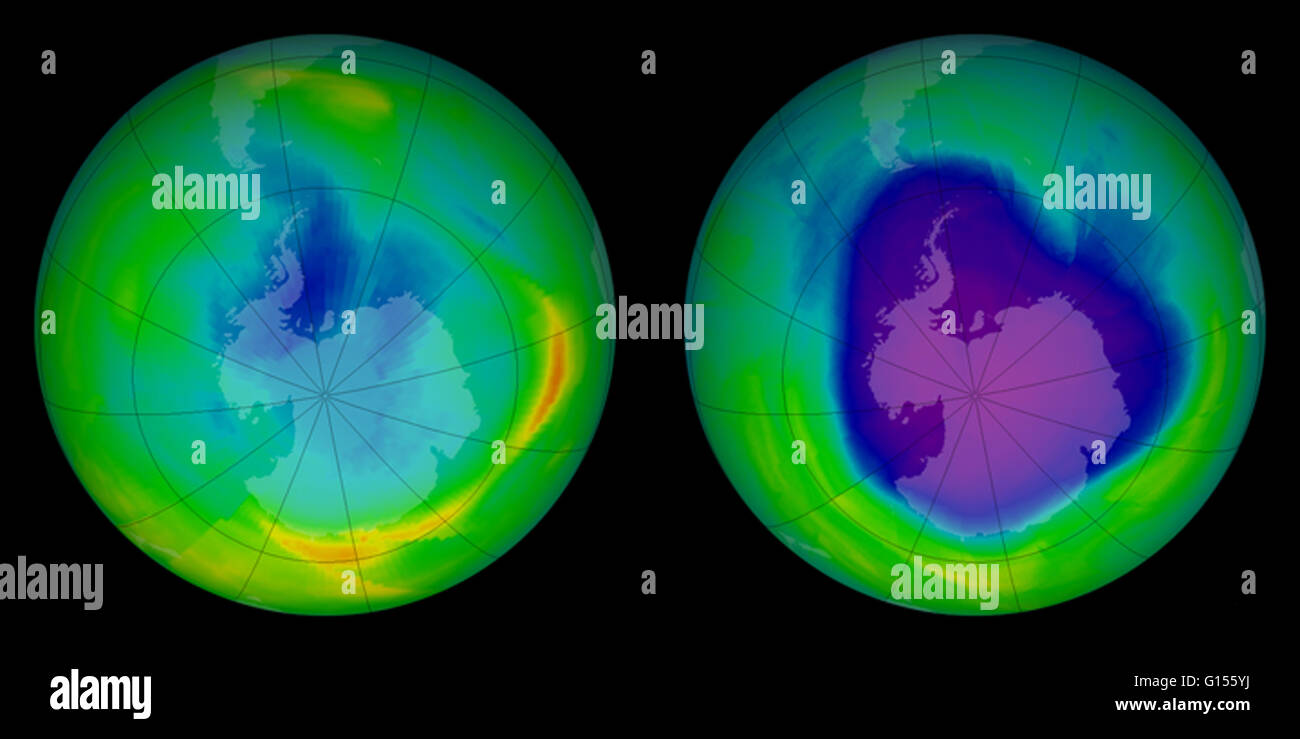 Change in ozone hole over South Pole, from 1979 (image on left) to 2008 (right). The stratospheric ozone layer protects life on Earth by absorbing ultraviolet light, which damages DNA in plants and animals (including humans) and leads to skin cancer. Prio Stock Photohttps://www.alamy.com/image-license-details/?v=1https://www.alamy.com/stock-photo-change-in-ozone-hole-over-south-pole-from-1979-image-on-left-to-2008-103991318.html
RMG155YJ–Change in ozone hole over South Pole, from 1979 (image on left) to 2008 (right). The stratospheric ozone layer protects life on Earth by absorbing ultraviolet light, which damages DNA in plants and animals (including humans) and leads to skin cancer. Prio
 Antarctica green algae in ice snow texture background Stock Photohttps://www.alamy.com/image-license-details/?v=1https://www.alamy.com/antarctica-green-algae-in-ice-snow-texture-background-image242862684.html
RFT339R8–Antarctica green algae in ice snow texture background
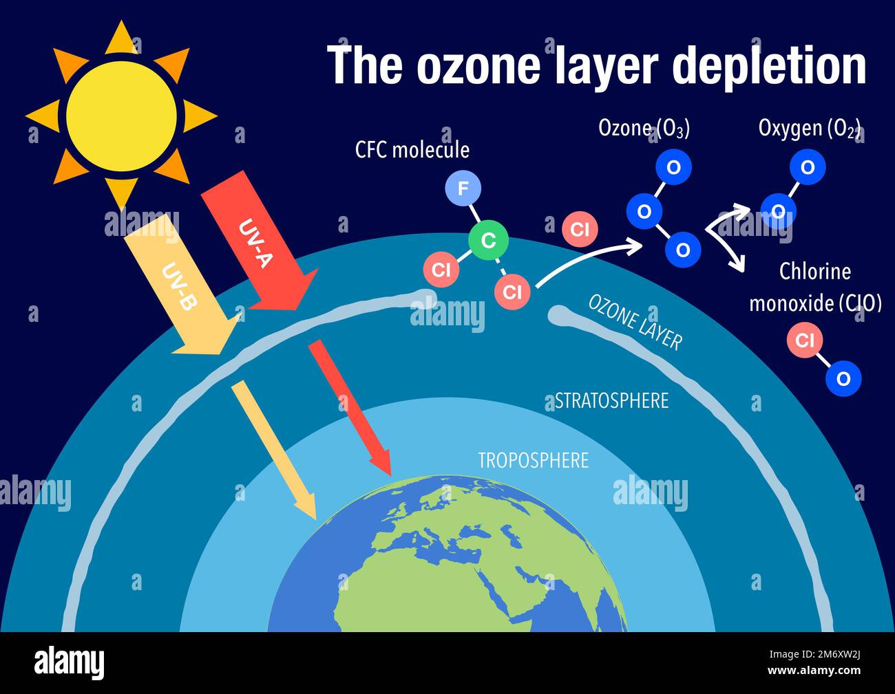 The ozone layer depletion explained Stock Photohttps://www.alamy.com/image-license-details/?v=1https://www.alamy.com/the-ozone-layer-depletion-explained-image503379034.html
RF2M6XW2J–The ozone layer depletion explained
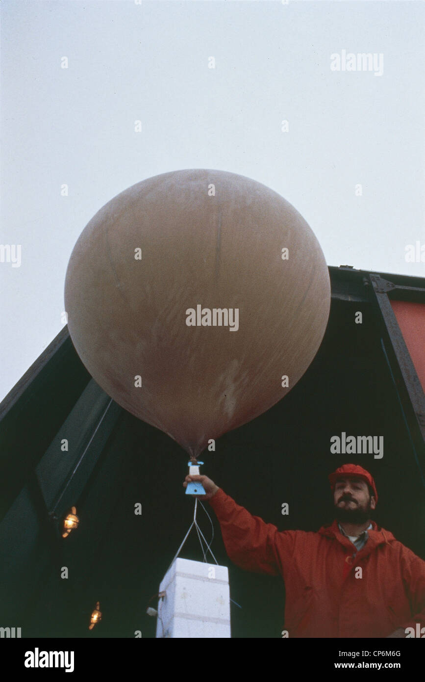 Antarctica - Seymour Island. Probe for monitoring the ozone layer in the base weather Argentine Marambio Stock Photohttps://www.alamy.com/image-license-details/?v=1https://www.alamy.com/stock-photo-antarctica-seymour-island-probe-for-monitoring-the-ozone-layer-in-48090744.html
RMCP6M6G–Antarctica - Seymour Island. Probe for monitoring the ozone layer in the base weather Argentine Marambio
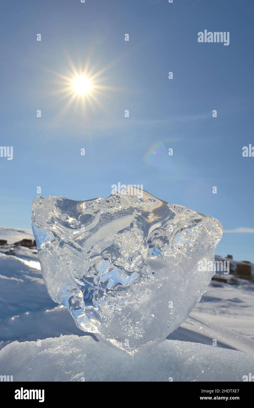 antarctica, global warming, melting ice, antarcticas, arctic, melting ices Stock Photohttps://www.alamy.com/image-license-details/?v=1https://www.alamy.com/antarctica-global-warming-melting-ice-antarcticas-arctic-melting-ices-image456007727.html
RF2HDTXE7–antarctica, global warming, melting ice, antarcticas, arctic, melting ices
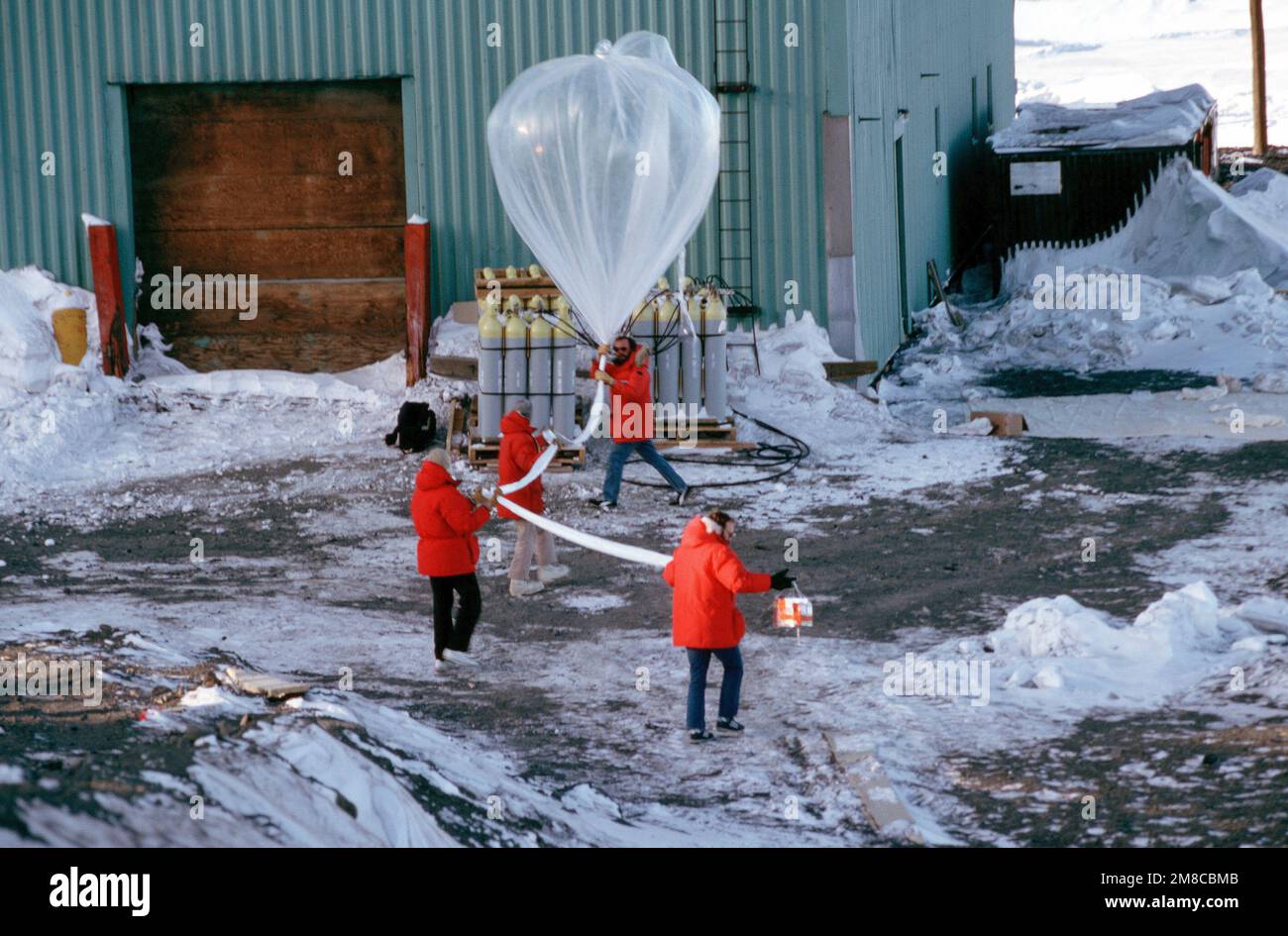 Dr. David J. Hofmann, Craig B. Sutter, Jim V. Hereford and Terry L. Deshler prepares to release a weather balloon as part of a National Science Foundation study of the atmosphere's ozone layer. Country: Antarctica (ATA) Stock Photohttps://www.alamy.com/image-license-details/?v=1https://www.alamy.com/dr-david-j-hofmann-craig-b-sutter-jim-v-hereford-and-terry-l-deshler-prepares-to-release-a-weather-balloon-as-part-of-a-national-science-foundation-study-of-the-atmospheres-ozone-layer-country-antarctica-ata-image504290539.html
RM2M8CBMB–Dr. David J. Hofmann, Craig B. Sutter, Jim V. Hereford and Terry L. Deshler prepares to release a weather balloon as part of a National Science Foundation study of the atmosphere's ozone layer. Country: Antarctica (ATA)
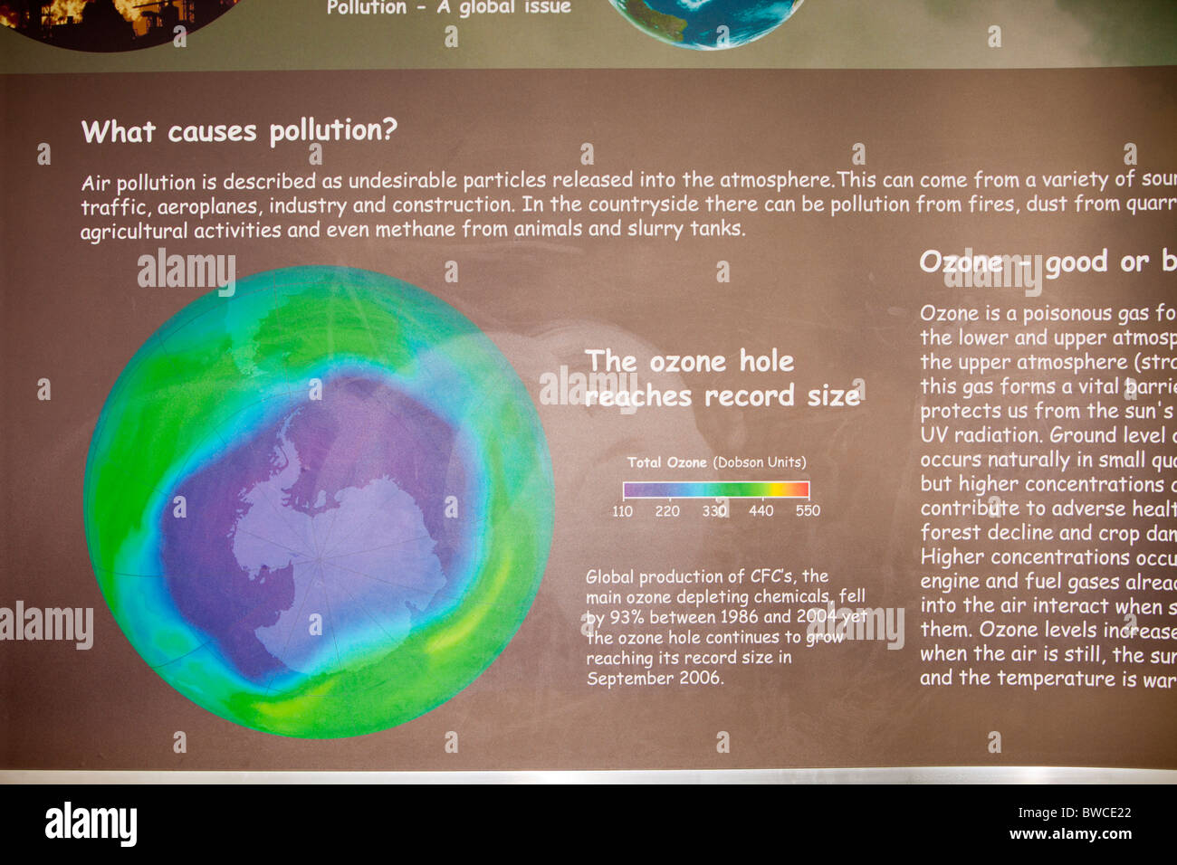 A display at the Solaris environmental centre run by Blackpool Council, Lancashire, UK. Stock Photohttps://www.alamy.com/image-license-details/?v=1https://www.alamy.com/stock-photo-a-display-at-the-solaris-environmental-centre-run-by-blackpool-council-32851226.html
RMBWCE22–A display at the Solaris environmental centre run by Blackpool Council, Lancashire, UK.
 cracks in cliff ice ready to break away behind snow covered islands. schollaert channel. antarctic peninsula. antarctica Stock Photohttps://www.alamy.com/image-license-details/?v=1https://www.alamy.com/cracks-in-cliff-ice-ready-to-break-away-behind-snow-covered-islands-schollaert-channel-antarctic-peninsula-antarctica-image487517293.html
RF2K9497W–cracks in cliff ice ready to break away behind snow covered islands. schollaert channel. antarctic peninsula. antarctica
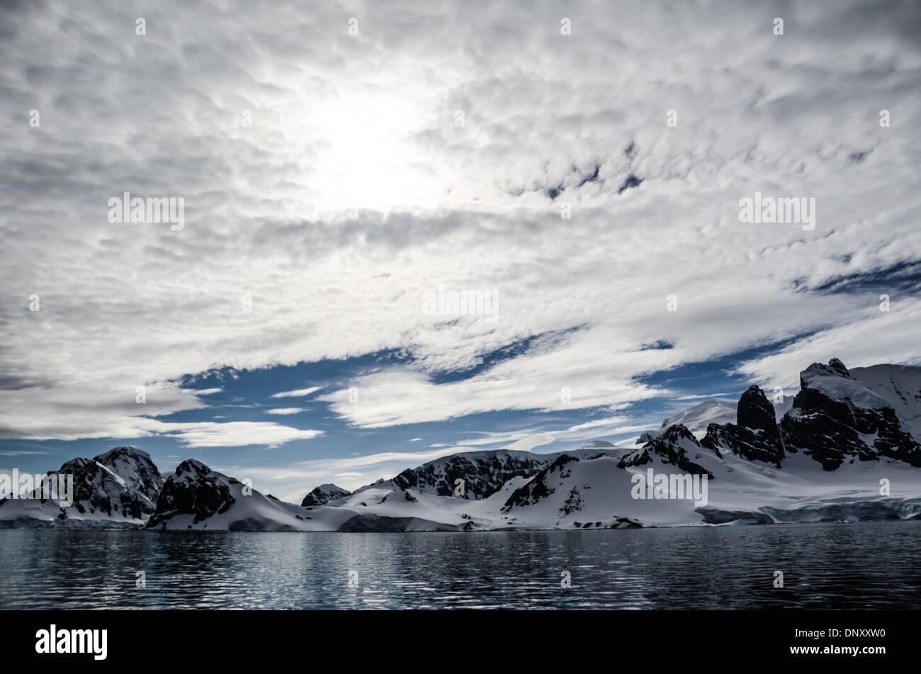 Cuverville Island Antarctic Peninsula Clouds And Sun // ANTARCTICA - A light layer of high clouds partially obscures the sun above Cuverville Island on the western side of the Antarctic Peninsula. Stock Photohttps://www.alamy.com/image-license-details/?v=1https://www.alamy.com/cuverville-island-antarctic-peninsula-clouds-and-sun-antarctica-a-image65130716.html
RMDNXXW0–Cuverville Island Antarctic Peninsula Clouds And Sun // ANTARCTICA - A light layer of high clouds partially obscures the sun above Cuverville Island on the western side of the Antarctic Peninsula.
 Icebergs and brash ice in the Southern Ocean, off the coast of Antarctica. Stock Photohttps://www.alamy.com/image-license-details/?v=1https://www.alamy.com/stock-photo-icebergs-and-brash-ice-in-the-southern-ocean-off-the-coast-of-antarctica-27763192.html
RMBH4M6G–Icebergs and brash ice in the Southern Ocean, off the coast of Antarctica.
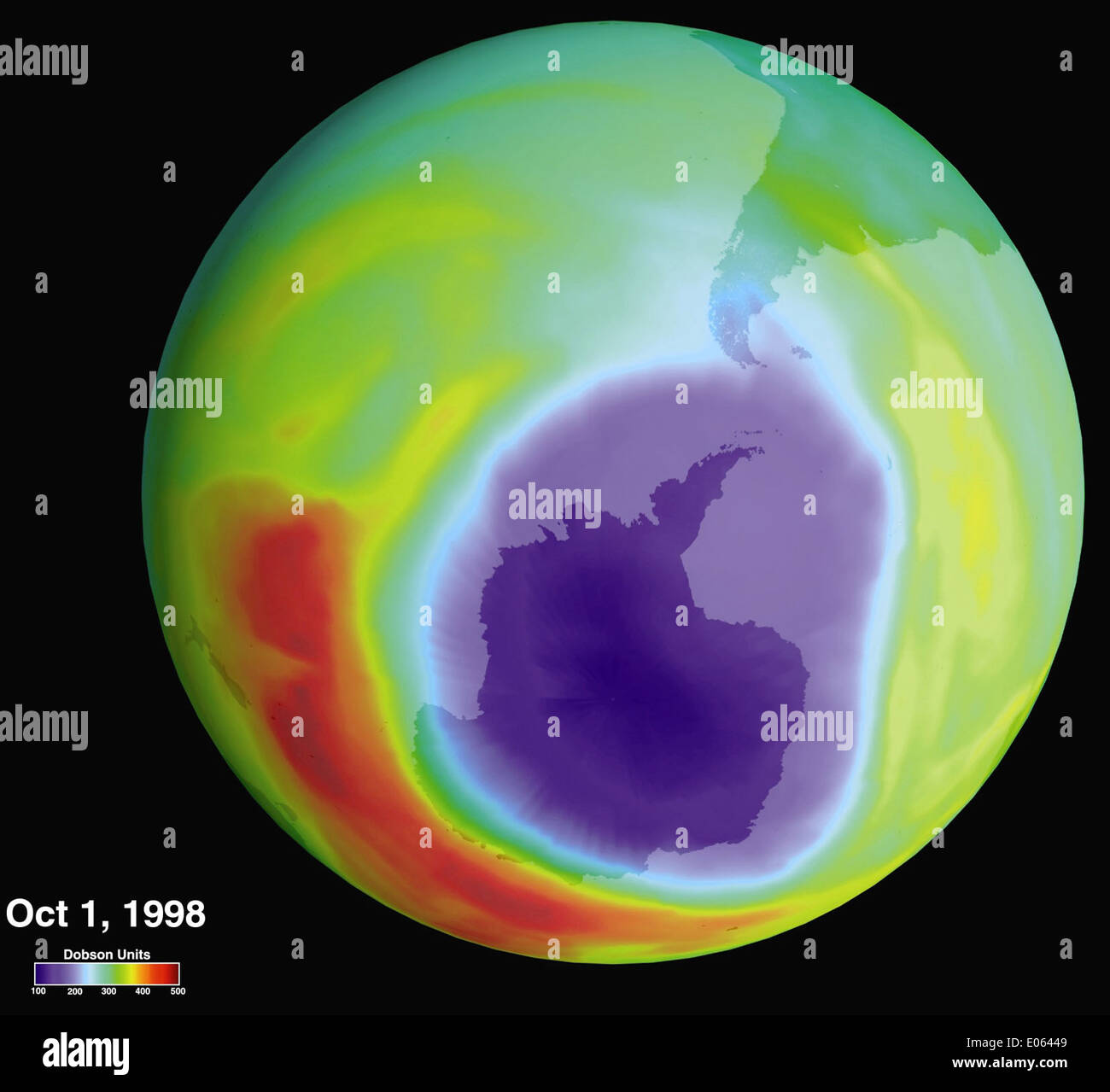 The annual thinning of the ozone layer over Antarctica is monitored by NASA's Goddard Space Flight Center. The hole, caused by CFCs and other chemicals, continues to be a significant concern for environmental health and space science research. Stock Photohttps://www.alamy.com/image-license-details/?v=1https://www.alamy.com/the-annual-thinning-of-the-ozone-layer-over-antarctica-is-monitored-image68976441.html
RME06449–The annual thinning of the ozone layer over Antarctica is monitored by NASA's Goddard Space Flight Center. The hole, caused by CFCs and other chemicals, continues to be a significant concern for environmental health and space science research.
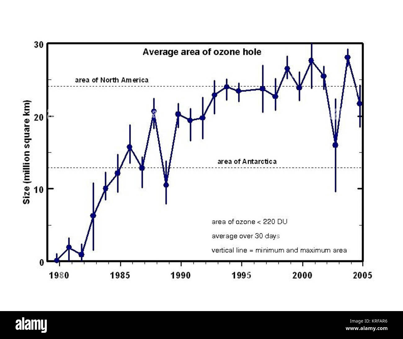 Ozone hole area Stock Photohttps://www.alamy.com/image-license-details/?v=1https://www.alamy.com/stock-image-ozone-hole-area-169368170.html
RMKRFAR6–Ozone hole area
 NASA and NOAA data reveal that a significant ozone hole over Antarctica continues to persist, affecting atmospheric conditions and climate patterns. The monitoring of the ozone layer remains crucial for understanding global environmental changes. Stock Photohttps://www.alamy.com/image-license-details/?v=1https://www.alamy.com/stock-photo-nasa-and-noaa-data-reveal-that-a-significant-ozone-hole-over-antarctica-54336792.html
RMD4B73M–NASA and NOAA data reveal that a significant ozone hole over Antarctica continues to persist, affecting atmospheric conditions and climate patterns. The monitoring of the ozone layer remains crucial for understanding global environmental changes.
 Antarctica Ship Bow Deck Snow South Shetland Islands // SOUTH SHETLAND ISLANDS, Antarctica — The bow deck of a ship in Antarctica in covered in a thin layer of fresh snow. Stock Photohttps://www.alamy.com/image-license-details/?v=1https://www.alamy.com/antarctica-ship-bow-deck-snow-south-shetland-islands-south-shetland-image65207421.html
RMDP2CMD–Antarctica Ship Bow Deck Snow South Shetland Islands // SOUTH SHETLAND ISLANDS, Antarctica — The bow deck of a ship in Antarctica in covered in a thin layer of fresh snow.
![Infographic of the evolution of the ozone hole in the atmosphere, its causes and consequences on the environment. [QuarkXPress (.qxp); 6259x4015]. Stock Photo Infographic of the evolution of the ozone hole in the atmosphere, its causes and consequences on the environment. [QuarkXPress (.qxp); 6259x4015]. Stock Photo](https://c8.alamy.com/comp/2NEBRX6/infographic-of-the-evolution-of-the-ozone-hole-in-the-atmosphere-its-causes-and-consequences-on-the-environment-quarkxpress-qxp-6259x4015-2NEBRX6.jpg) Infographic of the evolution of the ozone hole in the atmosphere, its causes and consequences on the environment. [QuarkXPress (.qxp); 6259x4015]. Stock Photohttps://www.alamy.com/image-license-details/?v=1https://www.alamy.com/infographic-of-the-evolution-of-the-ozone-hole-in-the-atmosphere-its-causes-and-consequences-on-the-environment-quarkxpress-qxp-6259x4015-image525176462.html
Infographic of the evolution of the ozone hole in the atmosphere, its causes and consequences on the environment. [QuarkXPress (.qxp); 6259x4015]. Stock Photohttps://www.alamy.com/image-license-details/?v=1https://www.alamy.com/infographic-of-the-evolution-of-the-ozone-hole-in-the-atmosphere-its-causes-and-consequences-on-the-environment-quarkxpress-qxp-6259x4015-image525176462.htmlRM2NEBRX6–Infographic of the evolution of the ozone hole in the atmosphere, its causes and consequences on the environment. [QuarkXPress (.qxp); 6259x4015].
 Wordie House Interior Bunks And Living Area Winter Island Antarctica // WINTER ISLAND, Antarctica — The main living area of Wordie House, with bunks to the right. Originally established in 1947 as Base F by the Falkland Islands Dependencies Survey, the successor organization to Operation Tabarin, and later renamed after James Wordie, chief scientist and geologist on Ernest Shackleton's Endurance expedition, this research station is preserved near Vernadsky Research Base in the Argentine Islands. Stock Photohttps://www.alamy.com/image-license-details/?v=1https://www.alamy.com/wordie-house-interior-bunks-and-living-area-winter-island-antarctica-image65140345.html
RMDNYB4W–Wordie House Interior Bunks And Living Area Winter Island Antarctica // WINTER ISLAND, Antarctica — The main living area of Wordie House, with bunks to the right. Originally established in 1947 as Base F by the Falkland Islands Dependencies Survey, the successor organization to Operation Tabarin, and later renamed after James Wordie, chief scientist and geologist on Ernest Shackleton's Endurance expedition, this research station is preserved near Vernadsky Research Base in the Argentine Islands.
 sun breaking through mist and cloud over snow covered ice shelf falling into the sea at Fournier Bay Antarctica Stock Photohttps://www.alamy.com/image-license-details/?v=1https://www.alamy.com/sun-breaking-through-mist-and-cloud-over-snow-covered-ice-shelf-falling-image68986975.html
RME06HGF–sun breaking through mist and cloud over snow covered ice shelf falling into the sea at Fournier Bay Antarctica
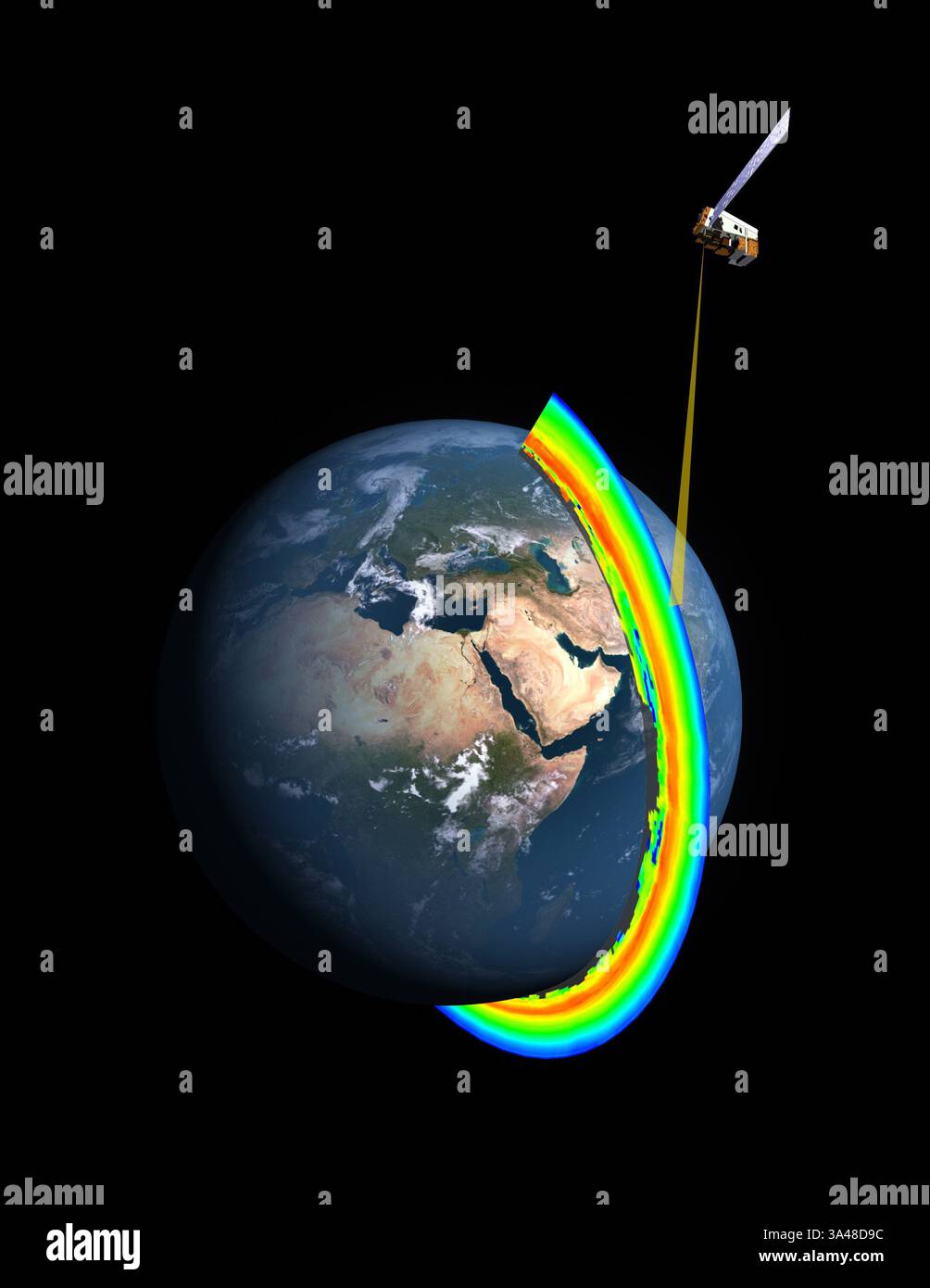 Dec. 11, 2013 - ..A cross-section of Earth's ozone layer as measured by the limb profiler, part of the Ozone Mapper Profiler Suite that's aboard the Suomi NPP satellite..NASA reveals new results from inside the ozone hole - 11 Dec 2013..NASA scientists revealed on Wednesday (11 Dec) the inner workings of the ozone hole that forms annually over Antarctica and found that declining chlorine in the stratosphere has not yet caused a recovery of the ozone hole.....More than 20 years after the Montreal Protocol agreement limited human emissions of ozone-depleting substances, satellites have monitored Stock Photohttps://www.alamy.com/image-license-details/?v=1https://www.alamy.com/dec-11-2013-a-cross-section-of-earths-ozone-layer-as-measured-by-the-limb-profiler-part-of-the-ozone-mapper-profiler-suite-thats-aboard-the-suomi-npp-satellitenasa-reveals-new-results-from-inside-the-ozone-hole-11-dec-2013nasa-scientists-revealed-on-wednesday-11-dec-the-inner-workings-of-the-ozone-hole-that-forms-annually-over-antarctica-and-found-that-declining-chlorine-in-the-stratosphere-has-not-yet-caused-a-recovery-of-the-ozone-holemore-than-20-years-after-the-montreal-protocol-agreement-limited-human-emissions-of-ozone-depleting-substances-satellites-have-monitored-image656638680.html
RM3A48D9C–Dec. 11, 2013 - ..A cross-section of Earth's ozone layer as measured by the limb profiler, part of the Ozone Mapper Profiler Suite that's aboard the Suomi NPP satellite..NASA reveals new results from inside the ozone hole - 11 Dec 2013..NASA scientists revealed on Wednesday (11 Dec) the inner workings of the ozone hole that forms annually over Antarctica and found that declining chlorine in the stratosphere has not yet caused a recovery of the ozone hole.....More than 20 years after the Montreal Protocol agreement limited human emissions of ozone-depleting substances, satellites have monitored
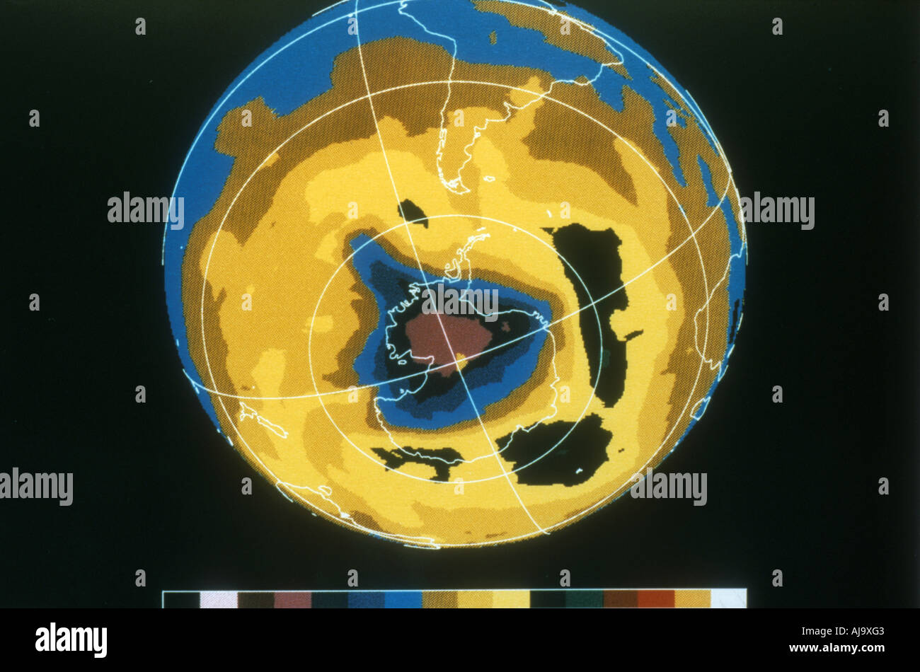 False colour image of Antarctic ozone hole, 30 November 1992. Artist: Unknown Stock Photohttps://www.alamy.com/image-license-details/?v=1https://www.alamy.com/false-colour-image-of-antarctic-ozone-hole-30-november-1992-artist-image8382594.html
RMAJ9XG3–False colour image of Antarctic ozone hole, 30 November 1992. Artist: Unknown
 Antarctic Ozone Hole, 2013 Stock Photohttps://www.alamy.com/image-license-details/?v=1https://www.alamy.com/stock-photo-antarctic-ozone-hole-2013-135015838.html
RMHRJE26–Antarctic Ozone Hole, 2013
 Antarctica red algae in ice snow texture background Stock Photohttps://www.alamy.com/image-license-details/?v=1https://www.alamy.com/antarctica-red-algae-in-ice-snow-texture-background-image242862685.html
RFT339R9–Antarctica red algae in ice snow texture background
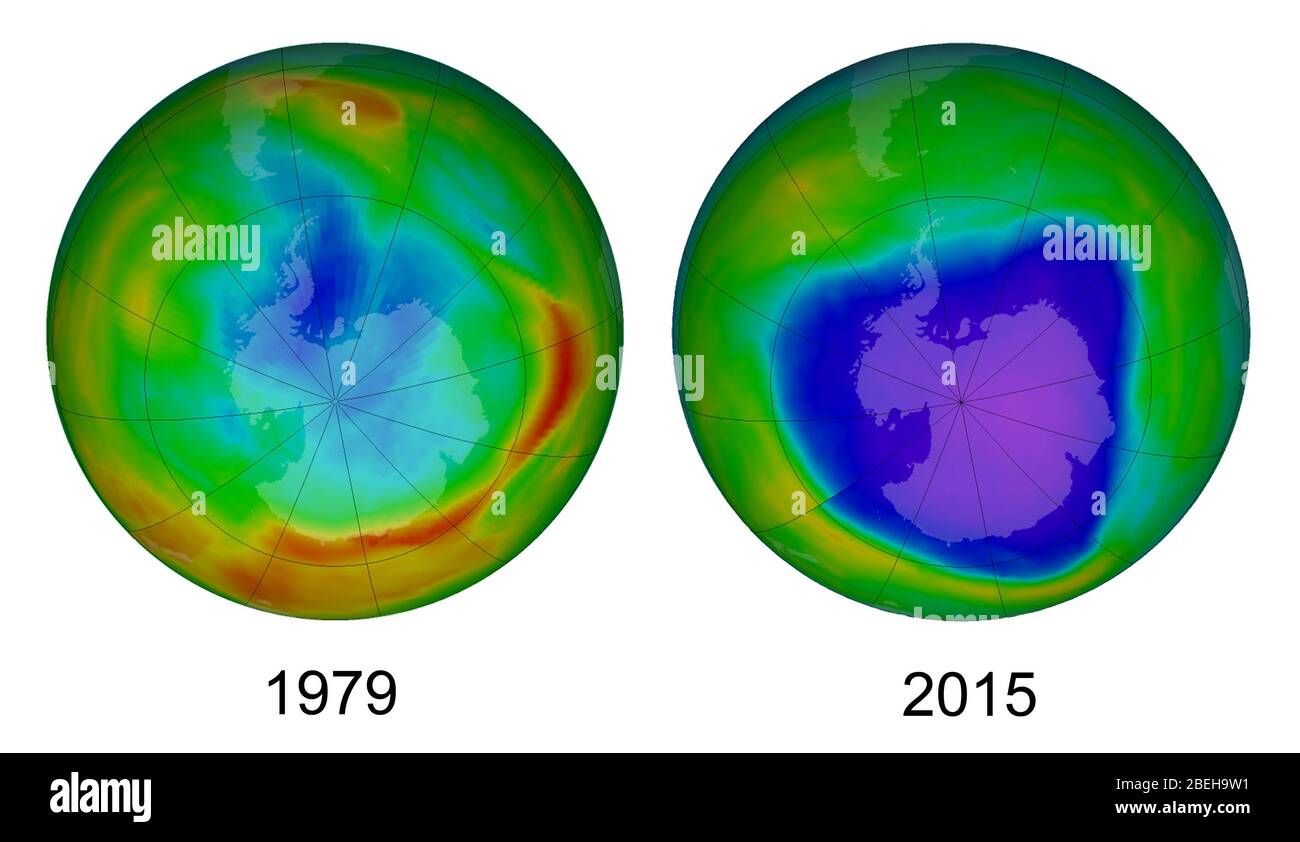 A comparison of the size and shape of the Antarctic ozone hole on 17 September, 1979 (left) and 4 October 2015 (right). Purple and dark blue areas are part of the ozone hole. As the images show, the word hole isn't literal; no place is empty of ozone. Scientists use the word hole as a metaphor for the area in which ozone concentrations drop below the historical threshold of 220 Dobson Units. Using this metaphor, they can describe the hole's size and depth. The map shows the state of the ozone hole on the day of maximum depth#the day the lowest ozone concentrations were measured. The measuremen Stock Photohttps://www.alamy.com/image-license-details/?v=1https://www.alamy.com/a-comparison-of-the-size-and-shape-of-the-antarctic-ozone-hole-on-17-september-1979-left-and-4-october-2015-right-purple-and-dark-blue-areas-are-part-of-the-ozone-hole-as-the-images-show-the-word-hole-isnt-literal-no-place-is-empty-of-ozone-scientists-use-the-word-hole-as-a-metaphor-for-the-area-in-which-ozone-concentrations-drop-below-the-historical-threshold-of-220-dobson-units-using-this-metaphor-they-can-describe-the-holes-size-and-depth-the-map-shows-the-state-of-the-ozone-hole-on-the-day-of-maximum-depththe-day-the-lowest-ozone-concentrations-were-measured-the-measuremen-image353193485.html
RM2BEH9W1–A comparison of the size and shape of the Antarctic ozone hole on 17 September, 1979 (left) and 4 October 2015 (right). Purple and dark blue areas are part of the ozone hole. As the images show, the word hole isn't literal; no place is empty of ozone. Scientists use the word hole as a metaphor for the area in which ozone concentrations drop below the historical threshold of 220 Dobson Units. Using this metaphor, they can describe the hole's size and depth. The map shows the state of the ozone hole on the day of maximum depth#the day the lowest ozone concentrations were measured. The measuremen
 June 26, 2013 - Hole in the Ozone Layer Over Antarctica: In 1985, a British scientist working in Antarctica discovered a 40 percent loss in the ozone layer over the continent. When Goddard Space Flight Center researchers reviewed their data, they confirmed the ozone loss. Since then, scientists have relied on instrumentation developed by Goddard to keep track of the environmental phenomenon, which in the 1990s prompted a worldwide ban on chlorofluorocarbons (CFCs), a chemical used for refrigeration and other industrial uses. In this image, the blue/purple areas show low ozone, while the red ar Stock Photohttps://www.alamy.com/image-license-details/?v=1https://www.alamy.com/june-26-2013-hole-in-the-ozone-layer-over-antarctica-in-1985-a-british-scientist-working-in-antarctica-discovered-a-40-percent-loss-in-the-ozone-layer-over-the-continent-when-goddard-space-flight-center-researchers-reviewed-their-data-they-confirmed-the-ozone-loss-since-then-scientists-have-relied-on-instrumentation-developed-by-goddard-to-keep-track-of-the-environmental-phenomenon-which-in-the-1990s-prompted-a-worldwide-ban-on-chlorofluorocarbons-cfcs-a-chemical-used-for-refrigeration-and-other-industrial-uses-in-this-image-the-bluepurple-areas-show-low-ozone-while-the-red-ar-image656894848.html
RM3A4M428–June 26, 2013 - Hole in the Ozone Layer Over Antarctica: In 1985, a British scientist working in Antarctica discovered a 40 percent loss in the ozone layer over the continent. When Goddard Space Flight Center researchers reviewed their data, they confirmed the ozone loss. Since then, scientists have relied on instrumentation developed by Goddard to keep track of the environmental phenomenon, which in the 1990s prompted a worldwide ban on chlorofluorocarbons (CFCs), a chemical used for refrigeration and other industrial uses. In this image, the blue/purple areas show low ozone, while the red ar
 ENVIRONMENT Antarctica/Swan Stock Photohttps://www.alamy.com/image-license-details/?v=1https://www.alamy.com/stock-photo-environment-antarcticaswan-105899039.html
RMG4838F–ENVIRONMENT Antarctica/Swan
 A gentoo penguin looks across the water at snow covered mountains from the rookery located on Jougla Point at Port Lockroy Stock Photohttps://www.alamy.com/image-license-details/?v=1https://www.alamy.com/a-gentoo-penguin-looks-across-the-water-at-snow-covered-mountains-image1165371.html
RMAHC83C–A gentoo penguin looks across the water at snow covered mountains from the rookery located on Jougla Point at Port Lockroy
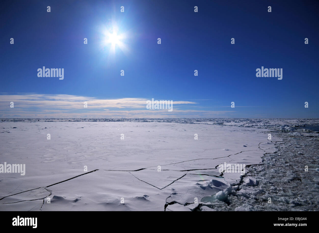 Sun over the breaking ice cover of the South Polar Ocean , Antarctica Stock Photohttps://www.alamy.com/image-license-details/?v=1https://www.alamy.com/stock-photo-sun-over-the-breaking-ice-cover-of-the-south-polar-ocean-antarctica-76010484.html
RMEBJG44–Sun over the breaking ice cover of the South Polar Ocean , Antarctica
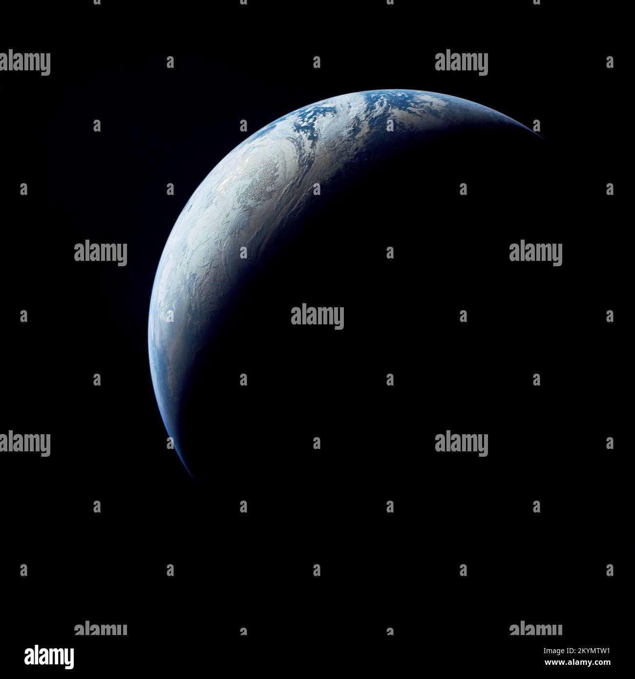 View of Earth from Apollo 4 Earth as viewed from 10,000 miles. In 1967, the Apollo 4 (Spacecraft 017/Saturn 501) unmanned test flight made a great ellipse around Earth as a test of the translunar motors and of the high speed entry required of a human flight returning from the moon. A 70mm camera was programmed to look out a window toward Earth, and take a series of photographs from 'high apogee'. Coastal Brazil, Atlantic Ocean, West Africa, Antarctica, looking west. This photograph was made when the Apollo 4 spacecraft, still attached to the S-IVB (third) stage, was orbiting Earth at an altitu Stock Photohttps://www.alamy.com/image-license-details/?v=1https://www.alamy.com/view-of-earth-from-apollo-4-earth-as-viewed-from-10000-miles-in-1967-the-apollo-4-spacecraft-017saturn-501-unmanned-test-flight-made-a-great-ellipse-around-earth-as-a-test-of-the-translunar-motors-and-of-the-high-speed-entry-required-of-a-human-flight-returning-from-the-moon-a-70mm-camera-was-programmed-to-look-out-a-window-toward-earth-and-take-a-series-of-photographs-from-high-apogee-coastal-brazil-atlantic-ocean-west-africa-antarctica-looking-west-this-photograph-was-made-when-the-apollo-4-spacecraft-still-attached-to-the-s-ivb-third-stage-was-orbiting-earth-at-an-altitu-image498944573.html
RM2KYMTW1–View of Earth from Apollo 4 Earth as viewed from 10,000 miles. In 1967, the Apollo 4 (Spacecraft 017/Saturn 501) unmanned test flight made a great ellipse around Earth as a test of the translunar motors and of the high speed entry required of a human flight returning from the moon. A 70mm camera was programmed to look out a window toward Earth, and take a series of photographs from 'high apogee'. Coastal Brazil, Atlantic Ocean, West Africa, Antarctica, looking west. This photograph was made when the Apollo 4 spacecraft, still attached to the S-IVB (third) stage, was orbiting Earth at an altitu
 burning lighter above map of the Antarctic, symbol for global warming Stock Photohttps://www.alamy.com/image-license-details/?v=1https://www.alamy.com/stock-photo-burning-lighter-above-map-of-the-antarctic-symbol-for-global-warming-76035577.html
RMEBKM49–burning lighter above map of the Antarctic, symbol for global warming
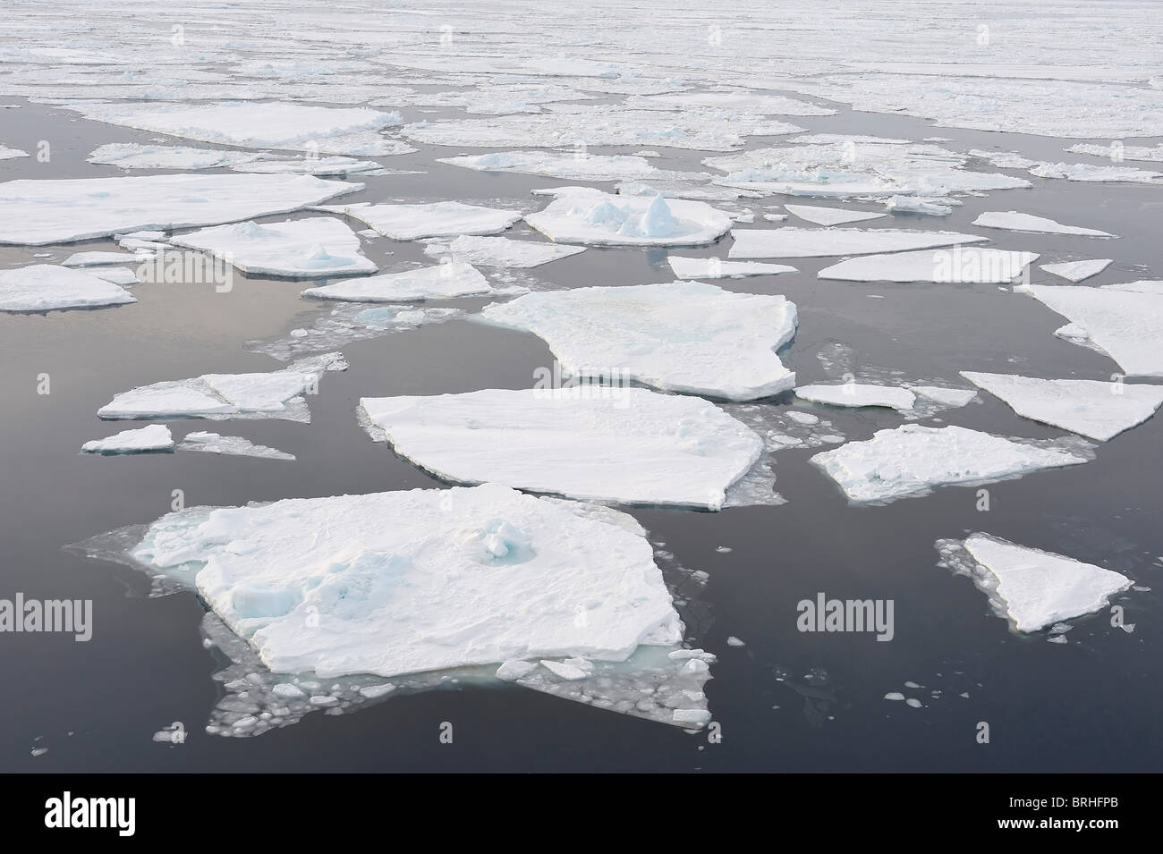 Ice Floe, Weddell Sea, Antarctic Peninsula Stock Photohttps://www.alamy.com/image-license-details/?v=1https://www.alamy.com/stock-photo-ice-floe-weddell-sea-antarctic-peninsula-31733027.html
RFBRHFPB–Ice Floe, Weddell Sea, Antarctic Peninsula
 First Space-Based View of the Ozone Hole (8006648994) Stock Photohttps://www.alamy.com/image-license-details/?v=1https://www.alamy.com/stock-image-first-space-based-view-of-the-ozone-hole-8006648994-169433411.html
RMKRJA17–First Space-Based View of the Ozone Hole (8006648994)
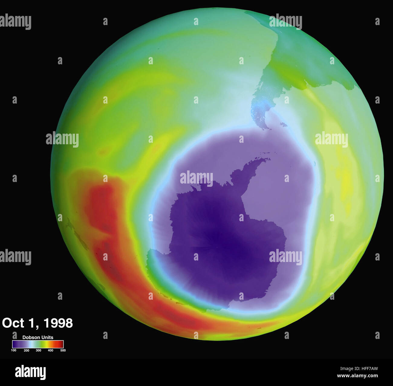 Hole in the Ozone Layer Over Antarctica 2002-000117 Stock Photohttps://www.alamy.com/image-license-details/?v=1https://www.alamy.com/stock-photo-hole-in-the-ozone-layer-over-antarctica-2002-000117-130027489.html
RMHFF7AW–Hole in the Ozone Layer Over Antarctica 2002-000117
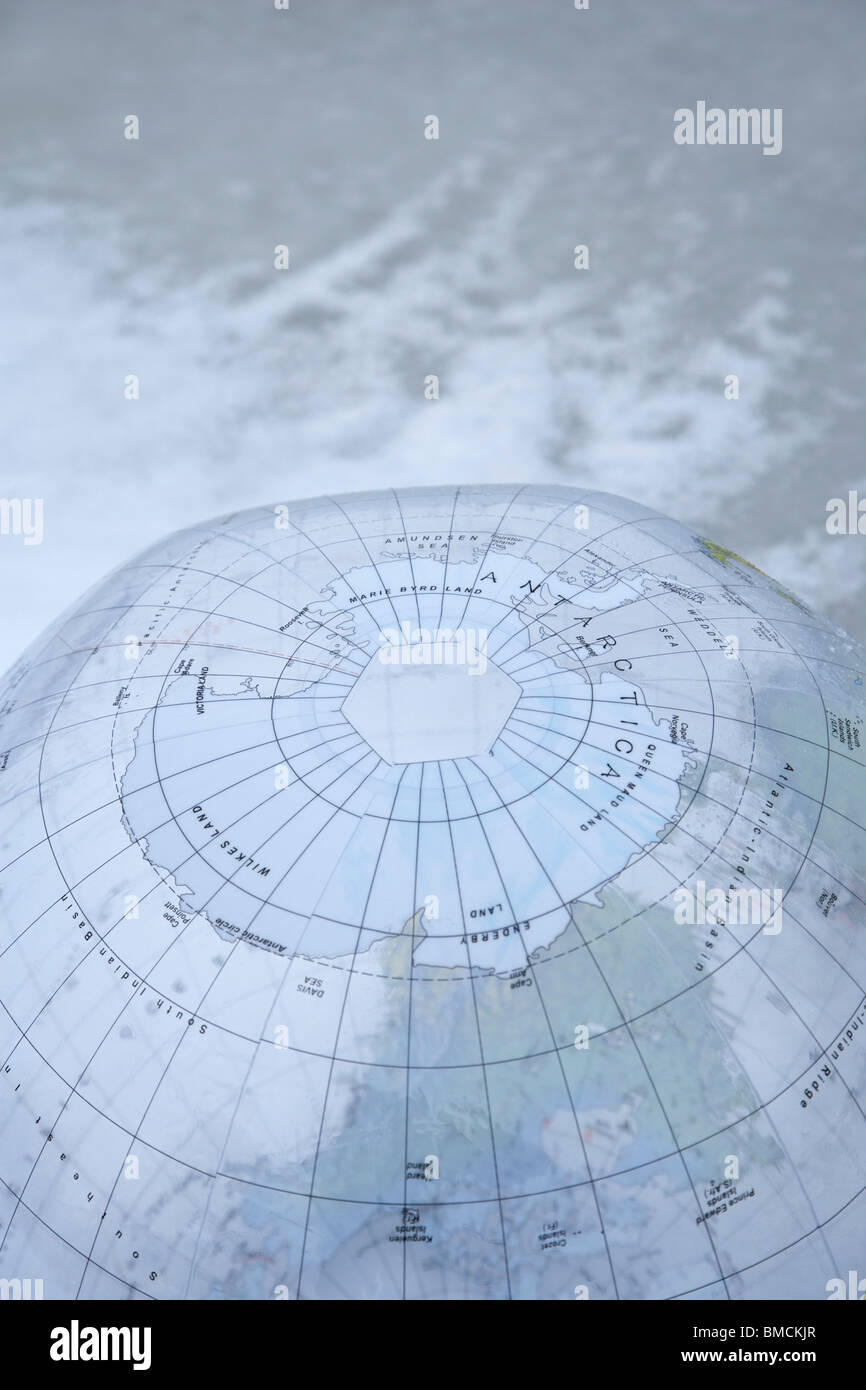 Global Warming Stock Photohttps://www.alamy.com/image-license-details/?v=1https://www.alamy.com/stock-photo-global-warming-29782335.html
RFBMCKJR–Global Warming
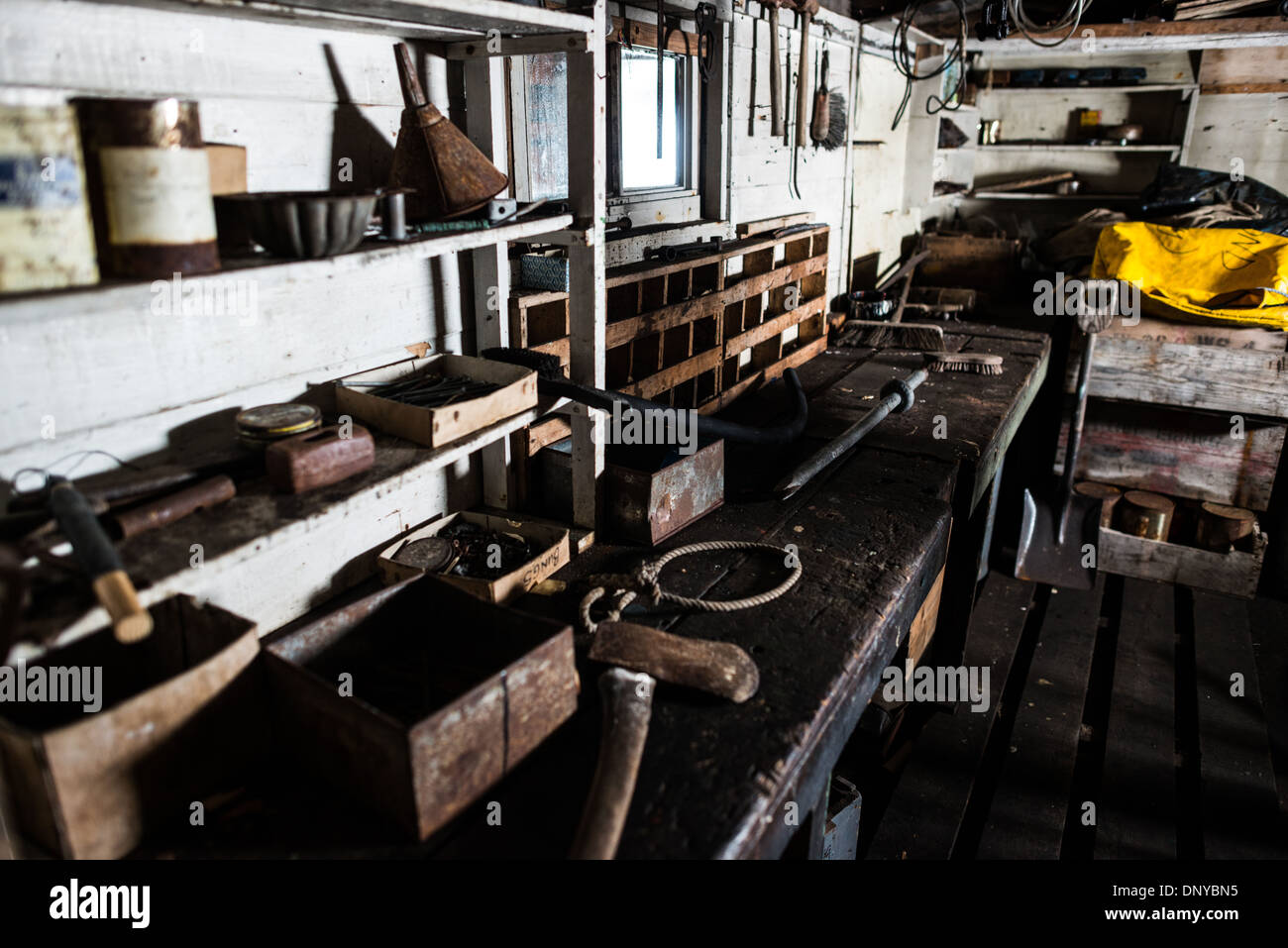 Wordie House Workbench Area Winter Island Antarctica // WINTER ISLAND, Antarctica — A workbench area at Wordie House. Originally established in 1947 as Base F by the Falkland Islands Dependencies Survey, the successor organization to Operation Tabarin, and later renamed after James Wordie, chief scientist and geologist on Ernest Shackleton's Endurance expedition, this research station is preserved near Vernadsky Research Base in the Argentine Islands. Stock Photohttps://www.alamy.com/image-license-details/?v=1https://www.alamy.com/wordie-house-workbench-area-winter-island-antarctica-winter-island-image65140801.html
RMDNYBN5–Wordie House Workbench Area Winter Island Antarctica // WINTER ISLAND, Antarctica — A workbench area at Wordie House. Originally established in 1947 as Base F by the Falkland Islands Dependencies Survey, the successor organization to Operation Tabarin, and later renamed after James Wordie, chief scientist and geologist on Ernest Shackleton's Endurance expedition, this research station is preserved near Vernadsky Research Base in the Argentine Islands.
 Antarctica green algae in ice snow texture background Stock Photohttps://www.alamy.com/image-license-details/?v=1https://www.alamy.com/antarctica-green-algae-in-ice-snow-texture-background-image242862683.html
RFT339R7–Antarctica green algae in ice snow texture background
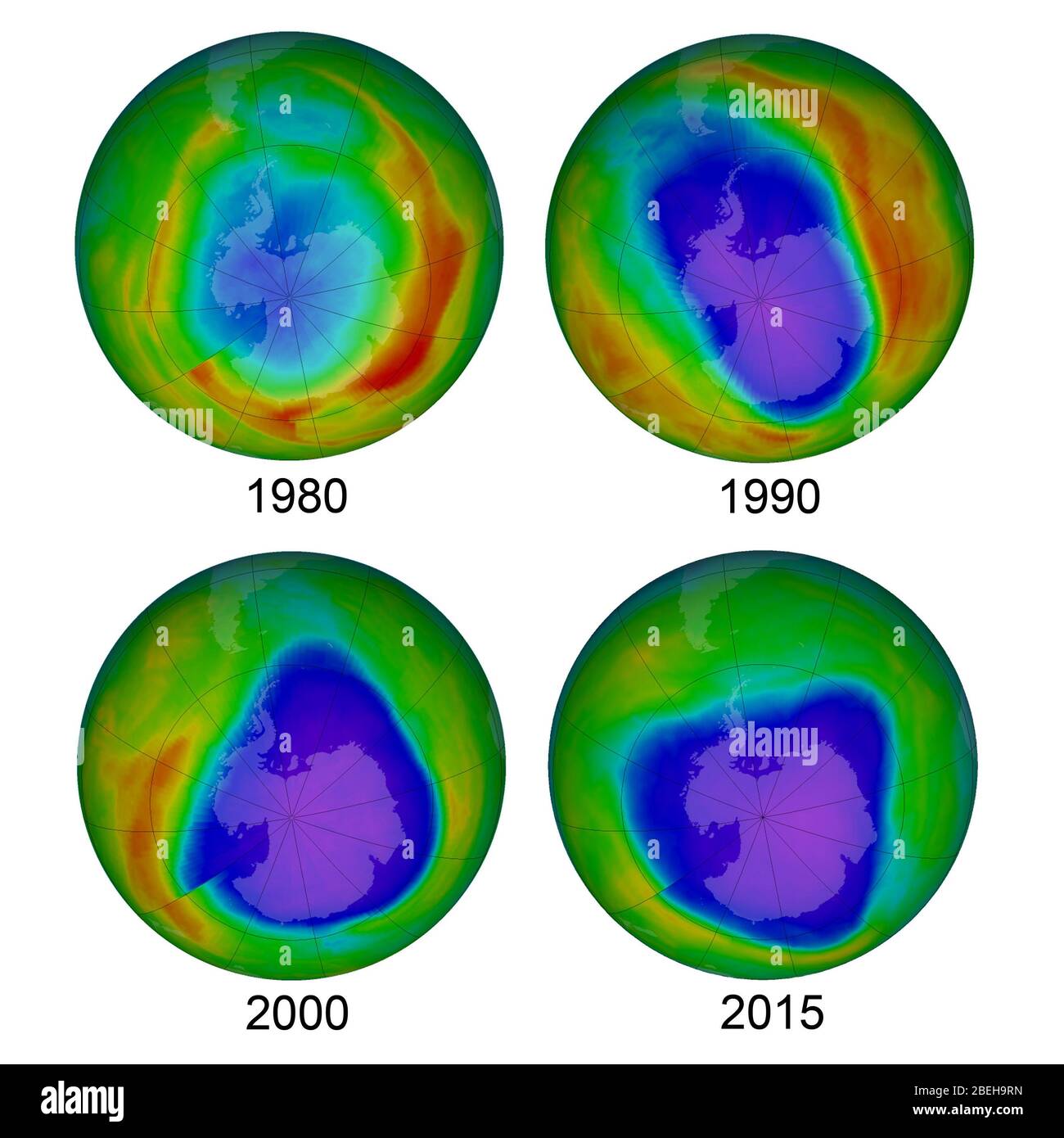 Antarctic Ozone Hole, 1980, 1990, 2000, and 2015 Stock Photohttps://www.alamy.com/image-license-details/?v=1https://www.alamy.com/antarctic-ozone-hole-1980-1990-2000-and-2015-image353193449.html
RM2BEH9RN–Antarctic Ozone Hole, 1980, 1990, 2000, and 2015
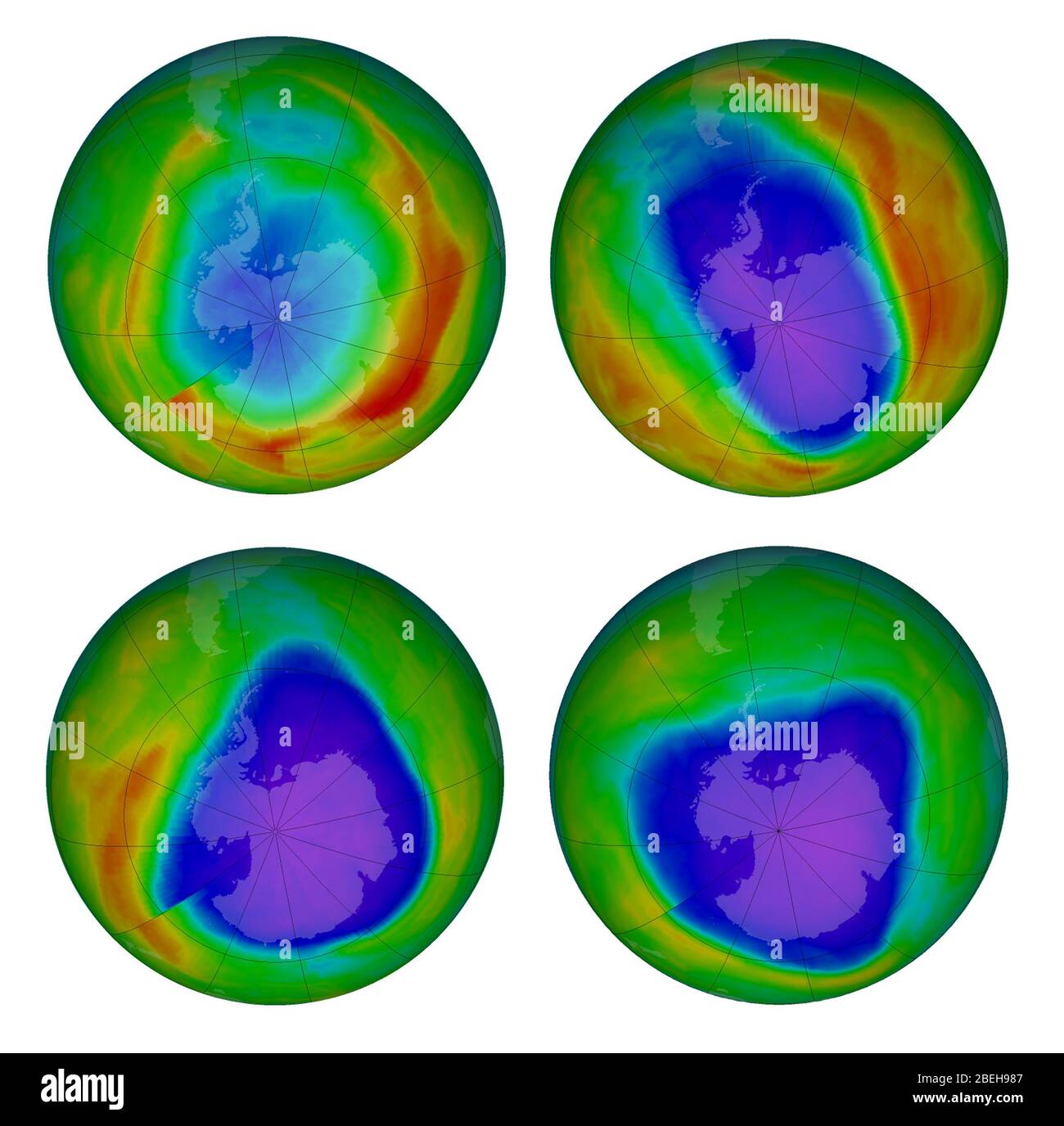 Antarctic Ozone Hole, 1980, 1990, 2000, and 2015 Stock Photohttps://www.alamy.com/image-license-details/?v=1https://www.alamy.com/antarctic-ozone-hole-1980-1990-2000-and-2015-image353193015.html
RM2BEH987–Antarctic Ozone Hole, 1980, 1990, 2000, and 2015
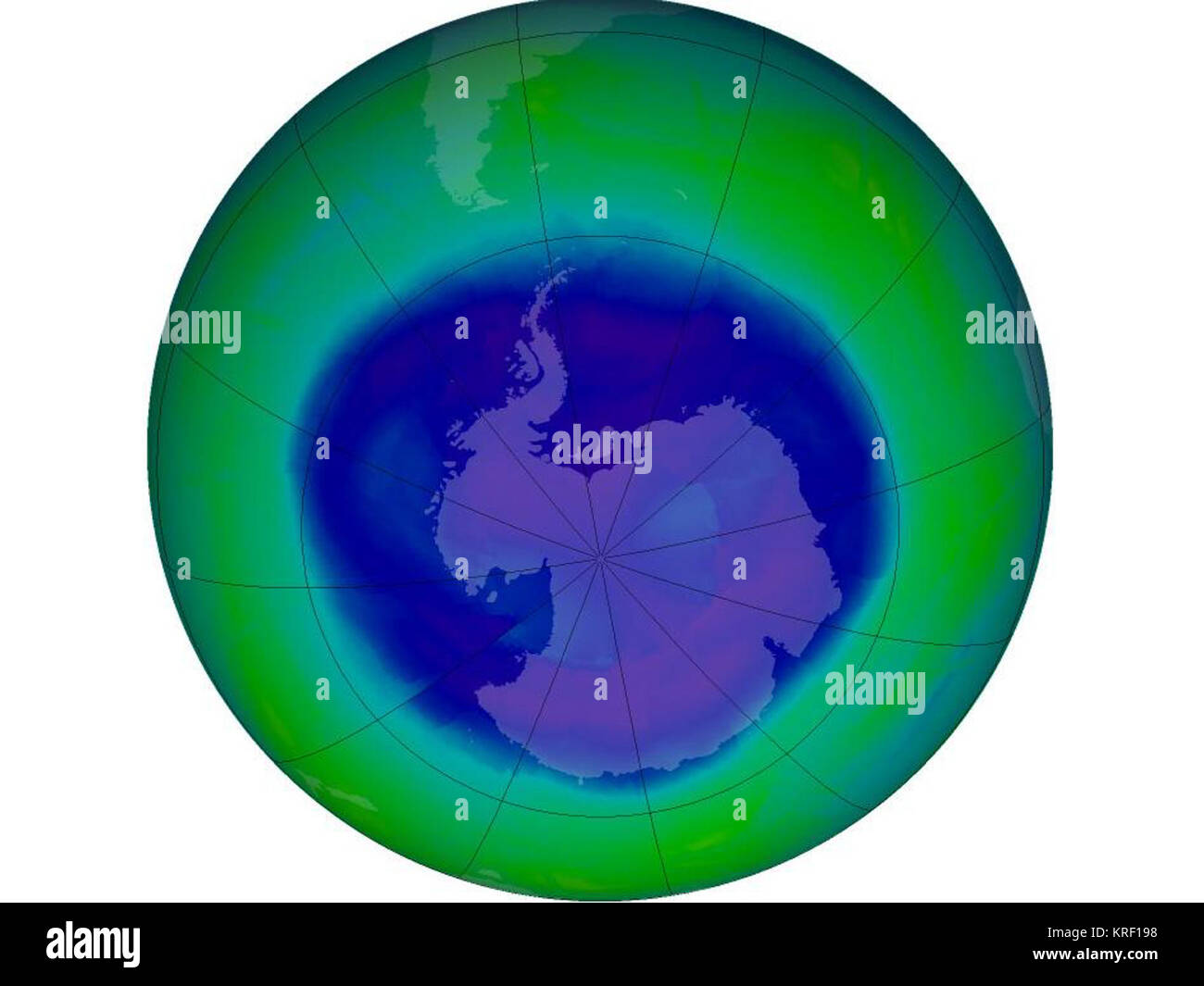 Ozone Hole Stock Photohttps://www.alamy.com/image-license-details/?v=1https://www.alamy.com/stock-image-ozone-hole-169360724.html
RMKRF198–Ozone Hole
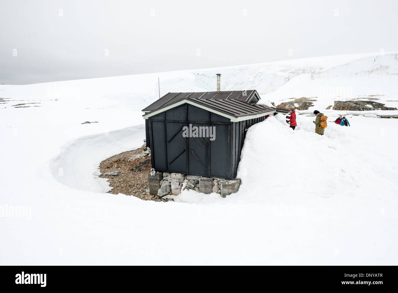 Wordie House Historic Site Winter Island Antarctica // WINTER ISLAND, Antarctica — Tourists explore the historic site of Wordie House, originally known as Base F. Originally established in 1947 as Base F by the Falkland Islands Dependencies Survey, the successor organization to Operation Tabarin, and later renamed after James Wordie, chief scientist and geologist on Ernest Shackleton's Endurance expedition, this research station is preserved near Vernadsky Research Base in the Argentine Islands. Stock Photohttps://www.alamy.com/image-license-details/?v=1https://www.alamy.com/wordie-house-historic-site-winter-island-antarctica-winter-island-image65140119.html
RMDNYATR–Wordie House Historic Site Winter Island Antarctica // WINTER ISLAND, Antarctica — Tourists explore the historic site of Wordie House, originally known as Base F. Originally established in 1947 as Base F by the Falkland Islands Dependencies Survey, the successor organization to Operation Tabarin, and later renamed after James Wordie, chief scientist and geologist on Ernest Shackleton's Endurance expedition, this research station is preserved near Vernadsky Research Base in the Argentine Islands.
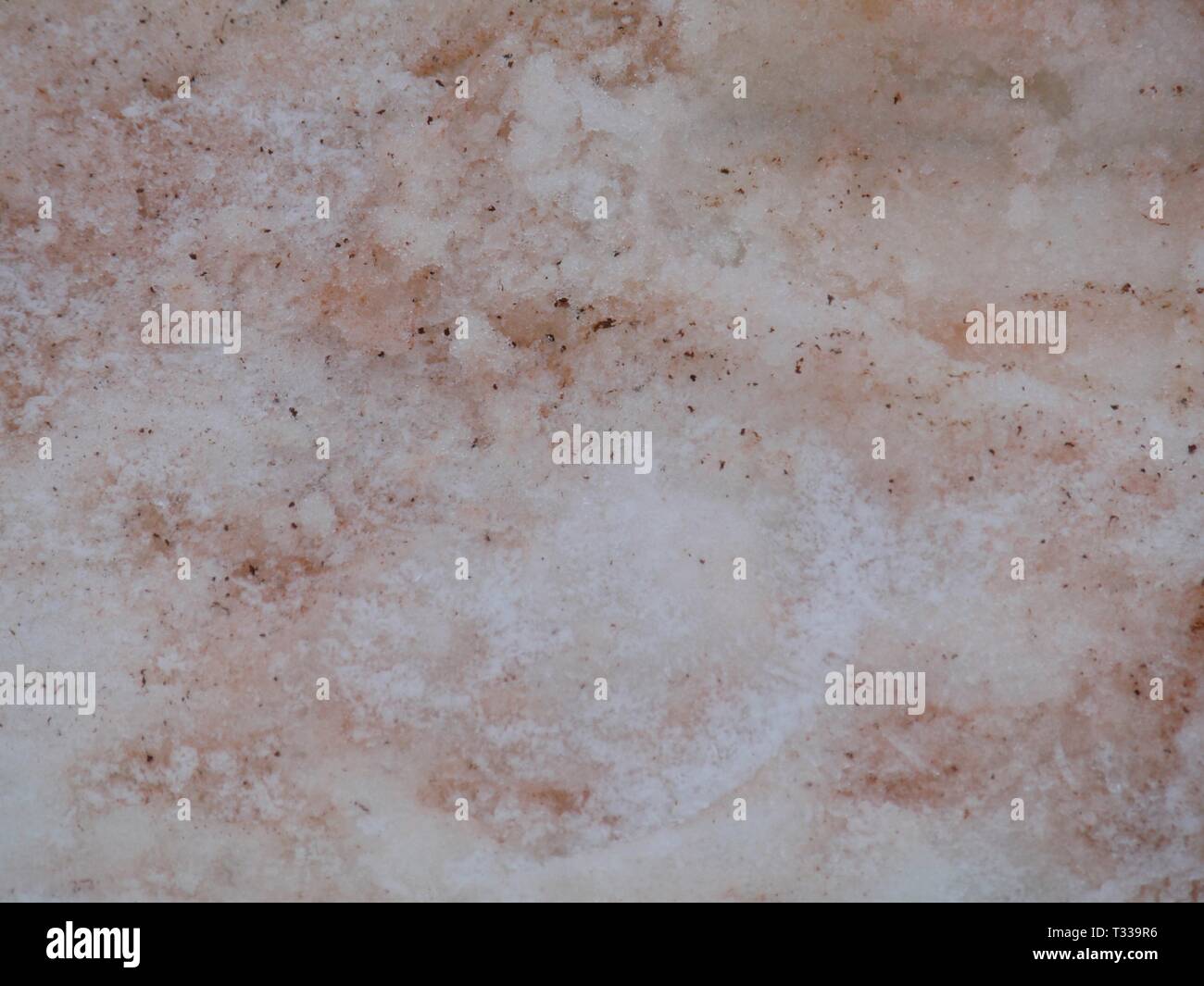 Antarctica red algae in ice snow texture background Stock Photohttps://www.alamy.com/image-license-details/?v=1https://www.alamy.com/antarctica-red-algae-in-ice-snow-texture-background-image242862682.html
RFT339R6–Antarctica red algae in ice snow texture background
 Antarctica red green algae in ice snow texture background Stock Photohttps://www.alamy.com/image-license-details/?v=1https://www.alamy.com/antarctica-red-green-algae-in-ice-snow-texture-background-image242862689.html
RFT339RD–Antarctica red green algae in ice snow texture background
 Largest ever Ozone hole sept2000 with scale Stock Photohttps://www.alamy.com/image-license-details/?v=1https://www.alamy.com/stock-image-largest-ever-ozone-hole-sept2000-with-scale-169323462.html
RMKRD9PE–Largest ever Ozone hole sept2000 with scale
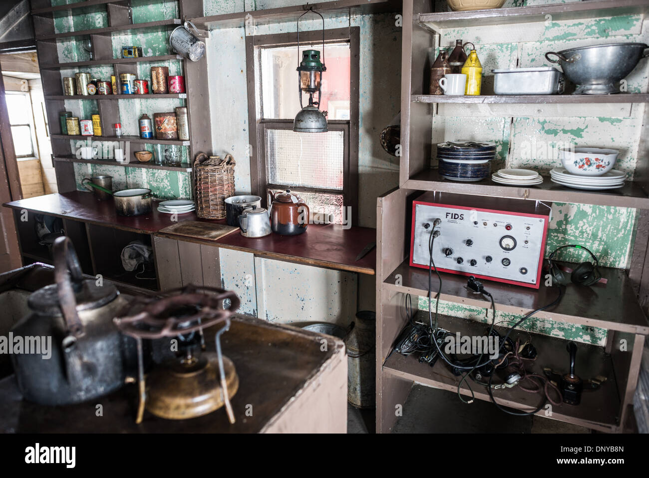 Wordie House Kitchen Radio Antarctica // WINTER ISLAND, Antarctica — The kitchen area of Wordie House, featuring a large radio with the acronym FIDS for Falkland Islands Dependency Survey. Originally established in 1947 as Base F by the Falkland Islands Dependencies Survey, the successor organization to Operation Tabarin, and later renamed after James Wordie, chief scientist and geologist on Ernest Shackleton's Endurance expedition, this research station is preserved near Vernadsky Research Base in the Argentine Islands. Stock Photohttps://www.alamy.com/image-license-details/?v=1https://www.alamy.com/wordie-house-kitchen-radio-antarctica-winter-island-antarctica-the-image65140453.html
RMDNYB8N–Wordie House Kitchen Radio Antarctica // WINTER ISLAND, Antarctica — The kitchen area of Wordie House, featuring a large radio with the acronym FIDS for Falkland Islands Dependency Survey. Originally established in 1947 as Base F by the Falkland Islands Dependencies Survey, the successor organization to Operation Tabarin, and later renamed after James Wordie, chief scientist and geologist on Ernest Shackleton's Endurance expedition, this research station is preserved near Vernadsky Research Base in the Argentine Islands.
 Antarctica red green algae in ice snow texture background Stock Photohttps://www.alamy.com/image-license-details/?v=1https://www.alamy.com/antarctica-red-green-algae-in-ice-snow-texture-background-image242862690.html
RFT339RE–Antarctica red green algae in ice snow texture background
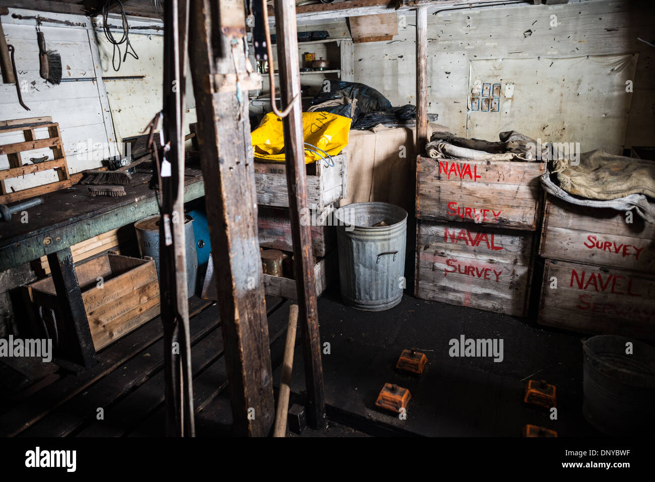 Wordie House Workshop Storage Area Winter Island Antarctica // WINTER ISLAND, Antarctica — The storage area in the workshop at Wordie House. Originally established in 1947 as Base F by the Falkland Islands Dependencies Survey, the successor organization to Operation Tabarin, and later renamed after James Wordie, chief scientist and geologist on Ernest Shackleton's Endurance expedition, this research station is preserved near Vernadsky Research Base in the Argentine Islands. Stock Photohttps://www.alamy.com/image-license-details/?v=1https://www.alamy.com/wordie-house-workshop-storage-area-winter-island-antarctica-winter-image65140923.html
RMDNYBWF–Wordie House Workshop Storage Area Winter Island Antarctica // WINTER ISLAND, Antarctica — The storage area in the workshop at Wordie House. Originally established in 1947 as Base F by the Falkland Islands Dependencies Survey, the successor organization to Operation Tabarin, and later renamed after James Wordie, chief scientist and geologist on Ernest Shackleton's Endurance expedition, this research station is preserved near Vernadsky Research Base in the Argentine Islands.
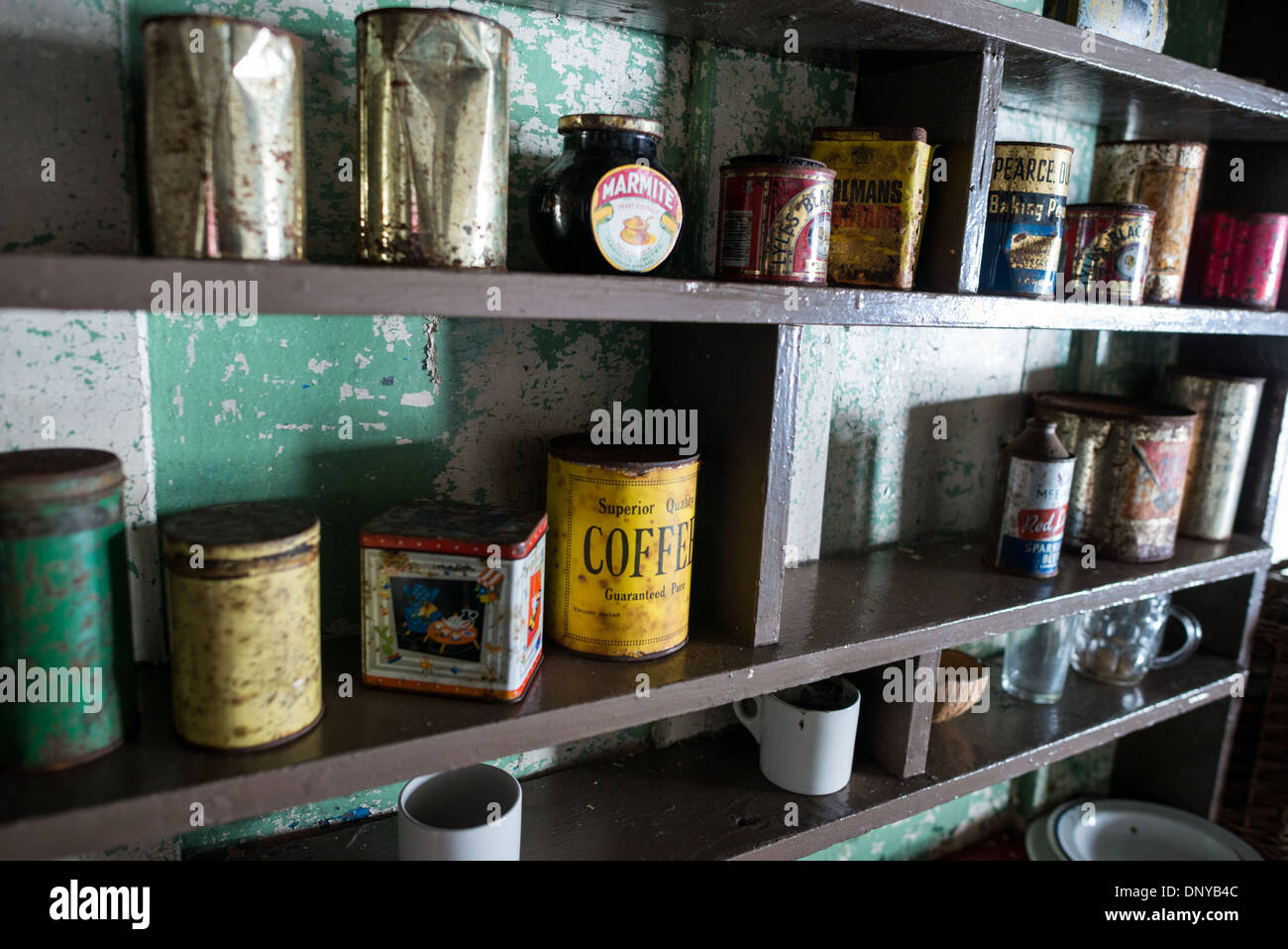 Wordie House Kitchen Food Storage Cans Winter Island Antarctica // WINTER ISLAND, Antarctica — The kitchen area of Wordie House, featuring a large radio with the acronym FIDS for Falkland Islands Dependency Survey. Originally established in 1947 as Base F by the Falkland Islands Dependencies Survey, the successor organization to Operation Tabarin, and later renamed after James Wordie, chief scientist and geologist on Ernest Shackleton's Endurance expedition, this research station is preserved near Vernadsky Research Base in the Argentine Islands. Stock Photohttps://www.alamy.com/image-license-details/?v=1https://www.alamy.com/wordie-house-kitchen-food-storage-cans-winter-island-antarctica-winter-image65140332.html
RMDNYB4C–Wordie House Kitchen Food Storage Cans Winter Island Antarctica // WINTER ISLAND, Antarctica — The kitchen area of Wordie House, featuring a large radio with the acronym FIDS for Falkland Islands Dependency Survey. Originally established in 1947 as Base F by the Falkland Islands Dependencies Survey, the successor organization to Operation Tabarin, and later renamed after James Wordie, chief scientist and geologist on Ernest Shackleton's Endurance expedition, this research station is preserved near Vernadsky Research Base in the Argentine Islands.
 Wordie House Breathing Apparatus Antarctica // WINTER ISLAND, Antarctica — A collection of vintage breathing apparatus and firefighting equipment hangs on the wall of Wordie House, a preserved mid-1940s British Antarctic research base. Originally established in 1947 as Base F by the Falkland Islands Dependencies Survey, the successor organization to Operation Tabarin, and later renamed after James Wordie, chief scientist and geologist on Ernest Shackleton's Endurance expedition, this research station is preserved near Vernadsky Research Base in the Argentine Islands. Stock Photohttps://www.alamy.com/image-license-details/?v=1https://www.alamy.com/wordie-house-breathing-apparatus-antarctica-winter-island-antarctica-image65141399.html
RMDNYCEF–Wordie House Breathing Apparatus Antarctica // WINTER ISLAND, Antarctica — A collection of vintage breathing apparatus and firefighting equipment hangs on the wall of Wordie House, a preserved mid-1940s British Antarctic research base. Originally established in 1947 as Base F by the Falkland Islands Dependencies Survey, the successor organization to Operation Tabarin, and later renamed after James Wordie, chief scientist and geologist on Ernest Shackleton's Endurance expedition, this research station is preserved near Vernadsky Research Base in the Argentine Islands.
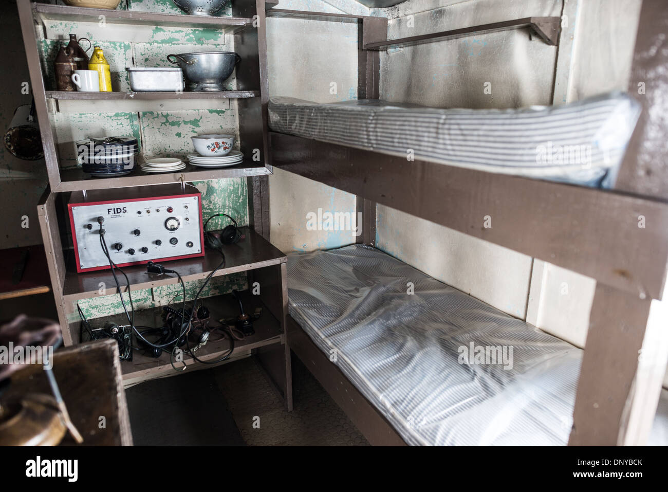 Wordie House Bunk Beds Winter Island Antarctica // WINTER ISLAND, Antarctica — Bunk beds near the kitchen in Wordie House, originally known as Base F and later renamed after James Wordie, chief scientist on Ernest Shackleton's Antarctic expedition. Originally established in 1947 as Base F by the Falkland Islands Dependencies Survey, the successor organization to Operation Tabarin, and later renamed after James Wordie, chief scientist and geologist on Ernest Shackleton's Endurance expedition, this research station is preserved near Vernadsky Research Base in the Argentine Islands. Stock Photohttps://www.alamy.com/image-license-details/?v=1https://www.alamy.com/wordie-house-bunk-beds-winter-island-antarctica-winter-island-antarctica-image65140563.html
RMDNYBCK–Wordie House Bunk Beds Winter Island Antarctica // WINTER ISLAND, Antarctica — Bunk beds near the kitchen in Wordie House, originally known as Base F and later renamed after James Wordie, chief scientist on Ernest Shackleton's Antarctic expedition. Originally established in 1947 as Base F by the Falkland Islands Dependencies Survey, the successor organization to Operation Tabarin, and later renamed after James Wordie, chief scientist and geologist on Ernest Shackleton's Endurance expedition, this research station is preserved near Vernadsky Research Base in the Argentine Islands.