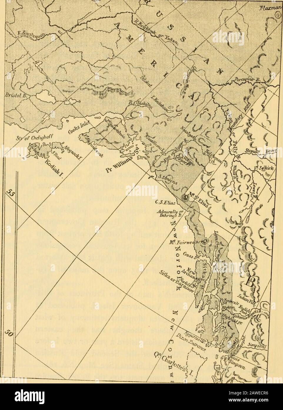
The Alaska frontier . This map shows that the strip of land on the con-tinent extended far enough inland to include allthe sinuosities of the coast so as to exclude, ac-cording to the United States claims, the Britishterritory altogether from any outlet upon salt waterabove fifty-four degrees forty minutes. Also on a Russian Imperial map published in1861 (see Map No. 15), the Russian Governmentagain claimed, without calling forth any protest fromthe British Government, for its American possessionsan eastern frontier identical with that it had assertedsoon after the treaty of 1825 upon the maps
Image details
Contributor:
The Reading Room / Alamy Stock PhotoImage ID:
2AWECR6File size:
7.1 MB (515.8 KB Compressed download)Releases:
Model - no | Property - noDo I need a release?Dimensions:
1360 x 1837 px | 23 x 31.1 cm | 9.1 x 12.2 inches | 150dpiMore information:
This image is a public domain image, which means either that copyright has expired in the image or the copyright holder has waived their copyright. Alamy charges you a fee for access to the high resolution copy of the image.
This image could have imperfections as it’s either historical or reportage.
The Alaska frontier . This map shows that the strip of land on the con-tinent extended far enough inland to include allthe sinuosities of the coast so as to exclude, ac-cording to the United States claims, the Britishterritory altogether from any outlet upon salt waterabove fifty-four degrees forty minutes. Also on a Russian Imperial map published in1861 (see Map No. 15), the Russian Governmentagain claimed, without calling forth any protest fromthe British Government, for its American possessionsan eastern frontier identical with that it had assertedsoon after the treaty of 1825 upon the maps of Kru-senstern and Piadischeff. John Arrowsmiths map of the Provinces of Brit-ish Columbia and Vancouver Island, published atLondon in 1864, gives eloquent testimony of whatEnglish cartographers thought was the easternboundary of the Russian lisiere a year or two beforethe Emperor Alexander the Second sold RussianAmerica to the United States (See Map No. 16). By a number of overt acts, too, the British Empire W-T ^^. tiTT^rv^ IT^^ ^^ ? ^^^^^ ^^ ^^ °^^^ °^ Commons to be printed72rLr ? l^ ^7- ^^ ^^^^^ Territory, which is Darker thanTHE Canadian in this Reproduction, is Colored Yellow on the Original Map. MAP No. 14.