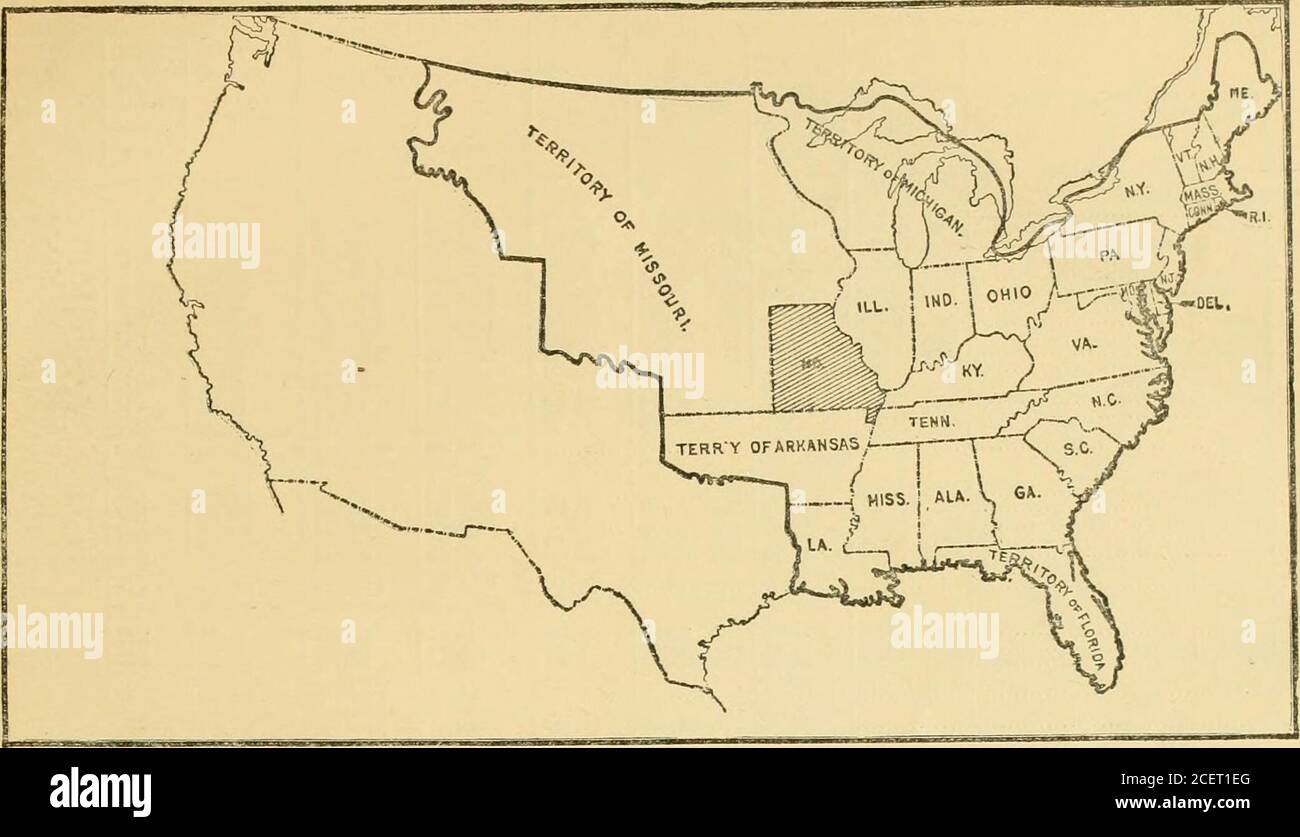
. Territorial and commercial expansion of the United States, 1800-1900. .66 29, 9, firs. 876794 9 59860004860898-I875038 57,530 Sq. mile*.318818411105862, 350 4343,145 2, 422508 40, 460 4,855 471 321 719 6,032 3,702 3,741 1,249 166 588 370 449 2,405 161 10,688 Sq. Vlilfs.49.191 5,612 2,380 69 59,436 - .i36 58740, 33283,03912,297 8,546 97,990 31,04643,280 9,377 8, 17353, 71952, 67444,46445, 928 1,24731,04842,056 ., .63 24,504 1,674 square miles of Lake Michigan included.230 square miles of Lake Michigan included. (10,653 square miles of Lake Superior; 12,922 of Lake Mich- i i »an, and 9,925 of
Image details
Contributor:
Reading Room 2020 / Alamy Stock PhotoImage ID:
2CET1EGFile size:
7.1 MB (209.9 KB Compressed download)Releases:
Model - no | Property - noDo I need a release?Dimensions:
2084 x 1199 px | 35.3 x 20.3 cm | 13.9 x 8 inches | 150dpiMore information:
This image is a public domain image, which means either that copyright has expired in the image or the copyright holder has waived their copyright. Alamy charges you a fee for access to the high resolution copy of the image.
This image could have imperfections as it’s either historical or reportage.
. Territorial and commercial expansion of the United States, 1800-1900. .66 29, 9, firs. 876794 9 59860004860898-I875038 57, 530 Sq. mile*.318818411105862, 350 4343, 145 2, 422508 40, 460 4, 855 471 321 719 6, 032 3, 702 3, 741 1, 249 166 588 370 449 2, 405 161 10, 688 Sq. Vlilfs.49.191 5, 612 2, 380 69 59, 436 - .i36 58740, 33283, 03912, 297 8, 546 97, 990 31, 04643, 280 9, 377 8, 17353, 71952, 67444, 46445, 928 1, 24731, 04842, 056 ., .63 24, 504 1, 674 square miles of Lake Michigan included.230 square miles of Lake Michigan included. (10, 653 square miles of Lake Superior; 12, 922 of Lake Mich- i i »an, and 9, 925 of Lake Huro::. 2, 514 square miles of Lake Superior included. 3.140 square miles of Lake Ontario included. 3.443 square miles of Lake Erie included.891 square miles of Lake Erie included. 2, 378 square miles of Lake Superior, and 7, 500 oi LakeMichigan included. rofal 820, 944 88, 106 909, 050 > Includes only that portion of the State formed from territory within boundaries of original thirteen States. 1902.] TERRITORIAL AND COMMERCIAL EXPANSION OF THE UNITED STATES. 379. No. 15.—1821. State op Missouri Formed, but Name of Missouri Territory Retained for the Undivided Portion of the Louisiana Purchase.