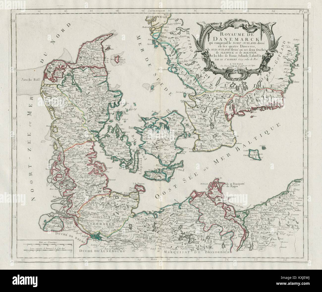
"Royaume de Danemarck…" Denmark Sweden. SANTINI / VAUGONDY 1784 old map
Image details
Contributor:
Antiqua Print Gallery / Alamy Stock PhotoImage ID:
KXJEWJFile size:
124.5 MB (4.6 MB Compressed download)Releases:
Model - no | Property - noDo I need a release?Dimensions:
7209 x 6036 px | 61 x 51.1 cm | 24 x 20.1 inches | 300dpiDate taken:
1784Location:
DenmarkMore information:
This image could have imperfections as it’s either historical or reportage.
Artist/engraver/cartographer: Santini, Paolo and Robert de Vaugondy, Gilles & Didier. Provenance: "Atlas Universel, dressé sur les meilleures cartes modernes", 1784 à Venise par P. Santini, rue Ste Justine, chez M. Remondini. Type: Large antique 18th century atlas map, printed on thick, good quality paper with original outline hand colour/color and decorative title cartouche. A decorative 18th century map of the Kingdom of Denmark, including North Jutland divided into its four Dioceses, South Jutland divided into its two Duchies of Sleswick and Holstein, and the Isles of Funen, Zealand, Lolland, &c. The map also shows part of southern Sweden including the modern provinces of Skane, Halland and Blekinge