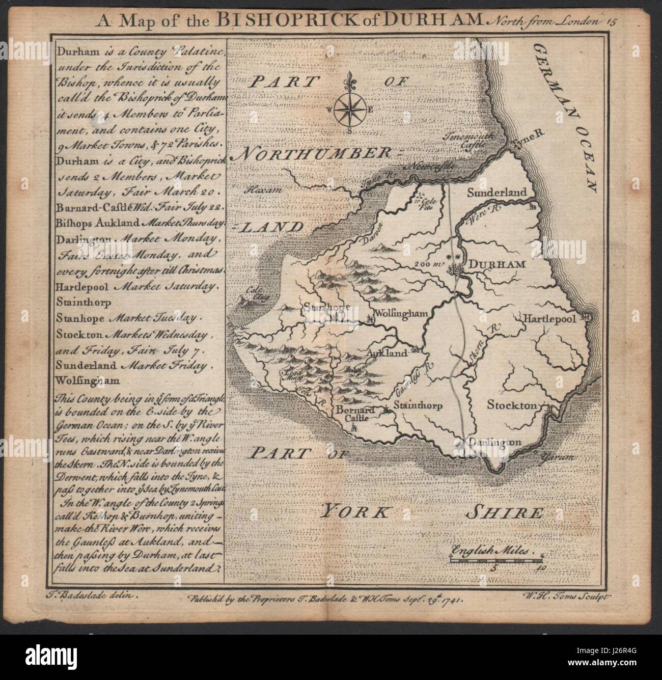
Antique county map of the Bishoprick of Durham by Badeslade & Toms 1742
RFID:Image ID:J26R4G
Image details
Contributor:
Antiqua Print Gallery / Alamy Stock PhotoImage ID:
J26R4GFile size:
11.4 MB (662.5 KB Compressed download)Releases:
Model - no | Property - noDo I need a release?Dimensions:
2036 x 1951 px | 34.5 x 33 cm | 13.6 x 13 inches | 150dpiDate taken:
1742Location:
DurhamMore information:
This image could have imperfections as it’s either historical or reportage.
Artist/engraver/cartographer: Thomas Badeslade & William Henry Toms. Provenance: "Chorographia Britanniae, or a set of maps of all the counties in England and Wales", printed for and sold by W.H. Toms, engraver in Union Court, near Hatton Garden, Holbourn 1742. Type: Antique copperplate map.