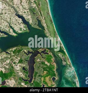
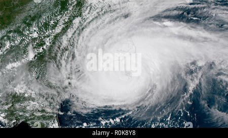
 The outer bands of Hurricane Florence battering the North Carolina coast. Stock Photohttps://www.alamy.com/licenses-and-pricing/?v=1https://www.alamy.com/the-outer-bands-of-hurricane-florence-battering-the-north-carolina-coast-image224158908.html
RFR0K8Y8–The outer bands of Hurricane Florence battering the North Carolina coast.
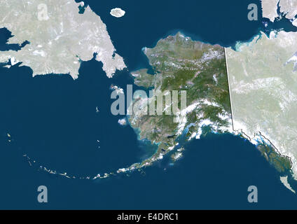 State of Alaska, United States, True Colour Satellite Image Stock Photohttps://www.alamy.com/licenses-and-pricing/?v=1https://www.alamy.com/stock-photo-state-of-alaska-united-states-true-colour-satellite-image-71603841.html
RME4DRC1–State of Alaska, United States, True Colour Satellite Image
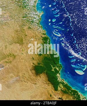 Natural-color satellite view of the Daintree rainforest in far north Queensland, Australia. Stock Photohttps://www.alamy.com/licenses-and-pricing/?v=1https://www.alamy.com/natural-color-satellite-view-of-the-daintree-rainforest-in-far-north-queensland-australia-image574923399.html
RF2TBA0JF–Natural-color satellite view of the Daintree rainforest in far north Queensland, Australia.
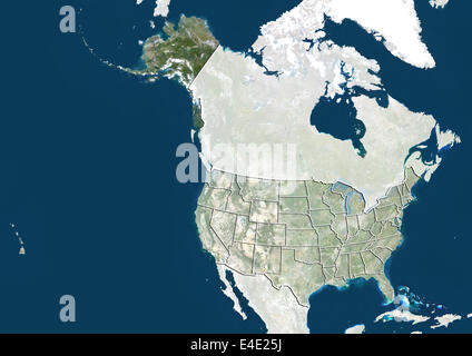 United States and the State of Alaska, True Colour Satellite Image Stock Photohttps://www.alamy.com/licenses-and-pricing/?v=1https://www.alamy.com/stock-photo-united-states-and-the-state-of-alaska-true-colour-satellite-image-71609150.html
RME4E25J–United States and the State of Alaska, True Colour Satellite Image
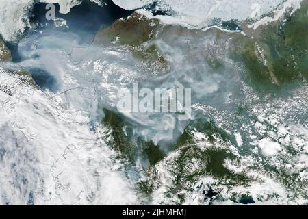 A satellite image showing smoke from wildfires blanketing the vast spaces of Alaska picked up by the NASA-NOAA Suomi NPP satellite, July 1, 2022, in Earth Orbit. Intense fires burning in June and July were located in the southern and interior regions of the state, but southeasterly winds pushed smoke into the far north as well. Stock Photohttps://www.alamy.com/licenses-and-pricing/?v=1https://www.alamy.com/a-satellite-image-showing-smoke-from-wildfires-blanketing-the-vast-spaces-of-alaska-picked-up-by-the-nasa-noaa-suomi-npp-satellite-july-1-2022-in-earth-orbit-intense-fires-burning-in-june-and-july-were-located-in-the-southern-and-interior-regions-of-the-state-but-southeasterly-winds-pushed-smoke-into-the-far-north-as-well-image475580466.html
RM2JHMFMJ–A satellite image showing smoke from wildfires blanketing the vast spaces of Alaska picked up by the NASA-NOAA Suomi NPP satellite, July 1, 2022, in Earth Orbit. Intense fires burning in June and July were located in the southern and interior regions of the state, but southeasterly winds pushed smoke into the far north as well.
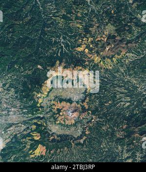 Natural-color satellite view of north-central Kyushu, Japan. Stock Photohttps://www.alamy.com/licenses-and-pricing/?v=1https://www.alamy.com/natural-color-satellite-view-of-north-central-kyushu-japan-image575101514.html
RF2TBJ3RP–Natural-color satellite view of north-central Kyushu, Japan.
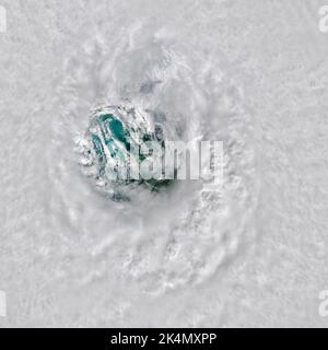 Caya Costa, United States of America. 28 September, 2022. Landsat 8 satellite view looking down at the eye of Hurricane Ian as it approached the southwest coast of Florida as a Category 4 monster storm September 28, 2022 near Caya Costa, Florida. Ian landed with sustained winds of 150 miles (240 kilometers) per hour, according to the National Hurricane Center. Credit: Landsat 8/NASA/Alamy Live News Stock Photohttps://www.alamy.com/licenses-and-pricing/?v=1https://www.alamy.com/caya-costa-united-states-of-america-28-september-2022-landsat-8-satellite-view-looking-down-at-the-eye-of-hurricane-ian-as-it-approached-the-southwest-coast-of-florida-as-a-category-4-monster-storm-september-28-2022-near-caya-costa-florida-ian-landed-with-sustained-winds-of-150-miles-240-kilometers-per-hour-according-to-the-national-hurricane-center-credit-landsat-8nasaalamy-live-news-image484808990.html
RM2K4MXPP–Caya Costa, United States of America. 28 September, 2022. Landsat 8 satellite view looking down at the eye of Hurricane Ian as it approached the southwest coast of Florida as a Category 4 monster storm September 28, 2022 near Caya Costa, Florida. Ian landed with sustained winds of 150 miles (240 kilometers) per hour, according to the National Hurricane Center. Credit: Landsat 8/NASA/Alamy Live News
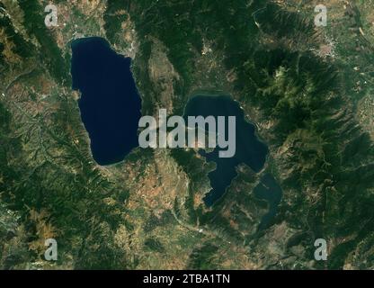 Natural-color satellite view of Lake Ohrid and Lake Prespa in the Balkans. Stock Photohttps://www.alamy.com/licenses-and-pricing/?v=1https://www.alamy.com/natural-color-satellite-view-of-lake-ohrid-and-lake-prespa-in-the-balkans-image574924357.html
RF2TBA1TN–Natural-color satellite view of Lake Ohrid and Lake Prespa in the Balkans.
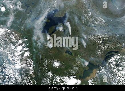 A satellite image showing smoke from wildfires burning across the Yukon and Northwest Territories of Canada, detected by the NASA Landsat 8 Satellite, July 6, 2022, in Earth Orbit. According to the Canadian government, 136 fires were burning in the Yukon and 65 in the Northwest Territories. Stock Photohttps://www.alamy.com/licenses-and-pricing/?v=1https://www.alamy.com/a-satellite-image-showing-smoke-from-wildfires-burning-across-the-yukon-and-northwest-territories-of-canada-detected-by-the-nasa-landsat-8-satellite-july-6-2022-in-earth-orbit-according-to-the-canadian-government-136-fires-were-burning-in-the-yukon-and-65-in-the-northwest-territories-image475580471.html
RM2JHMFMR–A satellite image showing smoke from wildfires burning across the Yukon and Northwest Territories of Canada, detected by the NASA Landsat 8 Satellite, July 6, 2022, in Earth Orbit. According to the Canadian government, 136 fires were burning in the Yukon and 65 in the Northwest Territories.
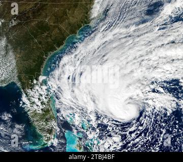 Satellite image of Tropical Storm Nicole as it strengthens over the Bahamas. Stock Photohttps://www.alamy.com/licenses-and-pricing/?v=1https://www.alamy.com/satellite-image-of-tropical-storm-nicole-as-it-strengthens-over-the-bahamas-image575101955.html
RF2TBJ4BF–Satellite image of Tropical Storm Nicole as it strengthens over the Bahamas.
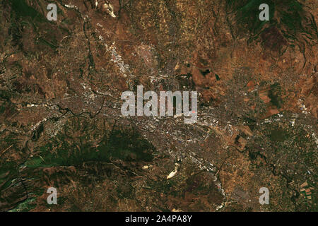 Skopje, the capital of North Macedonia, seen from space - contains modified Copernicus Sentinel Data (2019) Stock Photohttps://www.alamy.com/licenses-and-pricing/?v=1https://www.alamy.com/skopje-the-capital-of-north-macedonia-seen-from-space-contains-modified-copernicus-sentinel-data-2019-image329946651.html
RF2A4PA8Y–Skopje, the capital of North Macedonia, seen from space - contains modified Copernicus Sentinel Data (2019)
