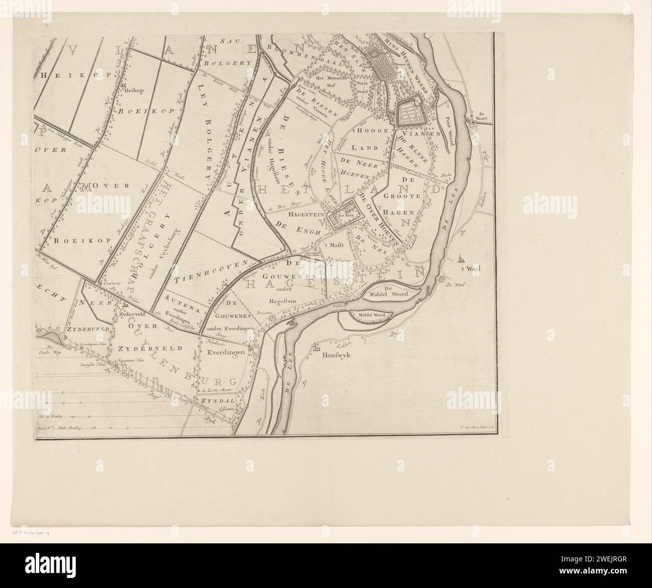
Map of the Vijfheerenlanden (part bottom right), Jan van Jagen, 1783 - 1787 print Share (bottom right) of a map of the Vijfheerenlanden, consisting of four parts. Orientation: north on the right. paper engraving maps of separate countries or regions. polder, reclaimed land Vijfheerenlanden
RMID:Image ID:2WEJRGR
Image details
Contributor:
piemags/rmn / Alamy Stock PhotoImage ID:
2WEJRGRFile size:
83.7 MB (3.3 MB Compressed download)Releases:
Model - no | Property - noDo I need a release?Dimensions:
5926 x 4936 px | 50.2 x 41.8 cm | 19.8 x 16.5 inches | 300dpiMore information:
This image is a public domain image, which means either that copyright has expired in the image or the copyright holder has waived their copyright. Alamy charges you a fee for access to the high resolution copy of the image.
This image could have imperfections as it’s either historical or reportage.