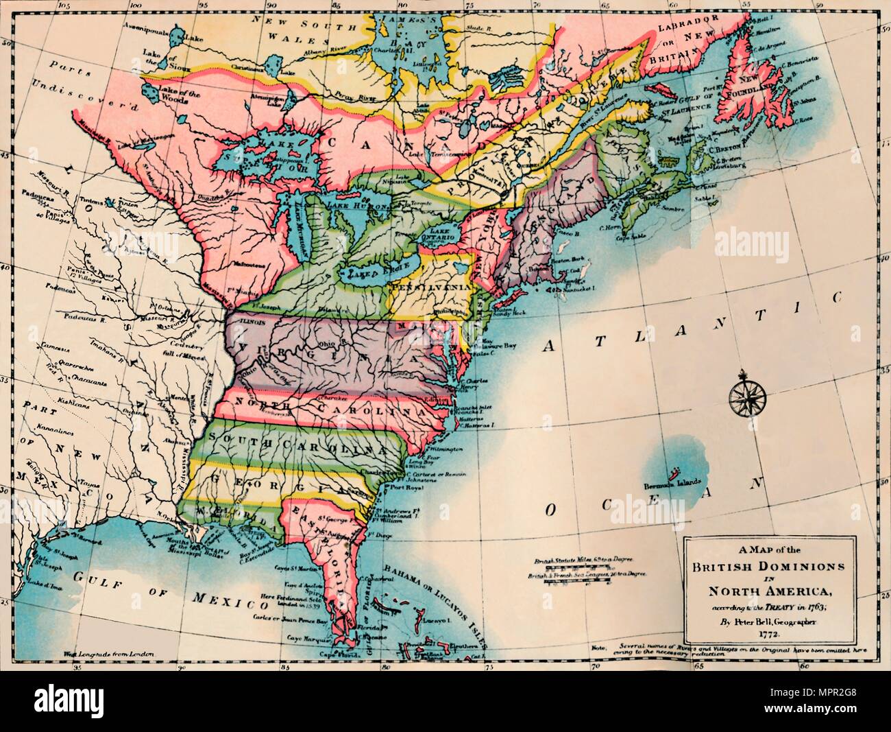
'Map of the British Dominions of North America', 1772, (1904). Artist: Peter Bell.
RMID:Image ID:MPR2G8
Image details
Contributor:
The Print Collector / Alamy Stock PhotoImage ID:
MPR2G8File size:
76 MB (2.2 MB Compressed download)Releases:
Model - no | Property - noDo I need a release?Dimensions:
5943 x 4470 px | 50.3 x 37.8 cm | 19.8 x 14.9 inches | 300dpiDate taken:
1772Location:
World,Oceans,Atlantic OceanPhotographer:
The Print Collector/Heritage ImagesMore information:
This image could have imperfections as it’s either historical or reportage.
'Map of the British Dominions of North America', 1772, (1904). From Social England, Volume V, edited by H.D. Traill, D.C.L. and J. S. Mann, M.A. [Cassell and Company, Limited, London, Paris, New York & Melbourne, 1904]