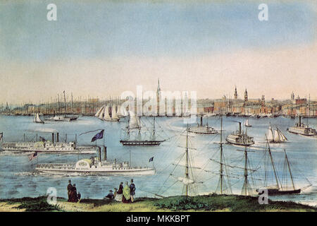
 1872 engraving, 'City of New York from Brooklyn Heights.' Stock Photohttps://www.alamy.com/image-license-details/?v=1https://www.alamy.com/stock-photo-1872-engraving-city-of-new-york-from-brooklyn-heights-30455599.html
RMBNFABY–1872 engraving, 'City of New York from Brooklyn Heights.'
 An engraving entitled 'City of New York from Brooklyn Heights' scanned at high resolution from a book published in 1874. Believed copyright free. Stock Photohttps://www.alamy.com/image-license-details/?v=1https://www.alamy.com/an-engraving-entitled-city-of-new-york-from-brooklyn-heights-scanned-image67187159.html
RMDW8HWB–An engraving entitled 'City of New York from Brooklyn Heights' scanned at high resolution from a book published in 1874. Believed copyright free.
 Brooklyn Ferry operating across the East River from New York City to Long Island mid 1700s. Hand-colored woodcut Stock Photohttps://www.alamy.com/image-license-details/?v=1https://www.alamy.com/brooklyn-ferry-operating-across-the-east-river-from-new-york-city-image9931979.html
RMA0AA3T–Brooklyn Ferry operating across the East River from New York City to Long Island mid 1700s. Hand-colored woodcut
 New York City from Brooklyn Heights. Stock Photohttps://www.alamy.com/image-license-details/?v=1https://www.alamy.com/new-york-city-from-brooklyn-heights-image184208496.html
RMMKKBPT–New York City from Brooklyn Heights.
 An old engraving of The Brooklyn Bridge, a hybrid cable-stayed/suspension bridge in New York City, USA. It is from a Victorian mechanical engineering book of the 1880s. Opened in 1883, the Brooklyn Bridge was the first fixed crossing across the East River between Manhattan and Brooklyn. It was also the longest suspension bridge in the world at the time of its opening. It was designed by John A. Roebling. It carried horse-drawn vehicles and elevated railway lines until 1950. Now only passenger vehicles and pedestrian and bicycle traffic are permitted. Stock Photohttps://www.alamy.com/image-license-details/?v=1https://www.alamy.com/an-old-engraving-of-the-brooklyn-bridge-a-hybrid-cable-stayedsuspension-bridge-in-new-york-city-usa-it-is-from-a-victorian-mechanical-engineering-book-of-the-1880s-opened-in-1883-the-brooklyn-bridge-was-the-first-fixed-crossing-across-the-east-river-between-manhattan-and-brooklyn-it-was-also-the-longest-suspension-bridge-in-the-world-at-the-time-of-its-opening-it-was-designed-by-john-a-roebling-it-carried-horse-drawn-vehicles-and-elevated-railway-lines-until-1950-now-only-passenger-vehicles-and-pedestrian-and-bicycle-traffic-are-permitted-image382822723.html
RM2D6R283–An old engraving of The Brooklyn Bridge, a hybrid cable-stayed/suspension bridge in New York City, USA. It is from a Victorian mechanical engineering book of the 1880s. Opened in 1883, the Brooklyn Bridge was the first fixed crossing across the East River between Manhattan and Brooklyn. It was also the longest suspension bridge in the world at the time of its opening. It was designed by John A. Roebling. It carried horse-drawn vehicles and elevated railway lines until 1950. Now only passenger vehicles and pedestrian and bicycle traffic are permitted.
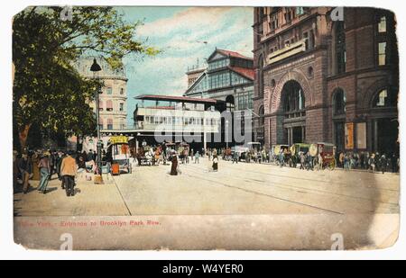
 Engraved postcard of the entrance to Brooklyn Park Row, New York City, New York, 1911. From the New York Public Library. () Stock Photohttps://www.alamy.com/image-license-details/?v=1https://www.alamy.com/engraved-postcard-of-the-entrance-to-brooklyn-park-row-new-york-city-new-york-1911-from-the-new-york-public-library-image261218468.html
RMW4YER0–Engraved postcard of the entrance to Brooklyn Park Row, New York City, New York, 1911. From the New York Public Library. ()
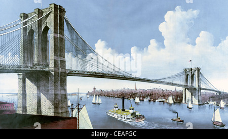
 Brooklyn Bridge The great East River suspension bridge: connecting the cities of New York and Brooklyn View from Brooklyn, looking west, circa 1886 Stock Photohttps://www.alamy.com/image-license-details/?v=1https://www.alamy.com/stock-photo-brooklyn-bridge-the-great-east-river-suspension-bridge-connecting-43257660.html
RMCEAFGC–Brooklyn Bridge The great East River suspension bridge: connecting the cities of New York and Brooklyn View from Brooklyn, looking west, circa 1886
 A late 19th Century view from Brooklyn Heights of New York City (NYC) in the United States. Situated on one of the world's largest natural harbours, New York City is composed of five boroughs, each of which is a county of the State of New York. The five boroughs—Brooklyn, Queens, Manhattan, the Bronx, and Staten Island—were consolidated into a single city in 1898 Stock Photohttps://www.alamy.com/image-license-details/?v=1https://www.alamy.com/a-late-19th-century-view-from-brooklyn-heights-of-new-york-city-nyc-in-the-united-states-situated-on-one-of-the-worlds-largest-natural-harbours-new-york-city-is-composed-of-five-boroughs-each-of-which-is-a-county-of-the-state-of-new-york-the-five-boroughsbrooklyn-queens-manhattan-the-bronx-and-staten-islandwere-consolidated-into-a-single-city-in-1898-image384315394.html
RM2D9725P–A late 19th Century view from Brooklyn Heights of New York City (NYC) in the United States. Situated on one of the world's largest natural harbours, New York City is composed of five boroughs, each of which is a county of the State of New York. The five boroughs—Brooklyn, Queens, Manhattan, the Bronx, and Staten Island—were consolidated into a single city in 1898
 View of Brooklyn, Long Island, from U.S. Hotel, New York. After a chromolithograph created circa 1850 by lithographer Francis Michelin, 1809/10-1878. Stock Photohttps://www.alamy.com/image-license-details/?v=1https://www.alamy.com/view-of-brooklyn-long-island-from-us-hotel-new-york-after-a-chromolithograph-created-circa-1850-by-lithographer-francis-michelin-180910-1878-image222893766.html
RMPXHK7J–View of Brooklyn, Long Island, from U.S. Hotel, New York. After a chromolithograph created circa 1850 by lithographer Francis Michelin, 1809/10-1878.
 New York map with inserts. Rendering of an old, detailed, decorative map shows New York City before the bridges. Decorated with eagle coat of arms and illustrations. This is an enhanced, restored reproduction of a colorful New York City map with pictorial inserts and featuring lower Manhattan. Issued circa 1850. Scenic vignettes: a New York steamer, Brooklyn, City Hall, Custom House, the Narrows from Fort Hamilton, New York from Williamsburgh. Shows ferry routes, parks, street plan, and many names of locations. Stock Photohttps://www.alamy.com/image-license-details/?v=1https://www.alamy.com/new-york-map-with-inserts-rendering-of-an-old-detailed-decorative-map-shows-new-york-city-before-the-bridges-decorated-with-eagle-coat-of-arms-and-illustrations-this-is-an-enhanced-restored-reproduction-of-a-colorful-new-york-city-map-with-pictorial-inserts-and-featuring-lower-manhattan-issued-circa-1850-scenic-vignettes-a-new-york-steamer-brooklyn-city-hall-custom-house-the-narrows-from-fort-hamilton-new-york-from-williamsburgh-shows-ferry-routes-parks-street-plan-and-many-names-of-locations-image435619463.html
RF2G8M51Y–New York map with inserts. Rendering of an old, detailed, decorative map shows New York City before the bridges. Decorated with eagle coat of arms and illustrations. This is an enhanced, restored reproduction of a colorful New York City map with pictorial inserts and featuring lower Manhattan. Issued circa 1850. Scenic vignettes: a New York steamer, Brooklyn, City Hall, Custom House, the Narrows from Fort Hamilton, New York from Williamsburgh. Shows ferry routes, parks, street plan, and many names of locations.
 New York Bay from the Margaret by Joseph Pennell, 1857-1926, artist. dated between ca. 1922 and 1926. New York City. As Wuerth described, 'In foreground housetops on Columbia Heights, middle distance Brooklyn docks, East River, Governor's Island, lower end of Manhattan, the Statue of Liberty and Jersey shore on the horizon. Colours, cream, blue, Gray, rose, brown, black, orange, white and violet, on dark Gray paper.' Stock Photohttps://www.alamy.com/image-license-details/?v=1https://www.alamy.com/new-york-bay-from-the-margaret-by-joseph-pennell-1857-1926-artist-dated-between-ca-1922-and-1926-new-york-city-as-wuerth-described-in-foreground-housetops-on-columbia-heights-middle-distance-brooklyn-docks-east-river-governors-island-lower-end-of-manhattan-the-statue-of-liberty-and-jersey-shore-on-the-horizon-colours-cream-blue-gray-rose-brown-black-orange-white-and-violet-on-dark-gray-paper-image210363173.html
RMP66TAD–New York Bay from the Margaret by Joseph Pennell, 1857-1926, artist. dated between ca. 1922 and 1926. New York City. As Wuerth described, 'In foreground housetops on Columbia Heights, middle distance Brooklyn docks, East River, Governor's Island, lower end of Manhattan, the Statue of Liberty and Jersey shore on the horizon. Colours, cream, blue, Gray, rose, brown, black, orange, white and violet, on dark Gray paper.'
 Sanborn Fire Insurance Map from Brooklyn, Kings County, New York (1888) by Sanborn Map Company. Stock Photohttps://www.alamy.com/image-license-details/?v=1https://www.alamy.com/sanborn-fire-insurance-map-from-brooklyn-kings-county-new-york-1888-by-sanborn-map-company-image446031184.html
RM2GWJD94–Sanborn Fire Insurance Map from Brooklyn, Kings County, New York (1888) by Sanborn Map Company.